
-
 13225 Hits
-
 90.48% Score
-
 32 Votes
|
|
Mountain/Rock |
|---|---|
|
|
46.56520°N / 10.62730°E |
|
|
Alto Adige |
|
|
Mountaineering, Scrambling, Via Ferrata |
|
|
Summer |
|
|
11072 ft / 3375 m |
|
|
Overview
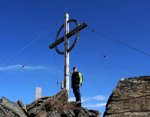
Tschenglser Hochwand / Croda di Cengles 3375 m
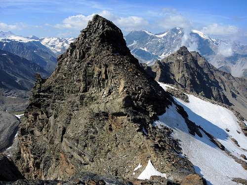
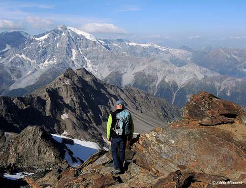
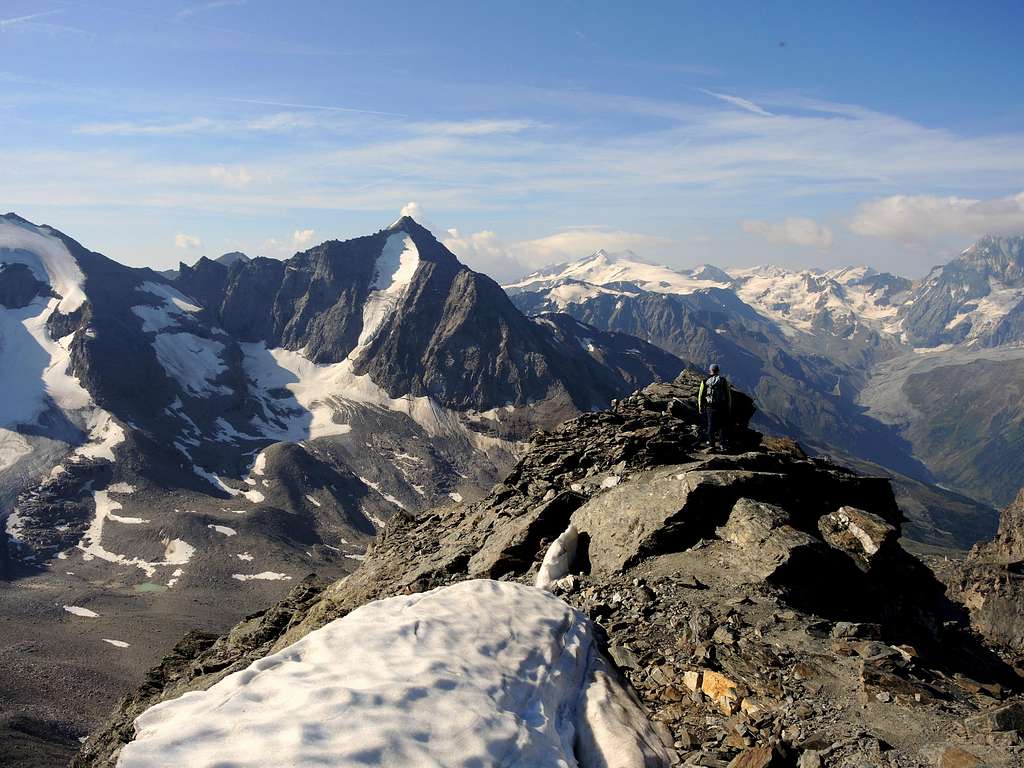
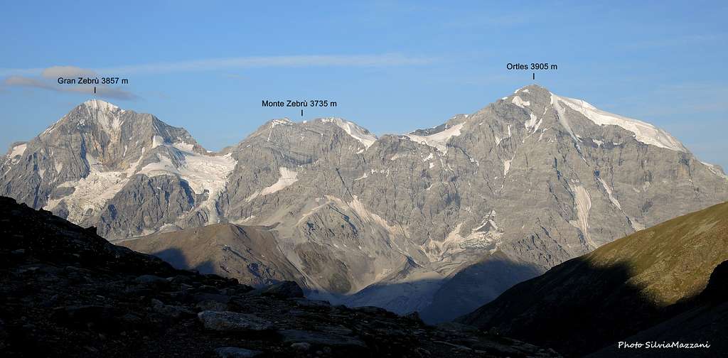
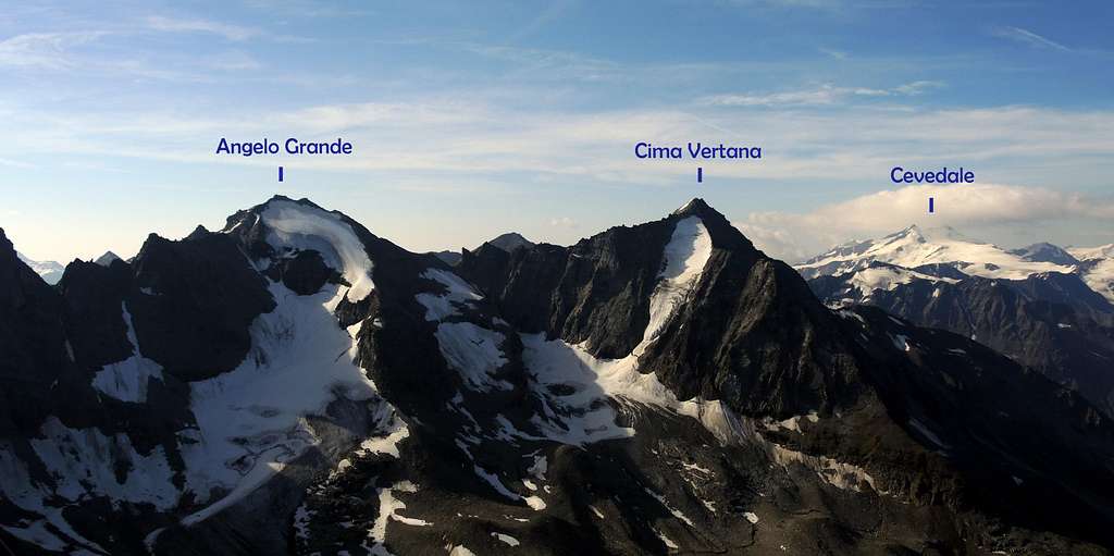
Tschenglser Hochwand (Italian: Croda di Cengles) is situated in Italian South Tyrol (Südtirol / Alto Adige) and belongs to the Ortles Group. The summit is 3375 m high and it is one of the best view points to Ortles, Gran Zebrù and neighboring mountains. The mountain lies on the Northern end of the valley called Zaytal (Valle di Zai) and to the Northeast has its “own” glacier: the small Tschenglser Ferner (Vedretta di Cengles). Opposite, to the Southeast, in the other side of Valle di Zai, we have the following summits: Kleine Angelusspitze (Angelo Piccolo, 3318 m), Hoher Angelus Spitze (Angelo Grande, 3521 m) and Vertainspitze (Cima Vertana, 3545 m).

To the Northwest of Tschenglser Hochwand it lies the valley of Razoi. The first ascent of Tschenglser Hochwand (Croda di Cengles) was achieved in 1871 by V. Hecht and the alpine guide J. Pingerra.
Getting There
The best outgoing point to Tschenglser Hochwand is the village of Solda/Sulden, which lies on the height of 1907 m. There is no train station, Solda is reachable by car (or bus):
1. From the Italian South Tyrol – Bolzano – by road SS38 Merano – Schlandres – towards Passo dello Stelvio, before pass, in Gomagoi turn left towards Solda.
2. From Italian Lombardia: from Milan by SS36 towards Lake Como, later by SS 38 towards Sondrio, through Passo dello Stelvio, in Gomagoi turn right towards Solda.
3. From Austria: Innsbruck – Landeck - Reschenpass, in Italy road SS 40 via Mals, later SS 38 via Schlunders towards Passo dello Stlevio, before pass, in Gomagoi turn left towards Solda.
4. From southern Germany: Munich – Garmisch – Landeck – Reschenpass, then in Italy road SS 40 via Mals, later SS 38 via Schlunders towards Passo dello Stlevio, before pass, in Gomagoi turn left towards Solda.

|

|

|

|
Routes overview
All the three mostly used routes to the summit of Tschenglser Hochwand (Croda di Cengles) start from the Rifugio Serristori, called also Zaytalhütte and Düsseldorfer Hütte. The hut is best reachable from the little town of Solda/Sulden on the marked route n. 5. The route from Solda takes two and a half hours. You can also take the chair lift from Solda to Kanzel station (2350 m), then the marked path n.12 to the left, which later meets the path n. 5 starting from Solda. From the Serristori - Düsseldorfer Hütte continue on the marked path n 5. After about 30 minutes on the right we find a small lake (i Laghetti), on about 2900 m. Just after the lake, on about 3000 m, we can choose one of the three possibilities:
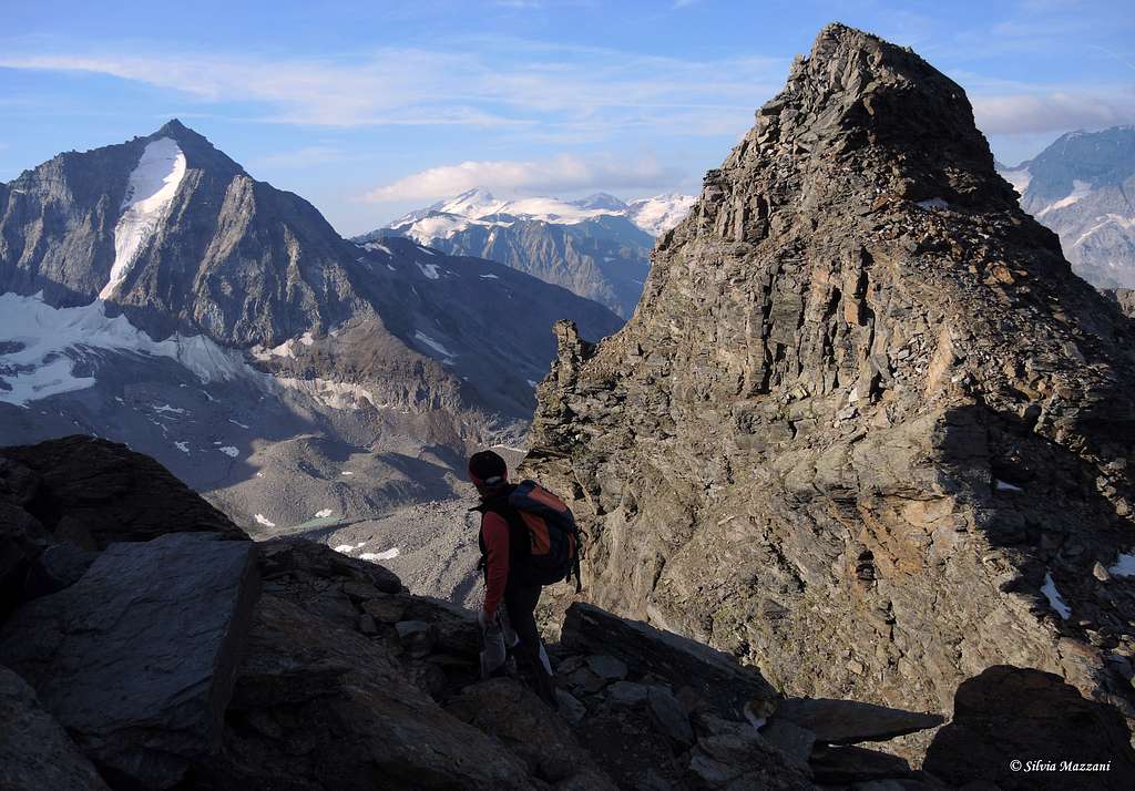
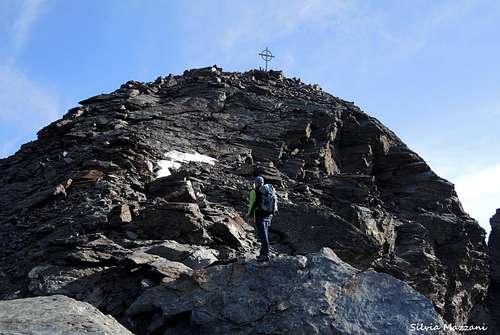
1. Normal route, which is heading to the left, along a gully to the well visible saddle. Later on southwest ridge light climbing to the summit. Here on SP the full route report: Croda di Cengles - Tschenglser Hochwand SW Normal route
2. Erich-Otto Klettersteig (via ferrata) leads direct through a stone ridge. That is not a typical via ferrata, but many sections are secured with steel cable, there are also some artificial steps and ladders on the route. Before the summit, on the southwest ridge the Erich-Otto ferrata meets the normal route. Via ferrata equipment is recommended, it is better to climb that route for ascent only.
3. New via ferrata through the South face. It was built in 2002 and is really exposed. You will seldom walk here, mostly climb, and many vertical sections are difficult. Only with ferrata equipment, like climbing harness with ferrata-set, helmet and gloves.
4. Possible is also a long way from Prad am Stilfser Joch (Prato allo Stelvio). Start is on 915 m, in Prad take the marked route nr 3, towards Gampenhütte (2014 m), then route 3A through the summit of Pederfick (Pietrafitta, 3114 m) and on west ridge to the summit. That is a very long route with big elevation difference.
Red Tape
No permits or fees for climbing are required. The mountain lies in the area of Parco Nazionale dello Stelvio (National Park Stilfser Joch). Please respect the rules: fires are strictly forbidden and the whole fauna and flora is protected. Don’t disturb fauna and other mountaineers and hikers’ peacefulness with every kind of noise.
Official site of the National Park

Accomodation
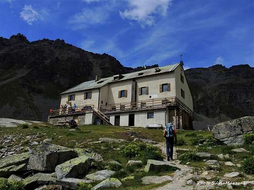
Near Tschenglser Hochwand (Croda di Cengles) there is the Rifugio Serristori, called also Düsseldorfer Hütte in German and Zaytalhütte. It lies on 2721 m in Valle di Zai ( Zaytal). This hut exists since 1892 and today belongs to Milan section of CAI (Club Alpine Italiano). It's managed by Reinstadlers, a famous family of alpine guides in the Ortles area. The hut is reachable from the Kanzel lift station, on the marked path n.12 or direct from Solda, path n 5. Details (in German or Italian only) are to find here:
Rifugio Serristori - Düsseldorfer Hütte
Another possibilities of accommodation you find sure in the town Sulden. There are many hotels, pensions and guest houses of different classes, partially with camping sites. They are to find here:
The best season is from June to September. Fresh snow and bad weather conditions are possible in high summer also. In early summer there is often snow in higher parts of Zay valley.

|
")
|
Meteo and Mountain Conditions
The actual weather conditions could be proofed here:
Meteo Provincia Bolzano
Site of Ortler area in Sulden
you can always see the alpine weather on that website: Weather by OeAV (Austrian Alpine Club)
Guidebooks and Maps


Ortles-Cevedale - Gino Buscaini - Collana Guide dei Monti d'Italia CAI-TCI
Prestigiosi Tremila del Sud Tirolo - Hans Paul Menara - Athesia ed.
Kompass: Nr 72, Ortler/Ortles-Cevedale, 1:50.000
Kompass: Nr 636, Ortler/Ortles-Stilfser Joch/Passo dello Stelvio, 1:25.000
Tabacco: Nr 08, Gruppo Ortles - Cevedale/Ortlergruppe, 1:25.000