
-
 3229 Hits
-
 80.71% Score
-
 13 Votes
|
|
Mountain/Rock |
|---|---|
|
|
43.21086°N / 4.73611°W |
|
|
Hiking, Mountaineering, Scrambling, Skiing |
|
|
Spring, Summer, Fall, Winter |
|
|
6975 ft / 2126 m |
|
|
Overview
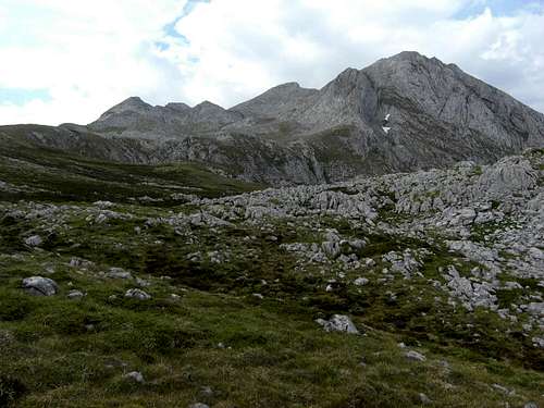
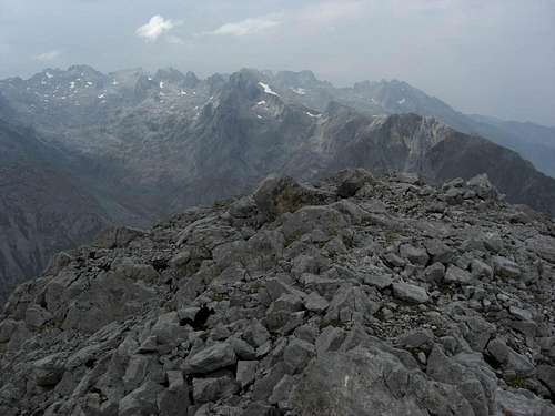
Cueto Teyau as seen from Pico Boru
The first summit within the Pico Valdominguero north ridge, coming from Jito Escarandi, which surmounts 2000 meters is the rock ridge of Cueto Teyau.
For a first look Cueto Teyau may be only a secondary summit within this ridge but nevertheless it seems to be visited quite often and even disposes of a summit buzon. Its easy and short ascent from Jito Escarandi, the short detour from a visit to Pico Valdominguero and the good views to the Macizo Los Urielles peaks makes an ascent worthwhile.
Cueto Teyau shows an impressive west face, about 1.200 meters above the Duje valley. The prominence to the southern col, leading to the Picas del Hou Sin Tierre, the southern neighbouring peaks, is, however, less than 50 m. Cueto Teyau clearly dominates its northern neighbor, Pico Boru, with more than 200 m of altitude difference.
Getting There
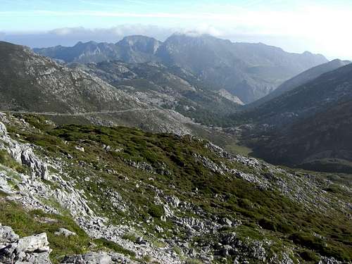
The road from Jito Escarandi to Caseton de Andara
Main trailheads are
You reach all these trailheads on road number AS-264 from Arenas de Cabrales (look up the Macizo de Andara SP page how to get to Arenas de Cabrales) to Poncebos. Turn there on road number CA-1.
Follow CA-1 until you reach Sotres, leave the village on that road to the east and park your car at or near the first switchback after the village limits.
For Jito Escarandi follow CA-1 until you reach this col between Sotres and Tresviso; there is a hiker parking area on the right side of the road.
For Caseton de Andara leave your car at Jito Escarandi and follow the old mine road in southern direction until you reach the Caseton (about 1 hour to walk).
Routes Overview
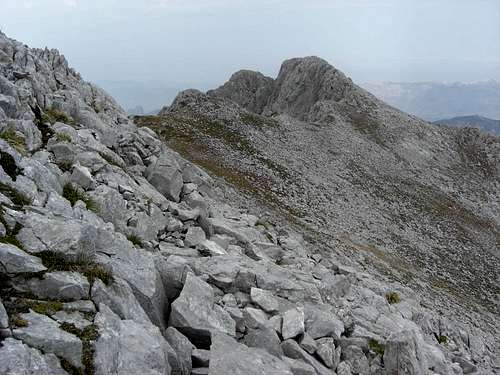
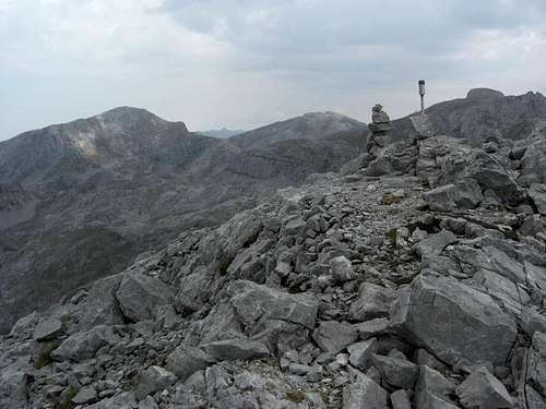
Cueto Teyau as seen from Picas del Jou Sin Tierre
Use the north ridge route of Pico Valdominguero from Jito Escarandi or from Sotres, pass by Pico Boru and ascend to a nameless little Jou east of Cueto Teyau and the Picas del Hou Sin Tierre.
There is a cairned trail starting at your right and ascending steeply the east slopes of Cueto Teyau (cairns) until you reach the south ridge to the Cueto. Follow the cairns on the south ridge (easy rock scramble) to the summit buzon.
The traverse from the Picas del Hou Sin Tierre main summit (that is the northernmost peak of this bunch of summits) is easy and short; just follow the narrow trail on the Picas north ridge to the south ridge of Cueto Teyau.
Direct route from Caseton de Andara
There seems to be a direct route from Caseton de Andara to the Jou Sin Tierre and to the north / east ascent to Cueto teyau but I did not explore that possible ascent. My guess is that you have to go to Collado de la Aldea, use the old mine road straight on to the ex Lago de Andara, now dried out due to the mining activities, and ascend to Collada del Medio between the minor summits of Cuetu de la Ramazosa and Cuetu de la Cueva. Then you enter the valley northeast of Pico Soriano and follow up that valley to a chute, leading up to Jou Sin Tierre.
Climb the Picas del Jou Sin Tierre and traverse to Cueto teyau or descend from the Jou Sin Tierre to the lower little Jou and take the direct trail/route up to Cueto Teyau.
Red Tape & Accomodation
National Park boundaries
Red Tape
Cueto Teyau is part of the Parque National de los Picos de Europa.
The entrance to the national park is free, you need no permits.
The regulations for the park can be seen here.
Accommodation
Mountain hut
Caseton de Andara with 20 places, food and drinks; guarded throughout summer
Gear & Mountain Condition
Summit view to the Macizo Los Urielles
Cueto Teyau is a year round summit, good for hiking in spring, summer and autumn.
As the slopes of the north ridge route are not too steep ski touring and snow shoeing should be possible.
You need normal hiking gear for a summer and autumn tour on Cueto Teyau.
Gaiters and hiking poles may be useful in springtime.
In winter and early spring you need full ski tour gear / snow shoe gear and avalanche protection.
A Spanish avalanche bulletin for the Picos de Europa (Boletin de Peligro de Aludes) can be checked here.
Current Weather for Sotres:
Maps & Guide Books
Summit with Pico Samelar and La Sagrada Corazon
Maps
Picos de Europa; Central and Eastern Massifs (Los Urielles Y Andara); Topographic Map, scale 1 : 25.000 with Hiking Trails; Adrados Ediciones –
the best and most detailed map as far as I know
For more information see the Adrados website (only in Spanish).
A good hiking map, not too detailed but sufficient for simple hikes:
Parque Nacional de Picos de Europa; 2 Mapas Excursionistas, Escala 1 : 40.000, Macizo Central y Oriental; Macizo Occidental; Editorial Alpina
Guide Books
Standard guide book in English:
Robin Walker: Picos de Europa, Walks and Climbs, Cicerone guide
Spanish publications and more maps can be purchased in the towns and villages round the Picos.