
|
|
Area/Range |
|---|---|
|
|
33.68664°N / 117.49603°W |
|
|
Hiking, Mountaineering, Trad Climbing, Sport Climbing, Toprope, Bouldering |
|
|
Spring, Summer, Fall, Winter |
|
|
5687 ft / 1733 m |
|
|
Overview
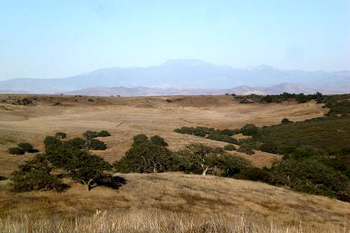
High Santa Ana's
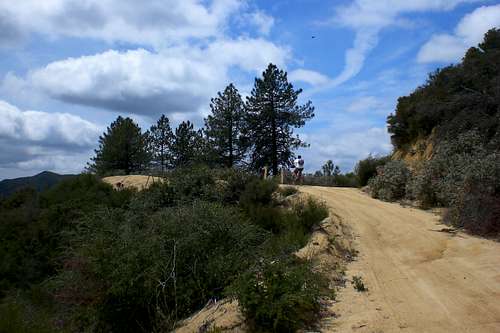
At first glimpse of these mountains, one gets the feeling that they are very unapealing. I fell prey to this first instinct. However, the beauty of the Santa Ana Mountains does not lie on the outside, but in it's deep canyons, ridgelines, history and its one of a kind landscape.
The Santa Ana Mountains are a peninsular mountain range in Southern California. The range is a key topographical landmark. The range forms much of the boundary between Orange and Riverside County. It is approximately 35 miles long. The highest peak within the range is Santiago Peak.
The Santa Ana Mountains are not rugged mountains geographically speaking. However, they are rugged in the sense of it's landscape. The majority of its slopes are covered with chaparral, a type of landscape native to Southern California. Chaparral is extremely thick and almost impenetrable. Oak Trees, sage brush, poison oak and brush weed grass interlock to form a seemingly unbreakable wall. It was only with slow progress that early pioneers could access certain areas. Luckily, the whole range is not like this. But, if one was to cross the range like early pioneers might have done, you for sure encounter chaparral. Also, any off trail/road adventure will most likely end up with you coming face to face with chaparral.
For most that live in Orange County, this range provides their taste of the outdoors. Many hikers come to experience different canyons such as Trabucco Canyon and Silverado Canyon.
The majority of the range is run by the Cleveland National Forest. Because of this, there are many National Forest maintained roads the cut through many parts of the range. Many roads are off limits to motorized vehicles, but still make for great hiking. Check the Forest Service page for details.
 Santiago and Modjeska Peaks
Geology and Geography

A rock formation

A rock

De Luz Canyon
The Santa Ana Mountains are said to start around Chino Hills and end around the Santa Margarita River. From end to end, they are about 40 miles long and almost 20 miles wide at its widest point. The majority of the range lies around 10-15 miles away from the ocean. South of the Ortega Highway, the range becomes very wide and the elevation decreases. In this section, the range consists of many rolling hills and mesas.
The range forms a natural barrier between Orange County and Riverside County. The county line runs along the entire range. In only one spot does a decent road cross the range. Above Lake Elsinore, the famous Ortega Highway crosses the Santa Ana Mountains. This range has always gotten in the way of transportation in Southern California.
Geological Structure
As far as geological structure goes, the Santa Ana Mountains consist mainly off Jurassic marine classic sedimentary, Jurassic volcanic, and Mesozoic granitic rocks. There is some mafic plutonic rock and small areas of Pleistocene basalt. The Puente and Chino Hills consist of Miocene marine sedimentary rocks. The nature of the range is steep to very steep with narrow to rounded summits and narrow canyons.
There are some rolling plateau surfaces, also the hills northwest of the Santa Ana River are also very steep. These hills and the Santa Ana Mountains trend northwest. The Santa Ana Mountains are bounded on the northeast by a steep escarpment along the Elsinore Fault Zone, and the Puente and Chino Hills are bounded on the south-southwest by the Whittier Fault Zone. The subsection elevation range is from about 300 feet along the Santa Ana River up to 5687 feet on Santiago Peak. Mass wasting and fluvial erosion are the main geomorphic processes.
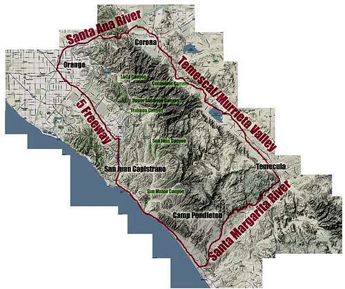 Geographic Stucture of the Santa Ana's

Elsinore Peak

Santiago and Modjeska Peaks

Trabuco Peak
Peak List
Santiago Peak(5,687ft)
Modjeska Peak(5,496ft)
Trabuco Peak(4,604ft)
Los Pinos Peak (4,510ft)
"Horsetheif Peak (4,313ft)
Pleasents Peak (4,007ft)
Bald Peak (3,947ft)
Bedford Peak (3,800ft)
Elsinore Peak (3,575ft)
Sitton Peak (3,273ft)
Margarita Peak (3 189ft)
Miller Mountain (2,945ft)
Rocky Mountain (2,360ft)
Squaw Mountain (2,680ft)
Monument Hill- 2,050ft
Gavilan Mountain (1,830ft)
Gilman Peak (1,670ft)

Mesa de Burro
Mesas
Yaeger Mesa- (3,035ft)
Redonda Mesa- (2,833ft)
Avenaloca Mesa- (2,544ft)
Mesa De Colorado- (2,170ft)
Mesa De Buro- (2,026ft)
Mesa De La Punta- (1,972ft)
Main Attractions

Tenaja Falls

Santa Margarita River

Santa Rosa Plateau
Tenaja Falls- A five tiered waterfall that drops nearly 150ft. This is a popular attraction for most and offers easy hiking on a well maintained trail. Be sure to go in the spring! It is dry most of the yearClick HERE for an interesting article about the falls.
Santa Rosa Plateau Ecological Reserve- Is a reserve that features miles and miles of well maintained trails and many vernal pools. Also, it boasts a premier example of pristine Southern California Landscape.
Santiago and Modjeska Peaks- The highest points of the range and offers amazing hiking and views of Southern California.
Silverado Canyon- Is a canyon offering nice hiking and many trails. The canyon splits into two different canyons: Modjeska and Santiago Canyons. Many utilize this area to escape the urbanized life of the surrounding Orange County communities. Its name is due to the fact that silver was once mined further up in the canyon. Also, this was an area devastated by the Santiago Fire of 2007.
Trabucco Canyon- This canyon offers a wide assortment of recreational opportunities. This is where the Holy Jim Trail begins also. This canyon was partially burnt by the Santiago Fire in 2007 and then saw lots of damage in the 2008 Modjeska Fire.
San Mateo Wilderness Area- A 38,484 acres wilderness area that offers lots of hiking through chaparral laden hillsides.
Temecula Canyon This is a little know feature of the Santa Ana Mountains. It is located at the southern most end of the range. The Santa Margarita cuts and winds its way through this amazing canyon. Granite cliffs tower over the canyon. Also, this canyon is home to some of the best (and only) whitewater rafting in Southern California (only during the rainy seasons. The river has a grade of IV. Also, a one hundred and two hundred foot waterfall cascade into this canyon.
Chino Hills State Park- This designated open-space area provides excellent hiking over gently rolling hills. It encompasses stands of oaks, sycamores and rolling, grassy hills that stretch nearly 31 miles, from the Santa Ana Mountains to the Whittier Hills.
When to go- Generally, the best times to hike or engage in any activities in the Santa Ana Mountains is late Fall, Winter or Spring. Hiking in the summer is possible, but make sure you get an early start or just pick a cool day.
Camping

Oak Trees
Here are some of the different campgrounds located throughout the range-
Blue Jay Campground- Car camping with 55 sites. It located off the Ortega Hwy (on the Riverside County side). It has hiking and 4 wheel drive roads. Click HERE for additional information.
Oneil Regional Park- Located in Trabucco Canyon and offers many hiking and off road trails. Tent, RV and car camping. Click HERE for additional information.
Caspar Regional Park- Located off the Ortega Hwy (on the Orange County side). This campground offers many hiking and mountain biking trails. Click HERE for additional information.
Chino Hills State Park- Located off the 91 fwy in Chino Hills. This campground offers tent camping with plenty of hiking trails. Click HERE additional information.
Water

Santa Margarita River

De Luz Creek
Water; a key issue in Southern California. A good rule a thumb when hiking in these mountains is to always expect that there will be no water at or along the way to your destination. Why? Well its because Southern California's Mediterranean climate. Generally, the range recieves less then 15 inches of rainfall. Often, droughts hit and in some years, not even 10 inches of rainfall is recorded. However, in 2005, a recorded 45 inches or rainfall was seen in certain areas.
As far as natural lakes go, there are none. However, there are an assorted amount of vernal pools located thought the range. These pools mainly form on the numerous mesas, which are some of the only ones in Southern California.
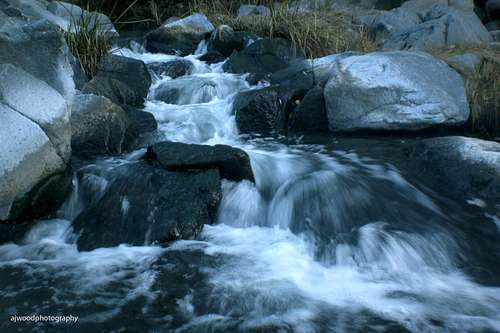
Water outside of vernal pools can be found in the hundreds of watersheds and canyons found throughout the range. The bigger the canyon, the greater chance that you will find water. Most of these streams and springs found in many of the canyons are seasonal. Spring and winter are the best time to hike if you are concerned about water. The majority of the water sources are ephemeral.
Water on the west side drains directly into the Pacific Ocean. Water on the north either drains into the Santa Ana River, Lake Elsinore, or Santa Margarita River. However, in the long run, all of these eventually lead to the Pacific Ocean.
 Santa Margarita River

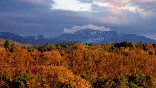
Saddleback Mountain with a dusting of snow.
Snow?- Yes, the range does have snowfall. Modjeska and Santiago Peaks generally receive snow whenever a winter storm hits Southern California. However, the snowfall is generally not very significant and does not last long. On average, temperature plummet at least once every year or so and snow falls on the entire range. However, this is rare.
Red Tape

The main red tape concern is that many different parts are on private land. Also, different areas like the Santa Rosa Plateau Ecological Reserve and the Santa Margarita Ecological Reservehave strict rules regarding their area. Be aware of that and check their websites for more information.
Also, the San Mateo Wilderness Area only allows hiking, no mountain bikes or any mechanical equipment.
The many Forest Service access roads that cut through the area are closed periodically. Also, due to different projects, fires, or other weather conditions, other areas are also closed sometimes. Check THIS link for more information about the current conditions of the Santa Ana Mountains.
To park within the Cleveland National Forest, an Adventure Pass is needed. They can be purchased for day use ($5) or for a yearly pass ($30) at most sporting good stores and at shops in and around the National Forest.
Fires!
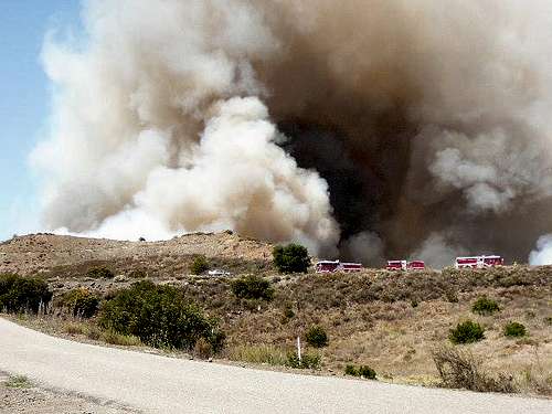
Fire burning by Camp Pendleton.
One Careless Flame.
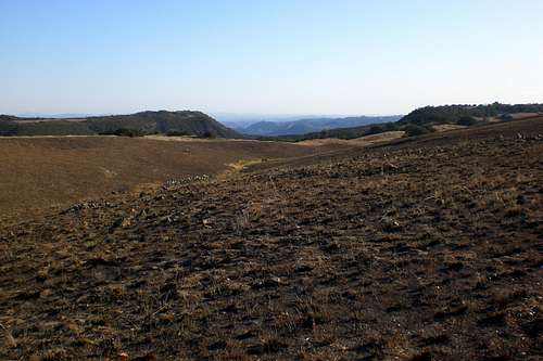
Evidence of a fire.
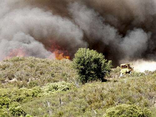
Bull-Dozer tackling the fire
This range is extremely prone to fires. The chaparral landscape is very very dry and will ignite with just about any fire source. In Santiago Canyon, there had never been a wildfire recorded in the canyon (where since records had been kept. Because of this, it was named one of the most high risk fire areas in Southern California.
However, in October 2007, the Santiago Fire broke in just outside the canyon and soon ended that streak. Whipped by Santa Ana Winds [winds that blow in from the desert towards the ocean (East to West)], this fire burned almost 30,000 acres. The fire burned practically right up to Santiago Peak. The Santiago Fire was started by arsonists. This a a recurring problem throughout this range and is the source of many many fires throughout the area. ClickHERE for more information about the Santiago Fire. The Rice Fire was another recent fire that devastated a large area at the southern end of the range. Click HERE for more information about the Rice Fire.
In November, 2009, the Freeway Compex fire devestated much of Santa Ana Canyon and Chino Hills State Park. This fire, like the Santiago Fire, was spurred on with strong Santa Ana Winds. This fire burned for four days and charred hundreds of homes. For more information, click HERE.
Warnings
In the Santa Mountains, you must always be on guard for these two things; rattlesnakes and poison oak. One can kill and the other can just be real annoying.
Rattlesnakes- In the summer, they are not active during the heat of the day, however, in the morning and evening you see them. In a summer day, you may find the out and about all day long. In the fall and spring, expect to see them all the time, except when it is extremely hot or cold. Also, I have seen some as early as February. So always be aware of rattlesnakes. Never reach where you can't see. Never put your foot where you can't see. Don't go walking through thick brush unless you have first made sure its safe. Rattlesnakes sense vibrations, so if your going into a place where you think you might see a snake, bang and stick around or throw some rocks around to make sure its safe.
Poison Oak- This is my personal weakness. I have had it around one hundred times and in every spot possible (don't ask). Poison oak generally grows in dark and damp places. It likes to grow beneath oak trees because water from fog catches on the oak trees and then drips below to the poison oak. The majority of north faces slopes have it as well. Also, around creek beds or in any place that looks overgrown will often support poison oak. What to look for- Leaves of three, leave it be (old Boy Scout saying). Look for a plant that has leaf formations in groupings of three. Its a tall slender plant and often has a red/reddish leaves depending on the time of year.
Plants and Animals

Oak Tree at sunrise
Oak Trees
Animals
A surprising wide array of wildlife can be found. Wildlife such as Mountain Lion, Mule Deer,Bobcat, Coyote, Gray Fox, Badger, Ringtail, Spotted Skunk, Western Gray Squirrel, Woodrat, Kangaroo Rat, Bats, Spotted Owl, Western Pond Turtle, Southern Steelhead Trout, Coast Horned Lizard, Least Bell's Vireo, Golden Eagle, Mountain Quail, Canyon Wren, Arroyo Toad, Western Spadefoot Toad, California Treefrog, California Sister Butterfly, Tarantula, Rattlesakes (Western Diamondback (this fact is up for debate) and Southern Pacific), turkey vultures and many more. The ones in italics are the one more often seen.

Native chaparrel

Wild Onion
Plants
The Santa Ana Mountains hosts a diverse array of plant species. Oak Trees are a key tree that clings to the hills of these mountains. There are two types: Coast Live Oak and Englemen Oak. Many different but distinct plant communities flourish such as coastal sage scrub, chaparral, riparian woodland, southern oak woodland, Rocky Outcrop, Vernal Pool, Valley Grassland, and Montane Coniferous forest. Interestingly, one of the southernmost stands of Madrones can be found in Trabuco Canyon. Groves of Knobcone Pine can be found around Pleasants Peak. Big-cone Douglas Fir and Coulter Pine can be found at the higher elevations around Santiago and Modjeska Peak. Rare flowers like the Intermediate Mariposa Lily, Heart-leaved Pitcher Sage, and Chocolate Lily are difficult to find, but breathtaking to observe. Fragrant sages, evergreen shrubs and trees, perennial bunch grasses, strange succulents, and fire-following flowers adorn the rugged terrain. Unfortunately, poison oak is far too common in this range as well.
History

Oak Trees-What the range is famous for!
Overview
At the time of the first Spanish exploration, the Santa Ana Mountains were settled by two main groups of indigenous peoples, the Tongva in the north, and the Acjachemen and Payomkowishum in the south.
A handful of historic sites remain in the range today. Registered California Historical Landmarks include an Indian Village Site in Black Star Canyon, Flores Peak, the mining boom town sites of Carbondale and Silverado, and Helena Modjeska's home. Cowboys used to occupy the "Adobes", found in the Santa Rosa Plateau Ecological Reserve. These are the oldest structures in Riverside County
Gray Wolf, pronghorn antelope, and California condor also occupied the Santa Ana Mountains.
Also, the Santa Ana Mountains have had some mining use. Silver, lead tin and zinc were found around the Bedford Canyon area. However, limited quantities of ore have been recovered since 1870. Mining however had little success due to the fact that the ore was very hard to trace.
The majority of the range was once owned by the Irvine and the Yorba families. Over the years, much of the land has been sold. However, portions of the range is still owned by them.
Grizzly Bears
In the early pioneer days, believe or not, the Santa Ana Mountains were feared because of grizzly bears. This is hard for me to fathom, but it is true. The Santa Ana Mountains had the densest grizzly bear population in the state of California. According to historians, on the California Flag, the grizzly bear seen walking is walking on bunchgrass- a grass native to the Santa Ana Mountains. Unfortunately (of fortunately, I'll let you decide), the grizzly bears became all but extinct in the Santa Ana Mountains. However, there was one more grizzly bear in the Santa Ana Mountains, a female misnamed Little Black Bear, who was shot and killed in January 1908 on the San Diego side of the county line in Trabuco Canyon. Little Black Bear was the last wild California grizzly in all of Southern California and one of the last of her kind anywhere. It's her hide (skinned, but not stuffed) in the Smithsonian Institute. Little Black Bear also achieved in death the melancholy distinction of being the only Santa Ana grizzly ever photographed. Of the last grizzly killed in Orange County–believed to have been Little Black Bear's mate–nothing remains: no photographs, no hide, nothing but memories, and very few of those.
Old Grizzly Bear Stomping Grounds
To the native peoples of California, the grizzly was a powerful and respected presence. Tribes throughout the state had grizzly shaman, who tried to channel the seemingly indestructible power of the bear (grizzlies were remarkable for being able to survive injuries that would have killed any other animal) in healing and other rituals. But the grizzly also played other roles in belief systems of the California Indians. In Chiningchinich, an Historical Account of the Beliefs, Usages, Customs and Extravagancies of the Indians of This Mission of San Juan Capistrano Called the Acagchemem Tribe, written by the missionary Geronimo Boscano in the early 1820s, the grizzly is depicted as an enforcer of the divine order. A severe transgression against the just order of things would result in the grizzly coming to punish the transgressors. The grizzly was essential in maintaining the stability of the world.
To European settlers, however, the grizzly was a menace. The first recorded killing of a grizzly occurred in 1769, the same year Spanish colonists arrived in California. The grizzly was seen as a threat to people, a belief driven by fear of such massive animals rather than any real evidence. Grizzlies, as California writers from the end of the 18th century into the 20th century agreed, tried to avoid people and rarely attacked unless already wounded by a hunter or if a mother bear perceived a danger to her cubs. More realistically, grizzlies were considered a threat to livestock.
Spectacular stories of grizzlies attacking pigs, sheep and cattle are plentiful–though most are second-hand and almost all have a tinge of hyperbole. Grizzlies, whose diet largely consisted of acorns and roots, certainly did attack livestock, but for the most part, they probably settled for eating the carcasses of animals killed by predators who preferred live prey, such as wolves. The grizzly, paradoxically, occupied both the top and the bottom of the food chain: it was the apex predator, but it was also a scavenger, devouring the leftovers from the kills of others. And it was this scavenger nature that ranchers counted on in their battle against the bears.
The methods used on Don Jose Sepulveda's Rancho San Joaquin, one of the largest ranchos in what would become Orange County, were typical of Spanish grizzly management. Vaqueros would slaughter a cow and leave the remains in area known to be frequented by grizzlies–Santiago and Limestone canyons were considered prime grizzly territory. The vaqueros would withdraw to a safe distance and wait. Eventually, a bear would appear, and after it had begun eating, the mounted vaqueros would swoop down on the bear and lasso its feet with riatas. Rendered immobile, the bear would then either be stabbed to death with lances or torn apart as the vaqueros holding the riatas galloped off in opposite directions.
As the grizzlies declined in number and the surviving bears moved farther from human settlement, this sort of hunting continued, but with one notable change: bears were more frequently taken alive to be used in such entertainments as bear and bull fights. The grizzly had gone from menace to source of amusement.
The Englishman Frank Marryat, who wrote one of the most accurate descriptions of these fights, found nothing amusing about them, calling them "the most cruel and senseless" thing he had seen in California. (Marryat was by no means a green in the current sense of the word. In his 1855 book, Mountains and Molehills, he recounts with pride killing a grizzly cub he happened across while hunting, even though he says he found the cub to be perfectly harmless and extremely cute.)
The bear, cramped in his limbs by the strict confinement that his strength and ferocity have rendered necessary, is placed in the arena; and attached to him by a rope is a bull, generally of fine shape and courage and fresh from the mountains. Neither animal has fair play, and, indeed, in most instances, each one avoids the other. The bull's power of attack is weakened by the shortness of the tether, while the bear, as above mentioned, has scarcely the free use of his muscles. . . . The fight generally ends without much damage on either side, for the simple reason that neither of the combatants means mischief. Bear and bull fights were popular throughout the 19th century in California, but they became less frequent as grizzlies became rarer. The arrival of Anglo-Americans at the end of the 1840s accelerated the bear's decline. The Americans brought improved technology with them: the repeating rifle, the steel trap and strychnine. Each would play an important part in the eventual extinction of the California grizzly. The role of the first two is obvious, but the importance of strychnine requires a word of explanation.
Rather than rely on hunting to keep their livestock safe from grizzlies, many American ranchers preferred to poison the bears. The rancher would slaughter an animal, lace the carcass with strychnine and leave it on the edge of his property, where it was likely to attract bears. On a ranch where bees were kept, a poisoned pool of honey often took the place of the dead animal. In the morning, the rancher would check to see what had taken the bait. The poison usually wasn't enough to kill a large grizzly, but it would incapacitate the bear, making it easy to shoot. In their book California Grizzly, Tracy Storer and Lloyd Tevis cite examples of ranchers who collected sheds full of grizzly skulls in this manner. The ranchers were generally not proud of what they had done, but considered it a necessity."
Because of the grizzlies, Teddy Rosevelt was invited to come out to hunt them. However, he was long in coming to Southern California. By the time Theodore Roosevelt arrived in Los Angeles, there would have been very little point in inviting him to hunt for grizzly. The last grizzly in Ventura County was killed in 1882. San Bernardino's last grizzly was shot in 1868. Riverside's last grizzly was recorded in 1895. And no one in Los Angeles County had seen a grizzly outside a zoo since 1897. In 1903, when Teddy Roosevelt was making speeches in Los Angeles, it's very likely there were only two wild grizzlies left in Southern California. In a few months, the number would be one.
Now, the grizzly bear is but a myth- a tale long forgotten memory of days long past. However, even though many people do not know of the grizzlies existence in Southern California and in the Santa Ana Mountains, the grizzly had imprinted an everlasting impression upon the Indians, settlers, and trappers of early California.
(assorted parts of this section taken from OC Register)
Black Star Canyon
Black Star Canyon is perhaps best known to historians as an important archaeological site as much information concerning the daily lives of the Gabrielino or Tongva people has been uncovered through studies of artifacts found in the canyon. It is known that many of the native Tongva people fled to the mountains in the summer, searching not only for relief from the heat, but acorns, their main source of food, which were easy to find among the canyon's many mature oak trees. It is very likely that the settlement, located in the upper part of the canyon (just past the top of the last switchback) was inhabited for only part of the year. The site of the settlement is now California Historical Landmark #217. As Jim Sleeper asserts in his 1976 book A Grizzly Introduction to the Santa Ana Mountains, Indian settlements were very sporadic, as the grizzly bear population of the Santa Anas was comparatively very high for such a small mountain range. Signs of Indian habitation, such as the "pothole rocks," are found only in canyons, such as Black Star or Bell canyons, where grizzly populations were known to have been low. The canyon to the north, Fremont, has just as many oak trees and forage sources as Black Star, with no archaeological traces of any human habitation, likely because the canyon was home to many bears.
The canyon is celebrated in local lore for a fabled Indian massacre, said to have been perpetrated by a company of Spanish conquistadors. In truth, the actual historical event, according to oral history, involved an armed conflict between early American fur trappers and a group of Gabrielino Indians in the year 1831. Below is a recounting of the story from the book Shadows of Old Saddleback by Terry E. Stephenson (1930).
The story of the battle, the bloodiest in the history of the Santa Ana Mountains, was told seventy years ago by William Wolfskill to J. E. Pleasants, and was repeated to us by Mr. Pleasants. The Indians were very fond of horseflesh. Ranchos were lacking in means of defense in the days when the missions were breaking up and Indians from the mountains and desert used to have no trouble in stealing herds of horses from the Spaniards. A party of trappers came across from New Mexico in 1831. Their long rifles and evident daring offered to the troubled dons a solution to their horse-stealing difficulties. Americans were not any too welcome in the Mexican pueblo of Los Angeles, and it was with a desire to please the Spaniards [Mexicans] in this foreign land a long way from the United States that the American trappers agreed to run down the Indian horsethieves. The trail of the stolen band of horses was followed across the Santa Ana river, eastward through what is now Villa Park and up the Santiago canyon to the mouth of Canyon de los Indios... Here, the trail turned into mountain fastnesses, into the unknown mountains, covered heavily with brush…The trail took the men up a steep mountainside, and, after two or three hours of climbing there was laid out before them a little valley with grassy slopes and hillsides [today called Hidden Ranch], upon which horses were quietly grazing. Smoke was coming from fires in the age-old campground of the Indians at the lower end of the valley. The Indians were feasting on juicy horseflesh. Perhaps it was the crack of a long rifle, the staggering of a mortally wounded Indian that gave the natives their first warning of the presence of an enemy. Among the oaks and boulders an unequal battle was fought. There were no better marksmen on earth than these trappers…The Indians were armed with a few old Spanish blunderbusses [muskets] and with bows and arrows. The battle was soon over. Leaving their dead behind them, the Indians who escaped the bullets of the trappers scrambled down the side of the gorge and disappeared in the oaks and brush. Of those who had begun the fight, but a few got away. The stolen horses were quickly rounded up. Some of them were animals stolen months before. The herd was driven down the trail to the Santiago and a day or two later, the horses were delivered to their owners. In the battle, not one of the frontiersmen was wounded.
This was not the only time the canyon will find itself the scene of a murder. In 1899, long after the canyon had been settled by both Anglo-American and Mexican homesteaders, a shooting occurred at hidden ranch that would forever change Orange County’s early political scene. The following passage is taken from Stephenson’s Shadows of Old Saddleback (1930).
Perhaps no death by violence touched the public career of any man in the county so much as did the killing of James Gregg on June 9, 1899, affect the career of its superior court judge, the late J. W. Ballard. The Hidden Ranch at that time was in the hands of Henry Hungerford of Norwalk and George M. Howard of Anaheim. At the ranch with them was Hungerford’s brother, Thomas L. Hungerford. On the evening of June 8, James M. Gregg of Centralia and his brother-in-law, Decatur Harris, and a 13-year-old boy, Clinton Hunt, arrived for the purpose of driving out some stock that Gregg owned. Gregg and Henry Hungerford quarreled. It seems that Howard owed Gregg $10 on a horse trade, and Gregg insisted that Hungerford and Howard accept $7.50 in settlement of their pasturage bill of $17.50. That night, Gregg, Harris and the boy slept on the ground in front of the house. When Gregg was rolling up his blankets the next morning, Henry Hungerford came out and the dispute resumed. It ended in shooting. The Hungerfords, each armed with a shotgun, and Gregg, with a revolver, fought it out. When the shooting ceased, Gregg was on the ground with charges of birdshot and buckshot through him. The Hungerfords hitched up a horse and drove down Black Star and on into Santa Ana, where they gave themselves up to Sheriff Theo Lacy. In the meantime, Gregg was laid in a spring wagon by Harris and the boy and was being taken to a doctor when, near the Irvine Park in Santiago canyon, the wagon was met by Sheriff Lacy and District Attorney R. Y. Williams. A doctor was found at El Modena and it was at a house in El Modena that Gregg died. The trial before Judge Ballard resulted in the conviction of Henry Hungerford. In those days killings were infrequent and a trial of this kind created an interest that was widespread and intense. Public sentiment was against the defendants. Following conviction, a new trial was sought, and unexpectedly Judge Ballard granted the motion on the ground that not enough evidence had been produced to warrant the verdict. Having presented all the evidence available there was nothing for the district attorney to do but ask for the dismissal of the case. Soon afterward, Judge Ballard came up for re-election, with Z. B. West as his opponent. Judge Ballard’s decision in the Hungerford case was the outstanding issue of the campaign, which was vigorous and which resulted in the defeat of Judge Ballard.
Under Spanish, and later Mexican rule, the canyon was called Canada de los Indios. Much of grassy foothill terrain to the west (across Irvine Lake) was part of the expansive Mexican land grant of "Rancho Lomas de Santiago (Ranch of Saint James' Hills)". The rancho later fell into the hands of the pioneer and horticulturalist William Wolfskill, and finally James Irvine, before becoming part of the Cleveland National Forest in the late 1880s. In the late 19th Century, it was the site of a short-lived coal mining operation called Black Star Coal Mining Company in 1879, which gave the canyon its current name. The coal was originally dug from a shallow pit on the hill just east of the canyon mouth, and sold by the wagonload as early as 1876 by canyon residents. While the operation lasted, six to ten tons of medium- to low-grade coal were extracted each day from the mine's 900 feet of tunnel. From there, mule teams hauled the cargo to Anaheim or Los Angeles by wagon. Unfortunately, a survey was run of the mine in the late 1870s, previously thought to be operating on government land, and it was found that the land actually belonged to the Irvine Ranch. Promptly losing interest in the mine, James Irvine sold the operation back to its former owners, destroying any possibility of profit. The Black Star mining operation was later replaced by the Santa Clara Mine, a more successful enterprise that sustained the town of Carbondale (once existed at the mouth of Silverado canyon), before it was taken over by AT&SF railroad. Traces of the Black Star mining operation can still be found, including rusted mining equipment, abandoned shafts, and piles of low-grade coal scattered about the floor of the canyon (similar to those found in Fremont Canyon to the north). Today, public access to the canyon's upper reaches in the Cleveland National Forest is currently allowed via a county easement through the lower section of the canyon (mostly private property), though County officials do not maintain the road.
Black Star Canyon's mysterious nature and its colorful, often dark history has given rise to a whole host of urban legends and ghost stories throughout the Orange County area. The air of mystery surrounding the canyon is further enhanced by its eerie silence and being prone to sudden gusts of wind (both due to its unique geography). Though historically inaccurate, one of the most popular ghost tales, which originally appeared on the Internet in 1995 and later published in the book Weird California, tells of a group of friends who witnessed the ghosts of the Spanish conquistadors marching down the hill in the form of small, black shadowy figures (Read here). Many of the more popular legends have sprung from the fact that Black Star Canyon was, allegedly, the meeting place of a Satanic cult in the 1980s, which is often misstated as having been the Ku Klux Klan due to the numerous hikers' reports of seeing distant bonfires in the canyon. Other stories include the canyon being haunted by a demon called "Black Star", being home to extraterrestrials and/or a secret military installation, and being guarded by Indian spirits. The oldest ghost story involving the canyon came from the Spanish, and involved the canyon being haunted by a banshee called "La Llorona" (The Wailer), who was said to live in a well and have the head of a horse. The following excepts, illustrating the rich urban legends and stories surrounding the canyon's history, is from the paranormal website.
The site of multiple Indian massacres dating back to the time of Spanish occupation, Blackstar Canyon is home to many strange phenomena. Indians said to have been spotted both roaming the ridges on horseback and walking the creek for a few steps before disappearing completely. Many night hikers report the feeling of being watched, and the sounds of an invisible presence pacing them shortly off the trail. Screams and howls haunt the night along with the faint chants of an age and people long past. Note: If you are planning an expedition to Blackstar Canyon, travel in groups as it is a very dangerous place, and pay no mind to the homemade "Private Property" signs. The Orange County Sheriffs Office has confirmed that all of the trail is in fact open to the public, and those signs were hung some time ago by squatters attempting to keep people off the land." "It's located behind Irvine park and the signs that say "no authorities will help you beyond this point" is a main reason why people don't go in. It's supposed to be home of the "KKK" and strange sightings and noises are heard such as running and screaming. Also lion type figures are said to be walking on the mountain tops. "Warning" If you do plan to go take flashlights because it's is freakishly dark (a sort of weapon would also be a good idea)." "The spectral inhabitant located in Black Star Canyon is dubbed “The Blue Lady” by the few individuals who have been able to catch a glimpse. Though she has been reported as having been seen in Black Star Canyon the primary information on her stems from sightings at the El Toro Memorial Park.
According to visitors, there is a group of eccentric individuals living in the canyon who attempt to guard the area as if it were private property (they have been known to threaten hikers and mountain bikers by brandishing shotguns), but the canyon is still considered open to the public and all legal recreational activities. The beginning of the canyon is marked with signs which declare the road as private, which is half-true since the lower part of the road is privately maintained, although the county and, therefore the forest service, have an easement of public right-of-passage on the road, and have had that right for many decades. As is true with all wilderness areas, it is recommended that those exploring the canyon do not travel alone, especially at night.
(text taken from Wikipedia)

Santa Margarita River
Santa Margarita River
"In the 1880s, Railroad tracks laid from the coast to Temecula along the Santa Margarita River (SMR) in 1882 and 1883. The first train traverses the SMR canyon on 9/13/1883. The tracks wash out on 2/15/1884; the line was rebuilt, and service resumed in 1885. In the 1890s, the Sante Fe Railroad builds a new line along the coast due to repeated washouts of inland track. In 1916-7, floods permanently close railroad station near De Luz. A Railroad train was stranded in Temecula Canyon when tracks washed out. A Pasadena house mover salvaged the equipment and laid temporary track down Fallbrook's Main Street for the train.
Santa Margarita River
In, 1924, Fallbrook Irrigation District announces plans for dam on the Santa Margarita River, 167' high, with the reservoir covering about 585 acres (which never went through). In 1926, Owners of the Rancho Santa Margarita y Las Flores (now known as Camp Pendleton) sued to limit the amount of water that Walter Vail could take from the upper SMR basin. In, 1934, The Fallbrook Irrigation District votes to go ahead with proposed Lippicott Dam on the Santa Margarita River, and asks the feds for $2,366,701. The request was obvivously denied.
In 1940, the 1926 suit was settled. The lower SMR basin water users were awarded 2/3 of the water flow, and upper basin water users granted 1/3. In 1949, FPUD and Camp Pendleton agree to jointly build a dam on the SMR (these plans ultimately fell through)
During the 1950s, The Fallbrook Public Utility District (FPUD) purchases 1200 acres along the SMR from Camp Pendleton to Riverside County to use as a reservoir by building two dams. In response to the 1951 suit, an independent water master was appointed by a federal judge to manage the watershed. Finally, in 1967. One of the longest, most involved and most expensive water rights litigations ends with an agreement between FPUD and the U.S. Navy giving FPUD 40% of the water from the lower basin of the Santa Margarita River and the Navy 60%.
1968. FPUD and Camp Pendleton announce plans to jointly build two dams on the SMR, the Santa Margarita Project. However, in 1984 FPUD abandoned these plans to build the two dams on the SMR due to the environmental opposition."
(text taken from HERE.)
Santa Rosa Plateau

"The Santa Rosa Plateau, with an average elevation of 2,000 feet, is located at the southern end of the Santa Ana Mountains in southwestern Riverside County, California. Ancient oak woodlands, rare bunchgrass prairie, and aromatic coastal sage scrub are a few of the plant communities that reside on this land located less than 20 miles from the Pacific Ocean.
The Plateau’s mild climate made the area an ideal habitat for people, beginning thousands of years ago with the arrival of Native Americans. Ancestors of local American Indians, known today as the Luiseno, harvested and hunted the oaks and mule deer that are still found on the land today. This hunting and gathering way of life came to an end on the Plateau in the 1820’s with the secularization of mission lands.
The Santa Rosa Plateau became Rancho Santa Rosa under a 47,000 acre 1846 Mexican land grant to cattle and sheep rancher Juan Moreno. In 1855, Senor Moreno sold his ranch to land-grantee neighbor Augustin Machado (owner of the Rancho La Laguna, today the Lake Elsinore area) for one thousand American dollars. The Moreno and Machado adobes still stand as the oldest structures in Riverside County.
The ranch passed from owner to owner until 1904, when the Vails, a ranching family from Arizona, purchased the Santa Rosa, plus much of what was to become Murrieta and Temecula. They continued to operate their large cattle ranch for the next sixty years. Fortunately, for the sensitive habitats on the Plateau, the Vails were wise stewards of their property. They kept the number of head per acre to a sustainable amount, and only grazed during the wet months, moving the cattle down to valley feed lots when the dry summer season arrived. The grazing practices of the Vail Ranch management may be the reason the Plateau is considered by many to be the finest remaining example of a once widely-scattered California bunchgrass prairie system.
In 1964, the Vails sold the ranch to the Kaiser Steel Company, which master-planned Rancho California - the communities that today comprise the cities of Temecula and Murrieta. In the first two decades of that era, grazing leases allowed cattle operators to continue to use the Plateau. Overgrazing and year-round use caused habitat deterioration during that twenty-year period, including the formation of deep erosion channels along the Plateau’s main creeks.
In 1984, The Nature Conservancy of California, recognizing the intense concentration of unique and rare species supported on the Plateau lands, purchased 3,100 acres in two parcels from the owner, KACOR (a subsidiary of Kaiser Steel). The intervening lands were targeted for later conservation purchase.
In the late 1980’s, however, Ranpac Inc. of Temecula purchased 4,000 acres comprising most of the intervening lands and prepared a specific plan for approximately 4,000 homes. A citizens group, Preserve Our Plateau, formed to try and protect the property from development. Purchase money was sought to buy the land back from Ranpac, who was agreeable to a sale. Awareness and moral support was widespread, but funds were scarce; county, state and national agencies were unable to secure enough for a purchase.
Seeking extensive and significant off-site mitigation opportunities for a new, large storage reservoir planned in the region, Metropolitan Water District of Southern California (MWD) approached the organization with an offer to provide $15.4 million towards a purchase in exchange for mitigation credits for their future Eastside Reservoir Project. The County of Riverside nearly matched that funding with $15 million; the State of California’s Wildlife Conservation Board provided $5 million from Proposition 117 (Mountain Lion Initiative) funds. The Nature Conservancy handled negotiations and provided closing costs. Each entity purchased its own property, but the entire site - known collectively as the Santa Rosa Plateau Ecological Reserve - is managed as one biological unit.
The four landowners (the state, county, MWD, and The Nature Conservancy), and the U.S. Fish and Wildlife Service (which owns no land on the Plateau, but has an interest in its rare and endangered species) signed a cooperative management agreement and today meet monthly to oversee management of the Reserve. Biological resource management, including a prescribed fire program and habitat restoration, is conducted by The Nature Conservancy while visitor management, including a Visitor Center and 40-mile trail system, is conducted by Riverside County Regional Park and Open-Space District. Metropolitan Water District of Southern California provides an education grant which allows over 5,000 local grade school children to visit and become inspired by one of their communities most outstanding resources.
Additional purchases have now expanded the Plateau’s protected size to nearly 8,500 acres. Annually, more than 40,000 day-use visitors travel to the Reserve for hiking, nature study, photography, etc. Visitors may also use designated trails for horseback riding and mountain biking."
(text taken from Santa Rosa Pleateau")
External Links
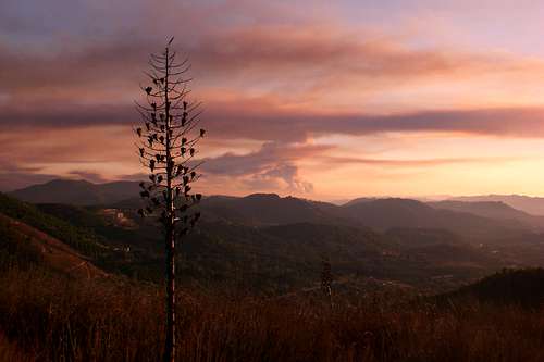
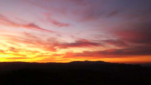 Santa Ana Moutains Sunset
The Nature Conservatory
Wikipedia
Sierra Club
SAMNHA
Trabuco Ranger District
1147 East Sixth Street
Corona, CA 92879
(951) 736-1811
Fax-(951) 736-3002
Geographical Features
Santa Margarita Ecological Reserve
SoCal Camping
Cleveland National Forest
San Mateo Wilderness Area
Chino Hills State Park
Misc
I am in need of more pictures for this page!. Also, if you have any other information not already on this page please tell me and I will be happy to add it.
Santa Ana Moutains Sunset
Cedar - Feb 6, 2010 4:00 pm - Voted 10/10
Another Mountainhttp://www.summitpost.org/mountain/rock/154824/sierra-peak.html Northernmost mountain in the range. Seems to not yet be attached.
Alex Wood - Feb 8, 2010 9:36 pm - Hasn't voted
Re: Another MountainI attached it, thanks! Have you climbed Sitton Peak?? That page needs a bunch of work on it...
Cedar - Feb 13, 2010 5:05 pm - Voted 10/10
Re: Another MountainI have climbed part of the route from the Candy Store but headed back down after daylight ran out. I'll see what I can do once I get a bit more free time. Meanwhile, I'll write up a comment (like I did last time with Modjeska Peak) about what to improve. If the author doesn't respond by the time I get back up there (99% chance he won't since last active date is 2007), I'll take it over.
Alex Wood - Feb 17, 2010 2:35 am - Hasn't voted
Re: Another MountainNice! it seems like a really cool peak, but the information on it is definitely lacking.
jkoeppel - Aug 28, 2014 11:40 pm - Hasn't voted
Last GrizzlyI read the section regarding the last southern California grizzly. There are several editions of this story, and I've heard the one printed here about the last grizzly being killed in Trabucco Canyon. This is likely incorrect. The last grizzly in southern California was likely killed in 1916 in Big Tujunga Canyon (although this is disputed too, but the best researched account I ever saw). You may wish to read Josh Sides' recent article on this in Natural History Magazine. You can find it here: http://www.naturalhistorymag.com/features/182751/the-sunland-grizzly.