Overview
It has come to my attention that Deer Creek Narrows is now closed to canyoneering as of June 2012! The closure was made suddenly and without many people knowing. Why it is closed, I do not know. What you can do is contact Laurie Parish, the superintendent of the Grand Canyon National Park, of your dissatisfaction by sending an email to her at laurie_parish@nps.gov.
Deer Creek Narrows or Lower Deer Creek Canyon is a stunning technical slot canyon located inside of
Grand Canyon National Park on the North Rim. Deer Creek Narrows is a very short slot canyon being only around 0.4 miles (500 meters) long. In those 0.4 miles, there are four rappels, with the last one being a 190 foot rappel off of Deer Creek Falls that lands one right next to the mighty Colorado River in the bottom on Grand Canyon! Even though the canyon is so short, you still have to work very hard for it. There are three upper forks to Deer Creek Canyon too but this page will focus on the lower section of Deer Creek Canyon that is most often called Deer Creek Narrows. The approach to Deer Creek Narrows is around 20 miles round trip with around 10,000ft of elevation gain and loss. So not only are you able to do an awesome technical slot canyon, you are also able to to hike the beautiful Bill Hall trail inside of the Grand Canyon. Generally, people do this trip in 2-3 days. Some have done it in one very long day. I would recommend doing it in 3 days in order to fully enjoy the area.
![Deer Creek Falls]() Last Rappel- 190ft!
Last Rappel- 190ft! | ![Inside Deer Creek Narrows]() Inside the narrows
Inside the narrows |
Route Description
Approach- Start at Monument Point, which is the starting point for the Bill Hall Trail. Follow this down to the Esplande. Continue hiking over the Esplande to Surprise Valley. Take the trail right (West) once you reach Surprise Valley and head towards Deer Creek. While you are going down, you will pass Deer Spring on the left side (this is your last water source on the way up). At the bottom, you will reach Deer Creek. Follow this downstream until you reach the camping area and pit toliet. If your camping here and even if you aren't, I would recommend stashing all of your excess gear here. From here, follow the trail downstream for another 10 minutes and you will be at the start of Deer Creek Narrows.
![From the Esplande]() Atop the Esplande
Atop the Esplande | ![Bill Hall View]() Looking down from near the top of the Bill Hall Trail-Long ways to go
Looking down from near the top of the Bill Hall Trail-Long ways to go |
![The Begining]() Start of Deer Creek Narrows
Start of Deer Creek Narrows | ![Rappel 1]() Bottom of Rappel 1
Bottom of Rappel 1 |
![Raging Water]() One of the numerous small and easy downclimbs in this section
One of the numerous small and easy downclimbs in this section | ![Rappel 2]() Kory on Rappel 2
Kory on Rappel 2 |
![Rappel 2 Anchors]() Rappel 3 Anchors
Rappel 3 Anchors | ![Midway on Rappel 3]() Midway on Rappel 3
Midway on Rappel 3 |
![Rappel 4]() The falls for Rappel 4. Taken from the anchors of Rappel 5
The falls for Rappel 4. Taken from the anchors of Rappel 5 | ![Hexcentric Anchor]() Hexcentric as the second anchor for Rappel 4
Hexcentric as the second anchor for Rappel 4 |
![Over the Edge Bolts]() Over the edge anchors..these are your second option for anchors on this last rappel
Over the edge anchors..these are your second option for anchors on this last rappel | ![Looking Down]() Looking Down the Big Rappel
Looking Down the Big Rappel |
![Last Rappel]() Rappeling the last waterfall...all 190ft of it!
Rappeling the last waterfall...all 190ft of it! | ![Half Way Down]() Half Way down the last rappel
Half Way down the last rappel |
![From Afar]() Deer Creek Falls from the River
Deer Creek Falls from the River | ![Looking Up]() Looking back up Rappel 5
Looking back up Rappel 5 |
![Kory Rappeling]() Rappelling on the third rappel
Rappelling on the third rappelGetting There
![Beginning the Appraoch]() The Approach
The ApproachRed Tape
![Waiting]() Waiting for Rappel 3
Waiting for Rappel 3Camping
Camping can be done all around.
In the Canyon-
If you are doing Deer Creek Narrows, it would be best to camp at the Deer Creek Campground (AX7 is the permit designation). There is a pit toliet, plenty of water, shade and easy access to Deer Creek Narrows.
![Canyoneering Christmas Tree]() Drying our gear at Deer Creek Camp
Drying our gear at Deer Creek Camp![Tapeats Canyon]() Tapeats Canyon and Thunder River
Tapeats Canyon and Thunder River![Eslpande Hoodoo]() Esplande Hoodoo
Esplande HoodooExternal Links
Todds Desert Hiking Guide
Great information about Deer Creek Narrows and lots of good informational about other canyons.
Grand Canyoneering
Todd Martain's comprehensive guide to canyoneering in the Grand Canyon.
AZHikes
Awesome photos and information on Deer Creek Narrows. Great resource for other off the grid hikes.
Grand Canyon National Park
Grand Canyon National Park Website with everything you could ever want to know about the Grand Canyon.
Technical Slot Canyon Guide to the Colorado Plateau
Michael Kelsey's Canyoneering book. His book is amazing for many of the slot canyons on the Colorado Plateau. The information about Deer Creek Narrows is awesome.
Current Weather Conditions
Current weather conditions as forecasted by NOAAMisc and Disclaimer
If you have any more additional information or photos, please contact me or add them to this page. This canyon is a very arduous undertaking. While I can provide lots of information about the canyon, flash floods always rearrange slot canyons and I cannot guarantee the information will be up to date. Always check for current conditions and go prepared for the worst. New beta will be posted as necessary. Thank you!

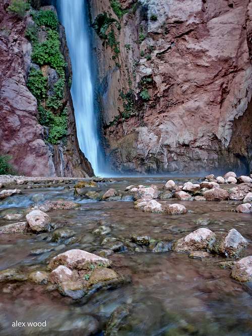 Last Rappel- 190ft!
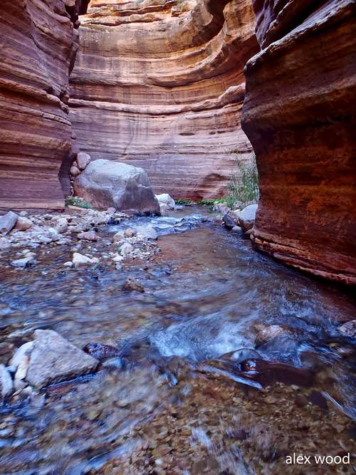 Inside the narrows
 Atop the Esplande
 Looking down from near the top of the Bill Hall Trail-Long ways to go
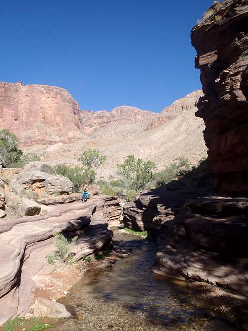 Start of Deer Creek Narrows
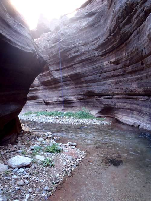 Bottom of Rappel 1
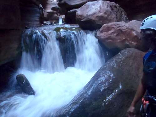 One of the numerous small and easy downclimbs in this section
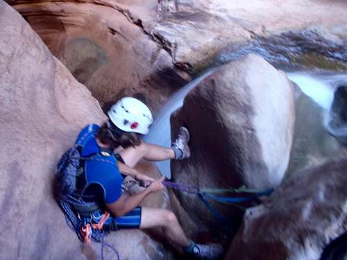 Kory on Rappel 2
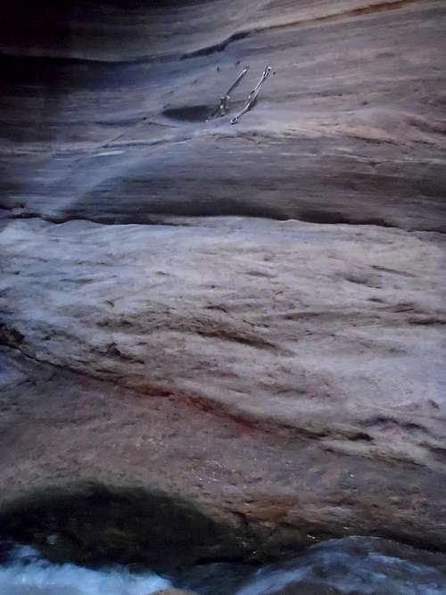 Rappel 3 Anchors
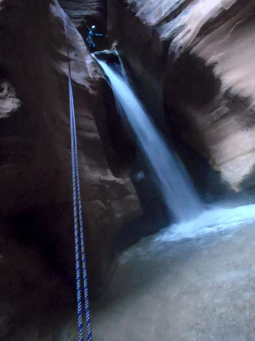 Midway on Rappel 3
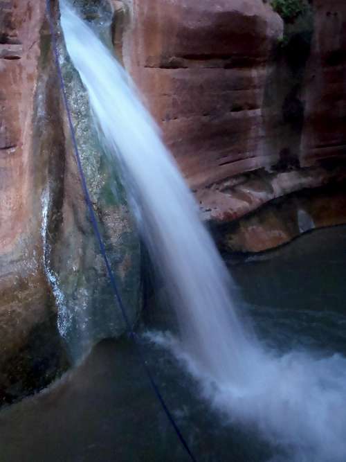 The falls for Rappel 4. Taken from the anchors of Rappel 5
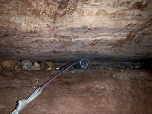 Hexcentric as the second anchor for Rappel 4
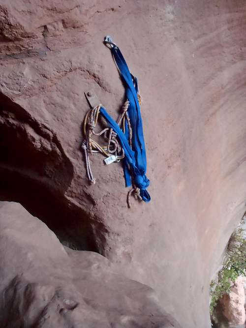 Over the edge anchors..these are your second option for anchors on this last rappel
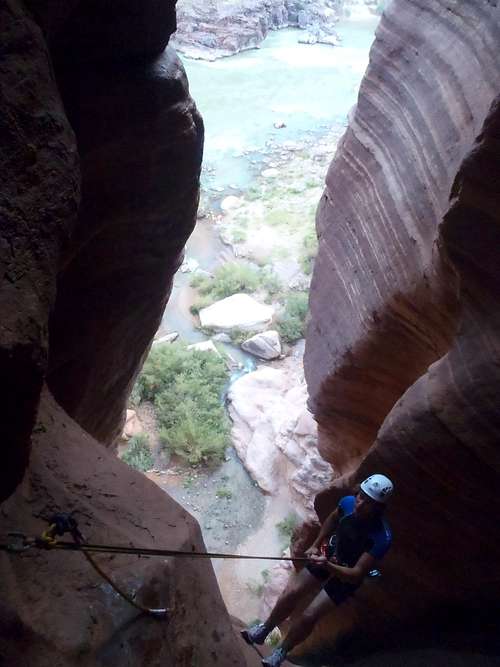 Looking Down the Big Rappel
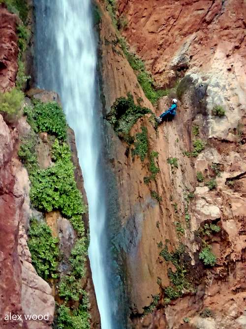 Rappeling the last waterfall...all 190ft of it!
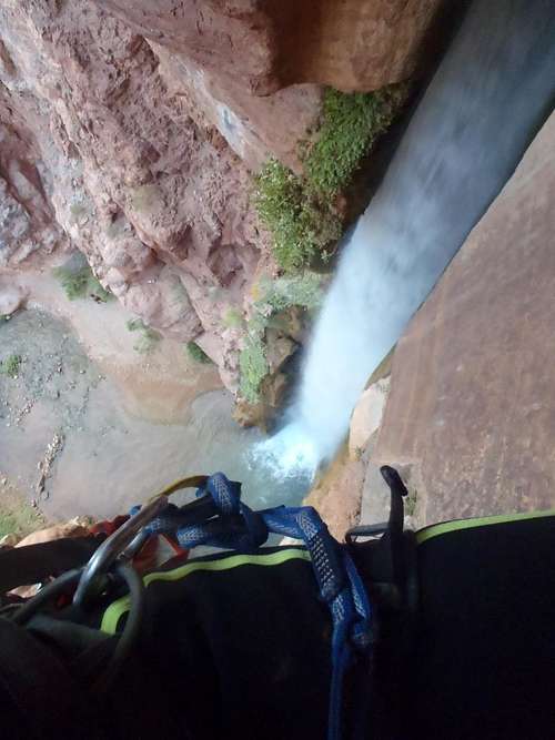 Half Way down the last rappel
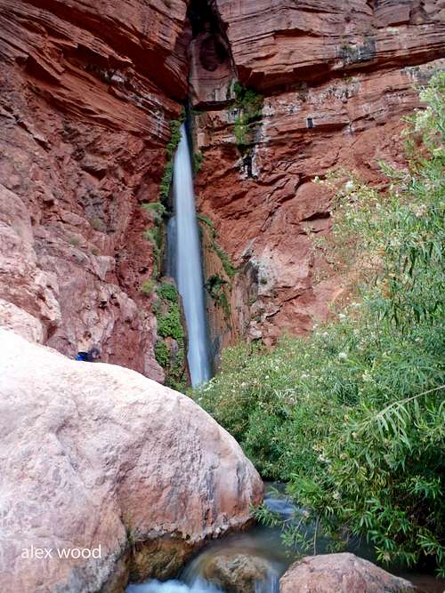 Deer Creek Falls from the River
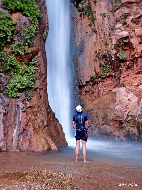 Looking back up Rappel 5
 Rappelling on the third rappel
 The Approach
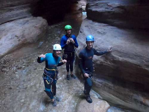 Waiting for Rappel 3
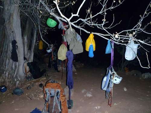 Drying our gear at Deer Creek Camp
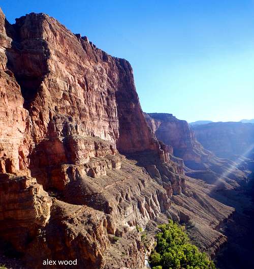 Tapeats Canyon and Thunder River
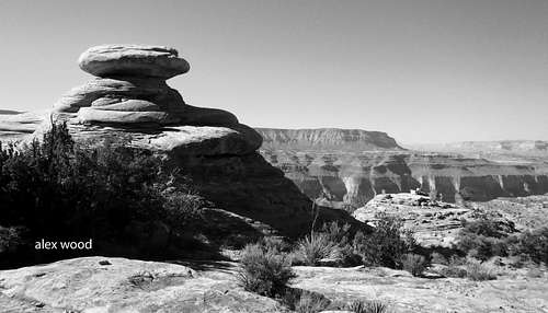 Esplande Hoodoo