
-
 9949 Hits
-
 81.84% Score
-
 14 Votes
|
|
Canyon |
|---|---|
|
|
37.97458°N / 110.48707°W |
|
|
Canyoneering |
|
|
Spring, Summer, Fall, Winter |
|
|
Overview
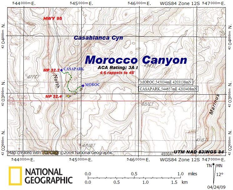
Morocco Canyon is a short and sweet slot canyon located in the North Wash region in Robbers Roost Country. Like the Merry Piglet Slot, it is a Wingate slot instead of a Navajo slot which gives it a different feel and offers a different experience. This canyon is characterized by a few awkward rappels, including one overhanging drop and some very nice narrows with a very short approach. If you only have a half day to do something or it is the middle of winter this is a great canyon to do. Utah Highway 95 heads south out of Hanksville to the east of the Henry Mountains and follows North Wash all the way to Lake Powell so many of the slots in the area, including Morocco Canyon, dump right out onto the highway. Longer canyons in the area can be approached by the Cedar Point Dirt Road which heads east off the highway just to the north of the junction with Utah Highway 276. Merry Piglet slot is a short slot in this area. The map below shows the location of this canyon.
Getting There/Route
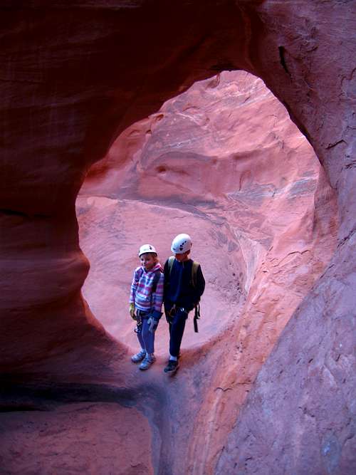
To get to this canyon, drive south on Highway 95 out of the small town of Hanksville, Utah. The highway starts here at mile zero and the mile markers are important to finding the correct place to pull out and park. Continue south on the highway as you begin descending and following North Wash. Once you reach mile marker 32.2, you will see a pull out on the left (east) side of the highway where there is a large area for camping and a small fire ring. This spot is located at the mouth of Casablanca Canyon and you will notice a man-made ditch and a metal culvert which takes any water under the highway and into North Wash. Park just off the highway near the fire ring on the north side of the large ditch. Where Morocco canyon dumps out is actually 0.2 miles further down the highway at mile mark 32.4 but you will have a short approach as shown on the map above. From where you park, hike around to the south side of the the ditch (over the metal culvert on the highway) and aim for the Wingate slickrock just to the east. Hike up the slickrock which is not very steep to the southeast and ascend about 60 feet from the highway. You should not exceed class 3 at any point. Begin turning to the south as you head through a small bowl above the highway and locate the contact between the Wingate and the Kayenta. Walk on a ledge to the south and round the corner on this contact. This ledge is pretty exposed as you head above a cliff just before rounding the corner. Continue around and head back to the east along the north rim of the slot until you get to the start of the slot marked by an open sandy area with a large rock pile marking the first deadman anchor.
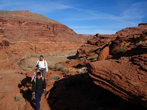 Hiking on the ledge to Morocco Canyon | 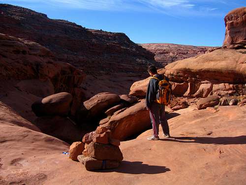 Scott at the first anchor to start the slot |
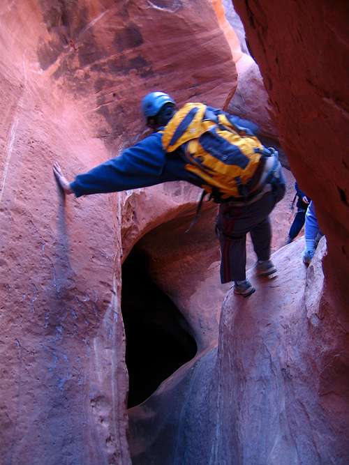
Once at the first anchor (which we improved a little) rap down the first rappel which was maybe 20 feet or so. Once inside the canyon work your way down through some nice narrows until you get to a small drop over a chalkstone with a pothole below and to the left side of the canyon. This pothole typically has water in it and would be a keeper if you fell in but it can be avoided. Stem down a little bit and walk on a nice ledge on the right side of the canyon and avoid the pothole. Just as you round the corner to the right you will notice a very nice arch. When you can see the arch it is a short jump to the sand below. Just past this is rappel 2. The anchor for rappel 2 is a large chalkstone and the rappel starts down a tight slot then becomes overhanging halfway down. Once you touch the ledge below the overhanging spot you can walk to either side and reach the canyon bottom once again. This drop is about 35 feet.
 Scott descending on the ledge to avoid the pothole. | 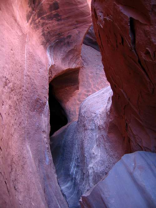 Looking down the pothole drop. The ledge to use is on the right. |
 Under the arch | 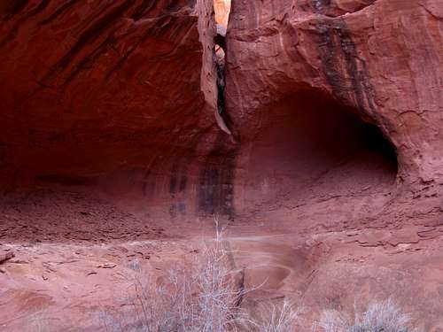 Looking back at rappel 2. The overhanging section seen right in the middle |
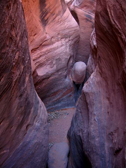
Beyond rappel 2 the canyon opens up a bit and you pass bu some nice cottonwood trees. Walk down canyon and you will quickly come to rappel 3 which is done off a chalkstone. On this 25 foot drop it is angled so use caution when rappelling to avoid bashing your hands on something. Continue down and pass by a spot where you may find some water but it's pretty easy to stem over or bypass by climbing up the right side on a large ledge and descending back down slickrock right before the anchor for rappel 4. This is another deadman anchor that we added some rocks to and you rappel down a 45 foot drop with somewhat of an awkward start since you don't want to pull up on the anchor at all.
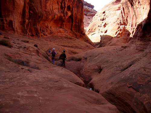 Walking through the open section after Rappel 2 | 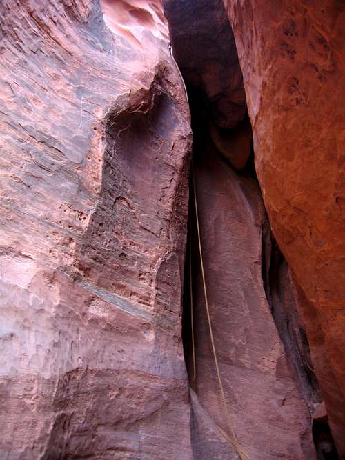 Looking at Rappel 3 | 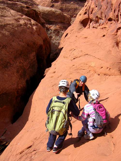 Walking around some water. Rappel 4 is below |
After rappel 4 the canyon slots up and you will come across another chalkstone with an anchor for a short 12 foot drop that can be down-climbed if you are fairly tall by stemming on both sides and working your way down. You could also handline or rappel this short drop. Just past this is another short drop under a chalkstone and down a 6 foot dryfall that you can simply slide down. I actually went over the chalkstone and basically jumped down but there was less sand here so it would be best to have someone spot your landing. After a few more minutes down canyon you will come to the final rappel (Rappel 5) off on a deadman anchor. This 30 foot drop was pretty simple however you really don't want to pull up on this anchor so you will have to start the rappel by down climbing a bit. After everyone makes this drop it is a short hike back to the highway. Turn right and hike north along the road for 0.2 miles back to your car.
 Looking down the short drop that can be DC'ed | 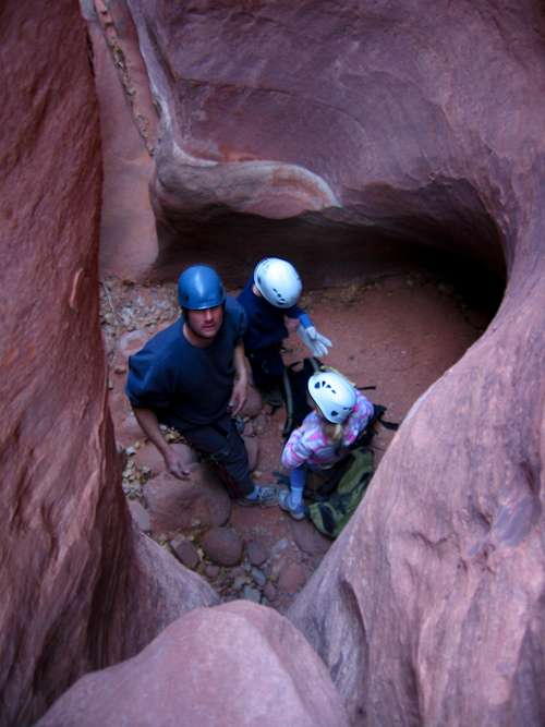 Looking down the short slide down | 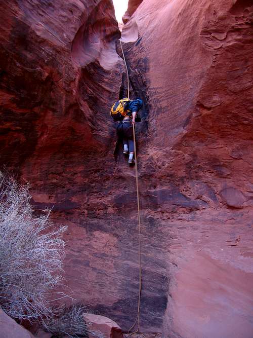 Scott on the final rappel (Rappel 5) |
Red Tape/Camping
No red tape here! This is the Utah desert in Robbers Roost Country which lies on BLM lands where there are no permits and no private property. Please leave no trace and avoid walking on the crypto-biotic soil. There are many great places to camp just off Highway 95 at the mouth of Blarney Canyon, Leprechaun Canyon, Sandthrax Canyon, and Stair Canyon. Each have dirt road pull offs looping around to various open camping areas where many people set up a camper or tents and have nice camp fires. Please try and bring your own firewood as the surrounding cottonwood trees take a long time to grow. Camping at these places can get quite crowded in the spring and fall when many parties come for a weekend of canyoneering so be prepared to share the area. Other camping opportunities can be found alongside the Cedar Point Road but up here the country is open and more exposed to wind.
Gear:
Take a single 30 meter rope. This will be long enough for all the rappels in the canyon, the longest of which is 45 feet (~14 meters). Also make sure you have harnesses, belay devices, extra webbing and rap rings and helmets. Know how to construct or improve deadman anchors as flash floods in these canyons can destroy or compromise existing anchors. Gloves are also nice for rappelling. Plan on 2-4 hours for this canyon depending on your group size and how fast everyone can rappel.