
-
 7131 Hits
-
 76.98% Score
-
 8 Votes
|
|
Mountain/Rock |
|---|---|
|
|
43.85790°N / 115.4238°W |
|
|
Elmore |
|
|
Hiking |
|
|
Summer, Fall |
|
|
7264 ft / 2214 m |
|
|
Overview
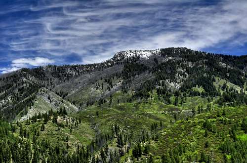
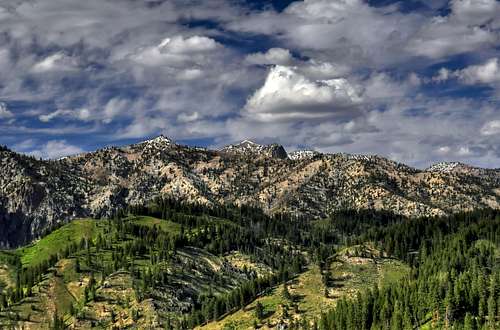
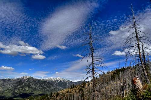
Location: North-Central Boise Mountains, between the North and Middle Forks of the Boise River
Nearby Peaks: Swanholm Peak, Goat Mountain, West Warrior, Silver Mountain, Steele Mountain, East Warrior
Linkups: Granite Mountain
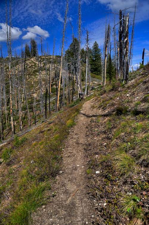
Difficulty: Easy hike on Jeep Road, single track trail, short off trail
Usage: Hiking, Motorcycles, Horses, Mountain Bikes (No ATVs)
Terrain: Rolling hills, relatively easy and regionally typical
Traffic: Very light most of the year, increased usage in Fall
Summit Register: Yes
History / Etymology: Traditional Mining, Logging and Hunting areas. Named for rocky outcroppings found on ridge tops.
Getting There
Nearest Dirt Roads / Conditions: Swanholm Creek Road (above average), North Fork Boise Road (seasonally good), Edna Creek (seasonally good)
Approach Trails / Conditions: FST 049 (excellent- recently improved)
Routes
Main Route: FST 049 starts just north of BM 5620. Jeep road soon becomes single track trail veering north and switching back south as it follows the ridgeline.
Main Route Stats: 11.6miles / 4053 (round trip)
Average RT Time: 4-6 hours
Other Routes: Trapper Creek, Wren Creek
Red Tape
Jurisdiction: National Forest Service
Permit: No
Other Users / Issues: Hunters
Maps: USGS Quad- trail shown on this quad is not accurate
Guide Book: Tom Lopez, Idaho: A Climbing Guide
When To Climb
Climbing Season: May through November
Ideal Climbing Time: June
Nearest Weather Station: Graham Guard Station
Weather Relative to Region: Slightly milder and drier than surrounding area because of relatively low elevation
Camping
Car Camping Sites: Flat area at trailhead, North Fork of the Boise- many options
Backpacking Sites: Not a traditional backpacking area, but beautiful flats on the 7084 site and lower in the pines. Water sources are few after June.

Flora & Fauna
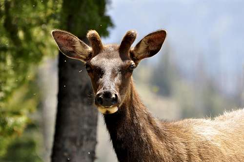
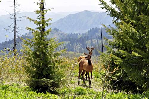
Potential Wildlife: Elk, Mule Deer, Mountain Lion, Black Bear, Coyote, Wolf
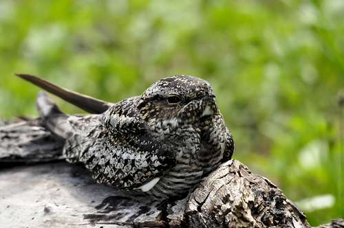
Confirmed Wildlife: Black Bear, Elk, Common Nighthawk
Vegetation: Ponderosa, Lodgepole, Aspen, Buckbrush
SawtoothSean - Jul 4, 2010 1:34 pm - Hasn't voted
Naming Confusion7264 is either Grand Mountain or Granite. The Benchmark says Granite, but the USGS label says Grand Mountain. Given what Lopez says, the name of the high point 7264 is Grand, but there's a good case to call it Granite. There's definitely some confusion because 7264 contains a benchmark that says Granite Peak, while 7084 contains no benchmark. 7264 contains some typical summit stuff- rock piles, some old wood etc. 7084 contains nothing out of the ordinary and is almost tough to tell it's a high point. Knowing that the USGS maps can be erroneous, there's a case to call Grand Mountain Granite. Also, there isn't the standard 300 foot drop between points 7264 and 7084. Further adding to the confusion is the general labeling across the high point ridge on the USGS map of "Grand Mountain". So in my mind, 7084 is more like "Granite Mountain North", while 7264 is Granite Mountain aka Grand Mountain. Confusing...