
-
 11556 Hits
-
 83.69% Score
-
 17 Votes
|
|
Mountain/Rock |
|---|---|
|
|
44.00053°N / 115.89286°W |
|
|
Boise |
|
|
Hiking, Skiing |
|
|
Spring, Summer, Fall, Winter |
|
|
5970 ft / 1820 m |
|
|
Overview

The Boise Basin once contained a thriving network of mining towns and contained the Pacific Northwest’s largest city in Idaho City. Idaho City has several hundred residents with a wide scattering of rural homes near Centerville, Placerville, and Pioneerville.
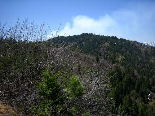
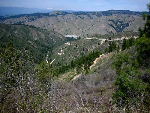
Mineral Mountain is one of the more gentle peaks in the region, even by Boise Mountain standards. A jeep road winds it way from the Alder Creek Summit past Mineral Mountain and ends near Grimes Pass. The last 100 feet of the peak must be hiked, but most of the outing can be trail run, hiked, biked, or skied. The summit is covered with large Ponderosa Pines, and is one of the few summits in the area of this fully tree covered nature. At one time, the largest Yellow Pine (Ponderosa) in Idaho was found just south of this area.
Getting There

West Approach: From Alder Creek Summit, follow a jeep road east for approximately 5 miles until your just south of the summit.
East Approach: From Grimes Pass, follow a jeep road west for approximately 4.75 miles until your just south of the summit. It is not obvious when your near the base.
Drive Approach:
Mineral
From ID-21, turn left onto the Grimes Creek Road at approximately MP 29.5. Follow the road as it turns to dirt and meanders along Grimes Creek to New Centerville. Turn left and then make a quick right and follow signs to Centerville and Pioneerville. From Pioneerville, it's 4.75 miles to Grimes Pass. OR From the New Centerville area, follow the road west and north to Placerville. From Placerville, it's approximately 3.2 miles to Alder Creek Summit.
Climate
| Jan | Feb | Mar | Apr | May | Jun | Jul | Aug | Sep | Oct | Nov | Dec | Annual | |
| Average Max. Temperature (F) | 35.4 | 41.3 | 42.5 | 48.6 | 59.0 | 68.7 | 77.0 | 88.1 | 77.4 | 64.4 | 45.9 | 36.5 | 60.8 |
| Average Min. Temperature (F) | 12.7 | 15.4 | 21.2 | 27.7 | 34.4 | 40.1 | 44.7 | 43.0 | 35.6 | 28.5 | 22.0 | 15.1 | 28.4 |
| Average Total Precipitation (in.) | 3.63 | 2.75 | 2.38 | 1.76 | 1.79 | 1.39 | 0.44 | 0.49 | 0.88 | 1.46 | 2.90 | 3.62 | 23.50 |
| Average Total SnowFall (in.) | 24.3 | 16.4 | 7.0 | 0.9 | 0.1 | 0.0 | 0.0 | 0.0 | 0.00 | 0.7 | 9.2 | 22.3 | 81.0 |
| Average Snow Depth (in.) | 17 | 19 | 11 | 1 | 0 | 0 | 0 | 0 | 0 | 0 | 1 | 8 | 5 |