
|
|
Mountain/Rock |
|---|---|
|
|
38.94033°N / 106.4717°W |
|
|
Chaffee |
|
|
Mountaineering |
|
|
Summer |
|
|
12848 ft / 3916 m |
|
|
Overview
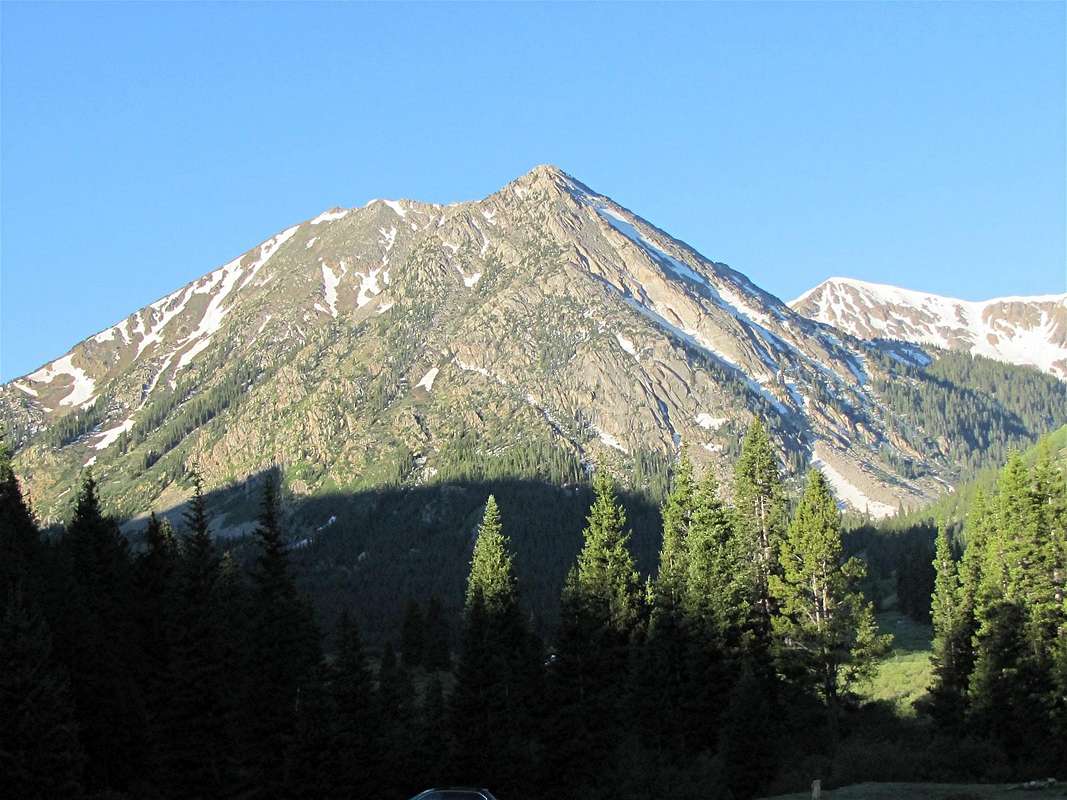
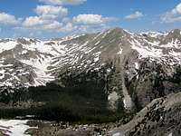
North face of Granite Mountain
Granite Mountain is an impressive peak that rises in the upper portions of the Clear Creek Valley in the Sawatch Mountains of central Colorado across from the famous 14er, Huron Peak. Clear Creek Valley is split into two branches by Granite Mountain. The eastern, western and northern slopes of Granite Mountain rise steeply above the valley giving Granite Mountain much visual prominence. The only connection that Granite Mountain has with its nearby peaks is to the southwest where a 12580 ft saddle separates it from Unnamed Peak 13253 ft.
The southern slopes of Granite Mountain are gentle and go down to form a high plateau known as Harrison Flat. You will find two small lakes on the plateau: Lake 11909 ft at the base of the summit of Granite Mountain and Lake 12155 ft at the base of the summit of Peak 13253 ft. The summit of Granite Mountain can be easily accessed via its southern slopes.
The usual starting place for climbing Granite Mountain is the ghost town of Winfield in Clear Creek Valley. From Winfield you can follow much of the length of a trail that goes to the nearby Lake Ann. At treeline, before reaching Lake Ann, you will have to leave trail and find your own way to Lake 11909 ft and the southern slopes of Granite Mountain. Along the way and from the summit of Granite Mountain, you will have spectacular views of the jagged Ice Mountain and the Apostles.
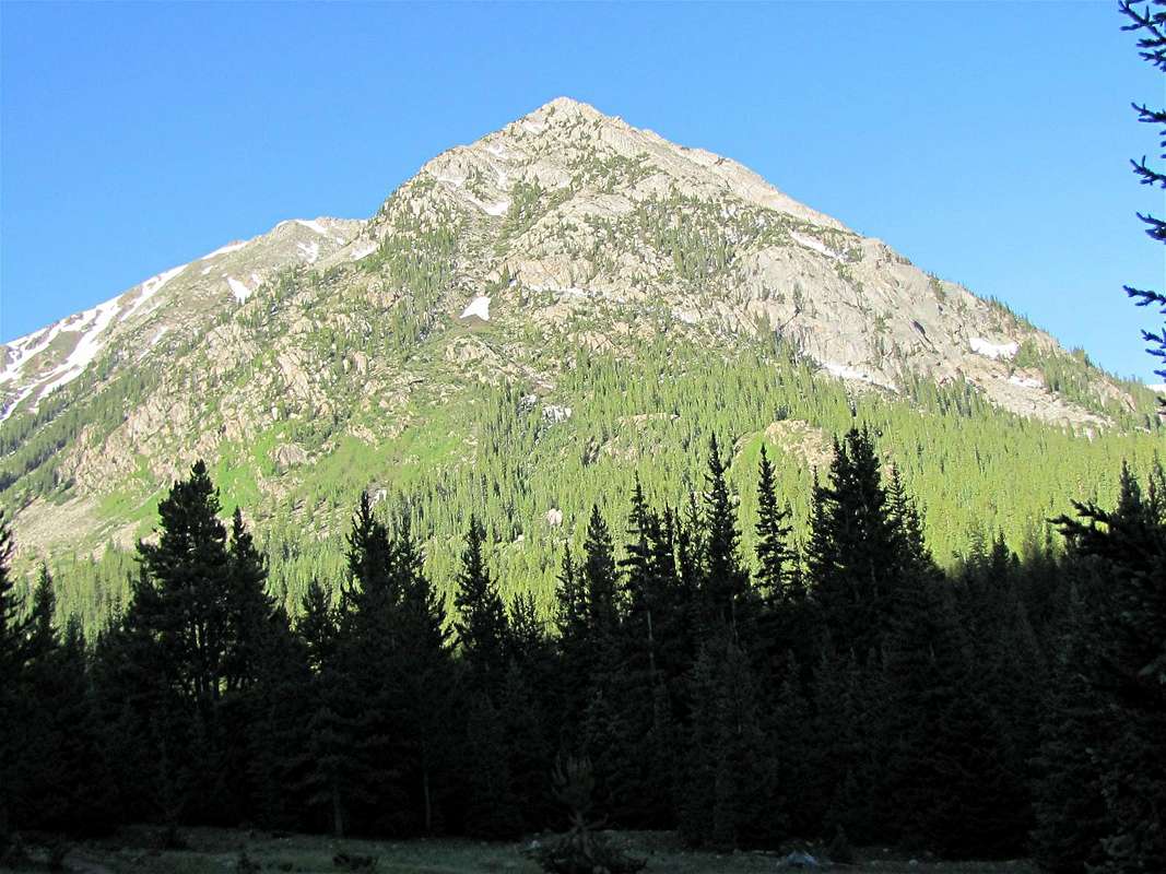
North face of Granite Mountain
Getting There
The trailhead for Granite Mountain is the same as the trailhead for Huron Peak. From Buena Vista, drive 15 mile north (or 19 miles south from Leadville) to Clear Creek Reservoir Road (County Road 390). Drive Clear Creek Reservoir Road 11.7 miles to reach the ghost town of Winfield (this is a smooth dirt road passable by any car). In Winfield, turn left and cross the bridge to reach a parking area. You might see signs for Huron Peak Trail. If you have 4WD, you can drive another 2 miles to the end of the roadRoute
For more pictures, see the page for Peak 13253 ft.All distances are per my GPS
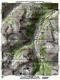 Map |
At the 2WD Trailhead, you might see signs for Huron Peak or Lake Ann. Head south and hike the 4WD Road through a forest (In 2 miles the road goes up only 300 ft). The forest will soon end and you will reach a meadow where Granite Mountain appears to the south. After 2 miles, you will reach the end of the road near the abandoned Banker Mine.
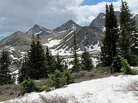
 Granite Mountain |
At the end of the road you will reach a gate where the trail splits. You will see a sign on the left for Huron Peak Trail. Do not go left. Go straight through the gate. This is the trail to Lake Ann. A registration box will appear after a few feet. You will have good views of some of the local 13ers such as Sheep Rock Mountain and Virginia Peak.
 Sheep Rock Mountain |  Virginia Peak |
Ice Mountain and the Apostles will be seen at the south end of the valley.
 Ice Mtn. & Apostles |  Ice Mtn & North Apostle |  West Apostle |
The trail will take you into the eastern branch of the Clear Creek Valley right at the base of the Granite Mountain.
 East face |
You will then reach a signed split in the trail. Take the right branch to Lake Ann and cross the stream. The trail will then continue in a dense pine forest.
 Forest |
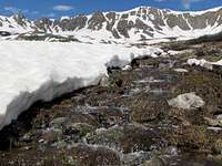
You will eventually have to leave trail and bushwhack up the slopes to reach Harrison Flat. If you leave the trail too soon, you will have to deal with the dense forest. A short distance after crossing a sizeable side stream (that drains Lake 12155 ft), at an elevation of 11600 ft, I chose to leave trail (you can leave trail at any spot, the GPS coordinates of where I left trail are 38, 55.418 N 106, 28.071 W)(In its upper portions, Lake Ann Trail became somewhat faint and might have even crossed to the east side of the stream. I knew that I wanted to stay on the west side of the stream. I was able to follow the faint trail to the spot where I left it).
 Stream |
Head west and go straight up the slopes. The forest here is thin and ends 150 feet up.
 After leaving trail | 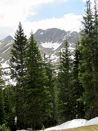 After leaving trail |
The gentle southern slopes of Granite Mountain will come to view.
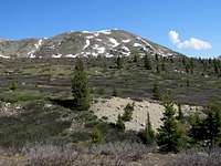 South face of Granite Mountain |
You will now have to head back north toward Granite Mountain and will soon have to cross the same stream again.
 Crossing Stream |
This is the beautiful Harrison Flat. You will have great views of the nearby peaks.
 Harrison Flat | 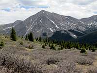 Harrison Flat |
 Harrison Flat | 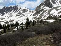 Harrison Flat |
You will then reach Lake 11909 ft.
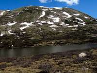 Granite Mountain & Lake 11909 ft | 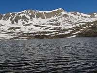 Peak 13253 ft & Lake 11909 ft |
Hike up the southern slopes of Granite Mountain to reach its summit.
Views from the summit:
 Ice Mountain & The Apostles | ||
 Huron Peak | 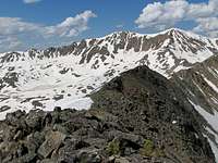 Peak 13253 ft |  Silver Basin |
 Lake 11909 ft | ||
 Sheep Rock Mtn. |  Virginia Peak |  La Plata |