
-
 8722 Hits
-
 82.48% Score
-
 15 Votes
|
|
Mountain/Rock |
|---|---|
|
|
46.81550°N / 12.50780°E |
|
|
9573 ft / 2918 m |
|
|
Overview
Geographical Classification: Eastern Alps > Hohe Tauern > Villgraten Group > Gumriaul
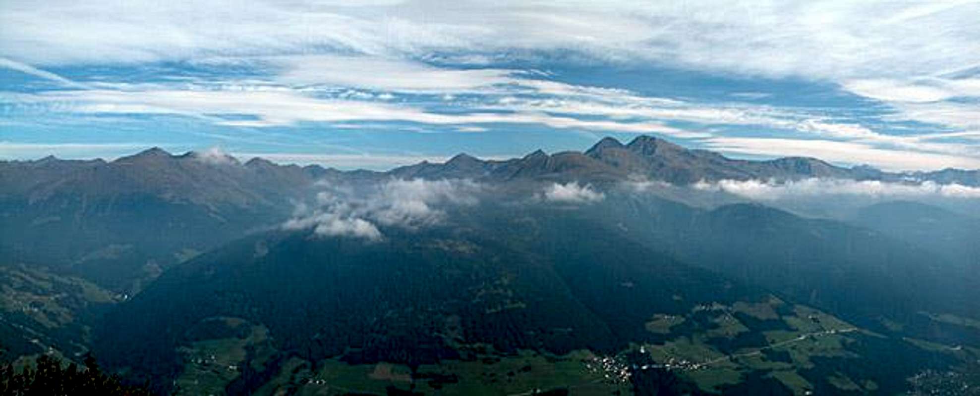
Gumriaul is one of the "almost 3000ers" of the Villgraten Group in the south of Hohe Tauern. It is located to the north-east of Sillian and the north-west of the city of Lienz in Austria. Together with Gölbner, the highest summit of the ridge, it is situated between the Winkeltal and Kristeinertal Valleys which both run to the north of Pustertal (the valley of the Drau River). Due to its location to the south of this subgroup, Gumriaul commands gorgeous views of the Lienz Dolomites, the Carnic Main Ridge as well as the whole Dolomites. On a clear day - and I was lucky to stand on the summit on such a day - you can see as far as the Ortler Cevedale Group in the west and Triglav in the east.
Being part of Hohe Tauern the summit view of course includes most of the well known mountains of that group. The only drawback is that Gölbner which is some 25m higher obstructs the view to the north so that Großvenediger cannot be seen. To reach the summit you almost certainly will come across one of the alpine lakes located south of Gumriaul. The largest one is Anraser See a dark lake which offers great views (and shots) towards the Sexten Dolomites.
There are two standard ascent routes to Gumriaul (see routes) both of which are rather unproblematic until you reach the summit block. The southern route uses the south-eastern ridge which is steep but not exposed with almost no climbing sections. The Western approach (and the variant of the southern one) uses the south ridge which is very steep, exposed and has some climbing sections of UIAA I+. Unfortunately the summit cross is placed on a false summit. To reach the real one includes exposed climbing of grade UIAA III+. Both routes are very long (1400m of altitude gain on 20km length). We decided therefore against the scramble and preferred to reach the valley in time for the sun to set.
The mountain itself is composed of red gneis rock which is in stark contrast to neighbouring Finsterkogel, a mountain so black (finster = pitch dark) that most of the pictures I took while doing the traverse from Gumriaul were overexposed. The reason for this anomaly is the location of the two mountains near the peradriatic fault which was the frontline during the buildup of the Alps, when the North African tectonic plate started moving into the European one. In several places the dark volcanic rock base was thrown up so that now it mingles with the newer formations. The contrasts are even more pronounced in the Lienz Dolomites and the Carnic Alps.
 |  | 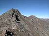 | 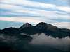 |
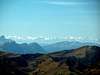
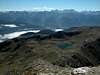
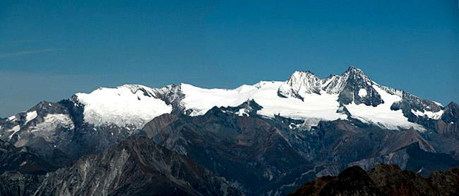
Summit views - other mountains seen from Gumiraul
Gumriaul - as said already in the overview section - is a perfect mountain for views. Decide for yourself! I have never before been able to see mountains 160km (100 miles) in the distance!
Anyone who is interested in the 360° pano, drop me a mail.
 |  |  |  |  |
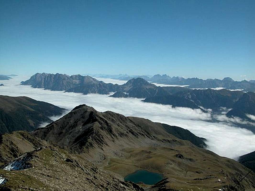
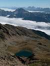
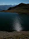
The Lakes
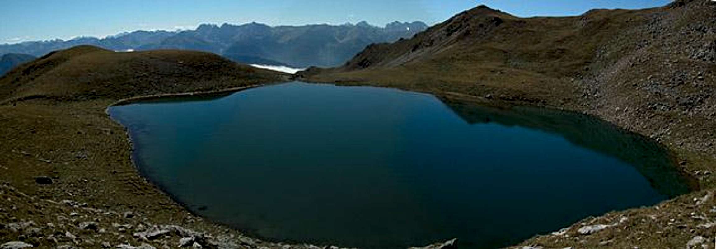
To the south of Gumriaul you can find quite a number of lakes, leftovers of the last ice age. They all are great foregrounds for the pictures of the Sexten or Lienz Dolomites and of the Carnic Alps.
 |  |  |  |  |
Getting There
The best starting points for an ascent of Gumriaul are the hamlet of Kobreil on the northern slopes of Pustertal) and the Reiterstubn Restaurant in Winkeltal (north of Außervillgraten). Both trailheads are located to the north of the Pustertal Valley.
From the West (Brenner Motorway A22)
Leave the Brenner Motorway near Brixen / Bressanone and follow SS49 to the east through Pustertal / Val Pusteria. To the east of Innichen / San Candido you cross the Austro-Italian border and follow the road (now B100) to Sillian or Abfaltersbach. To reach the Reiterstubn Restaurant, turn north in Sillian towards Außervillgraten and from there into Winkeltal.
To Reach Kobreil take B100 to Abfaltersbach where you turn north in the direction of Anras. In Anras, look for signs leading to Kobreil.
From the North
There are two possible roads:
- From Kitzbühel over B108 through the Felbertauern Tunnel to Lienz, then southeast to Oberdrauburg (B110), where you turn on to B100 west into Pustertal. Go through the city of Lienz until you get to Abfaltersbach or Sillian, depending on your preferred trailhead.
- From Salzburg along motorway A10 to Spittal. Turn west on B100 to Oberdrauburg, Lienz, Abfaltersbach and Sillian.
Red Tape
There is no red tape here. Free camping is not allowed but it is probably not necessary.
When To Climb
The best time is June through October. In winter ski ascents are possible along the south-eastern route. In fact Anraser See is a very popular ski tour destination in winter. But so are Finsterkofel and Gumriaul. You will have beautiful downhill skiing from the lake since the south-eastern route runs along a huge alpine meadow with great views.
Accommodation
For accommodation follow one of the following links:
- Hochpustertal official site
- Anras official site
- Sillian official site (click on the "Live Bilder" link for livecams and weather info).
- Lienz City official site
- Lienz Dolomites lodging (tiscover.at)
- Hochpustertal lodging (tiscover.at)
Weather Conditions
In general the weather here is better than in the rest of Austria because the Villgraten Group is located to the south of the Alpine Main Ridge.Look at the following websites for weather information.
- Tyrol weather
- Sillian official site (click on the "Live Bilder" link for livecams and weather info).
- Lienz City official site / weather
Maps 'n' Books
Maps
I have been using a map by Kompass Verlag, which is very good for the hiking trails though it does not show ALL the relevant summits of the area.
- Lienzer Dolomiten / Lesachtal
1:50000
Kompass Map WK47
Kompass Verlag
ISBN: 3-85491-053-3
Books
You’ll probably not be able to find anything on the Villgraten Group in a language other than German. The book I used is
- Hiking and Trecking
Osttirol Süd
W. Mair
Rother Verlag
ISBN: 3-7633-4132-3
Good descriptions with maps covering: Defregger Berge, Villgrater Berge, Carnic Alps, Lienz Dolomites