
|
|
Mountain/Rock |
|---|---|
|
|
46.74560°N / 11.03720°E |
|
|
Hiking, Mountaineering, Scrambling |
|
|
Summer |
|
|
10755 ft / 3278 m |
|
|
Overview
Note: On both sides of the border, the language is German - more precisely, local dialects thereof. Some objects have been given an Italian name, but even in Italy, these are not often used. Where I give two names, the German one is the first.After Roteck / Monterossa (3337m) and Texel Spitze / Cima Tessa (3318m), the Hohe Weiße (also Hohe Weisse) / Cima Bianca Grande is the third highest peak in the Texel group, a sub-range of the Ötztal Alps. It lies deep in the Texel group, just south of the main ridge of the Alps.
It is dominated by the nearby Hochwilde / L'Altissima (3482m), only 2.5 km to the north-west. Climbers and hikers usually prefer ascending this higher neighbor, and as a result the Hohe Weiße is a quiet peak.
 |
 |


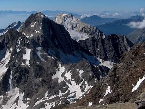
Lodner from Hohe Weiße

Descending the steep south side of the Johannisscharte

The Pfossental, with the Hohe Weiße in the distance, seen from the west.
The elevation of the Eisjöchl, the saddle between Hohe Weiße and Hochwilde, is 2895m, giving the Hohe Weiße a prominence of 383m. The Stettiner Hütte / Rifugio Petrarca all'Altissima (2875m) (46.757,11.029) lies very close to this saddle and is ideally located for climbing the mountain.

Hohe Weiße and Grafspitze from the Pfelderer valley
Just a little over 1 km to the south lies its conspicuous neighbour the Lodner / Cima Fiammante (3228m) (46.734, 11.040), with its strange flat top and unusual light grey rock. The even closer Grafspitze / Cima della Grava (3147m) (46.749, 11.039) is just a few hundred meters north and while it has its own name, it really is just a local high point on the north ridge. Likewise, the Kleine Weiße / Cima Bianca Piccola (3059m) (46.744, 11.026) is a local high point on the exposed west ridge, about 1 km away, beyond which the ridge drops very steeply to the Johannisscharte (2854m) (46.743, 11.020).
There are many other peaks and ridges surrounding the mountain, and as a result, it's not visible all to well from the lower valleys around the Texel Group. The best views are from the surrounding summits, or from the high valleys directly around it, notably the Pfelderer / Plan valley to the north-east, and the Pfossental to the west. As it happens, the Meraner Höhenweg, a popular long distance trail, runs through these two valleys.
The first recorded ascent was in 1871 by V.Hecht and R. Raffeiner (Source: Alpenvereinsführer Ötztaler Alpen, W. Klier).
 |
|
Getting There
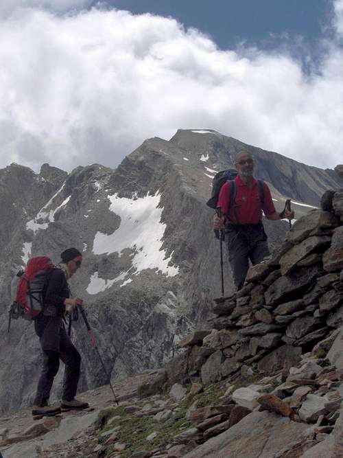
Grafspitze and Hohe Weiße sticking out behind it, from high up in the Pfelderer valley. We're hiking from the Zwickauer to the Stettiner Hütte, and will climb the Hohe Weiße in the afternoon.
Pfelders / Plan

Waterfall high up in the Pfelderer valley.
From the south
Pfelders / Plan lies in the Pfelderer valley. This is a side valley of the larger Passeier valley. From Italy, head for the Timmelsjoch, which lies at the end of the Passeier valley, but before crossing the pass, go left to Pfelders / Plan in the village of Moos in Passeier. From Pfelders you can hike along the Meraner Höhenweg to the Zwickauer Hütte.
From the north
Coming from the north, there are two options. Either enter Italy by the Brenner highway and, from Sterzing, just over the border, go west to the Timmelsjoch. Alternatively, take the scenic route down the Ötztal and over the Timmelsjoch and, after crossing the pass, go right to Pfelders / Plan in the village of Moos in Passeier.Pfossental
The Pfossental is a tributary valley to the Schnalstal / Val di Senales, just west of Meran / Merano. In the Pfossental, the dirt road beyond Vorderkaser (1693m) is private access only. From Vorderkaser you can hike along the Meraner Höhenweg to the Stettiner Hütte.

The Lodnerhütte
Partschins / Parcines
Partschins is a small village about 5km west of Meran, and roughly south of the Hohe Weiße. If you are using public transport, you can get there by train or bus. From Partschins (681m) you can hike via the Nasereith Hütte (1560m) to the Lodnerhütte / Rifugio Cima Fiammante (2262m) in a short day. The following day, you can continue over the Johannisscharte and Eisjöchl to the Stettiner Hütte, and climb the Hohe Weiße in the afternoon.
The normal route, "Willy-Ahrens-Weg"

Tiny lake along the route

A cairn marks the trail
There are four steep ridges: North, south, east and west. The normal route goes over the Grafspitze to the base of the north ridge, then ascends the north-east face.
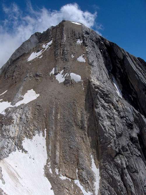
The highest peak, dropping steeply to all sides, is the Hohe Weiße. You're looking straight at the north ridge. Left in front is the Grafspitze, with its north-west ridge extending to the right.

Right before the summit of the Grafspitze
From the Stettiner Hütte, start south, descending a little bit, on the marked route to Pfelders. After a few minutes, the trail to Pfelders turns east. Instead, continue south on another marked trail leading to the north-west ridge of the Grafspitze.
Keep following the trail on the ridge, almost to the jagged rocky summit of the Grafspitze, where it turns south.

Summit cross
Watch out, it's a very steep descent of about 50m to the saddle between Grafspitze and Hohe Weiße! We were roped up, which turned out to be a good precaution when one of our party slipped.
On the saddle, the mountain looms big right before you. You might wonder how to get up there. Surprisingly, if you go a little bit left, you find a very steep hiking trail leading right to the top.
From the refuge to the summit and back takes about 3 hours.
Warning: If there is more than just a little snow on the route, this quickly turns into a potentially dangerous alpine ascent instead of a very steep hike!
Hohe Weiße from the saddle. The trail continues left of here.
The Grubferner route
When coming from the Lodnerhütte, after going over the Johannisscharte you can bypass the Stettiner Hütte and go directly east, over the former Grubferner, to the saddle between Grafspitze and Hohe Weiße. In the past, this route would have required glacier gear, but the glacier is gone now. The last steep section is well shaded for most of the day, so there will probably be a lingering ice and snow field for years to come, but the condition of this part of the route will be a question mark. Best to ask about it at the Lodnerhütte. If you want to try it, don't forget to bring crampons and ice axe and let me know the outcome, so I can update this page.Red Tape
The peak lies in the national park Naturpark Texelgruppe / Parco Naturale Gruppo di Tessa. Access is free.Accommodation
The Stettiner Hütte is ideally placed to spend the night before or after climbing the mountain.The Lodnerhütte is on the approach from Partschins.
Note: Early 2014, the Stettiner Hütte was struck by an avalanche. It has reopened for day visitors, but until further notice staying overnight is not possible. For information about the latest situation, check the site of the hut.
Guest house Eishof (2069m) (46.7541, 10.9695) is the last place to stay high up in the Pfossental. From there, you can hike to the Stettiner Hütte in the morning and climb the peak in the afternoon.
In winter, Pfelders is a small ski resort. As a result, there are lots of accommodation options and there are much fewer people in summer.
There is an enormous choice in accomodation in the surrounding valleys and villages. I had a pleasant stay at Hotel Goldenes Kreuz once.
Wild camping is not allowed.
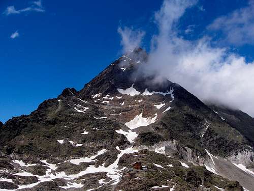
The Stettiner Hütte dwarfed by the Hochwilde.
Gear
For the normal route, if it is dry and there isn't have too much snow: sturdy hiking shoes, suitable for a bit of scrambling.If you want to rope up: rope and harness.
For the Grubferner route to the saddle you might need crampons and ice axe to negotiate the last steep bit to the saddle.
Maps and books
The 1:25000 Tobacco map Parco Naturale Gruppo di Tessa covers the whole national park.The 1:50000 map Freytag & Berndt WK S8 Passeiertal * Timmelsjoch * Jaufenpass / Val Passíria * Passo del Rombo * Passo Del Giovo covers the mountain and the approach from the Pfelderer valley, but only a small part of the Pfossental.
Alpenvereinsführer Ötztaler Alpen, Walter Klier. 14th ed. Bergverlag Rother, 2006. In German.
External Links
Meran tourist infoPfelders
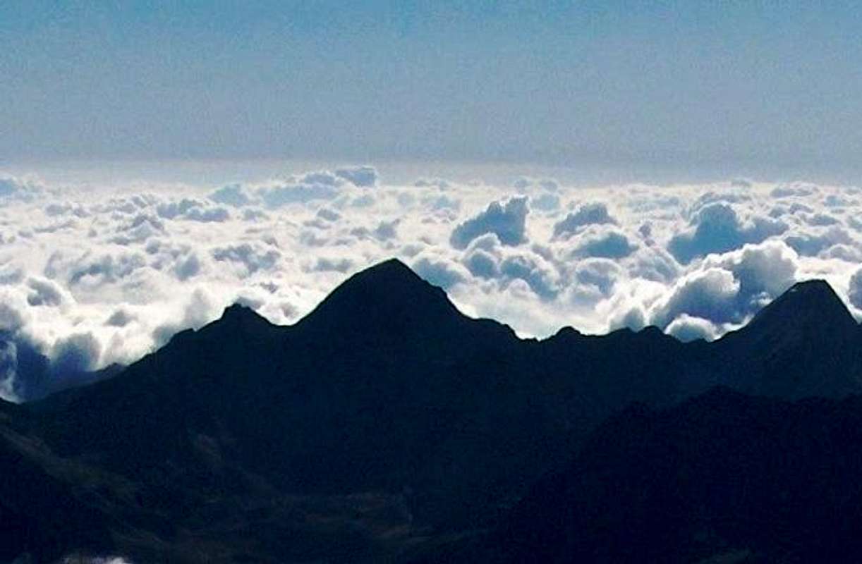
Hohe Weiße skyline from the west (with the Lodner on the far right)