
|
|
Mountain/Rock |
|---|---|
|
|
46.72350°N / 10.98430°E |
|
|
Hiking, Mountaineering, Scrambling |
|
|
Spring, Summer, Fall |
|
|
10948 ft / 3337 m |
|
|
Overview
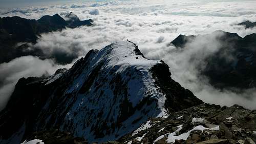
On the summit, above the clouds
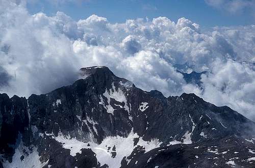
Gfallwand from Roteck
| Name | Elevation (m) | Distance from Roteck (km) |
|---|---|---|
| Roteck | 3337 | |
| Texelspitze | 3318 | 1.0 |
| Hohe Weiße | 3278 | 4.7 |
| Trübwand | 3264 | 1.4 |
| Lodner | 3228 | 4.4 |
| Gfallwand | 3175 | 2.9 |
The Texel Group makes up the southernmost part of the Ötztal Group, and most of its highest peaks can be seen, including Wildspitze (3768m), Weißkugel (3738m), Similaun (3606m) and Hintere Schwärze (3624m).
Just over 5 km to the northeast, Hochwilde (3482m), also part of the Ötztal Group, is Roteck's parent peak. The key saddle is the Johannesschartl (2854m), giving Roteck a prominence of 483 m.
As if that's not enough, on a clear day many more distant ranges are visible too. To the south and southeast lies the Ortler Group, with its highest summits just over 40 km to the southwest. And then there are the beautiful Dolomites, between east and southeast, in distance ranging from 50 km to more than 100 km. Turn the other way, to the SSW, and you may see the distant glaciated peaks of the Bernina Group, right above the Texelspitze. And finally, if you're really lucky, you may even make out Großglockner (3798m), Austria's highpoint, at a distance of 135 km and a heading of 73°.
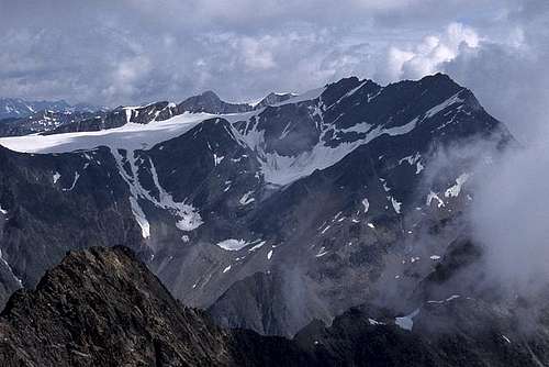
Hochwilde from Roteck
The green paddle points at Roteck.
Click here to view a larger map
Ridges
In addition to the one to the Texelspitze, Roteck has two more well defined ridges.Starting out to the north, turning northwest later on, is an exposed, narrow, jagged ridge that eventually leads to the Trübwand, which is the fourth highest summit in the group. There are lots of ups and downs, with a number of minor summits along the way, many with names of their own despite their relatively small prominence.
To the east stretches a much easier and generally much wider ridge, though high up on the mountain it there are still a few exposed and narrow places. While all ridges have been climbed, for most visitors hiking and scrambling up the east ridge is the route of choice.
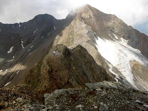
Texelspitze and the small Texelferner, from Roteck in 2012
Glaciers
Until recently, a small glacier called the Trübferner (Ferner = Glacier) covered the steep northeast face. Shaded as this area is by the Roteck north and east ridges, some snow and ice can still last well into summer here. Northwest of Roteck, the steep northern slopes of the ridge with the Texelspitze are still home of the small Texelferner, though it doesn't reach all the way up anymore.Valleys
There are no villages in the valleys immediately surrounding the mountain. To the west and the north lies the Pfossental (Tal = Valley), a high valley with some old dwellings that are still regularly maintained, and inhabited for at least part of the year. The popular Meraner Höhenweg, a long distance hiking route, follows this valley.Immediately to the south and southeast is the remote Lafaistal. Down in the valley, about 1.5 km southeast of Roteck, is the Kalberalm, a meadow with just one building that resembles a stable more than anything else. Perhaps people used to live there, but that must have been quite a while ago. In 2013 it still appeared to be maintained. Perhaps the fact that sheep and goats roam free in the Texel Group during the summer season has something to do with that.
About three kilometers to the east lies the Zieltal, of which the Lafaistal is actually a side valley. At the junction lies the Lodnerhütte. The northern end of the Zieltal is connected to the Pfossental by way of the previously mentioned Johannesschartl (2854m). A difficult hiking trail leads across this high alpine saddle.
The nearest villages are in the valleys that are a little further away. To the southwest lies the Schnalstal, of which the formerly mentioned Pfossental is a side valley with the scenic village of Karthaus (1327m) at the entrance. In turn, the Schnalstal itself is a side valley of the large, fertile Vinschgau, the main valley in the region that demarcates the southern border of the Texel Group.
A note on the name
Roteck lies in Süd-Tirol, a relatively autonomous region in Italy these days. The main language is German. In the past that was different: German was suppressed, and all geographical features received Italian names. In Italian, the mountain is called Monterosso or Monte Rosso.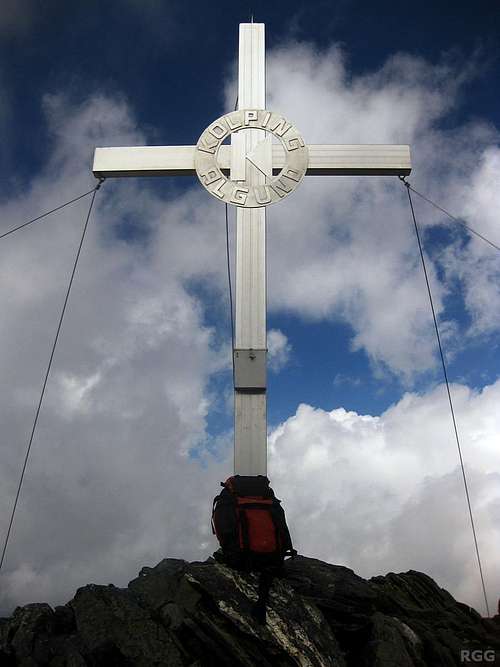
A big, shiny cross marks the summit
Getting There
The green paddle points at Roteck.
Click here to view a larger map
Getting to the area
The nearest city is Meran, a pleasant place southeast of the Texel Group with a lively center. Well shielded by the Alps from bad weather coming in from the north, it has a very nice climate. In summer, the area attracts a lot of visitors and for a small city it is well connected.The two closest villages are Partschins in the Vinschgau valley, just west of Meran, and Karthaus in the Schnalstal, at the entrance of the Pfossental.
By car
- From the north there are three options:
- Along the provincial road over the Reschenpass via Nauders and then down the Vinschgau valley;
- Via the mountain road over the Timmelsjoch (closed in winter), down the Passeiertal and turn right at Meran, into the Vinschgau valley;
- Over the Brenner motorway via Sterzing, and then also down the Passeiertal.
- Along the provincial road over the Reschenpass via Nauders and then down the Vinschgau valley;
- From the south, the only way is by the motorway from Bozen / Bolzano.
- From Switzerland, in the west, the Ofenpass and then down the Vinschgau valley is the most logical route
By public transport
Meran has regular train connections with Bozen / Bolzano, which is well connected to the rest of the Italian rail network as well as to Austria and Germany to the north. In addition, a regional train heads up the Vinschgau valley, west of Meran, as far as the small village of Mals. The station nearest to Partschins is Rabland. Alternatively, buses go from Meran up the Vinschgau valley, stopping at Partschins. Buses also serve the Schnalstal.From the north, from Austria, regular buses come over the Reschenpass to Mals. And likewise, from the west, from Switzerland, regular buses come over the Ofenpass to Mals.
Getting to the Lodnerhütte
The Lodnerhütte lies in the center of the Texel Group, directly northwest of the the Blasiuszeiger, where the Lafaistal joins the Zieltal. Of the many ways to get there, the shortest one is from the south, hiking up the Zieltal. From the Birkenwald car park (980m), still fairly low in the Zieltal above the village of Partschins, it's about 4 hours to the refuge. Early on you'll pass by the impressive Partschinser Falls.
Alternatively, to save an hour and some energy, you can start by taking the Texelbahn cable car from Partschins up to the Giggelberg (1535m) and hike north on the Meraner Höhenweg to the Nassereithhütte (1523m) and from there up the Zieltal to the Lodnerhütte.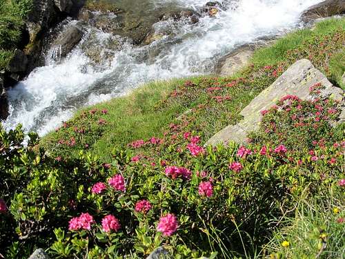
Alpenrosen at the banks of the Lafaisbach
Getting to the mountain
From the Lodnerhütte, access is by the Lafaistal. Somewhat confusingly, there are two trails that start out to the west, which is the right direction. Don't take the first one, which starts at the refuge, for it soon crosses the Lafaisbach down in the valley and then turns south, leading to the Blasiuszeiger. From the refuge, start out to the north instead. After just a few minutes the trail reaches a junction with the side trail to the west leading into the Lafaistal.For the rarely climbed routes on the northern side of the mountain, the highest road access is from the parking lot at Vorderkäser (1670m) in the Pfossental. The road doesn't actually stop there, but is private. It's a long way up from the trailhead, and one way to shorten it is to spend the night at Eishof (2076m).
Southwest of the mountain, the nearest road access is from the slopes above Katharinaberg (1245m) in the Schanalstal. It's a long ascent from there, but if you have a car you can drive up the mountain road to Schrofl (46.6903°N / 10.9476°W, ±1700 m). There is some room to park by the side of the road.
Routes
The East Ridge (Normal Route)
Half a kilometer after entering the Lafaistal from the east, at the signposted trail junction a few minutes north of the Lodnerhütte, there is another junction. "Roteck" is painted in red on the rocks alongside the trail, but if you don't pay attention it can easily be overlooked. Take the trail to the right, zig zagging up the slopes. If you accidentally take the wrong trail, you'll soon reach the Lafaisbach at the valley floor. If you do, don't cross the stream but either head back to the junction, or go cross country to the north until you hit the trail again.Just over half way up, the route reaches the base of the East ridge proper, with a false summit offering nice views. A huge cairn marks the route, which can be useful in poor visibility during the descent. Higher up, where the trail isn't visible anymore, the route is marked by cairns and red paint, and then the scrambling begins. At first it's quite easy, but higher up it becomes more exposed and there are chains to hold on to or to clip in. There is one move in particular where the cable turns a corner and you can't clearly see what's coming. It's exposed, but easier than it looks. However, not being able to see that makes this the crux of the route. After that, it's an easy 10 minutes to the small summit. It's UIAA grade I, but only a few places.
T h e E a s t r i d g e i n p i c t u r e s

Hikers just over half way up

The huge cairn

Lots of paint high up

Descending scramblers

False summit - the real one is in the clouds

The protective cable turning the corner

The final stretch

Approaching the summit cross

Annotated panorama from the south, from high on Gfallwand. Note the ridge between Texelspitze and Roteck as well as the long east ridge down to the Lafaistal.

The ridge to the Texelspitze as seen from Roteck in 2002,with the Texelferner on the right
The SSW Ridge
The Texeljoch (just a bit below 3200 m), halfway between the Texelspitze and Roteck, can be reached by scrambling up the scree and loose rock from the south, or by climbing the Texelferner from the north. From the saddle it's half a kilometer along the ridge to the summit, UIAA grade II.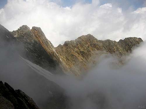 View of the jagged Roteck N and NE ridge | 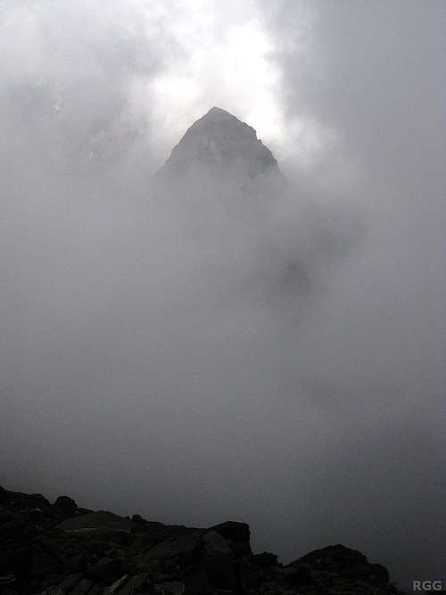 Trübwand from Roteck, rising in the mist |
The North Ridge
The North ridge is rated UIAA grade III.The shortest route is to ascend the Texelferner and then climb the rocky slopes above it to a low point on the ridge just a few hundred meters north of the summit.
One of the longest would be to first climb the Trübwand and follow the jagged 2 km long ridge all the way. From the Lodnerhütte, the Trübwand can be climbed by the NE ridge from the Zieltal (UIAA grade II).
There are several other alternatives to get on the ridge somewhere between Roteck and Trübwand.
The NE Face
Before the Trübferner disappeared, this steep face must have been an interesting route, but I don't know whether it is still climbed now. Perhaps it's still possible in spring, when the slopes are covered in snow.When to Climb
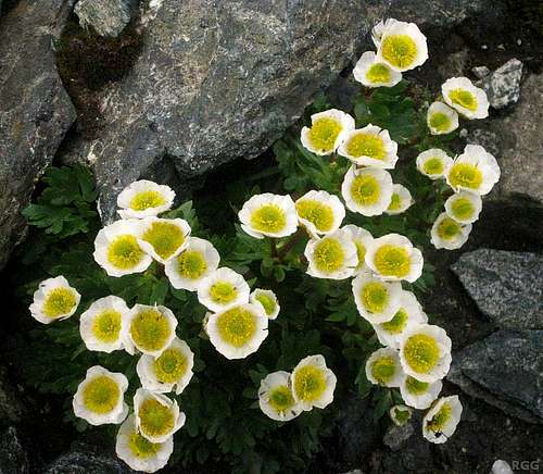
Alpine or glacier buttercups growing on the summit
For the SSW ridge, I expect that spring is good too, as long as there isn't too much snow and it has had enough time to settle. Packed snow on the slopes should make it easier to reach the Texeljoch, be it by way of the scree slopes on the south or up the Texelferner from the north. On the other hand, there shouldn't be too much snow, for then the ridge would get corniced.
Accommodation
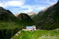
Lodnerhütte
Meran and the many nearby villages offer countless accommodation options. Furthermore, along the Meraner Höhenweg there are many places to stay.
Officially, wild camping is not allowed.
Red Tape
The Texel Group is a Natural Park, and is protected as such.Maps and Books
- The 1:25000 Tobacco map Parco Naturale Gruppo di Tessa covers the whole national park. It is the most detailed map, but considering its scale, it gives relatively poor information.
- The 1:50000 Freytag&Berndt map WK S2, Vinschgau * Ötztaler Alpen is decent, even if the 100m contours are rather coarse. However, the Lodnerhütte is right at the eastern edge of the map, and the approach up the Zieltal from the south isn't on it.
- Excellent free topographic maps are available at the base station of the Texelbahn cable car. The map covers a somewhat smaller area than the others, and highlights the the Meraner Höhenweg, but it has all the other trails and many details. Just one minor point: The map legend claims it is scale 1:50000, but it is close to 1:60000.
- Alpenvereinsführer Ötztaler Alpen, Walter Klier. 14th ed. Bergverlag Rother, 2006, ISBN 978-3-7633-1123-1. In German.
External Links
Vinschgau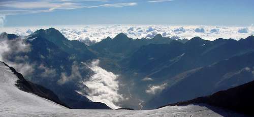
Pfossental panorama from Similaun. Roteck is at the rightmost edge.