
|
|
Mountain/Rock |
|---|---|
|
|
47.30679°N / 9.77782°E |
|
|
Hiking, Scrambling |
|
|
6575 ft / 2004 m |
|
|
Overview
Hoher Freschen is the highest mountain of the Freschen Group, the subgroup that forms the southwest corner of the Bregenzerwald Group. It is moreover the westernmost 2000er of the Eastern Alps north of the river Ill and the A14 (the highway linking Vorarlberg with the rest of Austria). Add to that, that it is rather pointy, and it is clear why it dominates the view east from the Swiss side of the Rhine.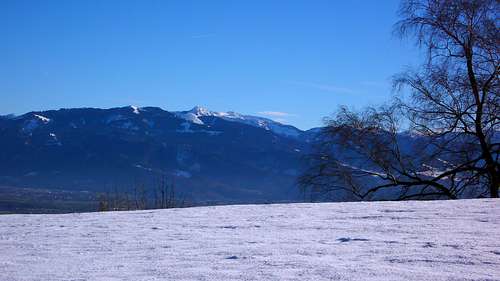
A distant view of the white summit pyramid of Hoher Freschen, from above Altstätten on the Swiss side of the Rhine
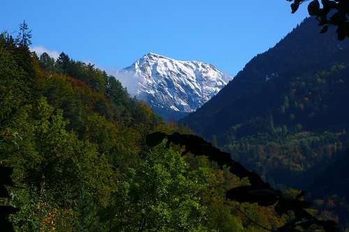
Hoher Freschen's south face, seen from near Viktorsberg's Eusebius Chapel
Setting
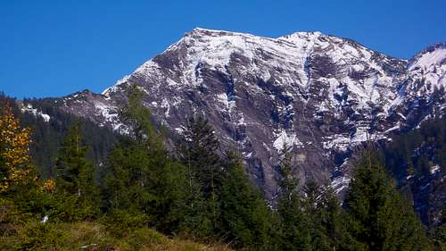
 The Bregenzerwaldgebirge in March, seen from Loch on Unter Kamor (1'420m / 4'659ft), with Hoher Freschen just left of the center
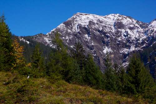
The above image also underlines one of the main characteristics of Hoher Freschen: its near-vertical south face. It features dark rock at an altitude where this time of year everything around it is white. Not only does it seem too steep for a stable snow cover. It is also faced to the sun and exposed to the relatively warm föhn-winds frequently blowing from the south.
The village just left of the middle is Viktorsberg. From here the south route starts.
 Hoher Freschen (2'004m) and Matona (1'998m) from just south-southeast of Hohe Kugel (1'645m), with Fraxner First (1'646m / 6'000ft) in the foreground
Getting There
Arguably the best view of the northwest face is enjoyed from the Valorsalpe
When coming by car or motorbike, note that it is —quite incredibly— actually allowed, provided the barrier at the end of the tarmac is open, to use the dirt road following the Ebniter Ache all the way to just after the wooden bridge (960m / 3'150ft). There the dirt road bifurcates, left to Unterfluhalpe, right to Achrainalpe. The track to the left is explicitly closed to motor vehicles. The track to the right may be open, but from there it is finally nice to walk. The first time I was there, I conservatively parked my motorbike in Ebnit, where the tarmac ends, and walked all the way. This is not recommended, as the first kilometers are mostly boring. So save yourself that bit, and park your bike at the bifurcation. Note that rain will render the track slippery (map).
For motor vehicles, the only road to Ebnit is that from Dornbirn, along the Dornbirner Ach. Bicyles can also use the narrow tarred road over the Rigla Pass (1'330m / 4'364ft) from Emsreute / Klien in the Rhine Valley. At the pass, turn right towards the Hinterbergalpe (1'379m / 4'525ft) for some stunning views of Hoher Freschen.
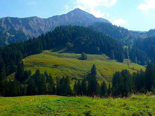
South face from above the Pöpiswiesalpe
Route from Viktorsberg


Valüra Ridge: "Alpine experience, being surefooted and free from dizziness essential!"
Elevation gain: 1'352m / 4'436ft
Eusebius Chapel near Viktorsberg 47.297°N / 9.669°E (652m / 2'139ft)
Pöpiswiesalpe 47.297°N / 9.744°E (1'110m / 3'642ft)
Kalterbrunn 47.301°N / 9.750°E (1'280m / 4'200ft)
Dümelesattel 47.307°N / 9.754°E (1'452m / 4'764ft)
Hoher Freschen 47.307°N / 9.778°E (2'004m / 6'575ft)
First 10 km for a gain of just 458m (1'503ft), on an extremely easy forest road (first km even tarmac) to Pöpiswiesalpe, with some nice views of the south face in front of you and the Alpstein Range over your shoulder.
Then about 1.5 km for a gain of 170m (558ft), on a much steeper dirt road, through pastures, to Kalterbrunn.
This is how far you could have come by car, had that been allowed. Riding a mountain bike to Kalterbrunn would be very easy.
At around 1'480m / 4'856ft, so with another 525 vertical meters to go
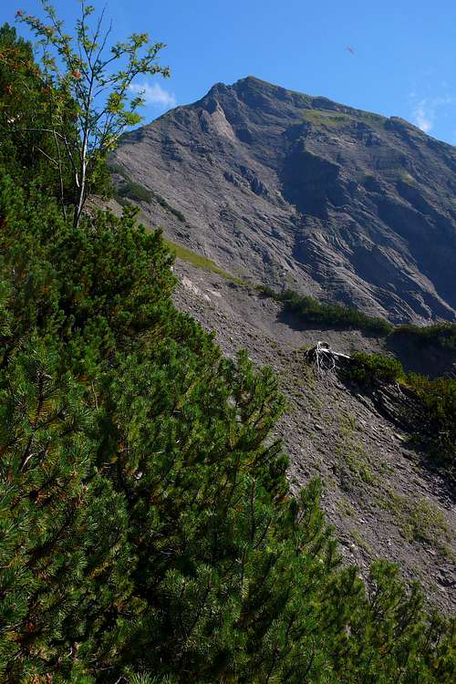
Shortly before the Dümelesattel (Dümele Pass) you leave the pine forest and enter more rugged terrain with low shrub.
Only from this point onwards do you get to enjoy sweeping views.
On the pass, turn right to follow the easy angled ridge up.
Initially the ridge is still harmless. This part is often categorized T3.
But then the vegetation stops and the Valüra Ridge proper begins.
Now it gets much steeper, and at times you will need your hands.
This is the part to which the repeated warning signs pertain.
Most sites I found categorize it as T4.
It is not really technical, but it is often narrow, and if you fall off to the south side, well, that would be it.
Falling off to the north side, though probably not lethal, would not be nice either.
There is of course no reason to fall.
In fact, in two or three places, there are even chains to hold on to.
I got into trouble at one point because I stopped thinking and just kept on following the ridge where the faint track actually went down a bit and then up again.
That was a little tricky. So be prepared to leave the west ridge at some point and turn towards the north ridge.
If you stick to the proper track, you should not have any problems.
Compared to scrambles like the Senda dal Diavel on Munt Pers, it is surely easier.
Shortly before the summit, you meet the track following the north ridge.
This is the 'safe ridge', which anyone can do. So from here there are chains and rails even at points where you really do not need them.
From the car park to the summit would take you a little under 4 hours.
The Valüra Ridge is not recommended for going down. You would spend far too much time looking at your feet rather than the splendid vistas. Therefore, go straight on at the summit, and trace your way back down via the Freschenhaus, with terrific views of the mountains to the south: Silvretta, Rätikon, and Alpstein.
You cannot go wrong: the track is obvious and the hut soon in full view, provided the sight is clear. If not, there are plenty of sign posts.
At the hut, continue straight on to the Lusbühel Saluveralpe (1'610m / 5'282ft). There, turn right and down to the Pöpiswiesalpe, from where you walk the same 10km back to the car park that you walked earlier on your way up.
This map —unfortunately with annoying ads— shows the entire route quite well.
Route from Ebnit

Track over the north ridge (Binnelgrat)
The proposed round trip takes you up from the right (Valüra Ridge) and down to the left (Binnel Ridge)
Ebnit, end of the tarmac / barrier 47.347°N / 9.755°E (946m / 3'104ft)
Bifurcation / possible car park 47.333°N / 9.751°E (980m / 3'215ft)
Sign pointing left to Achrainalpe / Binnelalpe 47.323°N / 9.752°E (1'087m / 3'566ft)
Footbridge / end of the forest road 47.317°N / 9.755°E (1'134m / 3'720ft)
Valorsalpe 47.313°N / 9.754°E (1'301m / 4'268ft)
Dümele Pass 47.307°N / 9.754°E (1'453m / 4'767ft)
North Ridge 47.308°N / 9.777°E (1'921m / 6'302ft)
Summit 47.307°N / 9.778°E (2'004m / 6'575ft)
The track to the Binnelalpe branches off just below the Achrainalpe
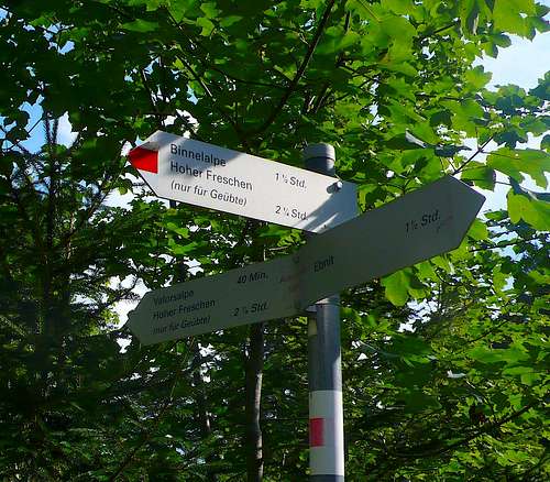
Less than 100 meters after this bridge, a signpost points left to the Untere Wäldlealpe and right to the Valorsalpe. Turn right and follow this forest road, very easy, all the way. This bit is fairly dark and boring, with no views whatsoever. You will pass two high waterfalls, but due to the trees, they are never in full view. Somewhat later you will also pass the signpost seen to the right, where the track to the Binnelalpe and Binnel Ridge branches off. For the Valüra Ridge, go straight on. The sign states, that from here it is another 2¼ hours to the summit.
The forest road ends at a footbridge. Cross it, and go, a lot steeper now, along a narrow trail. Initially, while still in the woods, there are a lot of rocks, but soon you reach the meadow and the Valorsalpe comes into view.
Up until this point, there is no feeling of being in the mountains, but now that you are out of the woods, this changes abruptly, and the scenery gets typically Austrian-alpine.
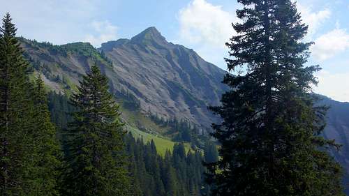
The tracks turns right and then left again, rounding the farm (uninhabited from mid September to mid May; fresh water from a pump). It is only here that you get your first view of Hoher Freschen (see the image above).
When I was here, the grass was almost a swamp and the track very muddy. There is a signpost just after the farm, but basically, you cannot go wrong, as the track is obvious.
After the meadow, in low forest and shrub, the track gets steeper again and full of rocks.
Shortly after you reach the warning sign of the photo above, a strenuous section on grass leads you in a straight line to the Dümele Pass (1'453m / 4'767ft), where the track from the south is met. From here, the route is the same as described in the above section.
Red Tape
South face from above the Pöpiswiesalpe
When to Climb
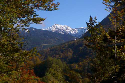
Autumn idyll: Hoher Freschen South Face from near Klausen
The northern route, from Ebnit, passes two really high waterfalls. They are especially impressive in spring. Overall however, autumn must be considered the best period: you have the place virtually to yourself and the birches and beeches look spectacular (impression to the right).
If you like cows with bells, check out the dates mentioned below. Normally they should be there May to September. Bear in mind however, that as long as they are there, you cannot drink the water from the streams. So also for fresh water, October is best.
The main problem with October is the length of the day in relation to the length of the hike. It is almost exactly 10km from the Eusebius Chapel car park (652m / 2'139ft) to the Pöpiswiesalpe (1'110m / 3'642ft), where the real climb, later scramble, begins. And these 10km you must also hike back again. So you must start fairly early if you want to make the summit.
Here is the mountain weather forecast for Hoher Freschen.
Camping
There are no formal campsites on the mountain itself. Consequentially, camping would boil down to wild camping, which would only be allowed if given permission by the dairy farmers that keep their cows on the alps. This is a problem, because either they are there, but then their cows are there as well, and camping is understandably difficult, or they are not there, and then there is simply no way to ask. Before the Almauftriebe and after the Almabtriebe (dates here), the Valorsalpe and Pöpiswiesalpe are deserted, and then, as long as it is only for one night, you pack your stuff first thing in the morning, and you leave no traces, camping would not likely be a big problem. However, since the owners of the alps are not there to ask permission, it is formally still illegal. There is fresh water at both alps.Warning: in autumn there is substantial hunting at dawn and dusk! Not that you wouldn't notice...
There is a convenient, though not always quiet campsite just outside Dornbirn, on the road to Ebnit. It is possible to walk from there up the mountain and down again in one long day. Open April to September. Info here.
The summit can also be reached from the little campsite in Bezau. Info here.
For both camping grounds, walk up the Guntenspitze (1'811m / 5'942ft) and follow the long ridge from there all the way to the summit of Hoher Freschen. See this map.
External Links
 Hoher Freschen, Rote Wand (2'704m), and Madererspitze (2'769m), seen from Switzerland
Camping Dornbirn
Camping Bezau (only in German)
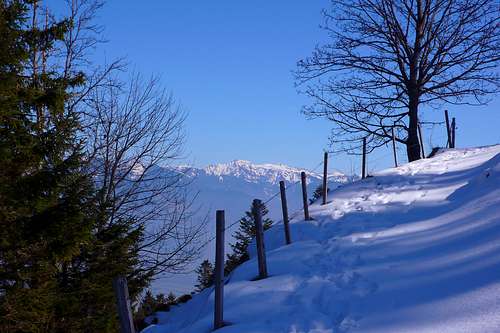
Photo-impression of a winter ascent (annotations in German)
Hoher Freschen from just below Montlinger Schwamm in Switzerland

From the northwest (HF is the pyramid to the far left)