
-
 4844 Hits
-
 85.36% Score
-
 20 Votes
|
|
Mountain/Rock |
|---|---|
|
|
46.47354°N / 12.08789°E |
|
|
Veneto |
|
|
Trad Climbing, Sport Climbing |
|
|
Summer, Fall |
|
|
8202 ft / 2500 m |
|
|
Overview
Geographical classification: Eastern Alps > Dolomites > Lastoni di Formin > IV Bastione di Mondeval
IV Bastione di Mondeval 2500 m
IV Bastione di Mondeval - aka Fourth Mondeval Buttress - is a mountain crag located in the Lastoni di Formin area, between the Croda da Lago-Cernera Group and Passo Giau, this latter being of the highest road pass of the Dolomites. As its name says, it's the fourth peak, and the last but one, of the long and steep wall starting from Forcella Giau and running on the South side - the left one if you’re watching from Forcella Giau - of the amazing Mondeval meadows. It shows a stunning South oriented face, built in a grey kind of “dolomia”. Nowadays there are two routes climbing this wall: a trad route and a modern one. Both are quite recommendable in reason of their exposition, the quality of the rock and the spectacular wide views over the Pelmo Group and the other surrounding peaks belonging to the Eastern Dolomites.

Nowadays there are two routes climbing this wall: a trad route and a modern one. Both are quite recommendable in reason of their exposition, the quality of the rock and the spectacular wide views over the Pelmo Group and the other surrounding peaks belonging to the Eastern Dolomites.
Getting There
The starting point to climb is Passo Giau m. 2236, one of the highest pass of the Dolomites, located 16 km. from Cortina d’Ampezzo, the main resort in this area and 10 km. from Santa Fosca. Passo Giau can be approached from Trento, Bolzano or Belluno.
Road access to Passo Giau m. 2236
- From Trento and Verona: take the Brennero Motorway towards North, exit Ora-Egna, then follow the road to Val di Fiemme and Val di Fassa, pass Cavalese and Predazzo; in Moena leave the main road and turn to right, following the Val di S. Pellegrino road to Falcade and Cencenighe Agordino. Here turn to left following the road to Alleghe, Caprile, Selva di Cadore, Passo Giau.
- From Bolzano: take the Brennero Motorway towards North, exit Ponte Gardena and then follow the Val Gardena road to Selva di Val Gardena and Passo Gardena, reaching Corvara and La Villa. Turn to right towards Passo Falzarego, get the pass and here descent towards left along the road SS48 towards Cortina d’Ampezzo as far as Pocol. In Pocol turn to right and follow the road to Passo Giau (signpost).
- From Belluno: follow the road SS 51 towards North reaching Longarone and Pieve di Cadore; from Pieve the SS51 turns to left, getting to San Vito di Cadore and Cortina d’Ampezzo. In Cortina take the road SS48 to Falzarego Pass and getting to Pocol turn to left (signpost Passo Giau), following the Road SP638 to Passo Giau (16 km. from Cortina).
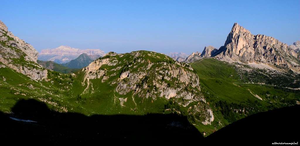
Gusela and Nuvolau group from Forcella Giau
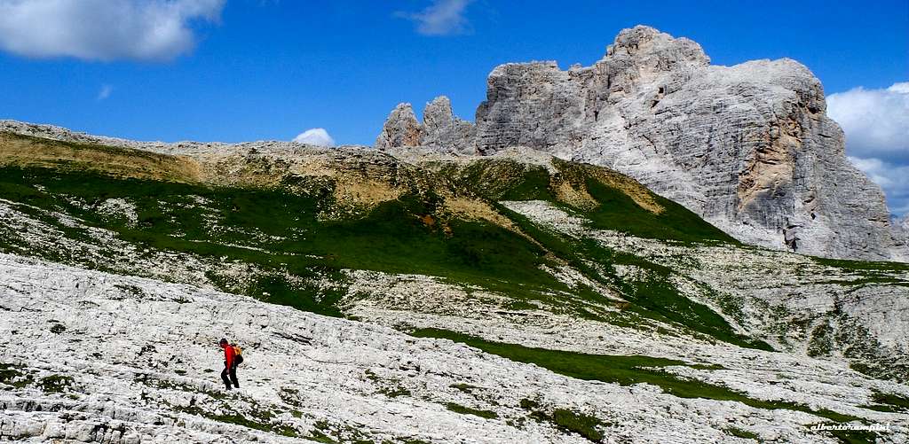
Mondeval summit tableland
Walking access to IV Bastione di Mondeval
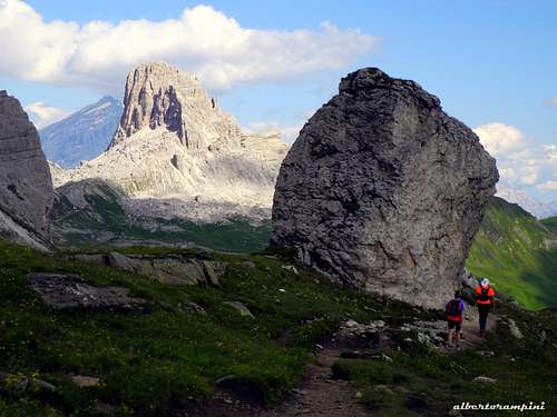
From Passo Giau m. 2236 (parking) head to South and take the path n. 436 to Forcella Zonia and Forcella Col Piombin; after a traverse and a short descent the path rises to Forcella Giau m. 2360. Follow the well worn path, descending to the amazing basin of Mondeval; when you are walking below the fourth grey buttress you can recognize in reason of a horinzontal roof cutting almost all the lower section of the wall, leave the main path and turn to left, rising along steep meadows an scree to the base of the route. (1 hour and 20 minutes from Passo Giau).
South Wall - Sperone Irene report
L1 – Up directly on a black slab, then climb some steps to a belay.(2 pegs, slings. 50 Mt., IV, III +, 50 m.
L2 – Follow a ramp towards right, then up directly and after a few meters slanting left, getting to a stance. III, V. IV+, 30 m.
L3 – Straightly above the stance, then slanted slightly slants to right to climb a ramp leading to slab beyond which to belay. V -, IV +, V, 35 m., 35 m.

|

|
L4 – Up the little overhang above the stance, then climb the successive wall gradually easier to the stance (hourglasses with cords) to the right of three yellow niches. V , IV-, 35 m. three hourglasses.
L5 – Climb a slab cut by cracks just above the stance, then slightly slants to right to a stance below a little wall. IV, III, 43 m. (1 pegs).
L6 – Up the little wall, then head to right climbing some rocky steps sometimes requiring to pay attention to the quality of the rock. Belay on a flake a few meters below the summit. IV+, I, II, 40 m. Up 20 meters along scree to gain the summit.

Descent: from the summit walk slants to right and the take the first rocky gully you meet (cairns). Downclimb the gully and at its end head to right to take the path n. 436, following it uphill to the Forcella Giau. From there back to the Passo Giau on the same path approaching.
Red Tape
No permits, no fees and no particulary restrictions in hiking and climbing, but the whole area had been acknowledged inside the Unesco World Heritage natural sites list and requires the best care and respect. More info about Dolomites Unesco World Heritage on Summitpost in this article by Silvia Mazzani: Dolomites, living mountains.

|

|
When to Climb
Best season goes from the end of June to the middle of October
Where to stay
- Rifugio Passo Giau just on the col
- Rifugio Col Gallina on the SS48 between Passo Falzarego and Pocol - Several accomodations (campsites, B&B, hotels) in Cortina d’Ampezzo
Meteo

ARPAV Dolomiti Meteo Phone +390436780007 fax +390436780008
Centro Valanghe di Arabba Phone +390436755711 fax 043679319 e-mail cva@arpa.veneto.it
Guidebooks and maps
 |
 |
- Guidebooks
“Arrampicare a Cortina d’Ampezzo e dintorni – Le vie più belle nelle Dolomiti” by Mauro Bernardi, Ed. Athesia
“Dolomiti Orientali Vol. I – Parte I” by Antonio Berti - Collana Guide dei Monti d’Italia, CAI TCI
- Maps
Tabacco sheet 03 – Cortina e Dolomiti Ampezzane 1:25.000
Kompass sheet 55 - Cortina d'Ampezzo 1:50.000