-
 17759 Hits
-
 94.24% Score
-
 46 Votes
|
|
Area/Range |
|---|---|
|
|
46.47650°N / 12.08360°E |
|
|
Hiking, Mountaineering, Trad Climbing, Sport Climbing |
|
|
Summer, Fall |
|
|
8717 ft / 2657 m |
|
|
Overview
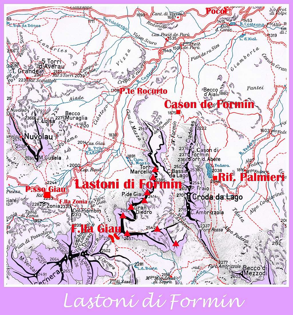
Geographical classification: Alps - Eastern Part > Dolomites > Lastoni di Formin
Lastoni di Formin
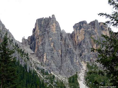
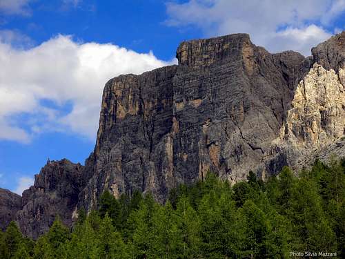
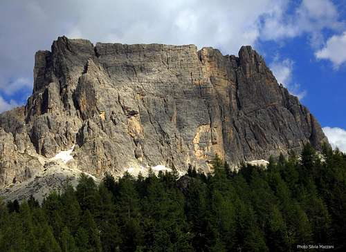
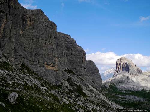
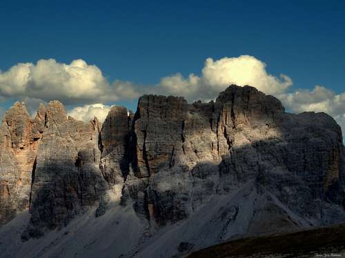
A steep and wide face of pure “dolomia” sprouting from the meadows… The Lastoni di Formin are an amazing massif lying on the boundary ridge between Cortina d’Ampezzo and San Vito di Cadore municipalities, in the Eastern Dolomites. The massif runs between the Croda da Lago-Cernera Group and Passo Giau 2236 m, one of the highest road pass of the Dolomites. Their Ladin place-name is “Lastoi de Formin” and the culminating point is named Ponta dei Lastoi.
The long and imposing 350 meters high West face is running very steeply side by side to the Cortina-Passo Giau road; surrounded by a wide extent of woods and meadows, creating a surprising contrast, it terminates on Forcella Giau m. 2360. Another stunning wall - South oriented - runs starting from Forcella Giau and overlooking the meadows of Mondeval. On the steep and attractive West face we can find a great number of beautiful classic climbing routes Dolomites style and some sport ones. Also the South face offers several interesting routes, both trad and modern. On the contrary the East side of the Lastoni di Formin area shows a sloping rocky Karst tableland, descending gently towards the Croda da Lago group and skirting the Formin Valley.


Observing the wall from the road rising to Passo Giau from Pocol and starting from the left the main climbing sectors are: Torrione Marcella, located on the extreme left of the long West wall, the Grande Diedro, the Grande Parete Costeana and the Punta Lastoi or Spitz de Mondeval. Overlooking the Mondeval meadows we have an facing South we have the IV Bastione di Mondeval and the V Bastione di Mondeval.
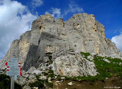
Unlike the majority of the peaks in the Dolomites, which don’t show a weak side, the particular structure of Lastoni di Formin is the reason of their easy accessibility along the Eastern side; a simple but absolutely satisfactory and magnificent hike starting from Passo Giau will lead you on the mountain’s highest point at 2657 m.
Getting There
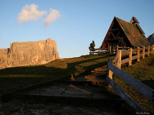
San Giovanni Chapel on Passo Giau
Road access
The best starting point is Passo Giau m. 2236, one of the highest pass in the Dolomites, offering a breathtaking view over the majority of the Eastern and Western Dolomites. Passo Giau is situated at 16 km. from Cortina d’Ampezzo m. 1230 (Belluno province), the main resort in this area. Cortina can be approached from Belluno or from Bolzano:
- Road approach from Belluno: follow the road SS 51 towards North reaching Longarone and Pieve di Cadore; from Pieve the SS51 turns to left, reaching San Vito di Cadore and Cortina d’Ampezzo.
- Road approach from Bolzano: take the Brennero Motorway, exit to Bressanone and then follow the road SS 51 along Pusteria Valley, reaching Brunico and Dobbiaco; from Dobbiaco follow on the right Val di Landro, reaching Carbonin m. 1432. At the fork road in Carbonin turn to right towards Cortina d’Ampezzo.
From Cortina d’Ampezzo m. 1230 to Passo Giau m. 2236
– Follow the road SS48 to Falzarego Pass and in Pocol turn to left following the Road SP638 to Passo Giau (16 km. from Cortina).
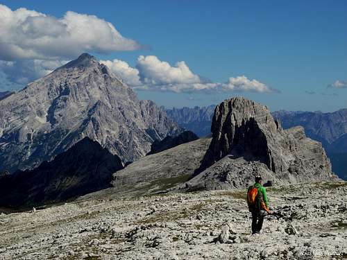
Lastoni di Formin from the path to Forcella Giau |
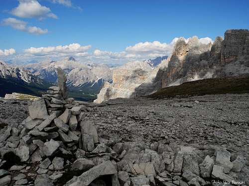
Summit view to Antelao and Becco di Mezzodì |
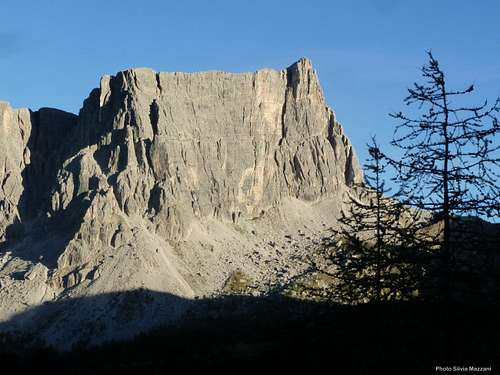
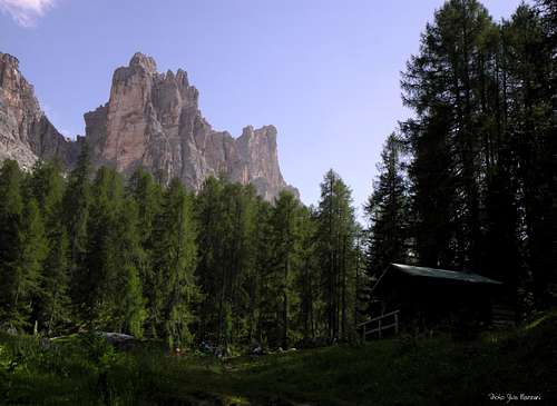
Lastoni di Formin in late afternoon |
Lastoni di Formin Normal Route from Ponte di Rocurto
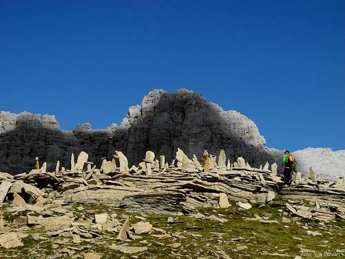
Stones on the tableland
- Lastoni di Formin Normal Route from Ponte di Rocurto
Difficulty: Walk
Difference in level: 900 m.
Total time: 6 hours
An amazing round trail to reach without difficulty Punta dei Lastoi, the highest summit of Lastoni di Formin. Here you’ll see one of the best view of the Dolomites. The route’s starting point is situated at Rocurto Bridge m. 1709, along the SP638 from Cortina d’Ampezzo to Passo Giau.
From Ponte di Rocurto (parking) follow the path n. 437 leading to Cason de Formin m. 1875. Turn to right and follow the path n. 435, rising along Val Formin, dominated by the beautiful massif of Croda da Lago. The path is getting to the reddish saddle named Forcella dei Lastoi m. 2462, also named Forcella Rossa (Reddish Saddle). Here you must leave the marked path (descending towards the Alpe Mondeval) and turn to right following at first towards West, then toward NW, a poor trail with several cairns crossing all the rocky Karst tableland and leading to Punta Lastoi, the culminating point of Lastoni di Formin. From the summit follow the same trail towards Forcella dei Lastoi or Forcella Rossa. Here carry on along the path n. 435 descending in the opposite side of the saddle col towards the Alpe Mondeval. The path crosses another path marked with the number 436 coming from Passo Giau: follow it towards Forcella Ambrizzola m. 2277, then turn to left reaching the Palmieri Hut m. 2046. From here a path comes back to Casoni di Formin; again the first part of the itinerary will lead you to the starting point.
Lastoni di Formin Normal Route from Passo Giau
Lastoni di Formin high Karst tableland
- Lastoni di Formin Normal Route from Passo Giau
Difficulty: Walk
Difference in level: 450 m.
Total time: 3,30 hours
Another shorter but amazing route leading to Punta dei Lastoi is starting from Passo Giau, m. 2236.
From the Chapel of S. Giovanni Guadalberto on Passo Giau (parking) follow the path 436 to Forcella Zonia and Forcella Col Piombin; after a short descent the path rises at Forcella Giau m. 2360, then a new gentle descent leads to Malga Mondeval di Sopra; the path turn to left rising towards Forcella Ambrizzola. Before getting to the col leave the path and turn to left following the path 462 to Forcella dei Lastoni or Forcella Rossa 2462 m. At the saddle leave the main path and follow on the left, at first towards West, then toward NW, a poor trail with several cairns crossing all the rocky Karst tableland and leading to Punta Lastoi, the culminating point of Lastoni di Formin. Descent along the same itinerary.
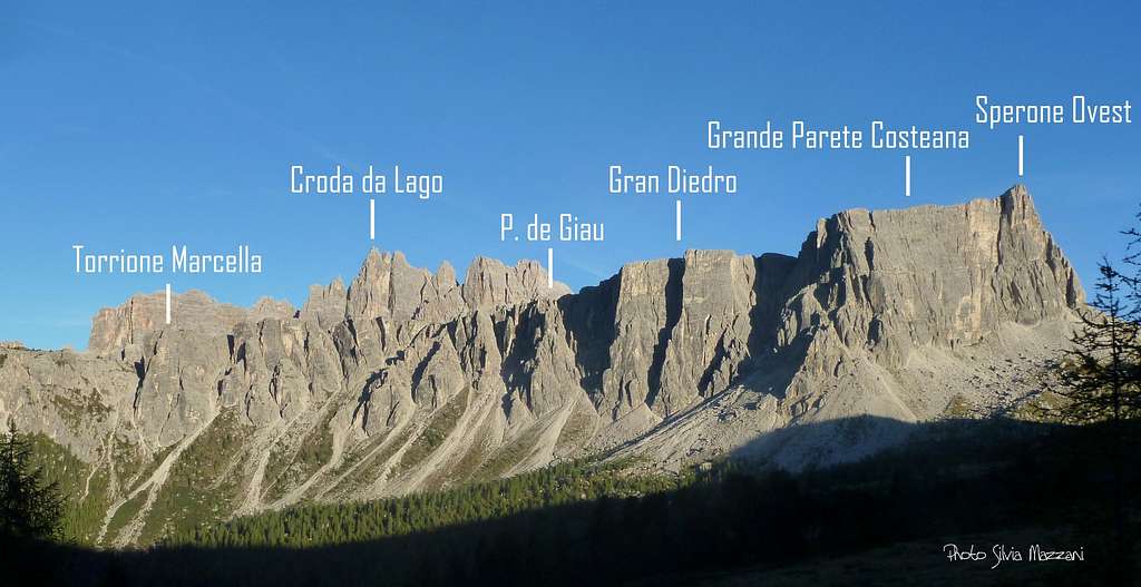
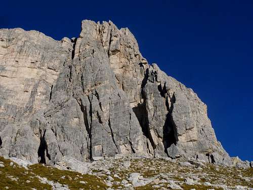
Lastoni di Formin main climbing sectors and routes
Lastoni di Formin main climbing sectors and routes
Lastoni di Formin Area offers a great choice of classic routes running on the long West wall facing the road rising to Passo Giau and on the South-West wall overlooking Alpe di Mondeval. There are also some moderne routes; these latters are mainly located on the Grand Diedro and the secluded South Face of Punta Lastoi - or Spiz de Mondeval - which dominates the wonderful basin of Mondeval. According to the Italian climbing areas' habit, trad routes grades are expressed with the UIAA Scale, while modern routes grades are expressed with the French Scale. Starting from the left the main climbing sectors are Torrione Marcella, Gran Diedro, Grande Parete Costeana, Punta Lastoi or Spitz de Mondeval, IV Bastione di Mondeval and V Bastione di Mondeval. Another interesting sector is Cima Cason di Formin belonging to Croda da Lago Group.
Torrione Marcella 2292 m |
Torrione Marcella 2292 m A slender tower on the left of Lastoni W face West face - Via Nikibi French 6b+, 6a obbl., 280 m., bolts - M. Dibona, G. Alexander 2002 |
Lastoni - Gran Diedro 2376 m |
Gran Diedro 2376 m The left sector of W Face West face - Pilastro Priolo VI (VI-, A0) 280 m., trad route - G.Buzzi, G.Calzi, R.Priolo, N.Zeper 1974 |
Lastoni - Grande Parete Costeana 2376 m |
Grande Parete Costeana 2585 m The right secor of W Face West face - Via dei Bolognesi IV, IV+ 280 m. - F. Bonetti, P. Bonetti, P.Mezzacasa 1977 |
Punta Lastoi or Spitz de Mondeval |
Punta Lastoi or Spitz de Mondeval 2376 m The left sector of South Face South face - Re Artù 6b, 350 m., bolts - Mario Dibona & co. |
Lastoni - IV e V Bastione di Mondeval |
IV e V Bastione di Mondeval 2376 m The right sector of South Face South face Sperone Irene V, 230 m. - M. Bernardi, I. Demetz 2004 |
Cima Cason di Formin 2376 m |
Cima Cason di Formin 2376 m A massive tower along the Val Formin North West face Diedro Dallago IV+, 330 m. - F. Dallago, D. Costantini 1970 |
Climbing shots
 |
 |
|---|---|
 |
 |
Main Rock Climbing Rating Systems
Climbing Grades:
| Rock Climbing Rating Systems | ||||||||
|---|---|---|---|---|---|---|---|---|
| French | YDS (USA) | UIAA | French | YDS(USA) | UIAA | French | YDS(USA) | UIAA |
| 1 | 5.2 | I | 6b | 5.10c | VII- | 7c+ | 5.12d | IX |
| 2 | 5.3 | II | 6b+ | 5.10d | VII | 8a | 5.13a/5.13b | IX+/X- |
| 3 | 5.4 | III | 6c | 5.11a | VII+ | 8a+ | 5.13c | X- |
| 4 | 5.5 | IV | 6c+ | 5.11b | VII+/VIII- | 8b | 5.13d | X |
| 5a | 5.6 | V- | 7a | 5.11c | VIII- | 8b+ | 5.14a | X+ |
| 5b | 5.7 | V/V+ | 7a+ | 5.11d | VIII | 8c | 5.14b | X+/XI- |
| 5c | 5.8 | VI- | 7b | 5.12a | VIII+ | 8c+ | 5.14c | XI- |
| 6a | 5.9 | VI/VI+ | 7b+ | 5.12b | VIII+/IX- | 9a | 5.14d | XI |
| 6a+ | 5.10a/5.10b | VI+/VII- | 7c | 5.12c | IX- | 9a+ | 5.15a | XI+ |
Lastoni di Formin summit views
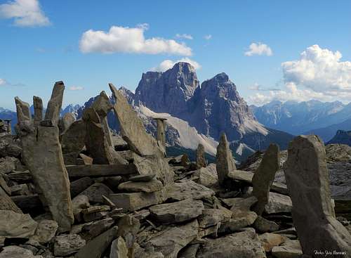
Pelmo |
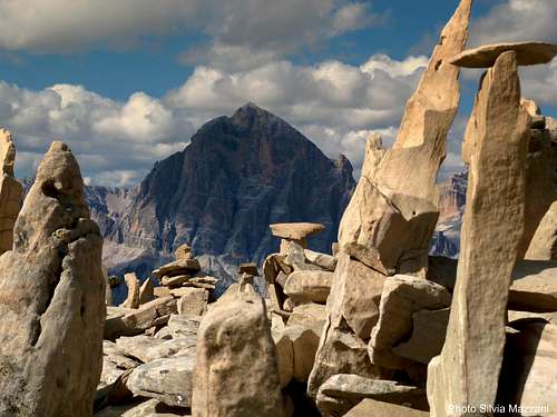
Tofana di Rozes close-up |
Croda da Lago seen from Lastoni di Formin Tableland |
Red Tape
There are not particulary restrictions in hiking and climbing, but Lastoni di Formin are situated inside "Pelmo and Croda da Lago" area, one of the nine mountains systems of the Dolomites acknowledged as UNESCO WORLD HERITAGE and require the best care and respect. More info about Dolomiti Unesco World Heritage here:
Dolomites living mountains
Dolomiti Unesco
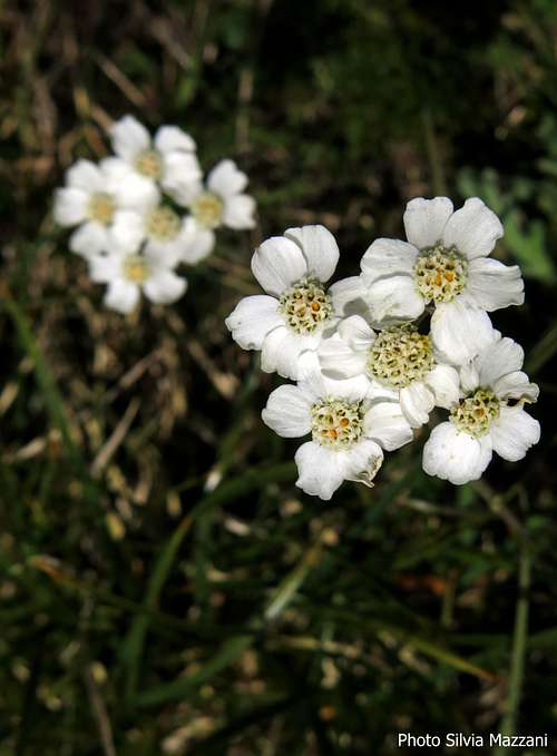
Achillea Moscata |
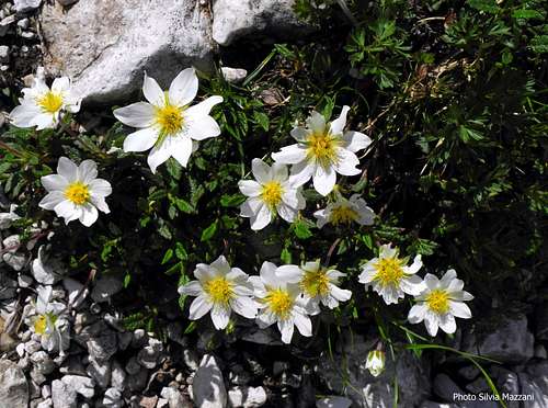
Drias Octopetala 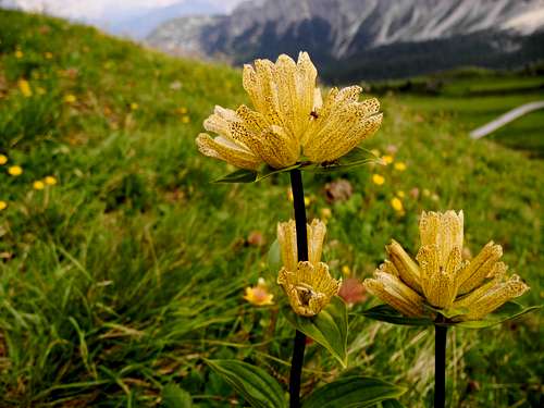
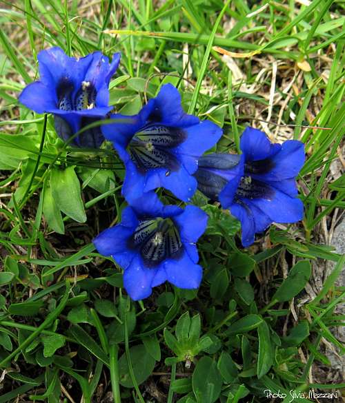
Gentiana Punctata |
Gentiana Acaulis, Mondeval meadows |
When to climb and hike
Best season goes from June to October
Meteo
ARPAV Dolomiti Meteo
Dolomiti Meteo - Veneto
ARPAV Dolomiti Meteo Phone +390436780007 fax +390436780008
Centro Valanghe di Arabba Phone +390436755711 fax 043679319 e-mail cva@arpa.veneto.it
Where to stay
Rifugio Passo Giau m. 2236
Rifugio Palmieri Croda da Lago m. 2042
Guidebooks
 |
 |
 |
 |
"IV grado e più Dolomiti Orientali" by E. Zorzi, L. Brigo, C. Piovan - Ed. Idea Montagna“
"Dolomiti Orientali Vol. I – Parte I” by Antonio Berti - Collana Guide dei Monti d’Italia, CAI TCI
“IV grado in Dolomiti” by Emiliano Zorzi - Ed. Idea Montagna
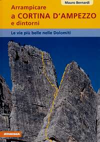
“Arrampicare a Cortina d’Ampezzo e dintorni – Le vie più belle nelle "Dolomiti” by Mauro Bernardi - Ed. Athesia
Maps
Map: Tabacco 03 – Dolomiti Ampezzane 1:25.000