|
|
Mountain/Rock |
|---|---|
|
|
36.52050°N / 50.68037°E |
|
|
Mountaineering |
|
|
Summer |
|
|
13173 ft / 4015 m |
|
|
Overview
For more pictures/info, see the page for the nearby Siyalan Peak.Elevation Note: Experience has proven to me that the most accurate maps of the Central Alborz Mountains are those with a scale of 1:50 000 produced by the Iranian armed forces. The elevations shown on these maps have generally agreed closely with measurements with my own GPS/altimeter. Other details (high points on ridgeline, valleys…) have also proven to be accurate. For the Kandigan area, however, the map turned out to have a few inaccuracies. It failed to identify the Kandigan Peak. Instead, it only showed a minor high point on the ridgeline with contour lines of 3840-3860 m. The Soviet military map shows a nameless peak with an elevation of “4000 m”. Most maps used by Iranian mountain climbers give an approximate elevation of 4050 m. My GPS showed an elevation of 13170 ft (4014.2 m).
Click for Introduction to the Central Alborz Mountains
Click for a detailed map of the Central Alborz Mountains. Please note that the word "Kandigan" will not appear on this map. Instead you will see "Darya Ab" 3850 m. See "Elevation Note" above.
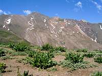
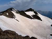
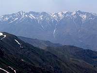
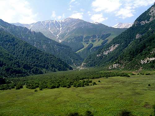 (R) Kandigan, (middle) slopes of Siyalan
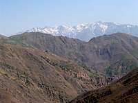
Sehezar River carves a deep valley in the northwestern part of the Central Alborz Mountains south of the coastal town of Tonkabon where the mountains rise abruptly above the Caspian Sea. If you follow some of the branches of the Sehezar River, you can go from an elevation of 25 meters below sea level at the Caspian coast to more than 4000 m within a distance of 30-35 Km. Most of the 4000 m peaks of the area belong to the Takhte Soleyman Massif to the east of the Sehezar River (The 4000 m mountain with the shortest distance to the Caspian Sea is probably the 4412 m Kalahoo Peak. Some of its sub-peaks are even closer). To the west of the Sehezar River, you will find a series of peaks with elevations in the high 3000 m range. Three of these peaks exceed 4000 m. These include:
1) Siyalan 4190 m
2) Unnamed Peak 4050 m
3) Kandigan 4015 m
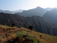
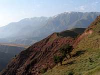
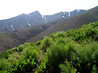
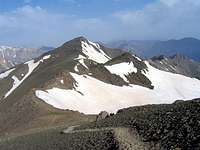
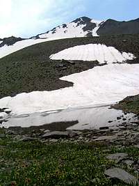
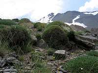
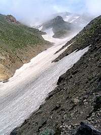
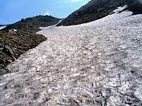
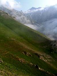
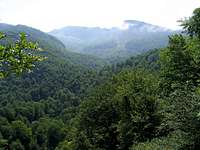
Kandigan sits to the west of Siyalan Peak and is connected to it via a 3870 m saddle. The northern slopes of these mountains drop steeply down to an elevation of 1000 m at the bottom of the Dohezar River Valley (a branch of the Sehezar River). Following the river north, will quickly get you down to the coastal plain. These slopes form a formidable barrier to the moist air that rises from the Caspian Sea. A lush sub-tropical forest covers the northern slopes up to an elevation of roughly 2200 m. The southern slopes see much less moisture and appear much drier. These slopes go down to the bottom of the Alamoot River Valley and are covered by a scattered growth of Juniper trees up to around 2700 m.
Kandigan is often climbed along with Siyalan in a multi-day hiking program. Shorter distance and less elevation gain, mean that the mountains are often climbed from the south. Most hiker, however, go on to descend the beautiful northern slopes. The starting place is the village of Haniz (2150 m) to the south. From there you will hike to the 3870 m saddle where you can set up your camp before climbing Siyalan and Kandigan. You will then descend the northern slopes down to the village of Asal Mahale (1250 m).
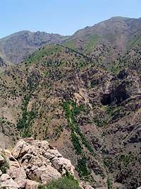
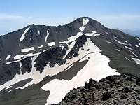
Unlike the summit of Siyalan which remains hidden from view from the beautiful northern slopes, the summit of Kandigan is often visible and provides a spectacular background for the foggy forests, lakes, meadows etc. on these slopes. This, in my opinion, makes Kandigan a much more photogenic peak than the higher Siyalan.
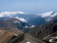
I was hoping to see the Caspian Sea from the upper slopes of these mountains, but clouds and haze blocked the view. At night, however, the obvious line created by the light of the coastal communities marked the coastal line very clearly.
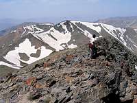
Below you will find a brief description along with some photos of what you will encounter on the hike. Please refer to the “Climb South, Descend North” Route Page for much more info. Check out the page for Siyalan Peak for more photos of the area.
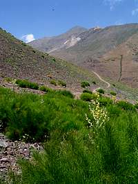
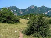
Alamoot Valley
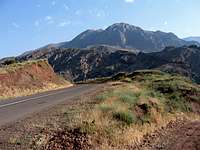
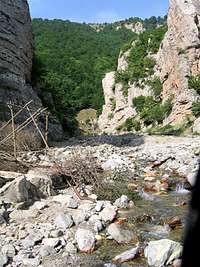
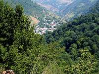
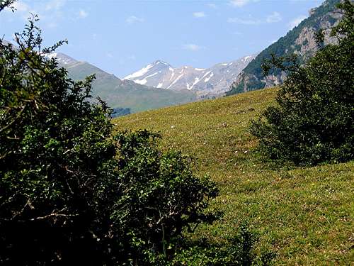
These pictures were taken on the road to Haniz Village.