
-
 5260 Hits
-
 85.87% Score
-
 21 Votes
|
|
Mountain/Rock |
|---|---|
|
|
49.21007°N / 7.87066°E |
|
|
Hiking, Trad Climbing, Sport Climbing, Scrambling |
|
|
Spring, Summer, Fall |
|
|
984 ft / 300 m |
|
|
Overview
 Bavariafels seen from Kuhfels Bavariafels seen from Kuhfels |
Kuhfels and Eselsfels (Cow and Ass Rock) are two sandstone cliffs, located right above the centre of the village of Wilgartswiesen in the Südpfalz Region. Right in the vicinity are Kuhplatte and Eselsturm (Cow Slab and Ass Tower) to complete the little animal farm of climbing crags. Three of them (the three first grow out of the south slopes of Großer Breitenberg, a steep hill-like mountain north of the village, while Eselsturm can be found about 1km to the west on the south slopes of Tiergartenhalde, a local nature preserve.
The crags are somewhat typical for the region in general and for the Wilgartswiesen region in particular - half of the crags of the area are what we call Massiv - a sandstone ridge starting from the top of the mountain, which suddenly drops away to reveal the cliff-like sandstone structures of the climbing cliffs. In this case all cliffs - whether the ones on this page or Mittlere Deichenwand to the west or Drei Felsen to the east reveal perfectly smooth vertical or overhanging south faces while the east and west faces are rather structured. Consequently they all have very difficult routes on the south faces, sometimes reaching grades of 9+ in difficulty.
Kuhfels (to the west) and Eselsfels (east) are no exception. Both are located so close to each other that the two ridges almost touch each other at their northern end, where they rise out of the surrounding slopes. The cliffs form an angle of roughly 30° with each other, encompassing a very steep mountain slope in between. The normal routes to the summit plateaus of the massifs run along the west faces, where a system of ledges lead to the top. Often you can walk out towards the sheer south faces where caves and overhangs offer shelter for climber - but also for birds of prey or owls. Recently I scared up quite a number of owls in places like that and droppings in the caves reveal the residents.
The two cliffs both have a large base, built up underneath their main faces, bases which in the case of Kuhfels also have established climbing routes on them. They are almost completely hidden beneath the dense forest canopy and will be seen only during the approach to the crags. The main faces - meaning the south faces of course - are both high vertical faces with a system of mainly horizontal grooves. There are quite a number of bolts to protect the established routes but much less than on other more popular Südpfalz crags. Speaking of popularity - both Kuhfels and Eselsfels, judging from the state of the paths towards them, don't seem to be overly popular. The access ledges in the east faces are somewhat overgrown so that the normal route turns into a bushwhack in several places.
On the top of Eselsfels there is a small tower, quite an interesting crag for the scramblers amongst us. It has several routes, rated 1 and 2 and the exposure adds to the fun. Kuhfels also has a set of summit structures, which, however, are rather small and only impede the normal route to the front plateau as a labyrinth of obstacles.
 |
 |
 |
 |
 |
Climbing Routes Kuhfels and Eselsfels
 Kuhfels south and east faces
Both crags have impressive vertical south faces which have lots of routes of all difficulties. On Kuhfels there are several established climbs on the base, while on Eselsfels there are several for the summit Tower. The main routes can be found on the south and east faces of both towers. Taking into account that only the topmost parts of the cliffs peep out of the forest canopy they are excellent climbing destinations on hot summer days.
Rather than reprinting the copyrighted information from the site of the Vereinigung Pfälzer Kletterer I link to their routes database directly with some summary info. Here is the link to the complete database.
| Feature | Routes link | Summary |
| Kuhplatte | Kuhplatte | 5 routes with variations ranging from 6- - 7- |
| Kuhfels Sockel | Kuhfels Sockel | 6 routes ranging from 1 - 6+ |
| Kuhfels Massiv | Kuhfels Massiv | 19 routes with variations ranging from 3 - 9+ |
| Eselsfels Gipfelturm | Eselsfels Gipfelturm | 2 routes with variations ranging from 1 - 2 |
| Eselsfels Massiv | Eselsfels Massiv | 9 routes with variations ranging from 1 - 8 |
 |
 |
 |
 |
 |
Getting There
 Kuhfels (left) and Eselsfels (right, with Gipfeltürmchen)
Both Kuhfels and Eselsfels are located directly to the north of the centre of Wilgartswiesen. You can find good parking possibilities at the western end of the village near the sports field. The closest airports are at Frankfurt and Stuttgart so the itineraries start there too.
From Frankfurt
There are two possible routes which both take equally long- Via Ludwigshafen
- From Frankfurt take motorway A5 southward to Darmstadt.
- There change to A67 south.
- At Viernheimer Dreieck turn onto A6 west. Leav
- e it at Frankenthaler Kreuz for A61 south.
- At Mutterstädter Kreuz take A65 south until you reach Landau.
- At Landau turn on B10 west.
- Leave B10 at Wilgartswiesen, drive through the village and right at its end turn right into the street which leads to the sports field. There is a convention hall with ample parking space.
- Via Kaiserslautern
- From Frankfurt take motorway A3 west
- At Mönchhofdreieck turn onto A67 south
- At Rüsselsheimer Dreieck take A60 west
- At Kreuz Mainz Süd take A63 south
- At Kreuz Kaiserslautern turn onto A6 west
- At Kreuz Landstuhl turn onto A62 south
- At Pirmasens turn onto B10 east
- At Wilgartswiesen turn off and follow the instructions above
From Stuttgart
- Take motorway A8 to Karlsruhe
- At Karlsruher Dreieck turn north onto A5
- Tke the next exit to head for A65
- At Landau North turn to B10
- Rest as above
Red Tape
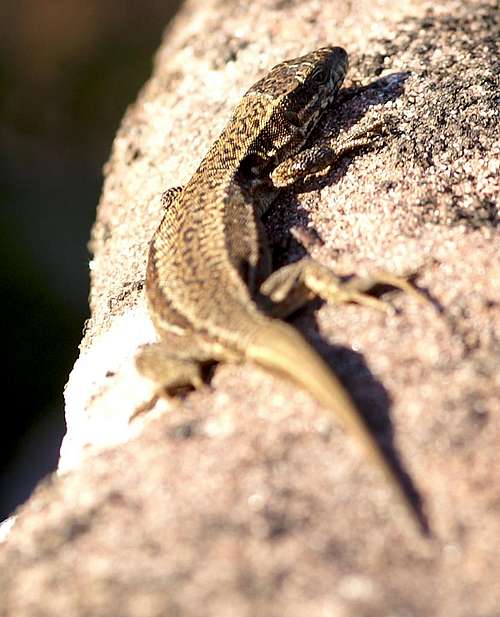 Female wall lizard on Kuhfels
The two crags are "natural monuments" so that general laws protect them. Kuhfels has a cave near its summits where obviously birds of prey, probably owls, build their nests or which they use as perches. Try to keep out of their way.
Moreover there are rules which apply for all crags of the Wasgau region:
The sandstone of Südpfalz forms lots of caves and overhangs. Though this makes it most interesting for climbers, two species of birds of prey compete for this habitat: the peregrine falcons (see section above) and the eagle owls. Both are endangered and wherever there is a eagle owl or peregrine falcon pair found nesting in the sandstone the crag will immediately be closed. Generally this closure lasts from the beginning of each year through Aug. 1st. If breeding is not successful the closures will be cancelled even before that date. For a list of closures see the Closure List of PK. However, if you find "Stop" signs on the access routes to the crags, please don't go there!
The use of magnesia is not allowed in the whole Südpfalz region. This is rather a directive or an arrangement than an outright law. Thus you probably will get away with using it but do so only when absolutely necessary. Magnesia closes the pores which you find in the sandstone and together they form a smooth surface which will get very slippery in wet conditions. The rule of thumb is to use magnesia in the highest difficulty sections and only extremely sparingly.
A list of guidelines can be found here (in German).
Accommodation
You can find hotels and apartments in Rinnthal or Wilgartswiesen. Have a look at the following links (which are in German, however):Weather Conditions
The following link is for the village of Wilgartswiesen:Maps & Books
Maps
As for maps there is a good overview map (1:50000) by Kompass Verlag but the best ones are the official topographic maps by the state government of Rheinland Pfalz, scaled 1:50000, 1:25000 and 1:5000. All official maps can be found on the web page of Landesvermessungsamt Rheinland Pfalz
1:50000
- Naturpark Pfälzer Wald
Kompass Map WK766
ISBN: 3-85491-523-3
- Pirmasens Süd
LVA RLP Map L6910
ISBN: 3-89637-193-2
1:25000
Books
Here are a number of climbing guidebooks on the region of Südpfalz. The best one is the one by U. Daigger and H.-J. Cron, complete with many topos. However, it is hard to get by and often out of print almost immediately after a new edition has been published. Currently it is available here.
- Hiking
- Pfälzerwald
B. & J.-Th. Titz
Rother Verlag
ISBN: 3-7633-4268-0 - Klettern im Buntsandstein
U. Daigger, H.-J. Cron
Westpfälzische Verlagsdruckerei St. Ingbert
ISBN: 3-00-015457-4
- Pfalz ++, Klettern im Buntsandstein
R. Burkard, P. Weinrich
Published privately
- Klettern im Naturpark Pfälzerwald
Naturfreunde Lambrecht
Published privately - Pfalz & Nordvogesen en bloc
A. Wenner, Y. Corby, I. Bald
Panico Verlag
ISBN: 3-936740-19-4
Climbing