
-
 9394 Hits
-
 81.18% Score
-
 13 Votes
|
|
Mountain/Rock |
|---|---|
|
|
34.73220°N / 83.903°W |
|
|
Lumpkin & Union |
|
|
Hiking |
|
|
Spring, Summer, Fall, Winter |
|
|
3900 ft / 1189 m |
|
|
Overview
 Boots in tree at Neels Gap
Levelland Mountain is a soft, rounded hump of a mountain crossed by the Appalachian Trail in northeastern Georgia. Among the top 25 highest mountains in Georgia, Levelland Mountain is the highpoint of Raven Cliffs Wilderness. Levelland Mountain is the first big tug northbound hikers on the AT encounter when leaving Neels Gap, and is tucked neatly between Bull Gap and Swaim Gap.
The summit is densely wooded with no views, but the enveloping forest is lovely and the wildflowers in the spring and early summer are divine.
Rank: 24th highest peak in Georgia
Prominence: 800 feet
USGS Quad: Neels Gap
Planning Map:
Rank & Prominence Source: Lists of John
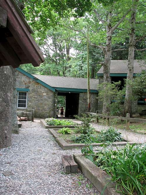
Getting There & Route Overview
 AT at Wasaliyi Inn | Bob Smith
The AT crosses very near summit of Levelland Mountain, and a short side-trip is required to reach the actual highpoint. Though nothing I found indicated the highpoint had been reached (such as a cairn or other marker), there were “flags” (orange tape) . As with many mountains in this region, the highpoint is rather indistinct.
From the west (AT Northbound): The peak can be accessed from the west via Neels Gap (elevation 3,109 feet) for an uphill chug, 4 miles roundtrip with 1,200 feet of gain. To reach Neels Gap from Dahlanega (about 60 miles north of Atlanta), follow U.S. 129/19 roughly 22 miles north.
 Boots in tree at Neels Gap
Red Tape
 Ascending Levelland Mountain
 Summit area in spring
| There is no fee to visit this part of the Chattahoochee National Forest and permits are not required for overnight stays in the backcountry. Please be mindful of posted Forest Service user warnings, such as “problem bear” alerts and campfire bans. Note that the Appalachian Trail is open to foot traffic only. Motorized vehicles and pack animals are not permitted. Wolf Laurel Top lies within the 9,100 acre Raven Cliffs Wilderness. Please follow LNT (Leave No Trace) principals: 1. Plan Ahead and Prepare 2. Travel and Camp on Durable Surfaces 3. Dispose of Waste Properly 4. Leave What You Find 5. Minimize Campfire Impacts 6. Respect Wildlife 7. Be Considerate of Other Visitors |
Camping & Lodging
 Trillium close-up
 Trillium on Levelland Mountain
AT Backpacker Camping
The nearest shelters to Levelland Mountain are the Blood Mountain Shelter (southbound) and the Whitley Gap Shelter (northbound).
Hiker Hostel
The Walasi-Yi Center at Neels Gap has lodging in their historic hiker hostel. The hostel is open 7 days a week, 365 days a year, lodging is available on a first come, first served basis.
Weather & Seasons
| Spring and Fall are considered by many the most pleasant time to visit the Southern Appalachians. Spring: In the Spring, daytime temperatures and warm and evenings are cool while the flowering shrubs are in bloom and the waterfalls are running. Water sources such as springs are most reliable this time of year. Fall: In the fall, the broadleaf deciduous trees put on a bright display of autumn color, though waterfalls may not be as impressive and springs and other water sources less reliable. The air is cooler and crisper and visibility should be prime for long-range views. Summer: Summer in this part of the country can be oppressively hot and humid and even the higher elevation and ample tree cover will not keep the hiker from feeling overheated, sticky and dirty. High humidity and haze plus deep leaf cover mean limited long-range vistas, though it is in summer that the term “temperate rainforest” will have the most meaning to and be most appreciated by the visitor. Winter: Winter in the South Appalachians can range from cool and damp to cold and severe with bouts of deep snow following major storms. In other words, while this range may be relatively low in elevation and southern in latitude, mountains are still mountains and can bring unpredictable and potentially dangerous weather. | 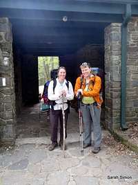 Leaving Walasi-Yi Leaving Walasi-Yi |
bpdude - Oct 19, 2017 10:22 pm - Hasn't voted
Top 25 - NotNice post but......Levelland Mountain is definitely NOT one of Georgia's top 25 peaks. It is actually #46, so there are 45 peaks in the state that are taller. I'm gonna pass over it this weekend, but I wont spend much time there because there are much better views to be had along this section of the AT and elsewhere in North Georgia.
Sarah Simon - Nov 6, 2017 11:58 am - Hasn't voted
Re: Top 25 - NotPerhaps our prominence criteria difffer in terms of state rank. Enjoy your views! I find beauty wherever I go. Sarah