Planning the Trip
Ever since spending the summer of ’05 in Boulder, Colorado, I had wanted to return to the state, mainly with the intent to summit another 14er or two. I had long since given up on the goal of bagging all of them (and had no desire to, since most of them [mostly the ones in the Sawatch and Front Range] didn’t seem all that impressive), but there were a few I wanted to at least see, and if possible summit. After going back and forth between which peaks I really wanted to climb and which ones I’d be fine to just admire from a distance, I finally narrowed my list down to two. They’re both among the most photographed mountains in Colorado, have rewarding scrambling routes to their summits, and the distance to their tops can be shortened via 4WD roads (which I had no qualms taking advantage of, since the 4WD vehicle given to us by my wife’s parents was on its last legs but had not yet been taken up into the mountains, and the 3,000 foot rule doesn’t mean much to me personally).
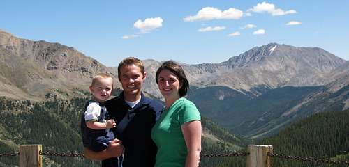
Mount Sneffels was first on the list. From what I could see, it was the clear monarch of the northern San Juans, and was located near a town (Ouray) that had enough things to keep the rest of my family busy (my wife Liz, our two-year old son Matthew, & my Mom) while my brothers and I were off doing our thing. The photos I’d seen of its north face made it appear that there couldn’t possibly be any routes easier than 4th class to the top, but I was pleased to learn that the standard route was 2nd class and another easily accessible route was 3rd class. If I knew that this was the only mountain we would end up climbing on the trip, then I probably would have chosen to climb the southwest ridge (3rd class) via Blue Lakes Basin, which is among the most scenic mountain locations in Colorado, but since this would be a warm-up hike to a more difficult scramble and my brothers had never done any scrambling before, I didn’t want to tire them out too early, so we would take the shorter approach from Yankee Boy Basin.
Depending on how my brothers handled the exposure on the southwest ridge of Mount Sneffels, we would also attempt Crestone Needle, which was located in the Sangre de Cristo range. Although not as tall as neighboring Crestone Peak, it was the favorite 14er of several people I’d talked to who had climbed them all (2nd in popularity in a poll on 14ers.com after Longs Peak, which I had already climbed), and its daunting horn-shaped summit would feel very rewarding to stand on top of. With the 4WD road on the verge of being permanently closed (only SAR teams will have access to the upper road after fall of ’09), it also gave us the opportunity to shorten this hike as well, giving us more energy to do other things with the family in between climbs. I scoured the internet in an attempt to find activities in the area around Westcliffe that my mom and Liz would enjoy as well, but didn’t find much. I was hoping that just meant no one had bothered to post anything.
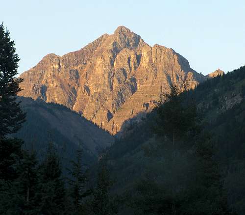
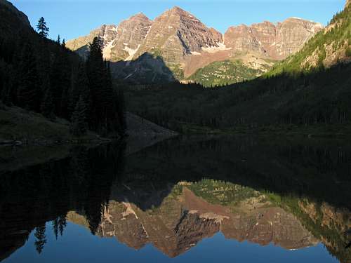
On the way back to Utah I wanted to swing through Aspen as well, to catch a glimpse of the Maroon Bells. While they’re the most photographed peaks in the United States, I didn’t really have much of a desire to climb them, mainly due to the sheer rottenness of the rock. I’m of the opinion shared by many that life is too short to waste time on climbs with generally loose and crumbly rock, so in terms of climbing, the Crestones held more of an allure to me than the Maroon Bells. Nearby Capitol Peak, the most difficult 14er in Colorado, is a peak that I still may end up trying some day, but as of right now I’m not comfortable with sustained 4th class scrambling. I've done a miniscule amount of steeper scrambling on the mainly 3rd class routes in the Wasatch range of Utah (specifically, on Twin Peaks and Lone Peak), so until I get more experience, mixed 3rd/4th class routes are about as difficult as I'm willing to do.
Regardless of what we would end up climbing on the trip, I couldn’t wait to finally see these great mountains in person.
Day 1 - Arches National Park
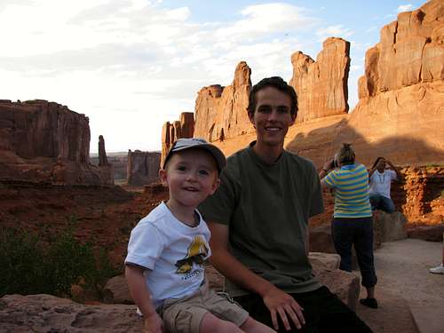
![Matthew & Johnny ...]() Matthew and Johnny at Park Avenue
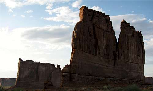
Matthew and Johnny at Park Avenue![Organ southern aspect]() The Organ
The Organ![Balanced Rock]() Balanced Rock
Balanced Rock
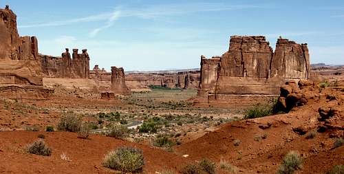
Liz had made a brief visit to Arches National Park a few years ago, but none of the rest of us had ever been, so we decided to spend a night at the La Quinta in Moab on the way down to Ouray, and see some of the well-known sites in the park. Since it was August we didn’t want to do much walking around in the middle of the day in the scorching heat, so the only hike we really planned to do was one in the evening to the famous Delicate Arch, which graces the license plates of many Utah vehicles. Along the way, we saw Park Avenue, Balanced Rock, the Petrified Dunes, and other notable landmarks. Since we arrived to the park a bit late, the sun was already low on the horizon when we pulled into the crowded parking lot at Wolfe Ranch. About halfway up the short trail (1.5 miles one way) the sun disappeared, so I jogged the rest of the way to the arch with my brothers (and Matthew on my back) in hopes of getting a couple shots while there was still a little light. The path wound around a steep shelf with some nice drop-offs on the side, but was wide enough to keep going up as the giant herd of people leaving the arch headed down. Liz was able to convince my Mom to keep going all the way to the top, so once everyone got there we were able to take a few more photos. It got dark on the way down, but Chris and Johnny’s flashlights made it easy to find our way back down the slickrock.
![Fiery Furncace from the south]() Fiery Furnace
Fiery Furnace
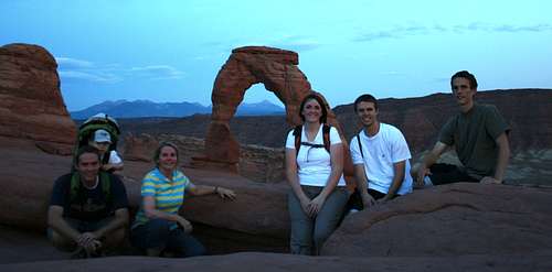
![Delicate Arch family pic]() Delicate Arch
Delicate Arch
Day 2 - Arches / Ouray
![Classic Utah view]() Arches Landscape
Arches Landscape
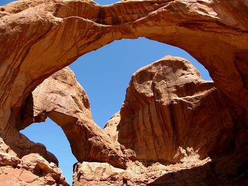
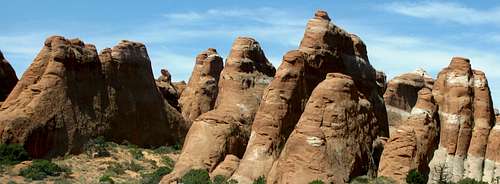
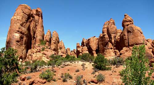
After breakfast at La Quinta we checked out and drove back up to Arches. This time we made a stop in the “Windows” section, and made the short walk up to Double Arch, where the initial scenes of “Indiana Jones and the Last Crusade” are filmed. After that we drove up to the Devil’s Garden section of the park, stopping at the Fiery Furnace viewpoint and other arch viewpoints along the way. There were several cars parked at the Devil’s Garden trailhead (even more than the Delicate Arch trailhead the previous evening), and for good reason from what I’ve heard, but it was quite hot at the time and we had to get to Ouray, so this hike would have to wait until our next visit.
![Double Arch]() Double Arch
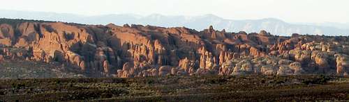
Double Arch![Devil s Garden fins]() Devil's Garden
Devil's Garden![Wetterhorn Peak]() Wetterhorn Peak
Wetterhorn Peak
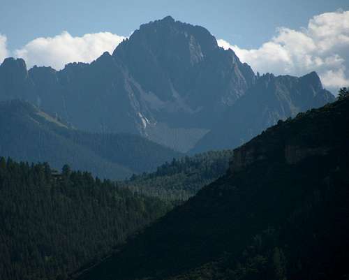
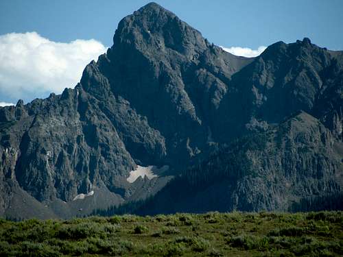
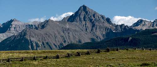
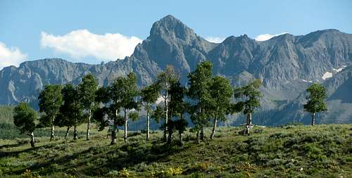
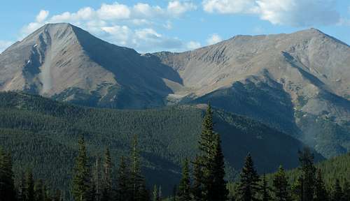
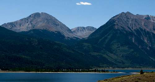
The three and a half hour drive to Ouray was pretty uneventful for the most part, except for when a coyote darted across the road in front of our car near the Utah/Colorado border. Matthew did well in his car-seat for the most part, playing with his dinosaur toy and watching Disney animated movies, but at one point threw up all over the place (most likely due to the heat, winding road, and him drinking more chocolate milk than he could handle). After cleaning him up we continued on our way. About halfway from Moab to Ouray I could discern the Sneffels range and Wilson group (near Telluride). The road went back down into a canyon following the CO-145 road, and shortly after turning onto the CO-62 road near Placerville, we caught our first views of the Sneffels Range. The views were awesome, and eventually we were able to see Mount Sneffels, our goal for the next day. We finished our drive through Ridgway on to Ouray, and checked into the Hot Springs Inn for the night.
![Mount Sneffels northeast aspect]() Mount Sneffels' northeast aspect
Mount Sneffels' northeast aspect![Sneffels Range Peak]() Sneffels Range Peak
Sneffels Range Peak![Mount Sneffels from CO-62]() Mount Sneffels' northwest aspect
Mount Sneffels' northwest aspect![Sneffels Range peak over aspens]() Sneffels Range aspen trees
Sneffels Range aspen treesDay 3 - Mount Sneffels
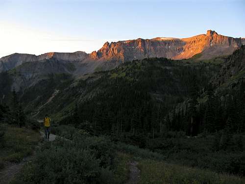
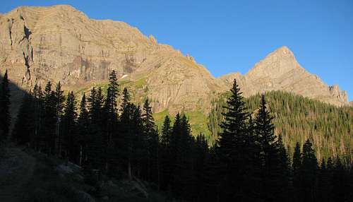
We woke up at 5am and drove up the dirt road from the south side of Ouray, which leads to Yankee Boy Basin beneath Mount Sneffels. The road wasn’t too bad, but driving up in the dark knowing that there were big drop-offs to our left at some parts was a bit unnerving. This was my first time taking our old Ford Explorer up a rough 4WD road, so I erred on the side of caution and decided we’d park at about 11,500 feet (I’m guessing that was the elevation, but don’t know for sure). My brothers were a little worried about whether they’d had enough time to acclimatize to the higher elevations, so I made sure they drank a lot of Gatorade during the drive up. We started hiking at about 6:30, just as the sun was lighting up the peaks in the area.
![Alpenglow in Yankee Boy Basin]() Yankee Boy Basin alpenglow
Yankee Boy Basin alpenglow![Wildflowers below Gilpin Peak]() Yankee Boy Basin wildflowers
Yankee Boy Basin wildflowers
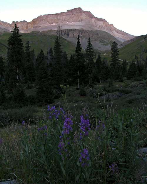
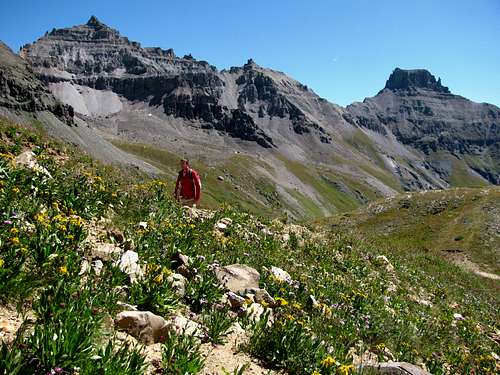
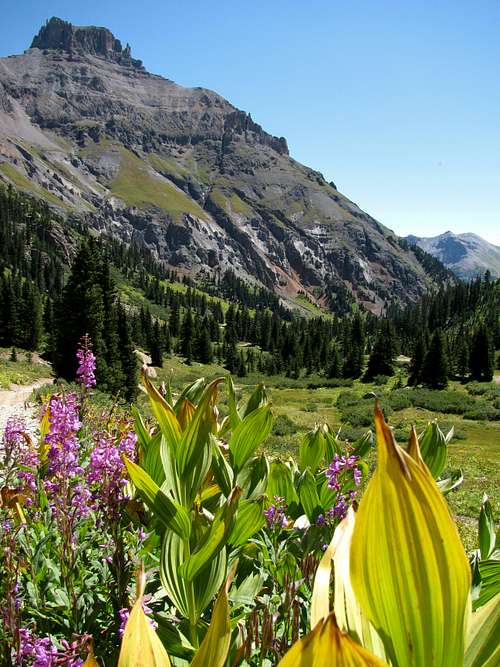
I was pleasantly surprised by the scenery in Yankee Boy Basin, and with all the wildflowers and jagged peaks around us I didn’t mind the hike up the remainder of the 4WD road. Usually it’s easy to tell right at the beginning of a hike what someone’s pace will be, and Johnny and Chris were doing just fine. We passed a couple guys from Pennsylvania who were still struggling with the thin air, and only took one short break on the way up to Blue Lakes Pass. It felt great being this high for the first time in four years, and the peace and quiet in the area was only interrupted by the sounds of the waterfall down by Wright Lake and occasional squeaks of pikas scurrying among the boulders on the trail. The views from Blue Lakes Pass were awesome, with Potosi Peak and Yankee Boy Basin back to the east, Gilpin Peak to the south, Blue Lakes Basin and Dallas Peak to the west, and our next leg of the journey up the southwest ridge of Mount Sneffels to the north. My brothers didn’t voice any concerns about the path we’d be taking up the gnarly-looking southwest ridge, so after consulting a few pictures I printed off from a 14ers.com route description we decided to give it a try.
![Sneffels Southwest Ridge]() Trail to Mount Sneffels' southwest ridge
Trail to Mount Sneffels' southwest ridge![Trail to Blue Lakes Pass]() Gilpin Peak
Gilpin Peak
The first part of the ridge wasn’t too steep, but we were required to test the strength of each of the loose boulders we stepped over on our way up. We made a straight line for the spot in between two pointy-looking rock outcroppings, and after a few short climbing moves we stopped at a flat spot for a little snack break. The scrambling steepened after this, and Chris was a bit hesitant about continuing. I knew he could do it, since I’d seen him climb up more difficult smooth truck-sized boulders on previous hikes for fun without any problems, but I think the exposure was causing him to freeze up a bit. Johnny and I told him where to put his feet, and after some encouragement he made it up the steep rock wall without any more problems.
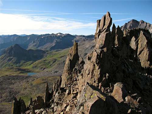
![Southwest Ridge spires]() Southwest ridge spires
Southwest ridge spires![Mount Sneffels summit]() Remainder of the climb
Remainder of the climb![Gilpin Peak from Southwest Ridge]() Gilpin Peak from southwest ridge
Gilpin Peak from southwest ridge![Second thoughts]() Second thoughts
Second thoughts
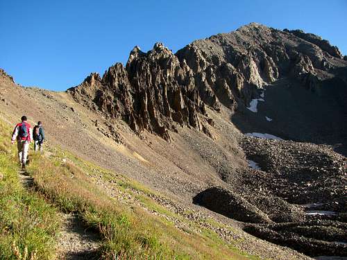
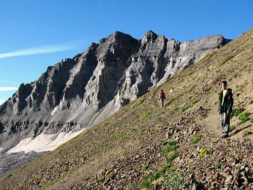
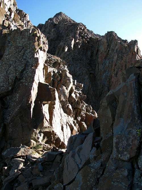
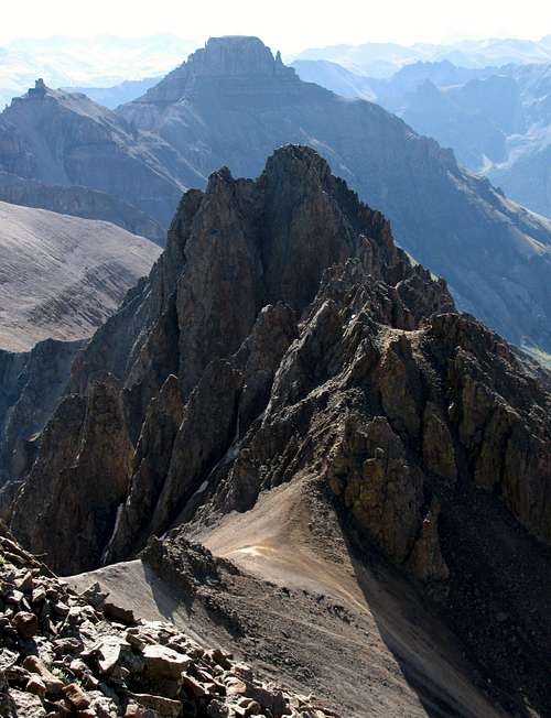
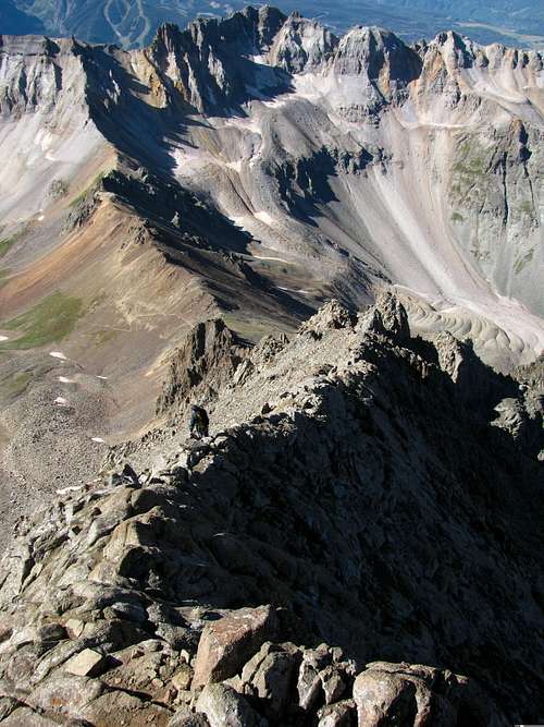
We were about 1/3 of the way along the ridge, and could see the summit up in the distance between a couple nearby spires. At this point the route actually lost a couple hundred feet, as we descended a gully to the east to find a more reasonable approach to the summit. I scouted out a ledge that hugged the side of the large rock wall we were working our way around to see if it would be doable for my brothers, but upon getting around the corner where we would start going back up a different gully, I discovered that the drop-off was still quite steep. I told Chris and Johnny to stay low in the other gully until they had an easy path into the second gully, and did my best mountain goat impression to slide around the wall and wait for them as they went below me and came back up the easier way. This second gully was the most difficult part of the climb in my opinion, and after climbing over some large, loose boulders we came to a wall that required careful foot and hand placement to get up. Johnny followed me up without any problems, and after telling Chris that if he could get past this part then he could make it to the top (I didn’t know if this would be the hardest part of the climb, but since it was classified as Class 3 I figured it was), he made up his mind that he could do it.
![Rugged Peaks]() View to the east
View to the east![Rugged southwest ridge]() Southwest ridge over Blue Lakes
Southwest ridge over Blue Lakes![Final scramble to the summit]() Great climbing on solid rock
Great climbing on solid rock
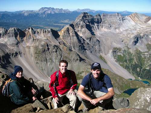
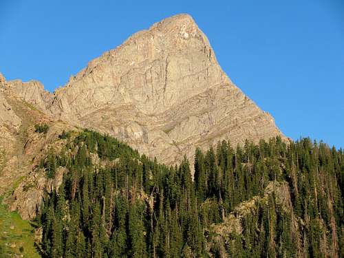
After that last steep section we were now at the “Kissing Camels” rock formation, about 2/3 of the way up the ridge. The narrow gullies we had been ascending now opened up, and the rest of the route to the summit now became visible. The rock became more solid at this point, and for the most part we now stayed right on top of the narrow spine leading to the top. This was my favorite part of the climb, and despite the exposure and steepness I jogged up the rock without having to use my hands that often, stopping occasionally to look back at Blue Lakes Basin and snap some pictures. I waited for Chris and Johnny about twenty feet from the summit, and once they caught up we took our last few steps up to 14,150 feet.
![Final push to Sneffels summit]() Final push to the top
Final push to the top![Sneffels Summit Shot]() Johnny, Chris, & Brandon at the summit
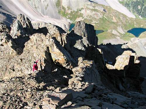
Johnny, Chris, & Brandon at the summit![Blue Lakes Basin from Sneffels summit]() Blue Lakes Basin
Blue Lakes Basin![West ridge spires]() West ridge spires
West ridge spires![Southwest ridge from Lavender Col]() Southwest ridge from Lavender Col
Southwest ridge from Lavender Col
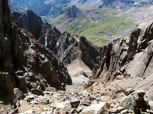
We reached the top just after 10 am, and the clear skies afforded us great views in every direction. I think we were the first ones on the summit that morning, and it was nice sharing the summit with my two younger brothers. Chris told me that for now he didn’t want to try anything harder than the scrambling we just did, so I considered the fact that we might just end up hiking to South Colony Lakes a couple days later instead of going for the summit of Crestone Needle. Despite really wanting to climb that peak as well, the views from the summit of Mount Sneffels were satisfying enough (probably the best I’ve seen in my short climbing career) that I would have considered the trip a success already. My brothers were glad that they had worn their coats up, but it was a lot less windy on top than I thought it would be, and I didn’t even end up putting my jacket on (the abnormal amount that I sweat means I’m usually warm enough, as long as there’s no wind to cool me off). We were feeling the effects of the altitude, so after each popping an Advil we decided to head back down the mountain, this time by the standard route through Lavender Col. I spotted the “V-notch” a couple hundred feet below the summit quite easily, and after passing through it we followed the large gully down to the peak’s eastern saddle. We passed a few people on their way up, and were careful not to knock any rocks loose as we criss-crossed back and forth down the gully, hugging the sides of the gully for the most part since there was more solid rock there. Someone had been injured by a large rock tearing down the gully a couple weeks ago, prompting encouragement by several people in online forums for the use of helmets here, but I felt that if we were careful enough then we’d be fine. I told Chris and Johnny that if they did accidentally send any big rocks tumbling down the mountain to shout “Rock!” but fortunately there was no need for this on our way down.
![Sneffels standard route gully]() Standard route gully
Standard route gully![Mount Sneffels east saddle]() View from saddle above Lavender Col
View from saddle above Lavender Col![Wilson Group]() Wilson group
Wilson group![Yankee Boy peaks]() Yankee Boy Basin peaks
Yankee Boy Basin peaks
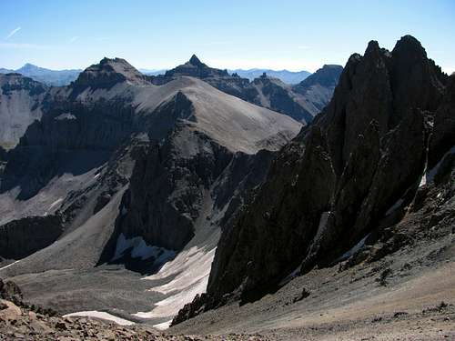
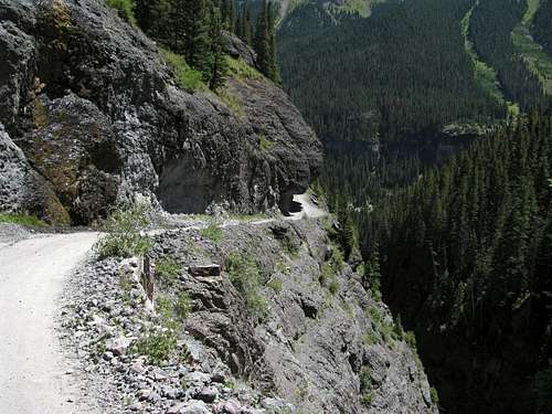
We took another break at the saddle to take in the views of Cirque Mountain and Teakettle Mountain, and described the rest of the route up to a couple inquisitive hikers. The rest of the way down to Yankee Boy Basin through Lavender Col was quite loose which made me glad we’d gone up the southwest ridge and done the loop, but going down was still faster this way. Once down the long slope of loose scree and talus, we were greeted with the familiar sounds of squeaking pikas. The upper 4WD parking lot, which didn’t have any vehicles parked on our way up, was now filled with about a dozen jeeps. We continued back down the road to our Explorer, and made it back at about 12:30. Driving back down the road to Ouray it was fun actually being able to see the rock overhang we had driven under on our way up earlier, and we were back at the Hot Springs Inn at about 1 pm.
![Yankee Boy Basin wildflowers]() More Yankee Boy Basin wildflowers
More Yankee Boy Basin wildflowers![Potosi Peak]() Potosi Peak
Potosi Peak
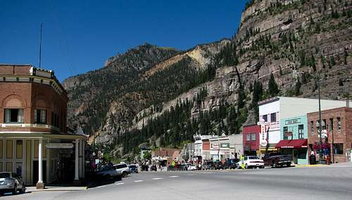
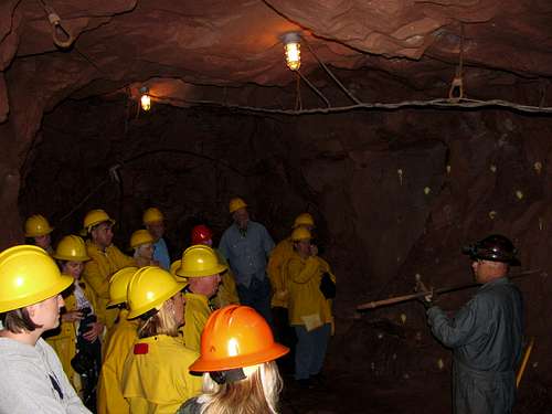
Later that afternoon I walked along the main street in Ouray with Liz and my Mom, who wanted to do some shopping, and after that we made the small drive north of town to get a tour of the Bachelor-Syracuse Mine. Matthew was scared of the mine car ride at first, but after awhile he started to like it. We stopped at a point 1800 feet into the mountain, where our guide showed us the tools miners would frequently work with and explained the history of the mine. It was interesting imagining what it must have been like for the men who worked in there day after day for most of their lives.
![Ouray]() Ouray
Ouray![Yankee Boy Basin road]() Shelf road leading back down to Ouray from Yankee Boy Basin
Shelf road leading back down to Ouray from Yankee Boy Basin![Ouray Peak]() Ouray from outside mine
Ouray from outside mine
That evening we got some dinner at a burger place in town, and went to the Ouray Hot Springs. Others may rave about them, but I thought they were disappointing. There were only a few different pools for wading/swimming in, and it was a bit of a letdown after going to better hot springs up in Idaho growing up. Besides that, there was a lifeguard on a power trip who got mad at us for splashing water at the bats who kept buzzing by our heads, and at closing time one of the workers took down the American flag from the flagpole and disrespectfully draped it around his head like a bathtowel. It was a bit strange being in the company of so many weird people in one place, but it made for an interesting experience that we won’t soon forget.
![Bachelor-Syracuse Mine]() Bachelor-Syracuse Mine
Bachelor-Syracuse MineMount Sneffels Stats
DISTANCE:
6.5 miles roundtrip
YANKEE BOY BASIN TRAILHEAD:
11,350 feet
SUMMIT ELEVATION:
14,150 feet
ELEVATION GAIN:
2,950 feet
DIFFICULTY (SOUTHWEST RIDGE):
Class 3
TIME:
6 hours
Day 4 - Black Canyon National Park
![Box Canyon Falls]() Box Canyon Falls viewing platform
Box Canyon Falls viewing platform![Box Canyon]() Box Canyon
Box Canyon![Box Canyon trail]() Stairs/trail to upper Box Canyon viewing platform
Stairs/trail to upper Box Canyon viewing platform![Ouray from Box Canyon]() Ouray from Box Canyon
Ouray from Box Canyon
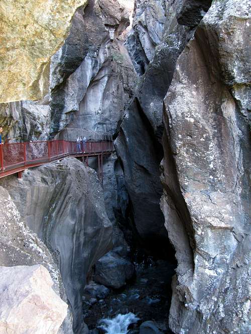
After enjoying a nice breakfast at the Hot Springs Inn (which my brothers and I had to skip the previous day because of our early start), we drove over to Box Canyon Falls. Matthew got a kick out of all the chipmunks fighting over the leftovers that had fallen from a birdfeeder at the start of the trail, and it was a short walk to the viewing platforms. The canyon was quite impressive, despite the fact that only a small portion of the roaring falls could be seen behind the tight rock walls. We went up the short trail that goes above the falls as well, which went through a tunnel and offered some nice views looking down on the town of Ouray.
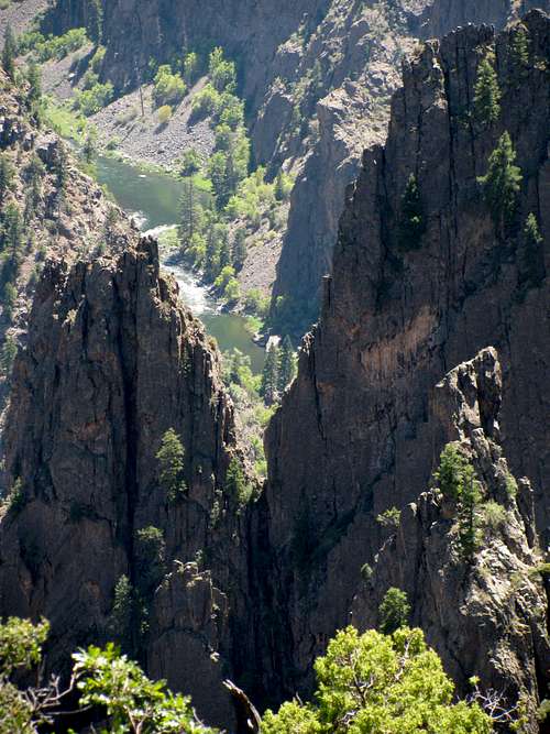
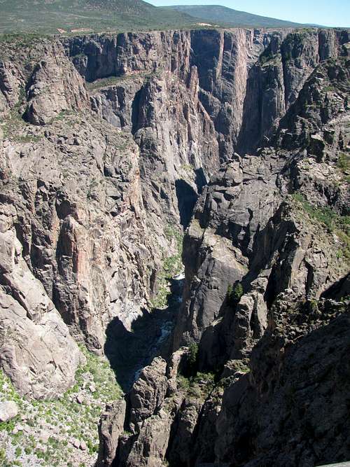
The drive to the south side of the Black Canyon of the Gunnison National Park didn’t seem all that scenic (although the road gains quite a bit of elevation from Montrose up to the park entrance), but when we got to the first overlook we were impressed. It had been awhile since any of us had been to the Grand Canyon, and although this one wasn’t as deep it had much narrower walls. Unfortunately this also made it hard to get many good photos due to the lighting, or lack thereof. The views from the visitor center and from the Chasm View point were among our favorites.
![Gunnison River from Tomichi Point]() Tomichi Point view at Black Canyon of the Gunnison National Park
Tomichi Point view at Black Canyon of the Gunnison National Park![Black Canyon from Chasm View]() Black Canyon from Chasm View
Black Canyon from Chasm View
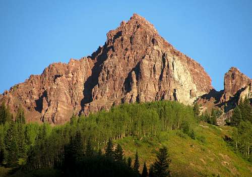
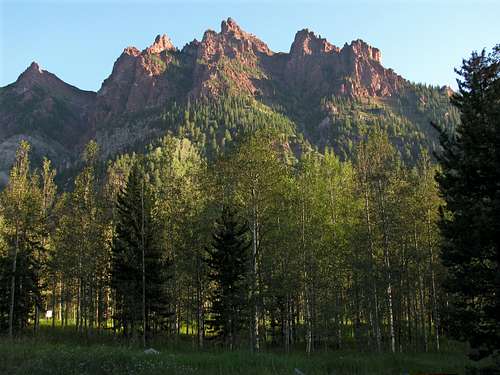
Driving from Black Canyon to Westcliffe via CO-50 started off in a pretty area with several reservoirs that was drier and less mountainous than I was expecting, but the view changed when we caught our first glance at Mount Aetna and Mount Taylor. Near Salida we first saw the Sangre de Cristo range to the south, and as we wound through a scenic canyon following a river we saw several bighorn sheep and bright yellow wildflowers (no photos, unfortunately). CO-69 was also quite scenic as well, as we wound our way through rolling hills and farmland. The jagged Crestones finally came into view as the sun was setting, and upon seeing them my brothers reaffirmed that they’d rather just hike to the lakes this time.
![Mount Aetna and Mount Taylor]() Mount Aetna and Mount Taylor
Mount Aetna and Mount Taylor
I shouldn’t have been overly optimistic, but the town of Westcliffe was a bit more Podunk-y than I was hoping. Liz noticed that it looked like there wasn’t much to do around town right off the bat, and after the day’s long drive she wasn’t in the mood for the trip to Royal Gorge I had planned for them the next day while we were up at the South Colony Lakes. We decided to cut our stay at the Westcliffe Inn to one night, and drive up to Aspen the next day as soon as we were back from our hike. It would have been nice to get everyone up to South Colony Lakes, but the Explorer only seated four people comfortably, and my brother didn’t want to tear up his car on the rough road. Another thing that complicated matters were the South Colony road closures going on throughout the month by constructions crews. Before 7:30 am the road was open, but from then until 5:30 pm it would only be re-opened temporarily at 10 am, 12:30 pm, and 3:30. I had originally planned on us summiting the needle and being back down by 3:30, but if we wanted to get to Aspen at a decent hour then we were hoping to be back down for the opening at 10.
Day 5 - South Colony Lakes
We set off from the hotel at 4:30, using some directions generated from the “Calculate Driving Time from your Address” link on the 14ers.com South Colony Lakes Trailhead page. A warning to anyone using this tool: it doesn’t work! I should have just followed the posted signs and stayed on Colfax Lane (which is what it actually says to do on the main page if you don’t care about generating directions from where you’re starting), because the Google Maps directions sent us off on a wild goose chase on a dirt road meandering through a bunch of farms north of the trailhead. We were running low on gas after getting lost, so I sped back to the gas station by our hotel, filled up, and sped back down to the trailhead going the right way this time. By the time we went over the cattle guard the eastern horizon was already lighting up, so it was unlikely I’d get any cool alpenglow shots that morning.
![Broken Hand Peak & Crestone Needle]() View from trail leading up to South Colony Lakes
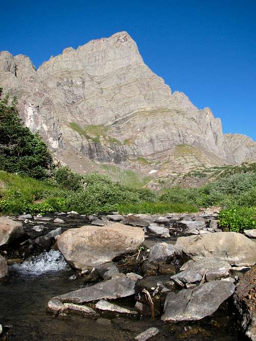
View from trail leading up to South Colony Lakes![Crestone Needle]() Crestone Needle over the trees
Crestone Needle over the trees
I hadn’t driven much on rough 4WD roads before, so we were in for a treat. The road was much bumpier than the one we’d taken up to Yankee Boy Basin two days before, but at least this time there weren’t any big cliffs we had to drive by. At first I didn’t know if I was going too fast, what with all the bouncing around, but we never bottomed out so I assumed our speed was okay. We made it to about halfway between the first stream crossing and the upper trailhead, before our slightly bald tires got to a spot where they couldn’t gain enough traction to get us over a series of smooth rocks. We parked there and hiked the rest of the way up the road.
![Crestone Needle]() Crestone Needle southeast ridge
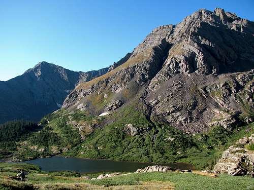
Crestone Needle southeast ridge![Lower South Colony Lake]() Broken Hand Peak over Lower South Colony Lake
Broken Hand Peak over Lower South Colony Lake![Humboldt Peak]() Humboldt Peak
Humboldt Peak![Johnny, Chris, & Brandon at South Colony Lakes]() Upper South Colony Lake
Upper South Colony Lake
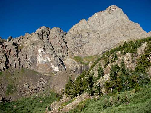
We passed several big trucks parked at campsites along the way, which made me realize that if I ever wanted another crack at the Crestones, camping was probably the way to go. By the time we got to the upper trailhead the alpenglow on Milwaukee Peak and Broken Hand Peak had gone away, but the views were still great. The views of the peaks above were neck-bending, and we could now see Crestone Needle in the distance. The trail was gradual and easy, so we were able to make it to the lower lake in about an hour. I wanted to get to the upper lake for a better view of Crestone Peak and the ridge connecting these two great peaks, so we continued on. After the split with the trail leading up to Crestone Needle, we encountered several trails branching off (one going to the lower lake, one back towards some other campgrounds, and one we missed that led up to Humboldt and the upper lake). After some bushwhacking up a moss-filled streambed we finally made it.
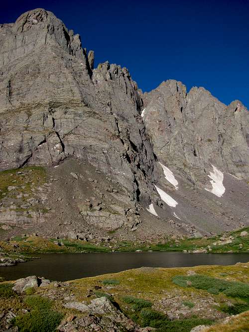
![Upper South Colony Lake]() The Crestones, towering above Upper South Colony Lake
The Crestones, towering above Upper South Colony Lake![Crestone Needle & stream]() A stream below the Needle
A stream below the Needle![Last 4WD road stream crossing]() Upper 4WD road stream crossing
Upper 4WD road stream crossing![First stream crossing]() Lower 4WD road stream crossing
Lower 4WD road stream crossing
I felt a small twinge of envy watching other groups ascend the trail leading up to Broken Hand Pass, but the views from right below the Crestones were still pretty amazing. After a short snack break we started back down.
Most of the people we encountered on the trail were quite friendly, but one group of three was in a bad mood for some reason. We were jogging back down the trail when their lead person intentionally shouldered Chris (who was in front) as he was trying to pass them as they were going up. I didn’t see it (otherwise I would have laid into the guy who did it) since Chris was farther down the trail than me and Johnny, so I just nodded and said hi as we passed them. Their leader gave me a dirty look and the others just stood there with blank expressions. I’m all for seclusion in the mountains, but despite my geeky tendencies I’d still like to think I’m not one of those socially inept people who requires absolute isolation to find enjoyment (which is hard to find on any of Colorado’s 14ers, anyway), which these people seemed to be. Maybe they wrecked their car on the way up the road and were upset about it, but who knows.
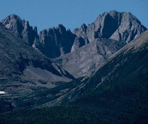
![Crestones from Westcliffe]() Rugged Crestones seen from near Westcliffe
Rugged Crestones seen from near Westcliffe
We made it back down to the road in good time, and jogged the remainder of the way back to the car. Driving back down we saw several trucks coming up (we stopped and let two pass, and two stopped to let us pass), so I was guessing the construction crew wasn’t closing the road that morning. We got back to the cattle gate at 9:45 and were back at the hotel at 10 in time to check out.
![Twin Lakes Reservoir]() Twin Lakes Reservoir
Twin Lakes Reservoir![CO-82 overlook]() Independence Pass viewpoint
Independence Pass viewpoint
On the way to Aspen we saw eleven Sawatch 14ers (Antero, Princeton, Yale, Columbia, Harvard, Oxford, Belford, Missourri, Huron, La Plata, and Elbert), most of which could be identified with signs from CO-285 and CO-24. We stopped at the Independence Pass overlook, which was at over 12,000 feet, and then continued on to Aspen, where we did some window-shopping and ate at an Italian food restaurant before checking in for the night at the Inn at Aspen.
Day 6 - Maroon Lake
![Pyramid Peak]() Pyramid Peak from Aspen
Pyramid Peak from Aspen![Maroon Lake family pic]() Family photo
Family photo
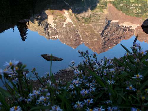
Early that morning we drove up the nearby road to Maroon Lake, and I soon saw why the Maroon Bells are among the most photographed peaks in the United States. Besides the fact that they’re located so close to Aspen, the U-shaped valley and lake are a picture perfect location. On the way there we got a nice view of Pyramid Peak, and the calm water made for an almost perfect reflection of the Bells. There were a few other fun-looking peaks to the north, but I didn’t know their names or if anyone really climbed them.
![Maroon Bells]() Maroon Bells
Maroon Bells![Maroon Bells reflection]() Maroon Bells reflection
Maroon Bells reflection![Maroon Lake wildflowers]() Maroon Lake wildflowers
Maroon Lake wildflowers![Capitol Peak]() Capitol Peak
Capitol Peak
After taking in the sites we went back to the hotel for breakfast, where we learned that a power outage had disabled several hallway lights, and among other things the waffle maker (as I learned when I tried eating a half-cooked waffle). The flashing lights in the hallway by our room made it seem like we were on board a sinking Titanic or in a haunted house, which was kind of cool. On our drive back towards I-70 we caught a parting glimpse of Capitol Peak off in the distance to the south, bidding us farewell on our journey back to Salt Lake City. To help keep Matthew happy on the drive back, we stopped at the dinosaur museum in Fruita, which had some lifelike animatronic dinosaurs that looked like they came right out of Jurassic Park.
![Peak northwest of Maroon Lake]() Peak northwest of Maroon Lake
Peak northwest of Maroon Lake![Peaks north of Maroon Lake]() Peaks north of Maroon Lake
Peaks north of Maroon LakeSummary
All in all, it was a great trip, and I’m glad we got to see so many different parts of Colorado while we were there. Surprisingly I don’t think we saw one storm cloud the entire time we were there. If I could have done it any differently, I probably would’ve had us stay in the San Juans longer to minimize the driving, but I’m glad we got to see the Crestones and Maroon Bells as well. Summiting the Crestones is still something I’d like to do in the future, but as there didn’t appear to be other non-hiking related activites in the area to keep my family occupied (a prerequisite for any vacation idea I pass by the wife), I'm not sure when I'll be able to get back and try them.
The summit views from Mount Sneffels made me realize that the San Juans indeed have the greatest collection of peaks (both in quality and quantity) of any area in Colorado. For a future trip we may stay in Lake City, Telluride, or Durango to mix things up a bit.


Comments
Post a Comment