
|
|
Mountain/Rock |
|---|---|
|
|
46.26794°N / 8.77607°E |
|
|
Hiking, Mountaineering |
|
|
Spring, Summer, Fall, Winter |
|
|
7431 ft / 2265 m |
|
|
Overview
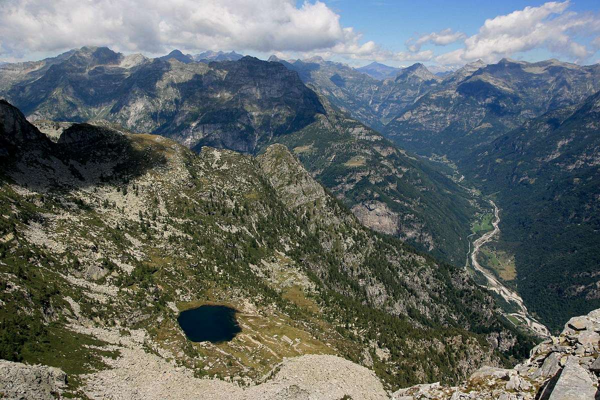
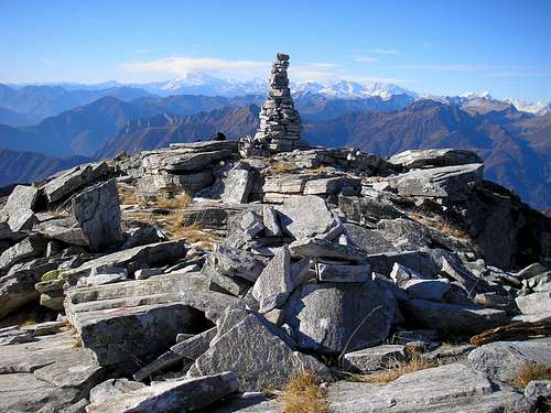
Summit view over the upper Verzasca valley by Mathias Zehring
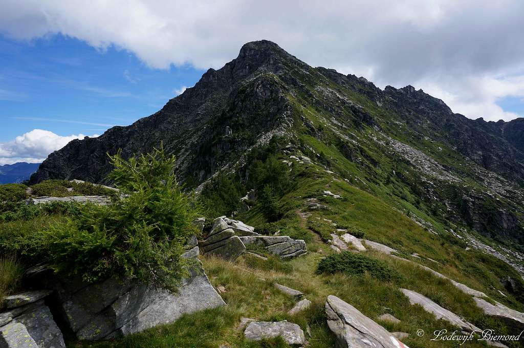
Madom da Sgiof (or Madone di Giove) is a great hikers peak located in the Swiss canton of Ticino. Madom Sgiof is situated between the famous Verzasca valley in the east and the less famous, but evenly beautiful Maggia valley in the west. The climb of this mountain is graded T3 and offers tremendous views over the rugged Verzasca en Maggia valleys. Towards the east the beautiful west walls of Poncione D'Alnasca and Fopia can be seen and towards the north you can see Madom Gross, with 2741m the highest peak of the Verzasca area. Towards the west you have an impressive view towards the Monte Rosa Group that with its heavy glaciated peaks dominates this view.
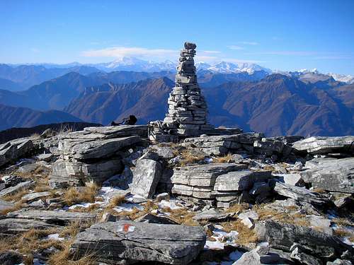 Summit Cairn | 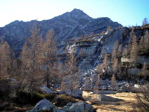 Madom da Sgiof 2265m | 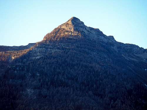 Madom da Sgiof at first light |
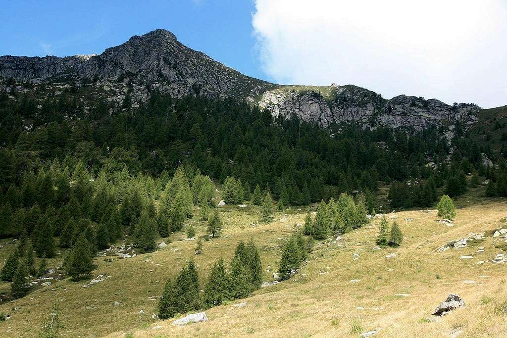
Madom da Sgiof is frequently climbed and is situated in one of the most wild regions of Switzerland. It therefore is a very worthwile climb than can be done within a day. The only catch is that the height difference between starting point and summit is over 1500 vertical meters. It therefore is occasionally done with a overnight stay at the Capanna Stralaresc. This mountain hut is loacted beautifully along the Starlaresc Lake. There are 2 main routes that lead to the summit. One starts from the Maggia valley in the west, the other one starts from the Verzasca valley in the east. A traverse from one valley into the other is therefore a nice variant to this climb.
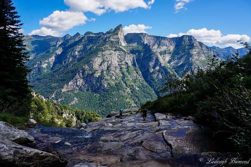 Val Verzasca view | 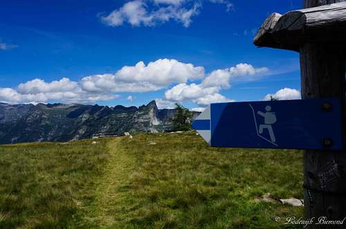 Sentieri at Starlaresc (1880m) | 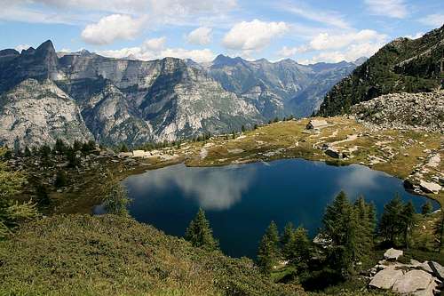 Lago del Starlaresc |
Verzasca Route
Madom da Sgiof (2265m)
This route starts at the east side of Madom da Sgiof near the village of Brione (756m). The route starts at Brione-Piee at 745m. It should be noted that the marked trails are sometimes not very well visible and the red-white-red paintmarks are sometimes overgrown by weeds and plants. Still, there is no difficulty with route finding since the trail is visible at all time during the route.
You will first find your way up to Pianèsc 819m, which is just minutes away from Brione. After reaching Pianesc, the trail leads straight into the forest and up towards Matar and afterwards Capanna di Starlaresc (1880m). This mountain hut is private ownership, but is accessible for hikers coming along. The door is Always open! Passing this hut you will also pass the beautiful lake called Lago di Starlaresc da Sgiof.
From this point on the marked route steepens as you head further towards the Passo Deva at 2038m. Passo Deva located on the ridge that separates the Maggia and Verzasca valleys.
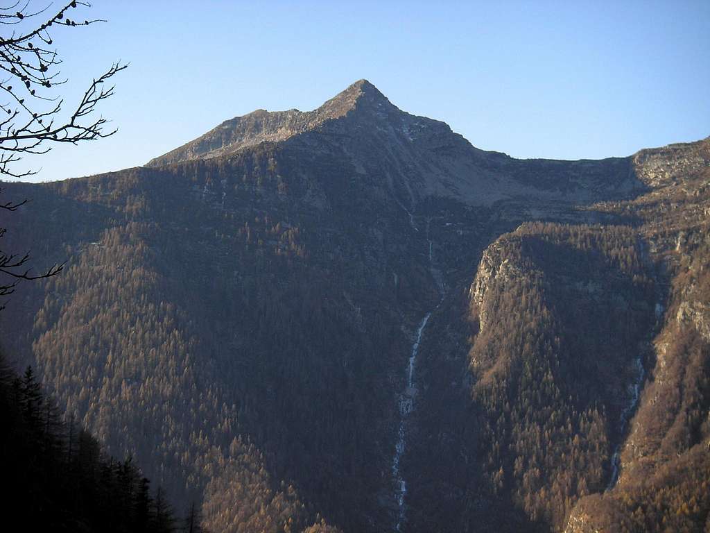
 Madom da Sgiof (2265m) | 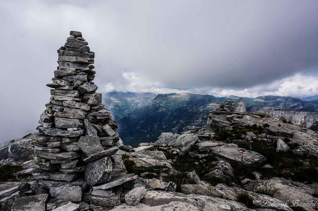 Madom da Sgiof Summit | 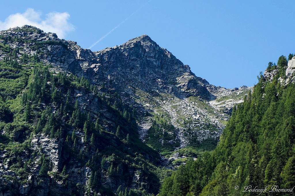 Madom da Sgiof / Madone di Giove |
The road continues on the North-West ridge towards the summit of Madom da Sgiof at 2265 meters. Descent can be done passing the East ridge. The road will lead down to Motaruch (2011m) and further down to Lago di Starlaresc. (1875m) From this point on the route is the exact same way as you ascended. A variant is to head east at Motaruch. Follow the signs ''Piano del Vald'' and ''Brione''. You will descent along the ridge towards the east and further down again to the north trough the dense forests. You will pass ''Piano del Vald'' a small village and eventually reach the road that leads to Brione. Also see the Normal routes from Brione, Verzasca Route page here on SP for a more detailed description of these routes.
The route is drawn in purple on the map below:
The route is drawn in purple on the map below:
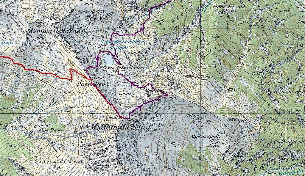
Route MAP Madom Sgiof
Maggia Route
Summit of Madom da Sgiof 2265m
The route from Valle Maggia starts from the village carrying the name of the valley: ‘’Maggia’’ at 332 meters. This is over 400 meters lower in elevation compared to the start of the other route in Brione, Val Verzasca. As a result, climbing Madom da Sgiof from this side means conquering almost 2000 vertical meters. The trail leads through the forest through the Valle de Salto, a side valley of Valle Maggia. Keep following the signs to Passo Deva. The trail passes Maiasco (965m), Pioee (1232m) and Alpe Deva (1556m).
At the split-up you have to follow the trail towards the right (east!) which will lead you up to Passo Deva at 2038m. From here the trail leads over the North-West ridge to the summit of Madom Sgiof. Descent is the same route back or another option is to descend into the Verzasca valley towards the east.
The route is drawn in red on the map above.
The route is drawn in red on the map above.
How to get There
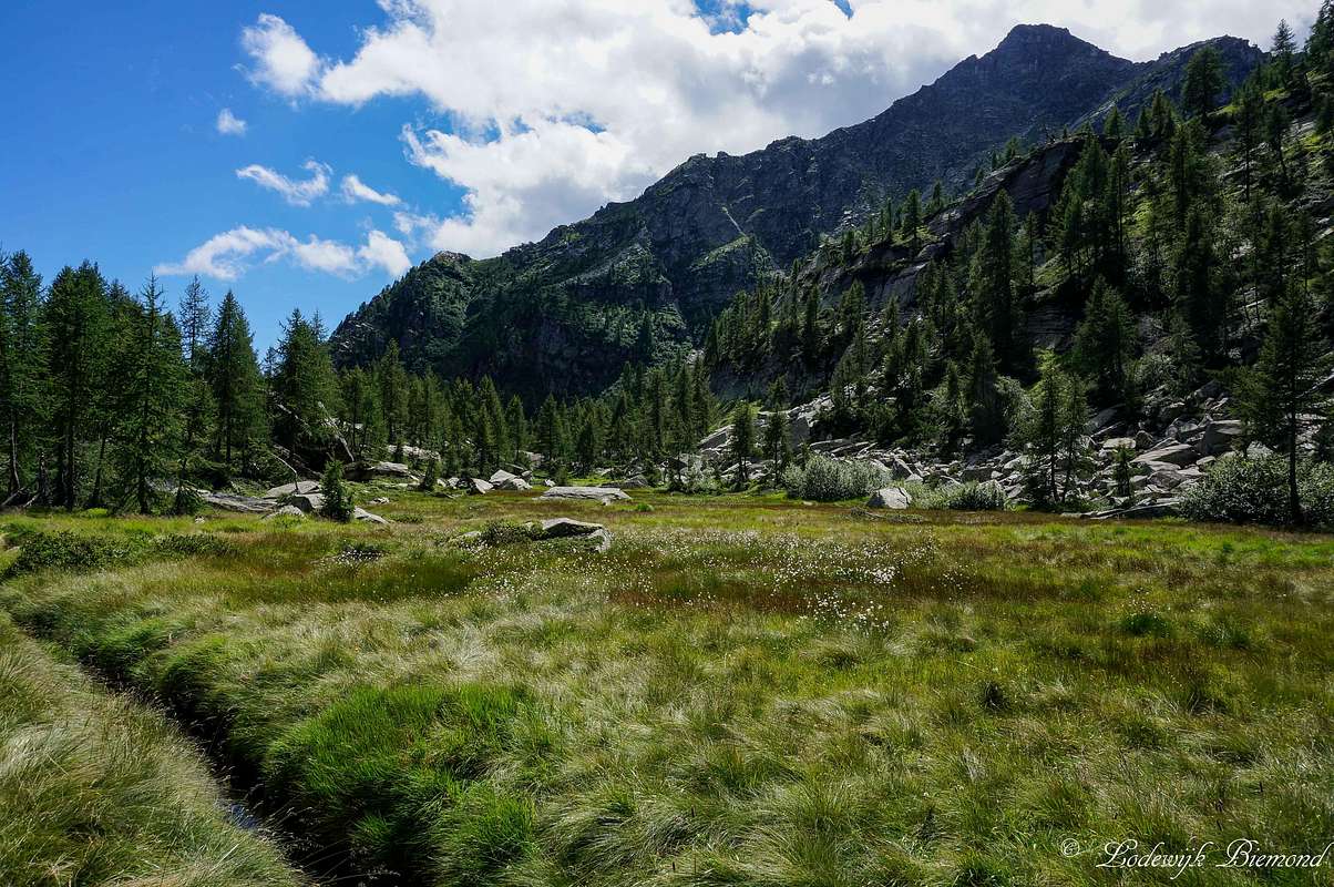
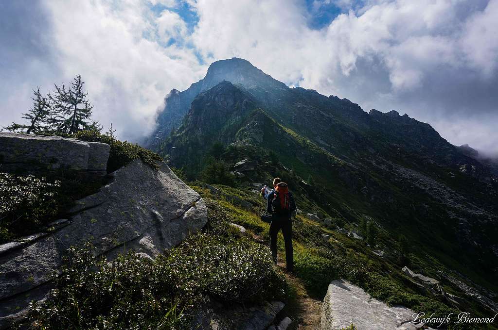
fine landscape
Verzasca Route:
The A2 highway crosses Switzerland from north to south. On this highway take exit 47 'Bellinzona- Sud'
Now you are on the secondary road no. 2. Follow the signs to ''Locarno''
Before reaching Locarno Val Verzasca will appear on the road signs. Follow these signs until you reach Val Verzasca.
In the Verzasca valley is only one major road. Follow this road and you will first pass the village of Vogorno, than you will pass Lavertezzo and the 3rd major village is Brione. The route starts just before the actual village at Restaurant Piee, which can be recognized by the parking space in front of the Hotel/Restaurant.
A Route Planner to Brione (Restaurant Piee) on Google Maps can be found here
Maggia Route:
On the A2 highway you also take exit 47 'Bellinzona- Sud'. Now you are on the secondary road no. 2. Follow the signs to ''Locarno'' After a few miles you will reach highway no. 13 which leads to Locarno. Keep on this highway until you are in central Locarno. Eventually the signs 'Valle Maggia' will appear. Take this exit ''Via Locarno'' and keep following the Valle MAggia signs. This will lead you straight into the Maggia Valley. After passing the small towns of Avegno and Gordevio you will enter the village called Maggia.
A Route Planner to Maggia on Google Maps can be found here
Practical Information
Madom da Sgiof 2265m
Climbing Madom di Sgiof does not involve any serious climbing and therefore is a great hikers destination. The climb is graded T3
-->Good mountain boots are sufficient. No ropes etc needed.
Note:
The altitude difference from the valley floor (starting point) until the summit is quite large. The climb includes an elevation gain of over 1500 vertical meters. Therefore, a good physical condition is advised.
-->Good mountain boots are sufficient. No ropes etc needed.
Note:
The altitude difference from the valley floor (starting point) until the summit is quite large. The climb includes an elevation gain of over 1500 vertical meters. Therefore, a good physical condition is advised.
Camping / Hotel
Madom da Sgiof NW-Face from Passo Deva
Campings in Ticino can be found on: Camping search
Personal Favourite: Camping Al Censo, Claro
Camping Al Censo
For hotels and other places to stay:Visit the Major cities: Bellinzona, Lugano or Locarno
Personal Favourite: Camping Al Censo, Claro
Camping Al Censo
For hotels and other places to stay:Visit the Major cities: Bellinzona, Lugano or Locarno
A good option for a hotel is Hotel Piee, since it is located directly at the starting point of the Verzasca Route up to Madom da Sgiof.
Local weather
This link leads to the weather in the Verzasca area:weather Madom da Sgiof AREA
In memory of..
This page was made with the great help of SP member Cyrill Rüegger , who tragically died in an accident on Piz Palü on June 13th, 2009.Rest in peace Cyrill, you will be missed.
---------------------------------------------------------------------------------------------------------------------------------------------------------------------