* Jul 28, 2017 - Ownership switched by andrea * Sep 09, 2018 - Overhaul of the page
The group "Mezzodì-Prampèr" belongs entirely to the "Dolomiti di Zoldo" range as a small section of it. More or less enclosed between the groups of Bosconeroto the East and Tamèr-S.Sebastiano to the West, the Mezzodì-Prampèr is also part of the Parco Nazionale delle Dolomiti Bellunesi. This small mountain group, including the two sub-groups Crode di Pramper and Spiz di Mezzodì, dominates the village of "Zoldo" 840 m and has the overall shape of a trapezoid. The pass called "Forcella del Venièr" 2100m is considered the boundary between the two subgroups. The most interesting and outstanding side is the Western one, which is situated from North to South almost entirely above the "Val Pramper". The group is surrounded by the valleys: "Valle di Zoldo", "Val Prampèr", "Val Pramperèt", "Valle del Grisol", and "Canale del Maè".
Spiz di Mezzodì 2323m and Cima di Prampèr 2409m are the major summit of the group.
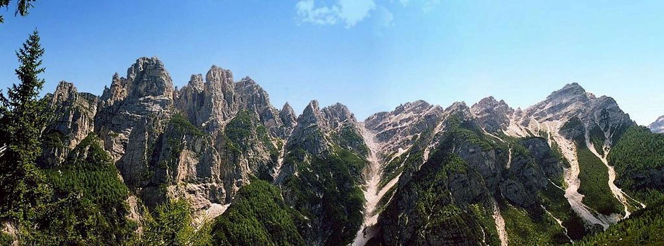
Both the subgroups, very different from each other, are joined and then geologically considered part of the same group. If seen from the East the group is not very impressive and consists of pretty steep and wooded slopes. Instead seen from the West, it stands above the “Val Prampèr” with cliffs covered of pines, buttress, canyons and numerous high rock towers that change color during sunset …. the "Spiz". The "Cima di Prampèr", at the southern end of the massif, has the shape of a pyramid and it is rocky on the North, West and South sides and detrital on the East side.
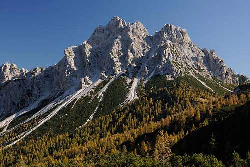
Spiz di Mezzodì west side
Not being very high peaks here - in fact the highest point is Cima di Prampèr 2409 m - they are underestimated by most of the tourists (exept for the locals). Anyhow these mountains are still very wild and challenging as all the South branch of the Dolomites of Belluno, with long and tough approaches. Water sources are also very rare in summer.
The origin of the term "Spiz" is typical of the mountains of Belluno. "Mezzodì" means "noon" due to its location perfectly to the South when viewed from the village of Zoldo. (There are others peaks that get the name from the sundial, for example the “Cima Dodici”, "Cima Undici", "Cima Una" in the “Dolomiti di Sesto”). The term "Prampèr" in the local dialect means "mountain pasture" and has a very ancient origin.
Cima di Prampèr
Getting there
The group is located into the “Dolomiti di Zoldo” region. For who came from “Pianura Padana” (Milan, Turin or Venice), the fastest way is reach the village of "Forno di Zoldo". Not far from the city of "Belluno". The way to reach the huts and the routes of the group, starts from the bottom of the Val Prampèr. It starts from the village of Zoldo. Cars are admitted till the location of "Piàn de la Fòpa" 1210 m with a good car park. A gravelled road keep going along the valley untill the refuge Sommariva.
From Turin or Milan or Venice: motorway A4 - Mestre - motorway A27. Otherwise, reach the village of "Zoldo". It isn't the easiest way but very panoramic.
From "Feltre" or "Belluno": road n.203 – Agordo – Passo Duran – Zoldo
The group
By plane The nearest international airports are "Treviso", used for many low-cost flights, and "Venice" "Marco Polo".
By train The nearest railway station is Longarone; Belluno station can also be used as the DolomitiBus service leaves from there for Longarone/Pecol.
By bus Various buses of the DolomitiBus service leave from the Belluno bus station (opposite the railway station) and reach Val Zoldana in approx. 1hour.
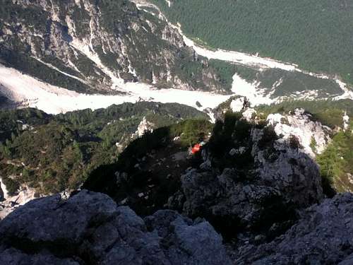
The bivouac Carnielli and the Val Prampèr seen from the summit of Spiz Sud
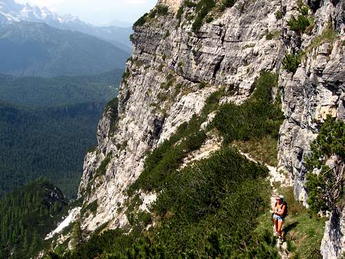
In the nearby of bivouac Carnielli
Major and minor peaks of the group
The peaks of the Mezzodì subgroup
The Mezzodì subgroup overlooks to the North the village of Zoldo, while its southern limit is the "forcella Venièr" 2100m.
Major peaks of the subgroup from north are:
- Spiz Tiziana 2088 m - Spiz Mary 2217 m Ma. - Spiz Nord 2305 m S.N - Spiz de la Oliana 1929 m - Spiz Laila 2216 m La. - Spiz Est 2317 m S.E - Spiz de la Tana de l’Ors 1965 m - Spiz di Mezzo 2324 m S.M. (main summit) - Spiz Sud 2309 m S.S
Minor peaks of the subgroup from north are:
- Spiz del Belvedere 2062m - Crèpe sòra’l Giaròn 2090m-2171m - Spiz Minimi 1850m - Spiz Nord Est 2040m - Torrione di Sòra’l Sass 1917m - Spiz Nord Ovest 2060m NO - Pulpito dello Spiz Nord Ovest 1950m - Spiz de la Porta 2171m Po. - Piccolo Dente 2194m P.D.
The Spiz di Mezzo from Spiz Sud
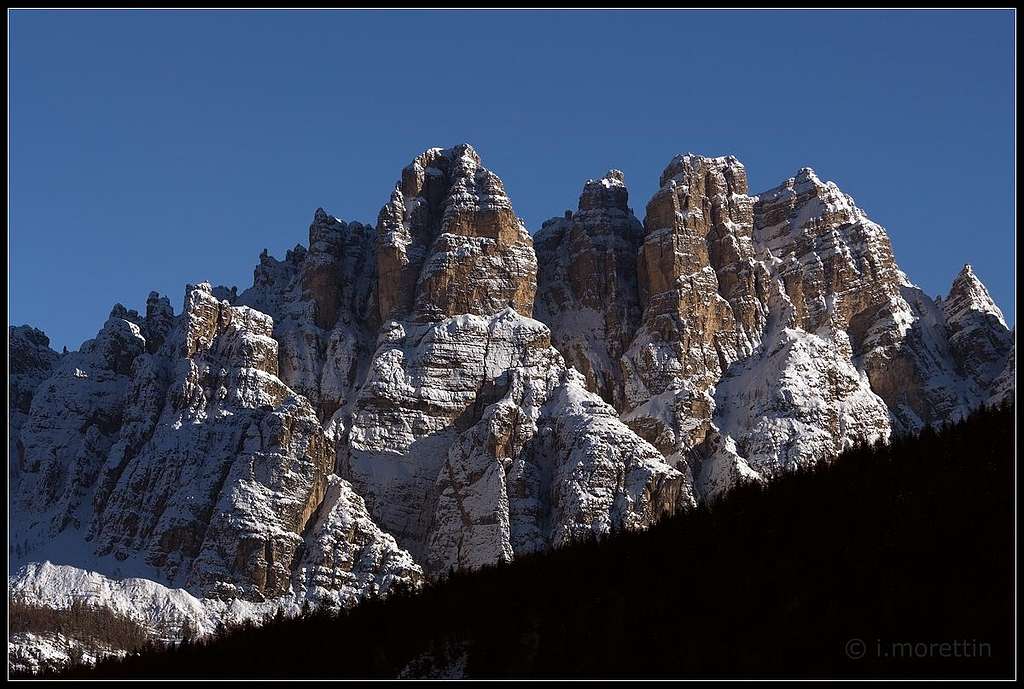
Spiz di Mezzodì
The subgroup of Cima di Prampèr overlooks the Val Pramperèt that belongs to the Val Prampèr. It starts from the "Forcella del Venièr" with numerous pinnacles.
The most important summits from North are:
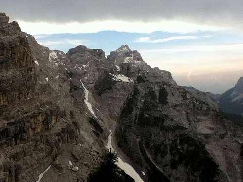
Cima di Prampèr from bivouac Carnielli
- Cima del Venièr 2237 m - Cima del Coro 2324 m - Dente della Sagretta 2233 m - Spìgol del Palòn 2314 m - Piccolo Spìgol del Palòn 2280 m - Cima di Prampèr 2409 m (main summit) - Cima di Pramperèt 2337 m - Piccola Torre di Pramperèt ?m - Spiz del Tita 2179 m
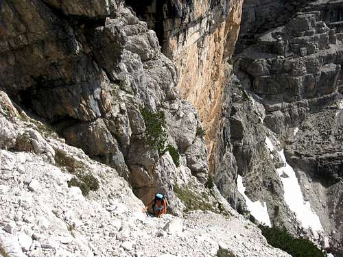
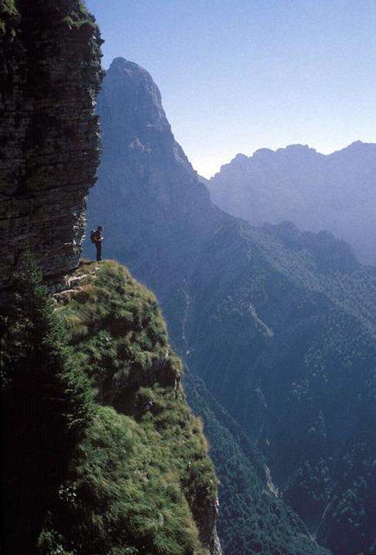
The "Viàz"
example of "Viàz"
History
The first explorers of the massif were the local hunters of chamois. Most of the paths get the origin from that ancient hunts. Even today, above the common tourist routes, there are same wild, hidden and exposed paths called “Viàz” that traverse the ledges of these rocky mountains. Routes across the ledges are typical of the Dolomites as much as the ledges are typical chacteristic of the structure of these famous mountains (for example the "Cengia Grohman" of Monte Pelmo or the "Cengia Gabriella" in the Dolomiti di Sesto and much more). The local dialect term "Viàz" anyhow is only used around the Zoldo range. A few of this kind of routes cross the massif. Two of these are very interesting and suggested:
- Viàz del Gonèla
The tradition attributes the discovery and the name of the viàz to the chamois hunter of last century "Giacomo Pra Baldi" nicknamed "El Gonèla". It consists of a magnificent ledge that crosses under the reddish walls of Spiz Nord. It requires knowledge of mountaineering and excellent sense of direction, in an impressive and solitary environment. It is also used to achieve the attacks of climbing routes. It connects the refuge Sora'l Sass to the bivouac Carnielli. 4.00/4.30h diff. EEA I/ II
- Viàz de la Oliana
It is a daring way through the ledges of the base of the Spiz Nord. In ancient times it was used as a shortcut between Zoldo and the carpenters who worked near the Pala dei Làres. The neme "Oliana" originates from the name of a young girl that was carrying food through this route to the woodcutters. It connects the same points of the Viàz del Gonèla, but it is lower and is now very poorly attended. 4.00/4.30h diff. EEA I
Red Tape
No fees no permits required. The whole group is part of the Parco Naturale delle Dolomiti Bellunesi, a mountain system included among the nine ones acknowledged as an UNESCO World Heritage Site in 2009. More info about Dolomiti Unesco World Heritage here:
Open from: Permanently Telephone: None Keeper: None Property: CAI Conegliano Tel: 043824041 Places: 9 From Pian de la Fòpa 1210m - path n.522 - 2 hours - diff. EE
Parents refers to a larger category under which an object falls. For example, theAconcagua mountain page has the 'Aconcagua Group' and the 'Seven Summits' asparents and is a parent itself to many routes, photos, and Trip Reports.

 7057 Hits
 88.91% Score
 28 Votes