Hiking, Mountaineering, Trad Climbing, Sport Climbing, Toprope, Bouldering, Ice Climbing, Aid Climbing, Big Wall, Mixed, Scrambling, Via Ferrata, Canyoneering, Skiing
When people comes to the Dolomites, always talk about the same mountains. Tre Cime, Marmolada, Civetta... Personally, after I had seen a little bit of them, I was impressed also by the smallest, less famous and frequented and especially wildest... This is the case of the Dolomiti Bellunesi. The walls and the cliffs are the same of the most famous Dolomites, but with a lower altitude and more covered by pines. Since they do not reach 3000 meters they are less visited by the mass tourism, and this is just an advantage... Where a famous mountain hosts a refuge, here there's only a bivouac or a cave; where on other parts it is placed a "Via ferrata", here goes only a "Viàz". If you don't look for famous climbing routes but wilderness and silence, if you don't like crowded refuges, souvenir shops and cols full of motorcyclists with sidecars...I think this mountain range is the right one for 12 months a year.
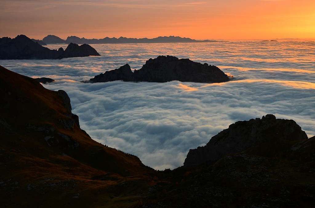
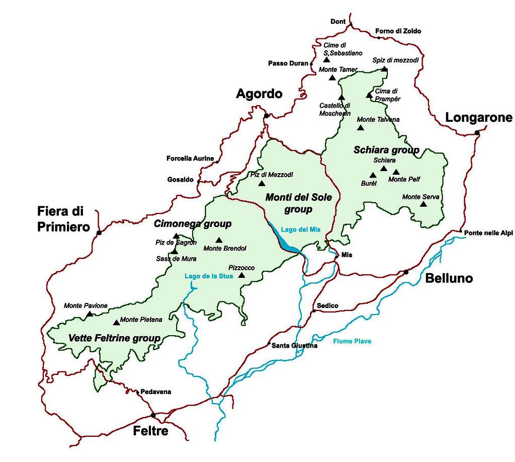
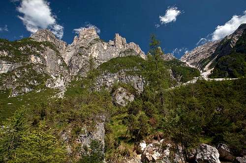
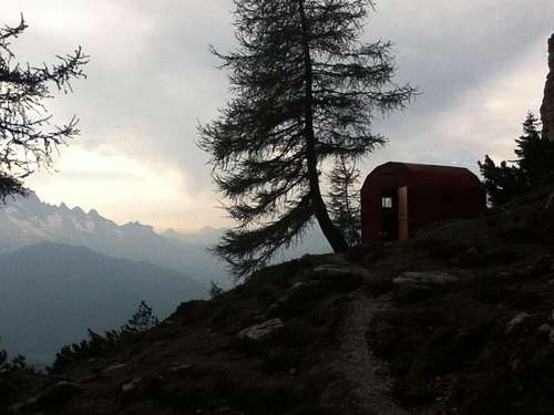
view from Vette Grandi
History
The “Parco Nazionale delle Dolomiti Bellunesi” was created to protect an area of outstanding and natural landscape. The Vette Feltrine and Monte Serva were already famous for their flora since the 18th century. The presence of rare species and an exceptional variety of environments is mainly due to the geographical location. It is in fact situated on the edge of the southeastern Alps, in very inaccessible areas, some of which have remained ice-free during very cold periods (glaciations) that have taken place during the Quaternary and the last of which was sold about 10000-12000 years ago.
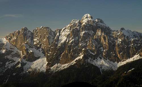
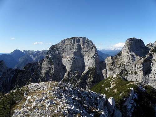
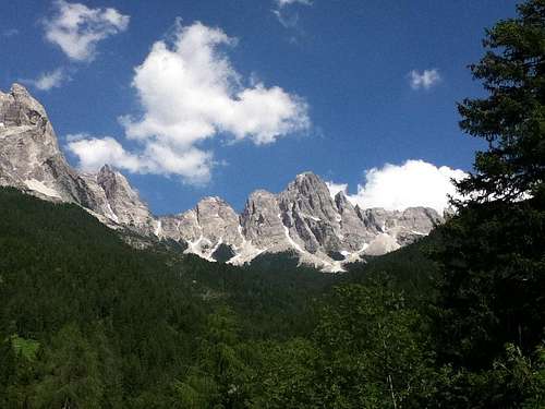
Gruppo del Cimonega (Sasso delle Undici, Sasso Largo and Piz di Sagron)
It’s entirely placed inside the province of Belluno (Veneto region), where the Monte Schiara with the elevation of 2565 m is the highest summit. The group is shared by the commons of: Belluno, Cesiomaggiore, Feltre, Forno di Zoldo, Gosaldo, La Valle Agordina, Longarone, Pedavena, Ponte nelle Alpi, Rivamonte Agordino, San Gregorio nelle Alpi, Santa Giustina, Sedico, Sospirolo, Sovramonte.
The areas of major natural interest are located in the highest mountains. The great variety of environments and landscapes is the most obvious feature particularly welcome in the summer season, characterized by colorful blooming.
The Western area, one of the Vette Feltrine properly so called, is characterized by peaks covered with grass (the most famous one is the pyramid of Monte Pavione 2335 m) and extensive scree slopes, glacial cirques, basins. It is accessed from the hilly area through steep paths that bypass the steep slopes but of great interest, with spaces that recall the rugged mountain landscapes. The subgroup of Cimonega, and its highest peak Sass de Mura, 2550 m high, has instead a typical Dolomites structure.
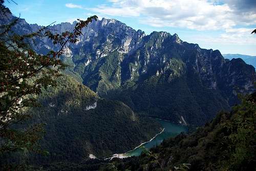
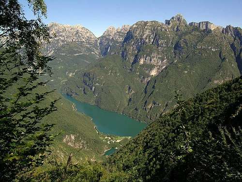
Lago della Stua
The Monti del Sole (on both sides, Mis and Cordevole) represent the wildest heart of the Park; proud and almost inaccessible sanctuary where natural forces seem to reject the attempts of man. Even as a very low altitude, deep ravines, gullies detritus, small waterfalls, steep ridges and rocky crags, wooded ravines, paint a landscape of rare beauty that reminds us of the most eastern areas of the Alps.
Also on Belluno side appreciates the alternation between towering walls of the Dolomites (Burel and Schiara) and peaks covered with grass (Monte Serva). Of exceptional quality also the beautiful forest in the basin of the woode hollow Cajada and grass-rock group of the Talvena.
Characteristic of the inner Dolomites healthy finally the cool slopes of Zoldo (Val Pramper and Grisol) which is different from the harsh and precipitous slopes that can be seen traveling up the Piave Valley. Within the perimeter of the park are also two artificial lakes, the Mis and La Stua in Val Canzoi.
Getting There
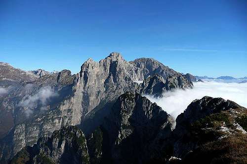
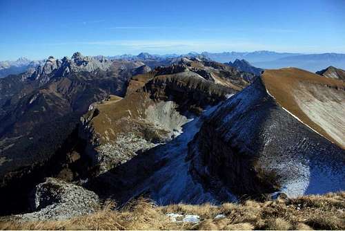
Schiara and Burel
The park covers the administrative territories of the fifteen townships, identified in four geographic areas: the Feltre, the Agordino, the province of Belluno and the Val di Zoldo. The south western area of the park is bordered by the Provincia Autonoma di Trento. The main entrance to the city park are Belluno, Feltre and Zoldo.
Belluno:
Belluno is reachable from Mestre and Venice, through the A27 motorway (exit Pian di Vedoia) and then along a short stretch before the state 51 to Ponte nelle Alpi and then the highway 50. For those who come from Padova, you may want to continue along the A4 motorway (Milan-Venice), exit at Mestre and, from this, reach Belluno via the motorway A27.
Feltre:
Feltre is reachable from Vicenza along the highway in the Val d'Astico A31 (exit Dueville), then continue along the SS 47 (Val Sugana) almost to Primolano, and then stretch of the highway 50. From the north, the main access roads to Feltre are: for those coming from the Trento SS47 (Highway of Val Sugana) to Primolano, and the state for those 50 crosses the Passo Rolle, and Belluno, for those coming from Cortina d 'Ampezzo and the Austrian border, is statale 51 (Alemagna).
Zoldo:
Zoldo is reachable from Belluno from the highway 50 Belluno-Longarone-Zoldo. Or from Feltre to Canale d'Agordo-Agordo-Passo Duran. From the village of Forno di Zoldo, a paved road leads to Pian de la Fòpa" 1200m. From here paths take to the northern part of the park.
From Friuli Venezia Giulia, for those coming from Gorizia, Trieste and the Slovenian border, it is preferable to take the A4 motorway and take, first of Mestre, the motorway A27 to Belluno, while those coming from Udine and Pordenone can follow the road 13 to Vittorio Veneto and then Route 51 to Ponte nelle Alpi and from here a short section of the state 50 to Belluno.
The Park area is intersected by two roads: the provincial 2 of Valle del Mis and statale Agordina 203 in the stretch that runs through the lower Val Cordévole. They run almost parallel and are separated from each other by the Monti del Sole group, and put in communication with the media Valbelluna to Agordino.
Unless the statale 203 Agordina, which rises from the valley of the Cordevole, and the road of Val Canzoi and Valle del Mis, there are other ways of penetration in the Park. Roads and forest tracks are strictly closed to vehicular traffic.
The map of "Parco delle Dolomiti Bellunesi"
Subgroups
The mountains enclosed into the park, belong to important Dolomites groups.
They are, from west to east:
Vette Feltrine
Vette Feltrine:
They are located in the south-western part of the Province of Belluno, near the border with Trentino, which includes the northernmost part. Are between the Primiero Valley (Val side with Noana) in the Province of Trento, north-west, the Val di Conca Canzoi to the east and south of Feltre.
Monte Pavione 2.334 (main summit)
Col di Luna 2.295 m
Cima Dodici 2.265 m
Monte Ramezza 2.250 m
Sasso Scarnia 2.226 m
Monte Pietena 2.195 m
Cimonega group
Cimonega group:
The group is bordered on the north by the Passo Cereda, to the east by the Forcella dell'Omo to the south and west by Passo Alvis and by Val Cismon.
Sass de Mura 2.547 m (main summit)
Piz de Sagron 2.486 m
Cima Pelughet 1.950 m
Monte Neva 2.228 m
Piz de Mez 2.440 m
Il Comedon 2.325 m
Monte Brendol 2.150m
Pizzocco 2.187m
Monti del Sole
Monti del Sole group:
Despite the low altitude, Monti del Sole are steep and rough in some places impenetrable, solitary, and are a destination for hikers in search of mountains that guarantee them the charm of the Dolomites without the crowds of mass tourism. There are also numerous climbing routes on the walls of Palazza, the Feruch and other peaks and towers.
Cima del Bus del Diàol 2.148 m
I Ferùch (Group of wild pinnacles, highest point Torre dei Ferùch 2.119m)
Torre del Mont Alt 2.043 m
Monte Pizzon (or Piz de Mezzodì not to be confused with the near Spiz di Mezzodì) main summit 2.240m
This small mountain range, enclosed for the most part into the territory of "Zoldo" village 840m, has the overall shape of a trapezoid. But the most interesting for climbers is the western side, which is placed from N to S almost totally above the "Val Praper".
It consits in two massif, very different from each other, are joined and then geologically considered part of the same group. If seen from the east the group is not very flashy it and consists of quite steep and wooded slopes. Instead seen from the west, they looming over the “val Prampèr” with cliffs covered of pines, buttress, canyons and numerous high rock towers that change color during sunset.
Spiz Mary 2.217 m
Spiz Nord 2.305 m
Spiz Est 2.317 m
Spiz di Mezzo 2.324 m
Spiz Sud 2.309 m
Cima del Venièr 2.237 m
Monte Coro2.324 m
Cima di Prampèr 2.409 m (main summit)
Cima di Pramperèt 2.337 m
Tamèr-S.Sebastiano group
Tamèr-San Sebastiano group:
Only the east side of this group belongs to park.
The chain of San Sebastiano is a mountain range that's precisely situated between the Valle Agordina, and the villages of Zoldo Alto and Forno di Zoldo.
Wide group located between the "Valle del Piave", the "Canale d’Agordo" and the "Valle di Zoldo". "La Schiara", also called in the local dialect "S'ciara", it's a Dolomite peak that overlooks the village of "Belluno", for more than 2000 meters drop in altitude, and the major elevation of the entire group. It is also a group by itself. The structure of the mountain encloses two other summits and several minor peaks.
Monte Talvena 2.542 m
Cime della Scala 1.902 m
Pelf 2.502 m
Burèl 2.281 m
Monte Zelo 2.083 m
Monte Coro 1.985 m
Catena del Terne-Tiròn-Sabiòi 2.000 m
Catena della Pala Alta 1.933 m
Monte Serva 2133 m
La Schiara 2.565 m (main summit)
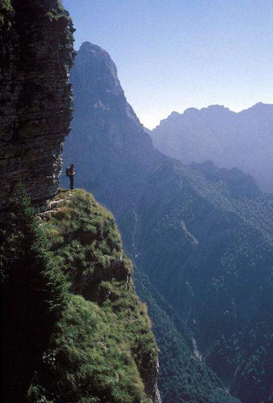
Viàz
Fearful routes on ledges, typical of these mountains, are the best way to appreciate the Park. Difficulties should not be underestimated!!!
History:
The first explorers of these mountains were the local hunters of chamois. Most of the paths get the origin from that ancient hunts. Even today, above the common tourist routes, there are same wild, hidden and exposed paths called “Viàz” that traverse the ledges of these rocky mountains.
Routes across the ledges are typical of the Dolomites as much as the ledges are typical chacteristic of the structure of these famous mountains. (for example the "cengia Grohman" of Monte Pelmo or the "cengia Gabriella" in the Dolomiti di Sesto and much more). But the local dialect term "Viàz" is only used around the Belluno range.
"Viàz"
Viàz enclosed into the Park listed by groups:
Spiz de Mezodì - Prampèr - Viàz de l'Oliana - Viàz del Gonéla - Viàz de la Tana de l'Ors - Viàz sora la Fopa - Cengia de la Cazeta - Viàz delle Lastiere
Vette Feltrine-Cimonega - Giro del Sass de Mura - Viàz de la Cesàrela Val Canzoi
Monti del Sole- Zengia Bruta (Covolere)- Zengia del Squarà (Zimon de Gena)- Caze Alte (Feruch)- Zengia dei Contrabbandieri- Alta Via dei Monti del Sole - Cengia del Montalt - Viàz della Zinturela (Rocchetta dei Monti del Sole)- Viaz di Porta Alta (Val del Mis)
Schiara- Viàz dei Camorz e dei Camorzieri (Schiara)- Viàz del Tita (Talvena)- Cengia de l'Adriano (Talvena, Belvedere del Piovon) - Troi de Panza- Val Ru da Molin- Cengia del Re sul Coro - La cengia del Fontanon (Pelf)- Zengia del Severino (Pulpito della Pala Bassa)- Anello delle Pale della Mola - Val Molin dei Frari
Red tape
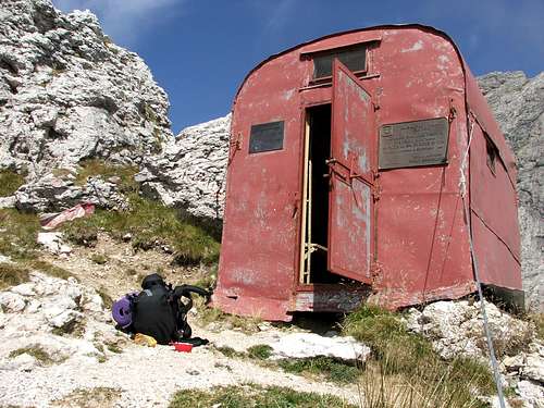
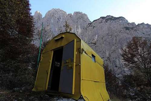
The bivouac "della Bernardina".
The Parco Nazionale delle Dolomiti Bellunesi is included among the nine areas acknowledged as an UNESCO World Heritage Site in 2009. More info about Dolomiti Unesco World Heritage here:
CENTRO VALANGHE DI ARABBA Phone +390436755711 fax 043679319 e-mail cva@arpa.veneto.it
Informations and links
- Tourist informations and assistance (I.A.T.)
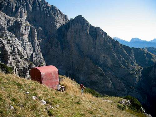
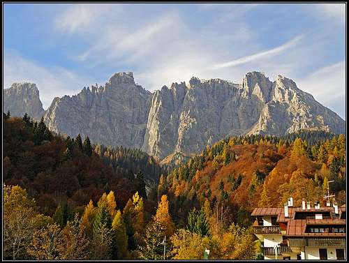
The mountains of Cimonega Group are worth of belonging to Dolomites - they are as wild and beautiful as the most popular other groups. One of their highest mountains is Piz de Sagron 2.486 m.
Belluno, Piazza dei Martiri 8, Tel. 0437/940083 - Fax 0437/940073 Feltre, Piazzetta Trento e Trieste 9, Tel. 0439/2540 - Fax 0439/2839 Forno di Zoldo, Via Roma 10/a, Tel. 0437/787349 - Fax 0437/787340
Children refers to the set of objects that logically fall under a given object. For example, the
Aconcagua mountain page is a child of the 'Aconcagua Group' and the 'Seven Summits.' The
Aconcagua mountain itself has many routes, photos, and trip reports as children.
Parents refers to a larger category under which an object falls. For example, theAconcagua mountain page has the 'Aconcagua Group' and the 'Seven Summits' asparents and is a parent itself to many routes, photos, and Trip Reports.

 19016 Hits
 88.51% Score
 27 Votes