
|
|
Area/Range |
|---|---|
|
|
46.50800°N / 12.33900°E |
|
|
Hiking, Mountaineering, Trad Climbing, Scrambling, Via Ferrata, Skiing |
|
|
Spring, Summer, Fall, Winter |
|
|
9619 ft / 2932 m |
|
|
Overview
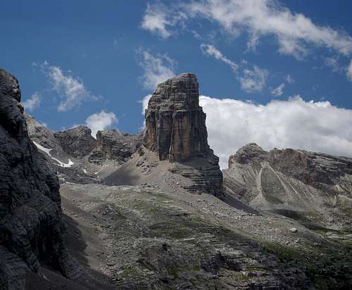
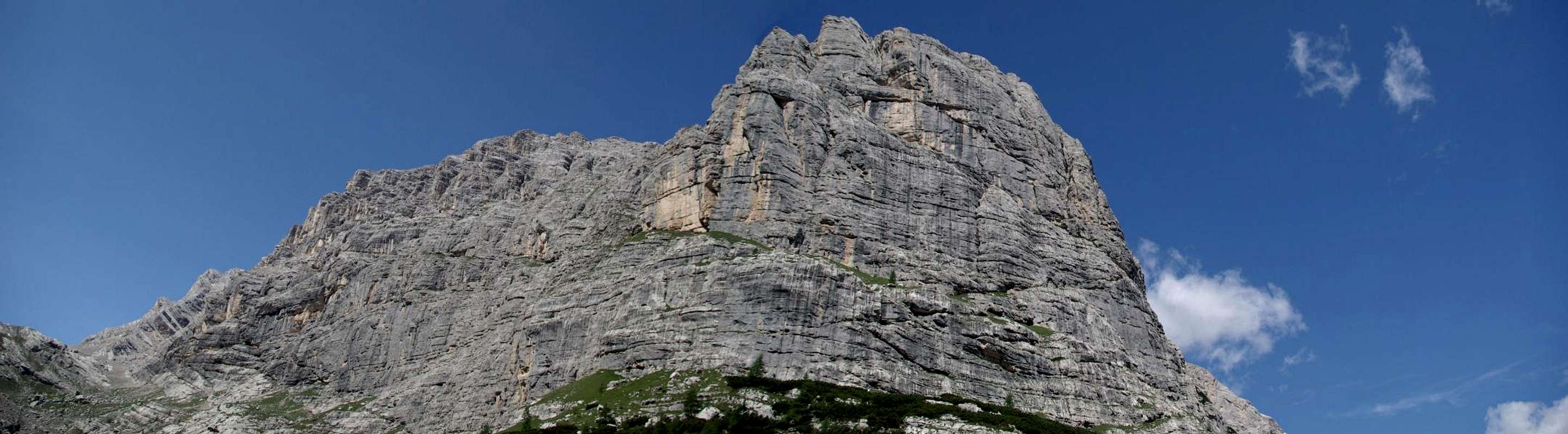
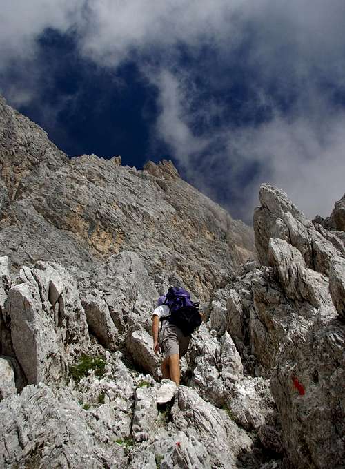
Torre dei Sabbioni
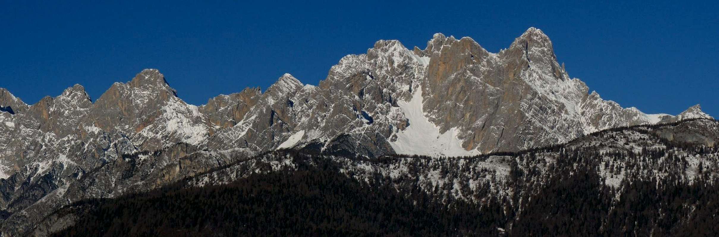
“The wildest group of the Dolomiti”. You can often hear this about the Marmarole when you are in the Dolomiti Orientali, and is probably true.
Somebody could ask how a mountain group like this, composed by wonderful peaks and towers of almost 3000 meters, situated very near popular touristic towns and famous mountains, can be still so wild in the year 2008. There are three main reasons: the first is that all the main summits are difficult to climb and require alpinistic experience. Some of them can be climbed without climbing equipment but you have to be familiar with rock climbing and with wild and isolated places. The second is that the valleys around this dolomitic peaks are deep and almost all the roads are not very good, so the approaches are often long, difficult and strenuous, too much for the modern hikers and climbers. The third reason is that there aren’t much information about this wild summits and whoever come in this area prefers the more safe and advertised ( but also overcrowded ) routes of the nearby mountains around Cortina and Misurina, like the Tre Cime di Lavaredo or the Tofane group. But if you think that the Marmarole are not worth a visit just take a look at them at sunset from the Lago di Centro Cadore or from San Vito and admire the spectacular colours of this fantastic cathedrals of dolomite.
Of course if a broad part of this area is off-limits for tourists and casual hikers it’s not difficult to understand that the Marmarole are a fantastic paradise for “old fashioned” alpinists and real mountain lovers, that can breathe the atmosphere of the first pioneers of the Dolomiti. In this group you can find wonderful classic normal routes, not technically difficult ( usually around the II UIAA degree ) but very challenging because are very long, hard and often not marked. There are also great climbing routes opened by famous rock climbers, like the Livanos routes on the Torre dei Sabbioni and the Corno del Doge.

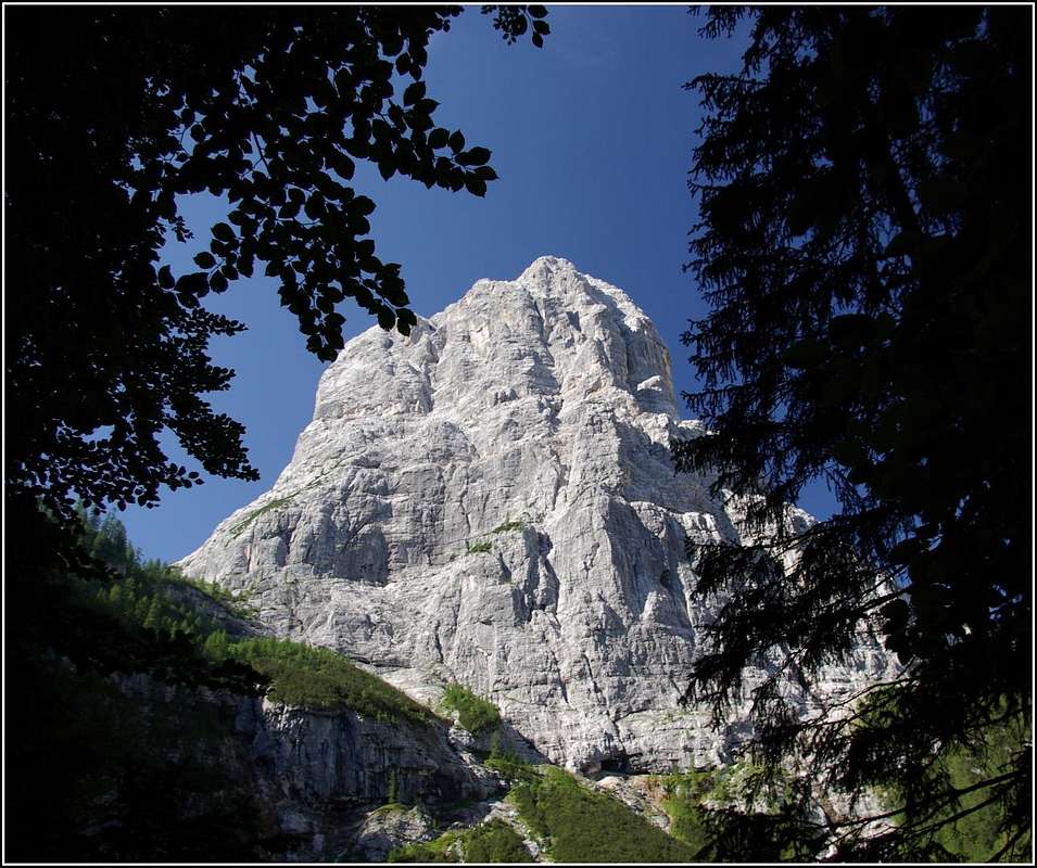
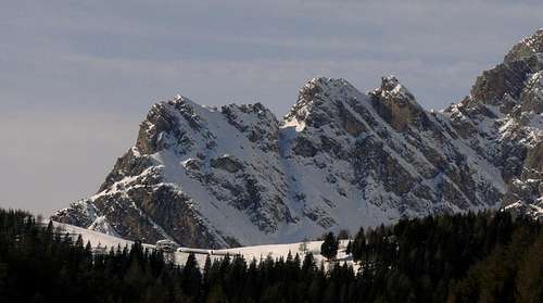
Bel Pra group in Winter
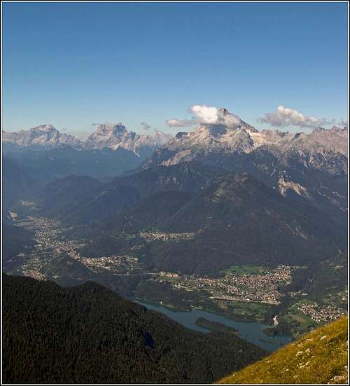
The views that you can enjoy from the summits of this peaks are breathtaking, among the best of the whole group of the Dolomiti. The mountains that you can see from there are countless, but within a range of 30 km you have Antelao, Pelmo , Civetta, Tofane, Croda Rossa d’Ampezzo, Sorapiss, Pomagagnon, Cristallo, Tre Cime di Lavaredo, Cadini di Misurina, Croda dei Toni, Monte Popera, Cima Bagni, Croda Da Campo, Peralba, I Brentoni, Cridola, Spalti di Toro-Monfalconi, Cima dei Preti and Duranno.
This are the mountains of Tiziano, one of the greatest italian painters of the Renaissance, that was born in Pieve di Cadore, just at the feet of them. He loved so much this group that he painted it in one of his most famous masterpieces, “La presentazione della Vergine nel tempio”, a huge painting that can be admired in the museum “Gallerie dell’Accademia” in Venezia. A nice summit ,a bivouac and a famous “Alta via” (a trekking route through the Dolomiti ) are named after him.
The Marmarole are usually put inside a broader group with Antelao and Sorapiss, but I think that it’s better to keep the three separate, because each one of them has its own identity and alpinistic history. And it’s really not fair to consider the imposing summits of this group just “minor” peaks near the two famous dolomitic giants.

Dante e Virgilio
Like many other ranges in the Dolomiti this one also is a fairy tale place, but here you won’t find elves or trolls but other strange inhabitants called Crodares, the sons of the rocks. Ruled by Tanna, a beautiful Queen that lives in a castle of ice, the Crodares are just like men but without feelings, because their heart is made of the same rock of the Marmarole. There are also stories about mythological animals, like the half black and half white chamoix.
The name Marmarole has probably the same root ( celtic ) of the Marmolada and should mean “splendour”.
Geography
From Monte Vedòrcia
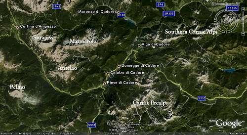
This dolomitic group is situated in the north-east of Italy, inside the Dolomiti Orientali, in the area known as Centro Cadore ( Regione Veneto, province of Belluno ). It’s a 13 km ridge ( direction east to west ) that is divided in three subgroups: Marmarole Occidentali ( Gruppo del Bel Pra ), Marmarole Centrali and Marmarole Orientali ( Gruppo del Ciastelin ).
The borders are : Val d’Ansiei, Val del Piave, Val d’Oten and Val di San Vito.
The average elevation of this summits is around 2500/2800 m, with three mountains ( Cima Bel Pra, Cima Bastioni and Cimòn del Froppa ) that nearly touch 3000 meters.
The highest summit is the Cimòn del Froppa ( 2932 m ).
 Gruppo del Bel Pra Gruppo del Bel Pra |
 Marmarole Centrali Marmarole Centrali |
 Gruppo del Ciastelin Gruppo del Ciastelin |
Geology
If you observe well this mountains from every side you can easily understand the complexity of their geological structure. The group originated between 180 and 240 million years ago and is basically a huge syncline situated between two big faults called Linea del Pian di Sera ( N ) and Linea dell’Antelao ( S ).
The central part of the group is composed by Dolomia Principale ( Norian period of the Triassic age ) but all around it you can find stratifications of different kinds of dolomitic rock and limestone of the Triassic and Permian Age.
Once this group would have more glaciers than any other of the Dolomiti ( Ghiacciaio delle Selle, Ghiacciaio del Froppa di Fuori, Ghiacciaio del Froppa di Dentro, Ghiacciaio Meduce di Fuori and Ghiacciaio Meduce di Dentro ) but today are all completely disappeared, like almost all the glaciers of the dolomitic range.
Alpinistic Hystory
The first ascent in the Marmarole was disputed for a while but today is accepted that the alpine guide from Calalzo di Cadore Giovan Battista Toffoli ( known as Tita Petòz ) and the Captain G. Somano climbed in 1867 the highest summit of the group, the Cimòn del Froppa.
Ten years later another guide from the Cadore, L. Cesaletti , climbed solo and unroped one of the most beautiful towers of the group, the Torre dei Sabbioni, overcoming very high difficulties for those years and opening a new era of the dolomitic alpinism.
In the following years famous alpinists like Darmstadter and Zsigismondy and local alpine guides like Orsolina, Siorpaes and the Dimai brothers started to explore the area and climbed the most accessible summits of the group.
Then in the years before the first world war the Fanton brothers ( Umberto, Arturo, Augusto, Paolo, Teresa and Luisa ), the famous pioneers of the dolomitic alpinism, explored this mountains in a systematic way and opened the famous Albergo Marmarole in Calalzo di Cadore, which became a meeting point for the alpinists of those years. Among the brothers Umberto was the strongest and can be considered the real pioneer of this group ( for many is the first italian alpinist ). He was also a pilot of the Italian air force and died very young fighting in the skies above his beloved Dolomiti during the first world war.
In more recent times famous mountaineers like Severino Casara, Ettore Castiglioni and Georges Livanos opened interesting routes in the group but after the sixties this mountains slowly have been forgotten from the modern alpinists.
Cadore
Centro Cadore
One of the most loved places of the Italian Eastern Alps, the Cadore is basically all the area around the high riverbed of the river Piave. This river, that springs at the foothills of Monte Peralba, runs between the Dolomiti and the Carnic Alps and is sacred to all the Italians due to the tragic events happened in the last year of the First World War.
After the rout of Caporetto ( 10/24/1917 ), where the Italian army lost more than 10.000 soldiers ( and almost 300.000 had made prisoners ), all northern Italy seemed gone. But with great sacrifice the Italian army managed to set a defense line on the river and, after a year of fierce battles, the november of 1918 won the war in the famous battle of Vittorio Veneto.
This area is well known for its rich history. The first inhabitants of Cadore were probably the Celts ( but there are also rests of the prehistoric men ), that settled in the area probably since the VI century B.C. . Then many populations lived in the Cadore: the Romans, the Erulians, the Ostrogoths, the Bizanthins, the Longobards, the Francs, the Carinthians.
After the dark middle age the area became part of the Republic of Venezia and for centuries its population could live in peace. In the last years of the XVII century the French came and a long period of wars started. The Cadore became soon part of the Austrian-Ungarian empire and for more than a century was a contented area, until it finally became part of the kingdom of Italy ( 1866 ).
During the first world war fierce battles had been fought in the Cadore, especially in the mountains, where there are still many rests of that sad years.
The people of Cadore are famous for their hospitality and laboriousness . The economy of the area, that once was based on the agriculture and on the exploitation of the natural resources of the mountains, today is much helped by the tourism and by the factories of glasses.
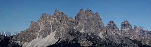
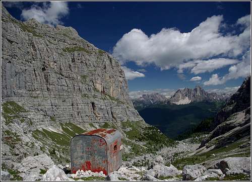
Panoramic views
 |
 |
 |
Marmarole Occidentali ( Gruppo del Bel Pra )
 |
|---|
| mountain | elevation | normal route | first ascent | Latitude/Longitude | image |
| Torre dei Sabbioni | 2531 m | From SW – difficulty around UIAA IV | L. Cesaletti, 8/24/1877 | 46.490/12.232 |
 |
| Cima Bel Pra | 2917 m | From NW – difficulty around UIAA II | L. Pitacco-C. Brandolini-L. Cesaletti, 9/04/1880 | 46.485/12.240 |
 |
| Costa Bel Pra | 2862 m | From the SW crest – difficulty around UIAA II/III | Von Roncador-O. Oppel, 8/18/1912 | 46.492/12.242 |
 |
| Corno del Doge | 2615 m | From SE – difficulty around UIAA II | A. Armandi Avogli-L. Borziini-G. Croveris, 8/28/1888 | 46.501/12.249 |
 |
| Punta Dina | 2526 m | From NW ( Forcella San Lorenzo )– difficulty around UIAA II/III | E. De Perini-G. Giavi, 8/17/1942 | 46.480/12.248 |
 |
| Punta Augel | 2686 m | From NW ( Forcella San Lorenzo )– difficulty around UIAA II/III | E. De Perini-G. Giavi, 8/18/1941 | 46.480/12.253 |
|
| Cima Scotter | 2800 m | From NW ( Forcella Cadin )– difficulty around UIAA II | E. and O. Lecher-C. Reissig- P. Dimai-S. Siorpaes-A. Dibona, 8/25/1900 | 46.482/12.262 |
 |
| Cima Nosoio | 2768 m | From the SE face – difficulty around UIAA V | A. Bianchini-B. Sandi, 8/17/1942 | 46.483/12.265 |
 |
| Cima Bastioni | 2926 m | From the NW face – difficulty around UIAA II | L. Darmstadter-P. Orsolina-L. Bernard-J.Stabeler, 7/06/1890 | 46.489/12.268 |
 |
| Croda de Marchi | 2796 m | From NE ( Forcella Vanedel )– difficulty around UIAA I/II | U. Fanton-G. Errera, 8/1914 | 46.497/12.264 |
 |
| Cima Sòra Casera | 2398 m | From the N face – difficulty around UIAA II/III | L.,P., and A. Fanton, 7/10/1910 | 46.485/12.276 |
Marmarole Centrali
 |
|---|
| mountain | elevation | normal route | first ascent | Latitude/Longitude | image |
| Torre Frescura | unknown | From N ( Forcella Croda Rotta )– difficulty around UIAA IV/V | L. Cornaviera-U. de Polo, 5/19/1944 | 46.504/12.272 | |
| Croda Rotta | 2632 m | From S ( Meduce di Dentro)– difficulty around UIAA II | M. Padoa-P. Orsolina, 8/31/1902 | 46.507/12.271 |
 |
| Cresta Vanedel | 2725 m | From N ( From Pian della Gravina )– difficulty around UIAA III | L.,U., and A. Fanton, 8/12/1911 | 46.503/12.280 |
 |
| Cima Vanedel | 2797 m | From S ( Val Vanedel)– difficulty around UIAA II/III | L. Darmstadter-L. Bernard-J. Stabeler, 7/04/1890 | 46.501/12.290 |
 |
| El Mèscol | 2413 m | From E ( Conca del Meduce di Fuori )– difficulty around UIAA I | K. Domènigg-K. G. von Saar, 8/2/1903 | 46.513/12.485 |
 |
| Cima Pelosana | unknown | From N ( Forcella Croda Rotta )– difficulty around UIAA IV/V | L. -U. Fanton, 10/11/1911 | 46.500/12.292 |
|
| Campanile San Marco | 2777 m | From the W face – difficulty around UIAA IV | M. de Jankovics-A. Dimai-S. Siorpaes, 8/26/1902 | 46.504/12.288 |
 |
| Cime Orsolina | 2803 m | From NW ( Meduce di Fuori )– difficulty around UIAA II | M. Padoa-G. Orsolina, 8/18/1902 | 46.502/12.288 | |
| Pala di Meduce | 2864 m | From NE ( From Forcella Schiavina )– difficulty around UIAA I/II | L. Darmstadter-A. Helversen-L. Bernard-P. Orsolina-J. Niederweiser, 7/09/1890 | 46.503/12.297 |
 |
| Monte Meduce | 2402 m | From W ( Bivacco Musatti )– difficulty around UIAA I/II | unknown | 46.516/12.297 |
 |
| Cima Schiavina | 2782 m | From NE ( Bivacco Tiziano )– difficulty around UIAA II/III | L. Darmstadter-P. Orsolina-J. Stabeler, 6/13/1891 | 46.506/12.300 |
 |
| Cima Tiziano | 2802 m | From W ( Forcella Tiziano )– difficulty around UIAA II | E. and O. Lecher-A. Siorpaes-A. Dibona-G. Barbaria, 8/12/1900 | 46.501/12.299 |
|
| Monte Oten | 2244 m | From S ( Pian della Gravina )– difficulty around UIAA I | unknown | 46.494/12.299 | |
| Cima Federa | 2513 m | From S ( Pian della Gravina )– difficulty around UIAA III | L. and P. Fanton, 1911 | 46.498/12.299 | |
| Cime di Vallonga | 2742 m | From W ( Forcella di Vallonga Ovest )– difficulty around UIAA II | L. Darmstadter-J. Stabeler-P. Orsolina, 6/13/1891 | 46.502/12.309 |
 |
| Monticello | 2803 m | From E ( Forcella Monticello )– difficulty around UIAA II/III | E. Zsigismondy-L. Purtscheller, 7/26/1882 | 46.504/12.316 |
 |
| Cime di Valtana | 2722 m | From NE ( Bivacco Tiziano )– difficulty around UIAA II/III | L. Darmstadter-P. Orsolina-J. Stabeler-l. Bernard, 6/14/1891 | 46.505/12.324 |
 |
| Punta Anita | 2765 m | From N ( ghiacciaio di dentro di froppa )– difficulty around UIAA I/II | L. and U. Fanton, 9/04/1913 | 46.504/12.337 |
 |
| Monte Froppa | 2840 m | From N ( Forcella Froppa )– difficulty around UIAA I/II | unknown | 46.505/12.339 |
 |
| Cima Salina | 2354 m | From S ( Rifugio Chiggiato )– difficulty around UIAA I/II | L. and P. Fanton, 1914 | 46.501/12.338 |
 |
| Punta della 68° compagnia alpina | 2595 m | From S ( Rifugio Chiggiato )– difficulty around UIAA I/II | 68° compagnia alpina-G. B. Petoz, 1900 | 46.507/12.340 |
 |
| Cimòn del Froppa | 2932 m | From SW ( Forcella Froppa )– difficulty around UIAA II/III | G. B. Toffoli-G. Somano, 10/19/1867 | 46.508/12.339 |
 |
| Cima Arduini | 2769 m | From N ( Bivacco Tiziano )– difficulty around UIAA I/II | L. and U. Fanton-G. Chiggiato-R. Levi, 10/14/1913 | 46.511/12.334 |
 |
| Cima del Rifugio | unknown | From N ( Bivacco Tiziano )– difficulty around UIAA I/II | L. and U. Fanton-G. Chiggiato-R. Levi, 10/14/1913 | 46.513/12.330 |
|
| Cima Petoz | 2877m | From S - difficulty around UIAA I/II | G.B. Petoz, 1900 | 46.509/12.339 |
|
| Punta Teresa | 2868 m | From W ( Ghiacciaio di Froppa di Fuori )– difficulty around UIAA I/II | L., A. and U. Fanton, 9/04/1913 | 46.511/12.343 |
 |
| Le Selle | 2851 m | From N ( Lastoni delle Marmarole )– difficulty around UIAA I/II | L. Orsolina, date unknown | 46.514/12.344 |
|
| Torre Augusto | 2718 m | From NW ( Lastoni delle Marmarole )– difficulty around UIAA II/III | L., A. and U. Fanton, 9/03/1913 | 46.515/12.345 |
|
| Croda dell’Arbel | 2729 m | From NW ( Forcella Cadin )– difficulty around UIAA I/II | K. Berger-J. Hechenbleikner, 7/22/1903 | 46.517/12.344 |
|
| Croda and Spalla dell’Arbel | 2729 m | From NW ( Lastoni delle Marmarole )– difficulty around UIAA I/II | unknown hunters | 46.518/12.346 |
|
| Cima dei Camosci | 2673 m | From N ( Croda Alta di Somprade )– difficulty around UIAA II | L. and U. Fanton-R. Chiggiato-R. Levi, 8/2/1903 | 46.523/12.343 | |
| Cresta degli Invalidi | 2783 m | From S – difficulty around UIAA I | unknown | 46.505/12.543 |
 |
| Croda da Rin | 2407 m | From the E face– difficulty around UIAA III | L. and P. Fanton-A. Berti, 9/07/1926 | 46.525/12.347 | |
| Croda Alta di Somprade | 2646 m | From SE ( ghiacciaio delle Selle)– difficulty around UIAA II | unknown | 46.527/12.337 |
 |
| Croda Bianca | 2841 m | From the south east edge – difficulty around UIAA III | L. Darmstadter-H. Helversen-L. Bernard-V. Innerkofler-J. Stabeler, 6/29/1890 | 46.505/12.350 |
 |
| Campanile Calalzo | unknown | From the south face – difficulty around UIAA IV | M. Giacomelli-G. Bertagnin-M. Girardi | 46.508/12.352 | |
| Torrione Libertà | unknown | From SE – difficulty around UIAA IV | E. Toffoli-M. A. Rossi, 8/15/1943 | 46.508/12.352 | |
| Monte Peronat | 2409 m | From the W face– difficulty around UIAA III/IV | E. Castiglioni-S. Tutino, 7/10/1941 | 46.505/12.364 |
|
Marmarole Orientali ( Gruppo del Ciastelin )
 |
|---|
| mountain | elevation | normal route | first ascent | Latitude/Longitude | image |
| Monte Ciastelin | 2570 m | From S ( From Val Baion )– difficulty around UIAA II/III | U. and P. Fanton, 9/6/1906 | 46.510/12.375 |
 |
| Campanile Ciastelin | 2602 m | From NW ( From Val Baion )– difficulty around UIAA II/III | F. Darmstadter-J. Stabeler-L. Bernard, 6/28/1890 | 46.512/12.377 |
 |
| Cima del Carro Armato | 2525 m | From S ( Alta Val Baion )– difficulty around UIAA III/IV | S. Casara-W. Cavallini, 7/16/1942 | 46.513/12.377 |
 |
| Torre walter | 2463 m | From S ( Alta Val Baion )– difficulty around UIAA V | S. Casara-W. Cavallini, 7/16/1942 | 46.513/12.375 | |
| Punta Granzotto | 2443 m | From S ( Alta Val Baion )– difficulty around UIAA V | S. Casara-W. Cavallini, 7/16/1942 | 46.514/12.377 | |
| Dente nord di Pomadonna | 2463 m | From S ( Alta Val Baion )– difficulty around UIAA V | F. Steirl-S. Schneider, 7/23/1952 | 46.515/12.373 | |
| Dente Sud di Pomadonna | 2443 m | From S ( Alta Val Baion )– difficulty around UIAA IV | S. Casara-W. Cavallini, 8/29/1944 | 46.515/12.373 | |
| Il Pupo | 2350 m | From NE ( Forcella di San Pietro )– difficulty around UIAA IV | O. Olivo-P. Fanton, 8/29/1925 | 46.513/12.381 |
 |
| Monte Ciarido - Cima Sud Ovest | 2504 m | From S ( Alta Val Baion )– difficulty around UIAA I/II | Fanton brothers | 46.514/12.386 |
 |
| Monte Ciarido – Cima Nord Est | 2453 m | From E ( Forcella San Lorenzo )– difficulty around UIAA I/II | Unknown, 9/20/1902 | 46.516/12.389 |
 |
| Torre Laura | unknown | South face– difficulty around UIAA IV | G. Segni-M. Segni-U. Bagnaresi, 8/1960 | 46.514/12.383 |
|
| Torre Artù | unknown | From S ( Alta Val Baion )– difficulty around UIAA V | F. Steirl-S. Schneider, 7/23/1952 | 46.518/12.391 |
 |
| Torre Pian dei Buoi | 2350 m | From NE ( Forcella di San Pietro )– difficulty around UIAA IV | O. Olivo-P. Fanton, 8/29/1925 | 46.519/12.391 |
|
| Torre San Lorenzo | 2504 m | From S ( Alta Val Baion )– difficulty around UIAA I/II | Fanton brothers | 46.521/12.392 |
 |
| Campanile di Val di Poorse | 2443 m | From S ( Alta Val Baion )– difficulty around UIAA IV | S. Casara-W. Cavallini, 8/29/1944 | 46.519/12.389 |
Getting there
You can approach the group from the valley of the river Piave ( South ), the valley of the river Bòite ( East ) and the valley of the river Ansiei ( North ). If you choose the southern and eastern approach you can start from the villages of Lozzo, Pieve , Calalzo, Domegge or San Vito di Cadore.
If you come from the north you can start from Auronzo di Cadore and its surroundings. There are some mountain roads that go up to Pian dei Buoi, Val d’Oten, Val di Poorse and Val di San Vito but they can be in very bad conditions, so is better to ask info in the villages around before to start.
From West: From the Brennero motorway exit Bressanone/Brixen and then San Candido, Cortina d’Ampezzo, Auronzo di Cadore.
Or
Cortina, San Vito, Pieve, Domegge, Lozzo di Cadore.
From East: From the Udine-Tarvisio motorway exit Carnia and then Tolmezzo, Villa Santina, Forni di Sopra, Sappada, Santo Stefano di Cadore and Auronzo di Cadore.
Or
Santo Stefano di Cadore, Lozzo, Domegge,Pieve, San Vito di Cadore.
Or
Villa Santina, Forni di Sopra,Lorenzago, Lozzo, Domegge,Pieve, San Vito di Cadore
Or
Villa Santina, Forni di Sopra,Lorenzago,Auronzo di Cadore
From South: From Venezia to Belluno, Pieve, Domegge, Lozzo, Auronzo di Cadore
Or
Pieve to San Vito di Cadore
When to climb?
The best season for hiking and climbing in the Marmarole group is the summer and the early autumn ( from June to October ). Winter ascents are only for very expert alpinists. Some of the huts can be reached snowshoeing in the winter season.
Veneto weather forecast
Hiking in the group
There are wonderful hiking routes in this group that can offer some of the best views of the whole dolomitic range. But it must be said that almost all this routes are very long and challenging, recommended only to expert and well prepared people, that know well all the possible dangers of the mountain. Another important thing to say is that the weather conditions in this area can change very fast and in case of storms and heavy rains the paths can become very dangerous, so avoid to plan excursions when the weather is not good. Rescues can be very difficult ( if not impossible ) in some areas of this group.
Sentiero degli Alpini
| description | marked path n° | hours | views to |
| Sentiero degli Alpini – From Rifugio Chiggiato to Bivacco Tiziano through Forcella Jau de Tana –medium via ferrata | 260 | 8/9 | Antelao, Marmarole, Cristallo, Croda Rossa, Dolomiti di Sesto |
| From Rifugio Chiggiato to Bivacco Tiziano through Forcella Marmarole and Forcella Froppa – difficult hiking route | 262-280-260 | 6 | Antelao, Cridola, Spalti di Toro Monfalconi, Marmarole, Cristallo, Croda Rossa, Dolomiti di Sesto |
| Sentiero della Cengia del Doge – From Rifugio Tre Sorelle to the big ledge of Corno del Doge – easy via ferrata exposed in some parts | 226-278-280 | 6 | Cristallo, Sorapiss, Marmarole, Dolomiti di Sesto |
| Sentiero Amalio del Pra – From Rifugio Ciareido to Forcella di San Pietro – medium via ferrata | 346-342-353 | 3.30 | Marmarole, Carnic Alps, Dolomiti di Sesto, Croda Rossa, Cristallo |
| From Rifugio San Marco to Bivacco Voltolina ( Sentiero Cengia del Doge with different approach ) - easy via ferrata exposed in some parts | 226-280-278 | 4 | Pelmo, Antelao, Tofane, Sorapiss, Marmarole, Dolomiti di sesto |
| Strada Sanmarchi – From bivacco Voltolina to Bivacco Musatti – very challenging hiking path, not always marked, secured in some sections | 280 ( alta via n° 5 ) | 8 | Marmarole, Cristallo, Dolomiti di Sesto |
| From Rifugio Tre Sorelle to Bivacco Musatti – hiking route with a short secured section | 349 | 3 | Marmarole, Dolomiti di Sesto, Cristallo |
| From Casa Alpina to Bivacco Tiziano – hiking route | 357-353 | 4.30 | Marmarole, Dolomiti di Sesto, Carnic Alps |
| From Rifugio Tre Sorelle to Rifugio San Marco – hiking route | 352 | 3.30 | Marmarole, Dolomiti di Sesto, Sorapiss, Antelao, Pelmo |
Alta Via "Tiziano Vecellio"
This famous trekking goes through some of the wildest places of the Dolomiti, in the groups of the Dolomiti di Sesto and the Marmarole. It’s a 100km trek that goes from Sesto to Pieve di Cadore and can be done in 6 or more days ( several variations can be done ). The part inside the Marmarole is the more demanding, although some sections have been secured with iron ropes. In particular the path called Strada Sanmarchi that goes from Bivacco Musatti to Bivacco Voltolina shouldn’t be underestimated ( several serious accidents have already happened ) and is recommended only to alpinists or very experts hikers.
The views are breathtaking since the beginning, with this trek you have the chance to admire almost all the famous summits of the Dolomiti Orientali ( but also many of the Carnic Alps and Prealps ) from an unusual point of view, in one of the wildest environment you can imagine in the Alps.
 Cadini and Tre Cime
| day | from | to | path n° | hours | views |
| 1 | Sesto | Rifugio Fondo Valle-Rifugio Zsgismondy Comici-Forcella Giralba-Rifugio Carducci | 102/103 | 4 | Tre Scarperi group, Popera group, Cima Una group, Croda dei Toni group |
| 2 | Rifugio Carducci | Val d’Ansiei-Tablà da Rin-Forcella Paradiso-Rifugio Ciareido | 103/109/270/273/272 | 5 | Croda dei Toni group-Popera group-Marmarole group-Cristallo group-Carnic Alps and Prealps |
| 3 | Rifugio Ciareido | Rifugio Baion E. Boni-Rifugio Chiggiato-Forcella Jau de Tana-Bivacco Tiziano | 272/262/260 | 8 | Carnic Alps and Prealps-Antelao-Pelmo-Civetta-Marmarole group-Cristallo group-Tre Cime di Lavaredo- Croda Rossa group -Croda dei Toni group-Popera group |
| 4 | Bivacco Tiziano | Bivacco Musatti-Bivacco Voltolina | 280 | 10 | Marmarole group-Cristallo group-Tre Cime di Lavaredo- Croda Rossa group - Cadini di Misurina-Croda dei Toni group-Popera group |
| 5 | Bivacco Voltolina | Rifugio San Marco-Rifugio Galassi | 280/226/227 | 4 | Marmarole group-Cadini di Misurina- Croda dei Toni group-Popera group-Sorapiss group-Pelmo- Antelao |
| 6 | Rifugio Galassi | Rifugio Antelao-Pieve di Cadore | 250/252 | 8 | Marmarole group-Sorapiss group-Antelao-Pelmo-Tofane-Carnic Alps and Prealps |
Climbing routes
There are interesting climbing routes in the Marmarole, but very few have been often repeated. Here’s a short list of the most known:

Via Bianchi-Urban
| route | summit | difficulty | elevation gain |
| Via Olivo | Il Pupo delle Marmarole | IV+ | 130 m |
| Cresta Fanton | Croda Bianca | III | 650 m |
| Via del Negro | Torre Pian dei Buoi | IV+ | 160 m |
| Via Cadorin-Scandolin | Croda Bianca | IV+ | 550 m |
| Via Cesaletti | Torre dei Sabbioni | IV | 170 m |
| Via Bianchi-Urban | Campanile San Marco | IV | 550 m |
Huts and Bivouacs
There are some nice alpine huts on the southern and eastern slopes of the group, but in the very heart of the group there are only four bivouacs.
 Rifugio Baion
| Huts |
</no format>
| mountain hut | valley | elevation | how to get there | owned by | Tel. number |
| Rifugio Scotter-Palatini | Col Negro | 1580 m | From San Vito di Cadore 2 kms by car and then you have to take the chairlift to the hut. It can also be reached by car from 6.30 p.m to 7.30 a.m. ( not asphalted road in bad conditions ) | Private | 0436.99035 |
| Rifugio San Marco | Sothern slopes of Cima Bel Pra | 1823 m | 20/30 minutes from Rifugio Scotter-Palatini | CAI Venezia | 0436.9444 |
| Rifugio Galassi | Col Negro | 2018 m | 1 hour and 30 minutes either from Capanna degli Alpini ( path n°255 ) or from Rifugio Scotter Palatini ( path n° 229-227 ) | CAI Mestre | 0436.9485 |
| Capanna degli Alpini | Val d’Oten | 1395 m | By car from Calalzo di Cadore. From Praciadelan not asphalted road | Private | 0435.31103 |
| Rifugio Chiggiato | Col Negro | 1911 m | From Calalzo di Cadore 7 kms by car through Val D’oten and then 2 hours from the village Praciadelan ( path n°260 ) | CAI Venezia | 0436.31452 |
| Rifugio Baion E. Boni | Col di San Pietro | 1828 m | From Lozzo di Cadore 17 kms by car. The road is very narrow and not asphalted in the last part. During the summer months you can go only up from 9 to 14 and only down from 14 to 17 | CAI Domegge di Cadore | 0435.76060 |
| Rifugio Ciareido | Alta Val Baion | 1969 m | From Lozzo di Cadore 15 kms by car to Pian dei Buoi and the 30 minutes to the hut | CAI Lozzo di Cadore | 0435.76276 |
Bivacco Voltolina
| Bivouacs |
</no format>
| name | elevation | place |
| Bivacco Fratelli Fanton | 1769 | south western slopes of Ciastelin |
| Bivacco Tiziano | 2246 | Lastoni delle Marmarole |
| Bivacco Voltolina | 2082 | Val di Mezzo |
| Bivacco Alberto Musatti | 2111 | Meduce di Fuori |
Accomodation
This is a wild group but very near popular touristic towns like Auronzo di Cadore, Cortina d’Ampezzo and San Vito di Cadore, so you won’t have problems to find lodging in this area ( just remember that in the summer months and during the Christmas holydays it’s better to book in advance ).
Pieve di cadore hotels
Auronzo di Cadore hotels
Calalzo di Cadore hotels
Camping Domegge
Domegge di cadore hotels
>San Vito di Cadore hotels
Cortina d’Ampezzo hotels
Maps and Books

Tabacco maps 1:25000
016 Dolomiti di Centro Cadore
A. and C. Berti - Dolomiti Orientali vol. II - C.A.I. - T.C.I.
G.Buscaini – Le Dolomiti Orientali - Zanichelli
J.Gilbert – G.C. Churchill - Montagne Dolomitiche – Nuovi sentieri editore
Antelao, Sorapiss e Marmarole – Luca Visentini - Athesia
G. Buscaini, S. Metzeltin - Dolomiti. Il grande libro delle vie normali – Zanichelli Editore
H. Kammerer, R. Goedeke – I 3000 delle Dolomiti – Tappeiner