


-
 8713 Hits
-
 83.69% Score
-
 17 Votes
|
|
Mountain/Rock |
|---|---|
|
|
45.82190°N / 7.00076°E |
|
|
Hiking |
|
|
Spring, Summer, Fall, Winter |
|
|
7694 ft / 2345 m |
|
|
Note
La montagna chiama i suoi figli, ed essi rispondono fedelmente al suo appello… Osvaldo Cardellina, Diario alpinistico, 1964-65 Page texts: @ OsvaldoCardellina "Osva", passed away on May 2, 2022. Page owners: Christian Cardellina e Osvaldo Cardellina. Any updates from September 12, 2022: Antonio Giani, page administrator, friend and climbing companion. Testi della pagina: @ OsvaldoCardellina "Osva", scomparso il 2 maggio 2022. Proprietari pagina: Christian Cardellina e Osvaldo Cardellina. Eventuali aggiornamenti dal 12 settembre 2022: Antonio Giani, amministratore della pagina, amico e compagno di salite. |
Stone Overview
This Summit is part of the little Subgroup Grande Rochère (3.326m), although it actually belongs, as an extreme offshoot of the Southwest, the continuation of the divide that from the Grand Golliaz (3.237m) down to the South by dividing the Val Ferret (West) by the Great Saint Bernard, Planaval and Sapin Valleys or Vallons. This mountain, very popular for its ease, was explored, known and climb up from Roman times that on its east side had discovered a mine of silver galena called "Trou des Romains", or "Hole of the Romans". On its Southern side ends with a massive rock wall on which were drawn several climbing routes; in the day of August during the "Alpine Guides Festival" in the entire Aosta Valley they execute some demonstration exercises to the delight of the numerous people who can observe from near the SS.26 to Courmayeur. Great views over the entire mountain Chain of Mont Blanc and in particular, in front, on the Gr. Jorasses, showing their beautiful Ridges Tronchey, Prà Sec and "des Hirondelles".
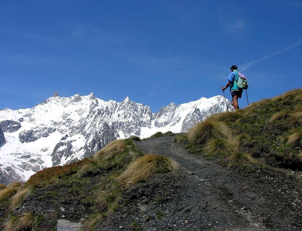
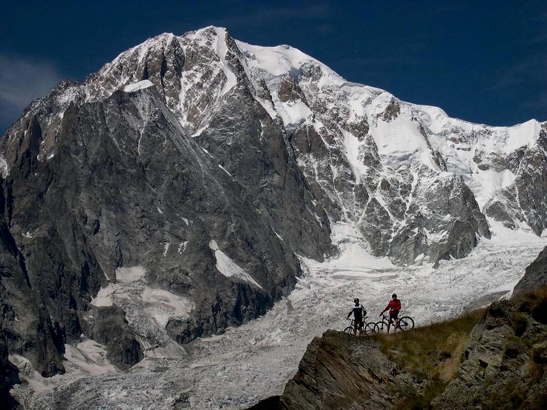
![]()
Mont Blanc Mountain Chain from Mont de la Saxe, by Antonio
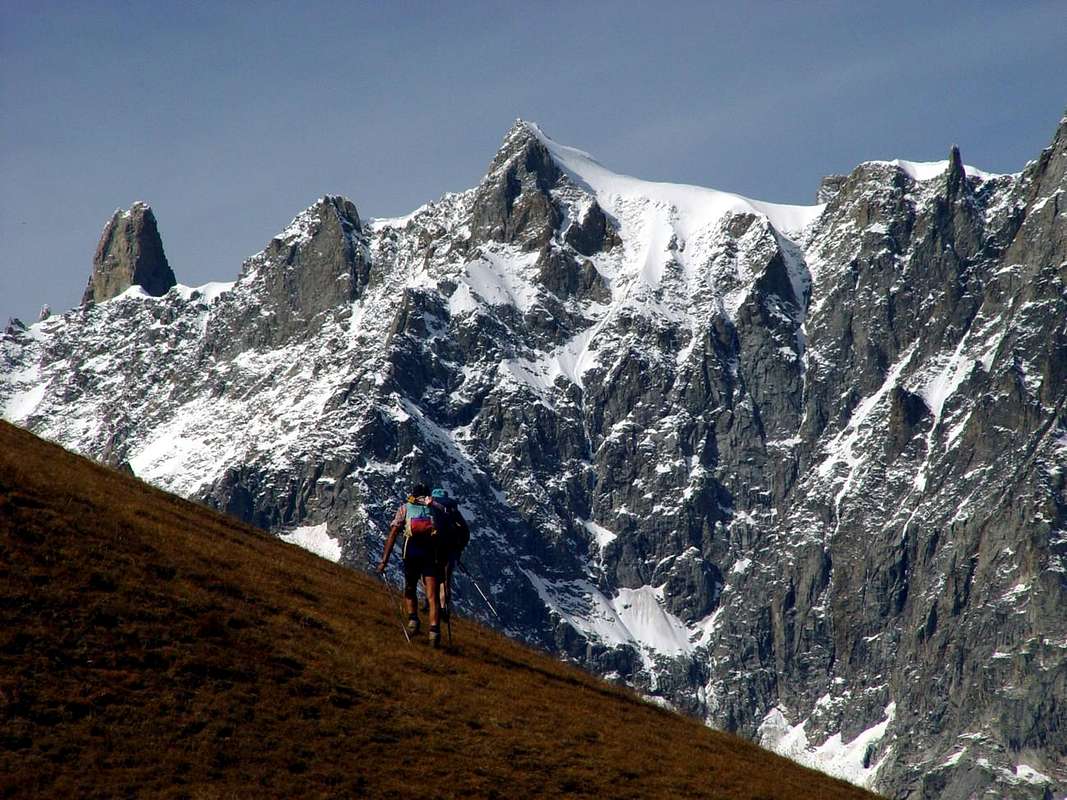
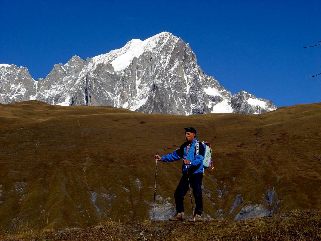
![]()
Crossing the various summits of Mont de la Saxe towards Giorgio Bertone Refuge, by emilius
![]()
"Mons Captivus" or Mont Chétif from Mont de la Saxe or North-northeast, by marco87
![]()
To the right "Mons Captivus" and Mont de la Saxe from Lex Blanche Vallon or West, by livioz
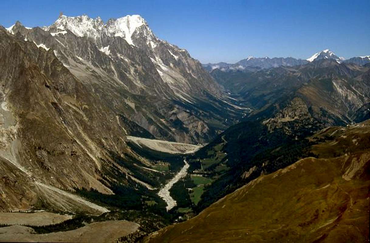
![]()
At beginning of Mont de la Saxe towards Southeastern Mont Blanc (4.811m), by livioz
At beginning of trail towards Giorgio Bertone Refuge at Mont de la Saxe, by Emilio Bertona aka emilius
A) - From Courmayeur-la Palud (1.370m) to subsequent parking (1.412m; in Northwest fork to Velà Chapy Hamlet (1.467m), below Dent de Jetoula (3.306m); leaving left the last same, continue Northeast with Regional Road and towards Montitaz (1.550m), Planpincieux (1.593m) Hamlets. From the alternative nearby Planpincieux-Camping Grandes Jorasses, small bridge in altitude around 1.600 meters before Pont small Village (1.606m) with dirt road, path concomitant, to Leuchey Dèsott or Lower Pasture (1.929m); from this, always path Alta Via n° 1, in short time reached Leuchey Damon or Upper. Continue, always Southeast through a long diagonal below Mont de la Saxe and progressively tourning more in East on much steep slopes to Giorgio Bertone Refuge (1.946m; E/F; 1h'20/1h'40), near Praz de la Saxe Alp (1.991m) at the end of Testa Bernarda (2.534m) and various Summits of Mont de la Saxe (2.403m, 2.333m, 2.348m, 2.311m, 2.251m, 2.227m) South-Southwestern watershed. Descent Variant: from shelter (splendid views to Mont Blanc) descent possibility, same path, in Val Sapin, Villair Hamlet.
![]()
Arriving from Planpincieux in Val Ferret, by Antonio
A) - Da Courmayeur-la Palud (1.370m) verso il successivo parcheggio (1.412 m; a Nordovest bivio per il Villaggetto di Velà Chapy (1.467 m), sotto la Dent de Jetoula 3.306 m); abbandonando sulla sinistra il medesimo, continuare invece verso Nordest tramite la Strada Regional verso quelli di Montitaz (1.550 m) e Planpincieux (1.593 m). Dall'alternativa nelle vicinanze di Planpincieux-Camping Grandes Jorasses al ponticello a quota 1.600 metri circa giusto prima del Villaggetto di Pont (1.606 m) tramite la poderale, concomitante al sentiero, verso l'Alpe di Leuchey Dèsott od Inferiore (1.929 m). Da questa, sempre sul sentiero Alta Via n° 1, in breve si raggiunge quella di Leuchey Damon o superiore. Continuare, sempre in Sudest tramite un lungo diagonale al di sotto del Mont de la Saxe e girando progressivamente sempre più verso Oriente con salita più ripida raggiungere il Rifugio Giorgio Bertone (1.946 m; E/F; 1h'10/1h'20), presso l'Alpe Praz de la Saxe (1.991 m) al termine della Testa Bernarda (2.534 m) nonché delle varie elevazioni del Mont de la Saxe (2.403 m, 2.333 m, 2.348 m, 2.311 m, 2.251 m, 2.227 m), posite sullo spartiacque di Sud-sudovest. Variante in discesa: dal rifugio (splendide vedute sul Monte Bianco) possibilità di scendere, stesso sentiero, in Val Sapin donde alla Frazione del Villair sopra Courmayeur.
Questa Cima fà parte del piccolo Sottogruppo della Grande Rochére (3.326 m), anche se in realtà appartiene, come estrema propaggine di Sudovest, alla continuazione dello spartiacque che dal Grand Golliaz 3.237 m), più a Settentrione, scende verso Mezzogiorno dividendo la Val Ferret (Ovest) da quelle del Gran San Bernardo, Planaval e Sapin. Questa montagna, molto frequentata per la sua facilità, era esplorata, conosciuta e salita fino dal tempo dei Romani che sul suo lato Orientale avevano scoperto una miniera di galena argentifera chiamata "Trou des Romains", ovvero "Buco dei Romani". Sul suo versante Meridionale termina con un'imponente parete rocciosa sulla quale son state tracciate diverse vie d'arrampicata. Nel giorno di Ferragosto durante la "Festa delle Guide Alpine" nell'intera Valle di Aosta vengono eseguite delle esercitazioni dimostrative percorrendo le medesime da parte delle Guide di Montagna per il diletto della numerosa gente, che può osservare da sotto nei pressi della SS.26 per Courmayeur. Grandiose vedute sull'intera Catena del Monte Bianco ed in particolare, in fronte, sulle Gr. Jorasses, che mostrano le loro belle Creste di Tronchey, Prà Sec e "des Hirondelles".
Toponymic Curiosities & Other
In Val Sapin "Trou des Romains", meaning "Hole or Mine Romans" that the gold extracted here by calling the same "Aurifodinae" with abundant fields and to Mont Chétif or "Mons Captivus" that de la Saxe; in the latter, he is known locally as "Borne de la Fée or Cave of the Fairy", actually was mined silver galena rich in lead to 60/%. The inlets are still at an altitude of 1.800 meters around above the Alp Chapy, but the tunnels are somewhat unsafe because of quite remarkable water seepage and landslides.
In Val Sapin "Trou des Romains", cioé "Buco o Miniera dei Romani" che qui estraevan l'oro chiamandola "Aurifodinae" con abbondanti giacimenti sia al Mont Chétif o "Mons Captivus" che al Mont de la Saxe; in quest'ultimo, conosciuto localmente come "Borne de la Fée o Grotta della Fata", in realtà s'estraeva galena argentifera ricca di piombo al 60/%. Gli imbocchi esistono tuttora a 1.800 metri sopra l'Alpe Chapy, ma le gallerie son pericolanti a causa delle notevoli infiltrazioni d'acqua e frequenti cedimenti.

Toponymically talking: but if the Mont Chétif is the "Mons Captivus", what is the Mont de la Saxe? The radical "Sax" leads us to inevitably rock, stone, which is the counterpart in the Celtic "Berrio or Berio" (see Berrio Blanc to the Little St. Bernard, Mont-de-Berio, Berrio Government, Berrio de la Bosse, Alp and Col Berrier in Valpelline etc.). So stony mountain, such as the Great Sassière and the Col of the Sachère in Valgrisenche or Aiguille des Leisache, Leisasses and still Sasses to the Great St. Bernard and the famous Sass Maor into the Pale of San Martino in Dolomites. In Leisache the name is attached to "Lex or Lé", ie sheet or fine rocky slab, generally smooth, shiny or wet, as the Vallon, Aiguille and Col of the Lex Blanche in Val Veny or Aiguille de Bonalex or Bonalé between Vallon Planavalle and Val Ferret. So the Mont de la Saxe is the mountain of stone or, better, the mount of the quarry from which, most likely, were extracted the smooth and flat slabs of stone for the construction of roofs and other civil works.
Toponomasticamente parlando: ma se il Mont Chétif é il "Mons Captivus", che cos'é il Mont de la Saxe? Il radicale "Sax" ci conduce inevitabilmente a sasso, pietra, che trova l'omologa parola nel celtico "Berrio o Berio" (vedi Berrio Blanc al Piccolo San Bernardo, Mont-de-Berio, Berrio di Governo, Berrio de la Bosse, Alpe e Col Berrier in Valpelline ecc.). Quindi monte sassoso, come la Grande Sassière ed il Colle della Sachère in Valgrisenche oppure Aiguille des Leisache, Leisasses ed ancora Sasses al Gran San Bernardo e Sass Maor nelle Pale di San Martino in Dolomiti. In Leisache il toponimo viene allegato a "Lex o Lé", cioè lastra, generalmente liscia, lucente oppure bagnata, come per il Vallone, Aiguille e Colle della Lex Blanche in Val Vèny oppure Aiguille de Bonalex o Bonalé tra il Vallone di Planavalle e la Val Ferret. Quindi il nostro é il monte della pietra o, meglio, il monte della cava dal quale, molto probabilmente, venivano estratte le levigate e piatte lastre di pietra per la costruzione dei tetti ed altre opere civili.
Getting There
BY CAR:
- From TORINO, MILANO, etc: Motorway A5. Exit at IVREA or Quincinetto (PIEDMONT).
- From IVREA Town: in West to Pont Saint Martin, Donnas, Bard, Donnas, Saint Vincent, Chatillon, Nus, Quart, Aosta, Sarre, Saint Pierre, Villeneuve, Arvier, Avise, Morgex and to Pré Saint Didier, Courmayeur Municipalities. From Courmayeur Resort: in East to Pré Saint Didier and Morgex Municipalities.
- From Courmayeur towards Val Ferret and Val Sapin From Courmayeur-la Palud (1.370m), towards Montitaz, Planpincieux (1.593m) Villages, Tronchey (1.620m), Praz Sec du Milieu, Lavachey (1.640m), Arnouva Dèsot (1.769m) Villages, through Municipal Road, to Malatrà Vallon and Walter Bonatti Refuge. Also from Arp Nouva to Elena Refuge, through dirt road on valley floor; or from the fork after Planpincieux, small bridge, towards Leuchey Dèsott, Damon Pastures to Mont de la Saxe Hump/Giorgio Bertone Refuge. From Courmayeur-Villair Dessus (1.282m), with Municipal Road and through dirt road to fork 1.470 meters and path to Refuge Bertone in Val Sapin.
- From FRANCE: through the Mont Blanc Tunnel to Entrèves-crossroads to Vény/Ferret Valleys - Mountain Guides of Courmayeur - La Saxe Rock Gym - Courmayeur. By Little Saint Bernard Pass, closed since November until half May to La Thuile Valley - Pré Saint Didier - Courmayeur. It is not necessary to take Motorway A5: you can drive on SS.26, in the direction of AOSTA - IVREA - TURIN.
BY PLANE:
- Aeroporto "Corrado Gex" Saint Christophe (Aosta).
Approaches & Routes
 |
 |
 |
 |
 |
By Val Ferret

Dalla Val Ferret
B) - Approach from Courmayeur-Villair towards Val Sapin: from Courmayeur to Villair Dessus Fraction with Regional Road (at the end signal no transit); through the path n° 42 to Refuge Giorgio Bertone, on woodes-rocky promontory at the beginning of Mount de la Saxe easily walked toward North. In descent, to Northwest, with path n° 3/TMB/Haute Route n° 1 in Northwest to Ferret Valley, lower part nearby Planpincieux (E/F; 1h'45/2h'15 in ascent; 1h'10 in descent; 3h'00/3h'30 for complete traverse).
![]()
Crossing North/South from Testa Bernarda, by emilius
C) - Route from Tsapy or Chapy Hamlet (1.635m) towards Sapin Hill 2.435m and traverse to the South by Testa Bernarda (2.534m): from Tsapy Village, collocated at the center of the valley and at the end of the private dirt road, leaving to the North the old route that runs along the bottom of the valley along the Torrent de Tsapy then navigate to the Northeast to the hill, climb decidedly to the East via the trail n° 43/44, which quickly reaches the Pasture of Freydevaz (1.739m). From here with sharp bends and semi circular path towards the Northeast to the alternative 2.962 meters, just before the Torrent de Currù in the adjacent vallon. Discarded in South deviation, that by the trail n° 43A leads to Alpages La Suche (1.810m), just after you reach the torrent. From this you leave on the right (East) the deviation with the trail n° 44 that leads to Liconi Hill and namesake Lake (2.674m, 2.555m), continuing, by means of a short descent, the path followed up to here which comes in a short time the Alp of Currù (1.964m); from here a long diagonal to the North, dominating from the high the vallon, easily leads to the hill by a long series of hairpin bends (E/F; 2h'15/2h'30). Variant with ancient route on valley floor: from Tsapy, where both the private dirt road that the concomitant trail n° 38, ends, continue in the same direction, but with a smaller path and not numbered, going for a short time along the shore hydrographic right of the Torrent de Sapin for then wade the same and continue on the other side until the altitude 1.732 meters, where you will return with a new ford to the West. From this point the trail, always going up next to the same torrent, bends most at Northwest reaching the altitude of 2.164 meters, where it ends; reach through grassy slopes-detrital subsequent to altitude 2.223 meters at two branches that give rise to the creek and, after crossing a small secondary vallon toward the Northeast, always using the same type of ground in a short time to reach the Sapin Hill (2.435m; EE/F; 1h'45/2h'15).
B) - Avvicinamento da Courmayeur-Villair: da Courmayeur con la Strada Regionale per la Frazione del Villair Dessus (al termine segnale di divieto); tramite il sentiero n° 42 al Rifugio Giorgio Bertone, sul promontorio boschivo-roccioso all'inizio della cresta del Mont de la Saxe (facile verso Nord). In discesa, a Nordovest, con quello n° 3/TMB/Haute Route n° 1 verso Nordovest in direzione della Val Ferret, parte inferiore presso Planpincieux (E/F; 1h'45/2h'15 in salita; 1h'10 in discesa; 3h'00/3h'30 per l'attraversata).
With crossings
D) - Val Sapin towards Giorgio Bertone Refuge at Alp de la Saxe and traverse towards the Sapin Hill with return to the Alp: from the junction 1.470 meters before lthe small Village of la Trappe with the path-mule track n° 42/TMB to the West or from the next village (1.505m; beautiful fountain on the dirt road) through a path in the Southwest diagonally unnumbered, which is linked to the previous one at the junction 1.547 meters, continue the trail through numerous and steep hairpin bends on the muletrack that crosses the beautiful forest of larch and fir trees reaching altidudine of 1.711 meters, at some rocky bands. Coming out of the forest in the area more open and leaving on the left a viewpoint, from this point the trail, through path at first more in the Southwest then to the Northwest, reaches a broad and grassy hump where the shelter is located, whence the previous itinerary will continue on the watershed crossing all the Summits to the Col Sapin and then the descent to the Village Tsapy with one of the two options described above (E/F; 1h'15/1h'30; 2h'15/2h'30 for complete crossing towards Col Tsapy; 5h'15/5h'30 to the Tsapy Village).
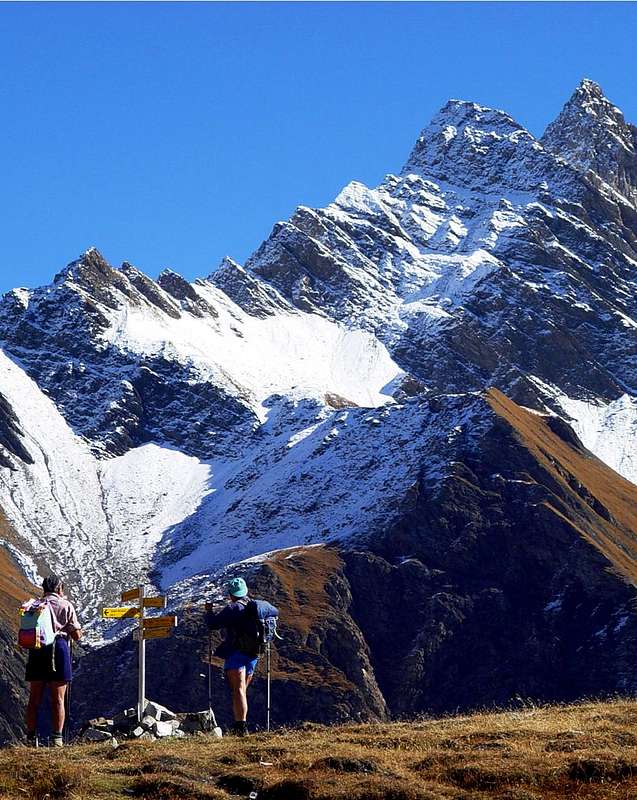
![]()
Sapin Hill towards Grande Rochère, by emilius
C) - Via dal Villaggio di Tsapy o Chapy verso il Col Sapin e traversata a Sud dalla Testa Bernarda (2.534 m): da Tsapy (1.635 m) al termine della poderale, lasciata sulla sinistra la vecchia via percorrente il fondo del vallone lungo il Torrent de Tsapy per poi traversare verso Nordest al colle, salire invece decisamente ad Oriente tramite il sentiero n° 43/44, che in breve tempo raggiunge l'Alpeggio di Freydevaz (1.739 m). Da qui con stretti tornanti e percorso semicircolare verso Nordest si raggiunge il bivio 2.962 metri, poco prima del Torrent de Currù nell'adiacente vallone. Scartata a Sud la deviazione, che tramite il sentiero n° 43A conduce all'Alpe La Suche (1.810 m), subito dopo si raggiunge il torrente. Da questo si abbandona sulla destra (Est) la deviazione che con il sentiero n° 44 porta al Colle di Liconi ed omonimo Lago (2.674 m, 2.555 m), proseguendo, per mezzo d'una corta discesa, col sentiero sin qui seguito, che arriva in breve tempo all'Alpe del Currù (1.964 m); da qui un lungo diagonale a Settentrione, dominando dall'alto il vallone, conduce facilmente al colle per mezzo di una numerosa serie di stretti tornantini (2.435 m; E/F; 2h'15/2h'30). Variante sul fondovalle: da Tsapy, al termine della poderale e del concomitante sentiero n° 38, si prosegue sempre nella stessa direzione, ma con un sentiero più piccolo e non numerato, salendo per breve tempo lungo la sponda idrografica destra del Torrent de Sapin per poi guadare lo stesso e proseguire sulla sponda opposta fino all'altitudine 1.732 metri, dove si ritorna con un nuovo guado ad Occidente. Da questo punto il sentiero, salendo sempre affianco al torrente medesimo, flette maggiormente a Nordovest raggiungendo l'altitudine di 2.164 metri, dove termina; pervenire per mezzo di pendii erboso-detritici alla successiva di 2.223 metri presso due rami originanti il torrente e, dopo aver attraversato verso Nordest un valloncello secondario, sempre tramite stessa tipologia di terreno, in breve tempo raggiungere il Col Sapin (2.435 m; EE/F; 1h'45/2h'15).
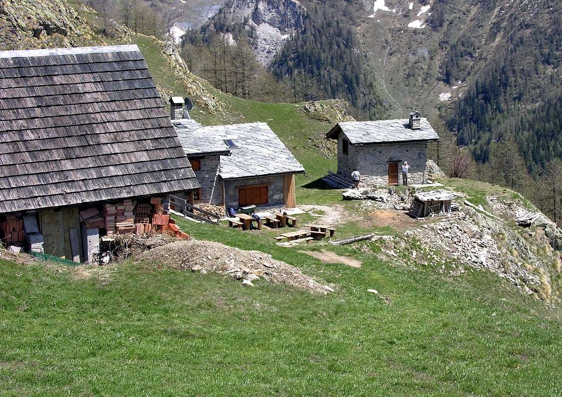
![]()
Giorgio Bertone Refuge (1.946m)) near Praz Alp at Mont de la Saxe, by Antonio
Con traversate
D) - Dalla Val Sapin al Rifugio Giorgio Bertone all'Alpe de la Saxe e traversata verso il Col Sapin con rientro all'Alpe: dal bivio 1.470 metri prima di la Trappe con il sentiero-mulattiera n° 42/TMB verso Occidente o dal successivo villaggio (1.505 m; bella fontana sulla strada) tramite un sentierino a Sudovest in diagonale non numerato, che si ricollega al precedente al bivio 1.547 metri, proseguire con percorso tramite numerosi ripidi tornanti sulla mulattiera che attraversa la splendida foresta di larici ed abeti raggiungendo l'altidudine di 1.711 metri, presso alcune fasce rocciose. Procedendo su terreno gradualmente sempre più aperto e lasciando sulla sinistra un punto panoramico, da questo punto la mulattiera, tramite percorso dapprima maggiormente a Sudovest poi a Nordovest, raggiunge un dosso ampio ed erboso ove é collocato il Rifugio Giorgio Bertone, donde con il precedente itinerario si continua la traversata di tutte le Sommità sino al Col Sapin per poi effettuare la discesa al Villaggio di Tsapy con una delle due possibilità di cui sopra (E/F; 1h'15/1h'30; 2h'15/2h'30 per la completa traversata al Col Tsapy; 5h'15/5h'30 sino al Villaggio di Tsapy).
Difficulty & Equipment
This route can be considered E/F or EE/F+ (Experts Hikers) in winter (even by snowshoes or Ski).L'itinerario è da classificare in E/F oppure EE/F+ (Escursionisti Esperti) in inverno (anche tramite Racchette da neve od in Scialpinismo).
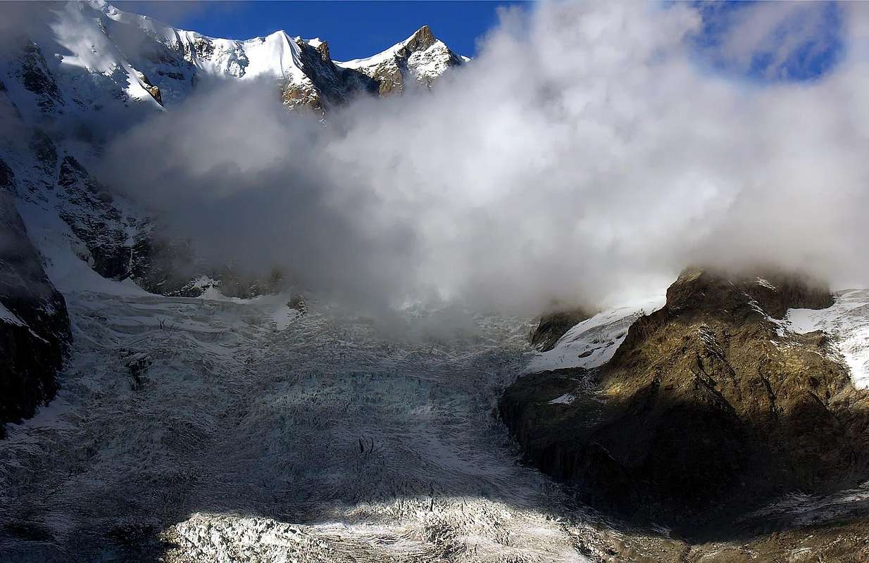
![]()
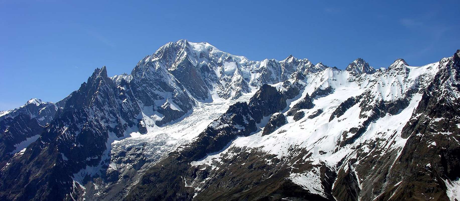
Maudit & Brenva Glacier from Mont de la Saxe, by Antonio
Hiking gear, in winter as for Ski-Mountaineering or with Snowshoes
Da Escursionismo, in inverno da Scialpinismo o con Racchette da neve.
Camping
Remember that free camping is forbidden (except for emergency reasons, over 2.500m, from darkness until dawn).Mountain Conditions
- You can get meteo information at the official site of the Regione Valle d'Aosta:
- Valle d'Aosta Meteo
Books and Maps
- "Guida delle Alpi Occidentali", di Giovanni Bobba e Luigi Vaccarone C.A.I. Sezione di Torino Volume II (parte II), 25 Maggio 1896.
- "Guida dei Monti d'Italia-Alpi Pennine" (Vol. I°) di Gino Buscaini-Club Alpino Italiano/Turing Club Italiano, Luglio 1971 (in Italian).
- "Guida della Regione Autonoma Valle d'Aosta" di Mario Aldrovandi; Ed. S.P.E. di Carlo Fanton, Torino 1964.
- "I Rifugi della Valle d'Aosta" di Stefano Ardito, Ed. Guide iter, Febbraio 2003.
- "A piedi in Valle d'Aosta" (Vol. 1), di Stefano Ardito, Ed. Guide iter, Giugno 2003.
- "Diari Alpinistici" di Osvaldo Cardellina e Indice Generale accompagnato da Schedario Relazioni Ascensioni 1964-2019 (inediti).
 |
 |
 |
 |
- Kompass "Massiccio del Monte Bianco Valle d'Aosta Sentieri e Rifugi" Carta turistica 1:50.000.
- I.G.C. Istituto Geografico Centrale Torino "Massiccio del Monte Bianco" (n° 4), Torino, 1998 1:50.000.
- I.G.C. Istituto Geografico Centrale Torino "Monte Bianco-Courmayeur-Chamonix-La Thuile" (n° 107), 1:25.000.
- L’Escursionista "Monte Bianco Courmayeur" (n° 1) Edizioni Rimini 2004 1:25.000.
- L'Escursionista "Gran San Bernardo Ollomont" Ed. Rimini ( n° 5) 1: 25.000.
- Edizioni Tabacco "Mont Blanc" Udine, 1978 1:50.000.
- Studio F.M.B. Bologna 1988 "Monte Bianco-Mont Blanc" 1:50.000.
Important Information
- REGIONE AUTONOMA VALLE D'AOSTA the official site.
- FONDAZIONE MONTAGNA SICURA Villa Cameron, località Villard de la Palud n° 1 Courmayeur (AO) Tel: 39 0165 897602 - Fax: 39 0165 897647.
- Società Guide Alpine Courmayeur www.Guidecourmayeur.com - Strada Villair n° 2 - 11013 Courmayeur (Aosta) Italy - Tel. +390165842064 Fax. +390165842357 - P.I. 01022640070
- A.I.NE.VA. (Associazione Interregionale Neve e Valanghe).
Useful numbers
- Protezione Civile Valdostana località Aeroporto n° 7/A Saint Christophe (Ao) Tel. 0165-238222.
- Bollettino Meteo (weather info) Tel. 0165-44113.
- Unità Operativa di Soccorso Sanitario Tel. 118.