


-
 2550 Hits
-
 80.49% Score
-
 12 Votes
|
|
Mountain/Rock |
|---|---|
|
|
45.62400°N / 7.23035°E |
|
|
Mountaineering |
|
|
Summer, Fall |
|
|
10410 ft / 3173 m |
|
|
Note
La montagna chiama i suoi figli, ed essi rispondono fedelmente al suo appello… Osvaldo Cardellina, Diario alpinistico, 1964-65 Page texts: @ OsvaldoCardellina "Osva", passed away on May 2, 2022. Page owners: Christian Cardellina e Osvaldo Cardellina. Any updates from September 12, 2022: Antonio Giani, page administrator, friend and climbing companion. Testi della pagina: @ OsvaldoCardellina "Osva", scomparso il 2 maggio 2022. Proprietari pagina: Christian Cardellina e Osvaldo Cardellina. Eventuali aggiornamenti dal 12 settembre 2022: Antonio Giani, amministratore della pagina, amico e compagno di salite. |
Overview
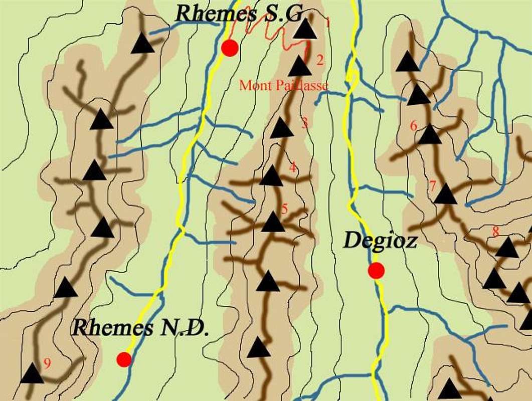
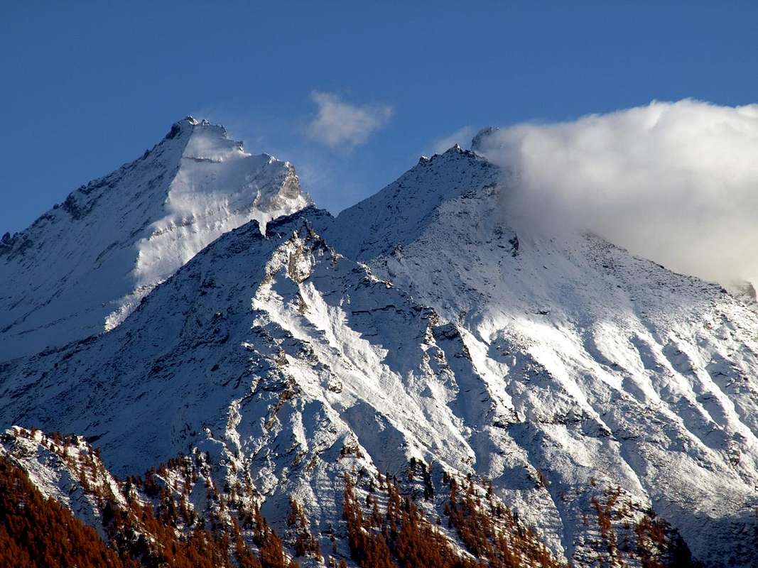
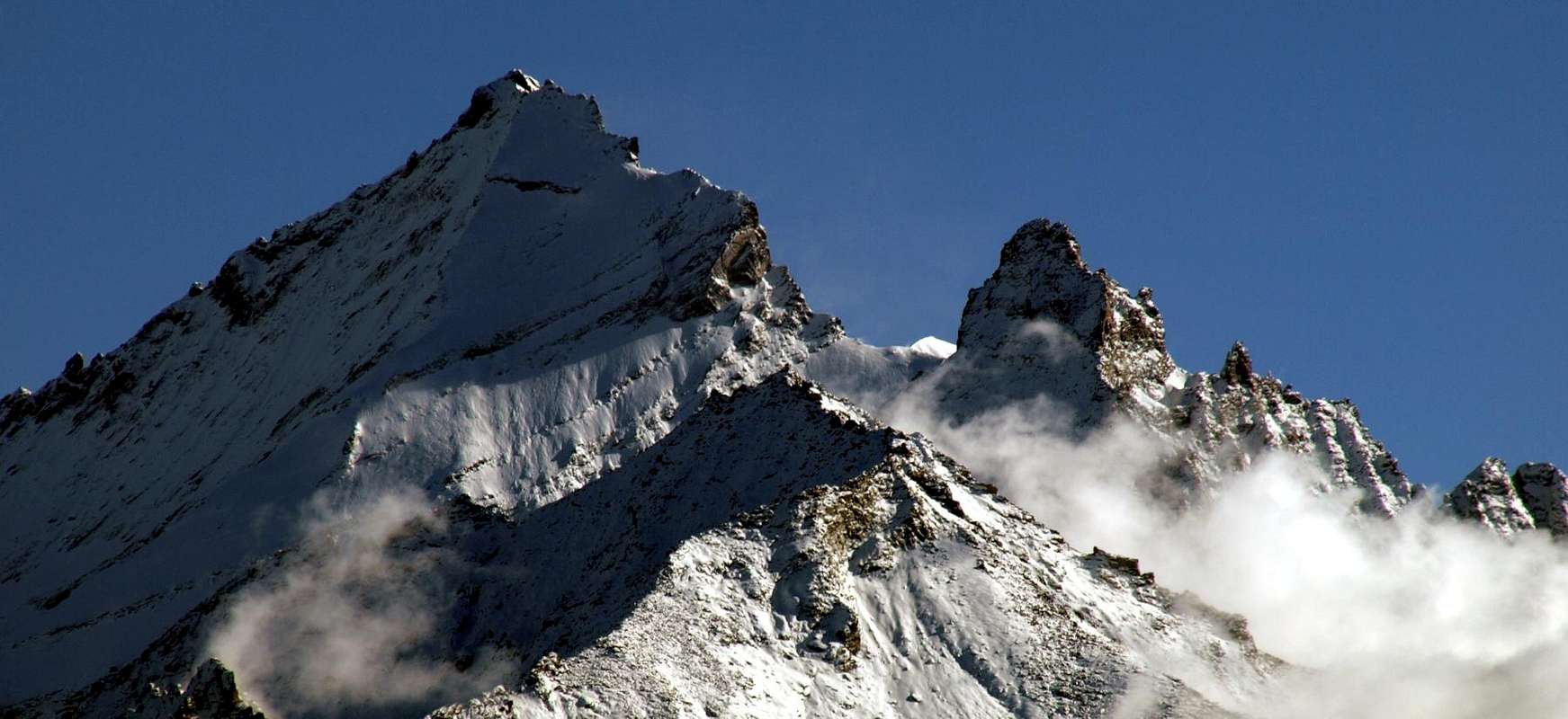
Mont Favret or Mont Ruje? All two names. From the famous Grivola (3.969m). From this comes down to the North-northwest a bumpy ridge, after forming the Grand Nomenon (3.488m), he reaches the Col Charbonnière (2.916m) between the Vallons of Nomenon (to the East) before going to "die" above the fresh Torrent Grand'Eyvia, or the Great Water and Molère/Leysettaz (West). The Mont Favret so dominates the underlying Villages of Vieyes in the first or Cogne's side, while the Hill of the Charbonnière (2.916m) sends his impetuous Western slopes towards Valsavarenche and then disappear into the underlying Vallon amongst the three Fraction of Fenille, Bois de Clin and Rovenaud. A Summit made of two distinct Tops that has given rise to some confusion, so also remained due to the poor attendance of the application and reached also by poachers in the past more than by mountaineers. Likewise for the next Punta Valletta (2.973m), while the furthest Northern reaches with Mont Poignon (1.568m) above Pondel Village and Villeneuve Municipality recorded a higher number of steps thanks to a good path following to be easier and less steep grassy slopes in the middle of a dense forest. In the upper parts instead remains a mystery with a created confusion, as often happens, just by Cartographers who already in the extension of the "Charter C.A.I." 1880 indicates the Antecima Southeast (3.167m) as well as the Mont Favret, while the Northwest, the highest, is named as Mont Ruje (3.174m); for against the measurements and evaluations by the I.G.M. 1931 cut the Gordian knot not indicating both place names and even the relative altitudes. The fault is partly passed on to the next "Card Giuseppe-Alessio Nebbia" 1960, Scale 1:100.000 and edited by "Art Workshop of Courmayeur" where reappears the Favret name, while the placement is put, not to do harm and wrong to no one, between the two Summit. They will have to wait for the "modern Maps" and their measurements for to unravel the "snag". But in the meantime this mountain is falling into oblivion and it is also vanished the name of "Ruje", conserved, perhaps, only in the memory and hearts of some old, nostalgic hunter .....
![]()
![]()
![]()
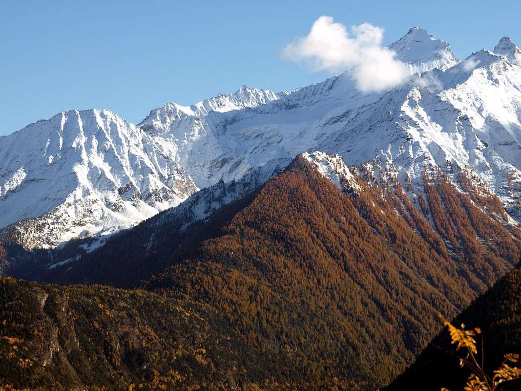
Mont Favret oppure Mont Ruje? Entrambi i toponimi. Dalla famosa Grivola (3.969 m) si dispiega verso Settentrione il lungo spartiacque, divisorio la Valle di Cogne da quella attigua di Valsavarenche, che raggiunge il Grand Nomenon (3.488 m). Da questo discende verso Nord-nordovest una cresta accidentata raggiungente il Col Charbonnière tra i Valloni di Nomenon (ad Est) prima d'andare a "morire" sopral Torrente Grand'Eyvia, cioé la Grande Acqua e di Molère/Leysettaz (Ovest). Il Mont Favret quindi domina i sottostanti Villaggi di Vieyes sul lato di Cogne, mentre dal Colle di Charbonnière (2.916 m) vertiginosamente si indirizzano al Torrente Savara nella Valsavarenche vertiginosi pendii in direzione dei tre sottostanti Villaggi di Fenille, Bois de Clin e Rovenaud. Una Cima formata da due distinte Sommità che ha dato adito ad un pò di confusione, rimasta tale vista anche la scarsa frequentazione alla medesima e raggiunta anche nel tempo passato più dai bracconieri che non dagli alpinisti. Così pure per la successiva Punta Valletta (2.973 m), mentre le estreme propaggini Settentrionali con il Mont-de-Poignon (1.568 m) sopra il Villaggio di Pont d'Ael o Pondel ed il sottostante Comune di Villeneuve registra un maggior numero di passaggi da parte di escursionisti grazie ad un buon sentiero segnalato e seguito da più facili e meno ripidi pendii erbosi in mezzo ad una fitta foresta. Al di sopra invece permane un certo mistero con una confusione creata, come spesso succede, proprio dai Cartografi che già nell'estensione della "Carta C.A.I." 1880 indica nell'Antecima Sudest (3.167 m) il Mont Favret, mentre quella Nordovest, la più elevata, viene denominata come Mont Ruje (3.174 m); per contro le misurazioni e valutazioni dell'I.G.M. 1931 taglian la testa al toro non indicando entrambi e neppur relative quote. L'errore viene in parte tramandato anche nella successiva "Carta Giuseppe-Alessio Nebbia" 1960, in Scala 1:100.000 ed editata dalla "Bottega d'Arte di Courmayeur", dove riappare il toponimo di Favret, mentre il posizionamento viene inserito, onde non far torto a nessuno, tra le due Sommità. Si dovranno attendere le "moderne Carte" e misurazioni per dipanare il "busillis". Nel frattempo la montagna é piombata nel total dimenticatoio e con essa é scomparso anche il nome di "Ruje", rimasto, forse, esclusivamente nella memoria e nel cuor di qualche vecchio, nostalgico cacciador ....
First Ascents
- First on Summit: unknown.
- In Winter: unknown.
- Southwest Slope and West-southwest Crest: Georges Yeld and Guide Beniamino Pession; August 06th, 1910, in ascent with crossing from Col Charbonnière.
- Northwest Face: Osvaldo Cardellina and Marco Cossard; August 03th, 1980, in ascent from Fenille Village through Arolla Cabin.
- Northern Ridg Face: unknown.
- North-northeast Face: Giovanni Bobba and Luigi Vaccarone ?, from Vieyes through Leutta, Arpissonet and Arpisson Alpages.
- East Face and South Crest: Georges Yeld with Valtournanche Guide Beniamino Pession; August 06th, 1910, in descent towards Gran Nomenon Vallon.

Getting There
BY CAR:
- From TORINO, MILANO, etc: Motorway A5. Exit at IVREA or Quincinetto (PIEDMONT) also Pont Saint Martin, Verrès, Châtillon, AOSTA East (Nus) and West (Aymavilles) Municipalities.
- From Aymavilles towards Cogne Valley From Aymavilles (646m) towards Cogne Valley with Regional Main Road: Vieyes (1.132m) Fraction; continue to Silvenoire (1.331m) Village, by small path in Nomenon Vallon up to the Mario Gontier Bivouac (2.323m) at Grand Nomenon Alp and with traces in terminal parts towards Trajo, Belleface and Charbonnière Passes. From Aymavilles to Villeneuve and from this to Valsavarenche Valley From Aymavilles (646m) towards Villeneuve (670m) through Regional Road in South of Dora Baltea. From Villeneuve, passing Introd Common, to Savarenche Valley up to the Dégioz-Valsavarenche Commune(1.541m). It is not necessary to take Motorway A5: you can drive on SS.26, in the direction of AOSTA - IVREA - TURIN.
Approaches & Routes
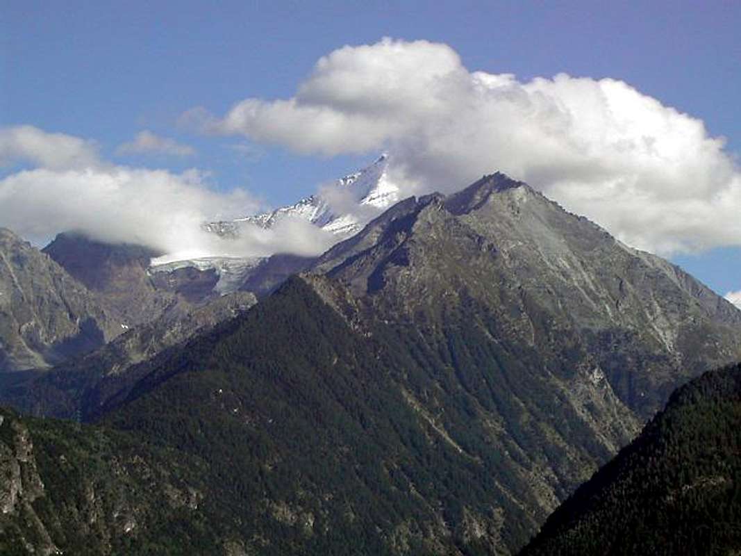
This mountain has a topography seemingly easy but actually quite complex. Placed on South-southeast-North axis and between the Hills of Belleface and Charbonnière (3.095m, 2.916m) it has only two sides in practice. The first is aimed at the Cogne Valley to the Northeast over the Valley of the Grand Nomenon above Vieyes Hamlet (1.132m). It is divided into two parts by a small buttress that reaches the Col Fenêtre (2.843m). The second is directed towards Valsavarenche and, in turn, is separated into two sections by a clear ridge facing West-southwest adapted to separate the Northwest side, projected above the Cabin P.N.G.P. Arolla (2.218m) and placed between the Torrents Mollère and Leysettaz, from the Southwest over the Alpe Maisoncles (1.861m) between the Torrents Reseun and Maisoncles. Both are incised by steep parallel couloirs on which we do not recommend the climb, as the face of Cogne, more uniform and less high but formed by moraines and steep, dangerous grassy slopes. Better does the path of the crests and between these is preferable that on the Northern reachable from the Casotto Arolla (in turn accessible by the trail n° 14 starting from the exit of the gallery-tunnel immediately previous Fenille Hamlet (1.292m, 1.304m), up at the little saddle 2.781 meters, located between Punta Valletta and the Mont Favret. Or crossing on the first with bypass, always through the same path n° 14 first in the North and then West reaching the Col de Becca Plana (2.256m). It is also possible, but with more long route and varying the start with departure from Champleval Dessus (1.057m) above the Common of Villeneuve, go up with the trail n° 1 that climbed the Mont-de-Poignon (1.567m), reaches the Casotto P.N.G.P. Petit Poignon (1.559m) at the homonymous pasture (1.540m). From this reach, covering South-southeast the entire watershed through the dense forest, first towards the Becca Plana (2.296m) and then Punta Valletta whence to the previous routes (EEA; F/F+; 4h'00 from Maisoncles; 5h'30 from Champleval).
![]()
![]()
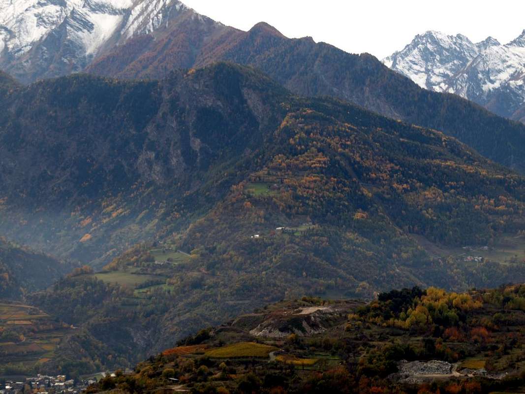
Questa montagna presenta una topografia apparentemente facile ma in realtà abbastanza complessa. Disposta sull'asse Sud-sudest-Nord e compresa tra i Colli di Belleface e Charbonnière (3.095 m, 2.916 m) presenta in pratica esclusivamente due versanti. Il primo é rivolto a Nordest ed alla Valle di Cogne sopra il Vallone del Grand Nomenon soprastante Vieyes (1.132 m). Risulta diviso in due parti da un piccolo contrafforte che raggiunge il Col Fenêtre (2.843 m). Il secondo verso la Valsavarenche ed, a sua volta, viene separato in due settori da un evidente cresta rivolta ad Ovest-sudovest atta a separare il versante Nordovest, proiettato sopra il Casotto P.N.G.P. d'Arolla (2.218 m) e collocato tra i Torrents Mollère e Leysettaz, da quello Sudovest sopra l'Alpe Maisoncles (1.861 m) tra i Torrents Reseun e Maisoncles. Entrambi sono incisi da ripidi canaloni paralleli sui quali si sconsiglia la salita, come per il versante di Cogne, più uniforme e meno alto ma formato da morene e da ripidi e pericolosi pendii erbosi. Conviene il percorso sulle creste e tra queste risulta preferibile la Settentrionale raggiungibile dal Casotto di Arolla (a sua volta raggiungibile tramite il sentiero n° 14 con partenza dall'uscita del tunnel-galleria subito precedente al Villaggio di Fenille (1.292 m, 1.304 m), sino alla selletta 2.781 metri, posta tra Punta Valletta e Mont Favret. Oppure scavalcando la prima con aggiramento per mezzo sempre dello stesso sentiero n° 14 dapprima verso Nord e poi ad Ovest raggiungendo il Col de Becca Plana (2.256 m). Inoltre é possibile, ma con percorso più lungo e variando la partenza con inizio da Champleval Dessus (1.057 m) sopra il Comune di Villeneuve, salire con il sentiero n° 1 che, scavalcato il Mont-de-Poignon (1.567 m), raggiunge il Casotto P.N.G.P. Petit Poignon (1.559 m) presso l'omonima alpe (1.540 m). Da questo raggiungere, percorrendo a Sud-sudest l'intero spartiacque attraverso la fitta foresta, prima la Becca Plana (2296 m) ed in seguito la Punta Valletta donde agli itinerari precedenti (EEA; F/F+; 4h'00 da Maisoncles; 5h'30 da Champleval).
Difficulty & Equipment
This route can be considered EE/F+ (Experts Hikers).L'itinerario è da classificare in EE/F+ (Escursionisti Esperti).
![]()
Hiking gear.
Da Escursionismo.
Mountain Condition
- You can get meteo information at the official site of the Regione Valle d'Aosta:
- Valle d'Aosta Meteo
Books and Maps
- "Guida dei Monti d'Italia-Gran Paradiso Parco Nazionale" E. Andreis, R. Chabod, M. C. Santis, Club Alpino Italiano/Touring Club Italiano, prima Ed. 1939; seconda Ed. 1963; terza Ed. 1980.
- "Parco Nazionale del Gran Paradiso" di Stefano Ardito, Ed. Guide iter, Novembre 2001.
- "Guida delle Alpi Occidentali", di Giovanni Bobba e Luigi Vaccarone C.A.I. Sezione di Torino Volume II (parte II), 25 Maggio 1896.
- "Gran Paradiso itinerari escursionistici" di Franco Brevini, Ed. Musumeci, Luglio 1982.
 |
 |
- Kompass "Gran Paradiso Valle d'Aosta Sentieri e Rifugi" Carta Turistica 1:50.000.
- Enrico Editore Ivrea-Aosta "Gruppo del Gran Paradiso" 1:50.000.
- L'Escursionista "Valle di Cogne Carta dei Sentieri" 1:25.000.
- L'Escursionista "Tour de la Vallée de Cogne Grand Paradis" 1:25.000.
- I.G.C. Istituto Geografico Centrale "Parco Nazionale del Gran Paradiso" 1:50.000.
Important Information
- REGIONE AUTONOMA VALLE D'AOSTA the official site.
- FONDAZIONE MONTAGNA SICURA Villa Cameron, località Villard de la Palud n° 1 Courmayeur (AO) Tel: 39 0165 897602 - Fax: 39 0165 897647.
- SOCIETA' GUIDE ALPINE DI COGNE Tel. 347/9473526 – 328/1373728.
- A.I.NE.VA. (Associazione Interregionale Neve e Valanghe).
- A.IA.T. Cogne Gran Paradis via Bourgeois n° 34 Tel. 0165-74040. E-mail: aiat@cogne.org
- Ezio Sport articoli sportivi - via Bourgeois n° 64 Tel. 0165-74204.
Useful numbers
- Soccorso Alpino Cogne (SAR) Tel. 3482685406.
- Protezione Civile Valdostana località Aeroporto n° 7/A Saint Christophe (Ao) Tel. 0165-238222.
- Bollettino Meteo (weather info) Tel. 0165-44113.
- Bollettino Valanghe Tel. 0165-776300.
- Unità Operativa di Soccorso Sanitario Tel. 118.