
-
 1778 Hits
-
 83.1% Score
-
 16 Votes
|
|
Mountain/Rock |
|---|---|
|
|
28.27002°N / 16.82693°W |
|
|
Hiking, Scrambling |
|
|
Spring, Fall, Winter |
|
|
2831 ft / 863 m |
|
|
Overview
Montaña de Guama 863 m
Geographically belonging to the African continent, but politically to Spain, the island of Tenerife is the largest island of the seven ones that make up the Canary archipelago. It is also the most popular and touristized and the highest, being home to the Pico del Teide, an extinct volcano that reaches an altitude of 3718 meters, the highest mountain in Spain. Tenerife is also home of other lower mountain ranges. The relief of the island is characterized, fundamentally, by three types of well-differentiated volcanic structures: the old massifs (Anaga, Teno and Adeje), the ridges (Pedro Gil, Abeque and the South or Adeje ridge) and the central building of Teide-Pico Viejo.
Montaña de Guama belongs to the fascinating and wild Teno range, located in the North-West of the island, a mountainous region which constitutes one of the most ancient geologic formations of the island.
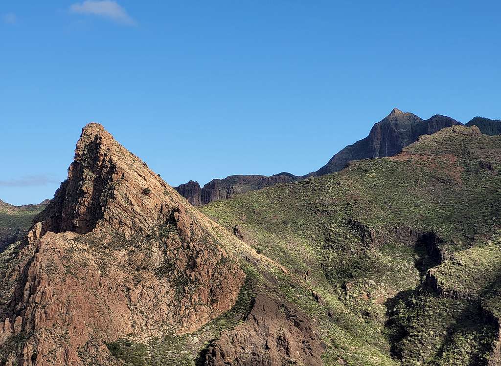
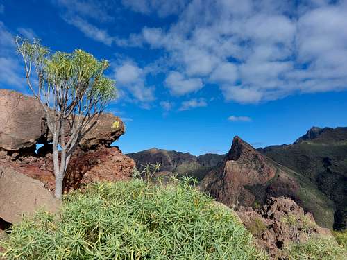
The Teno range exceeds 1000 meters by a few hundred meters, but despite its limited height it's quote a spectacular venue. It counts tremendous "barrancos", above all across the cliff named Acantilados de Los Gigantes, about 600 m drop vertically above the sea. The most famous of them is the ravine of Masca, one of the most frequented adventurous walks on the island, a fantastic labyrinth of rocks and ravines. Very close to Los Gigantes and Masca there is a classic and interesting circular route starting from the town of Tamaimo and running along the crest of the Montaña de Guama, a summit belonging to this splendid and interesting mountain range. It absolutely deserves to be climbed in reason of its superb panoramas and its particularities.
Getting There
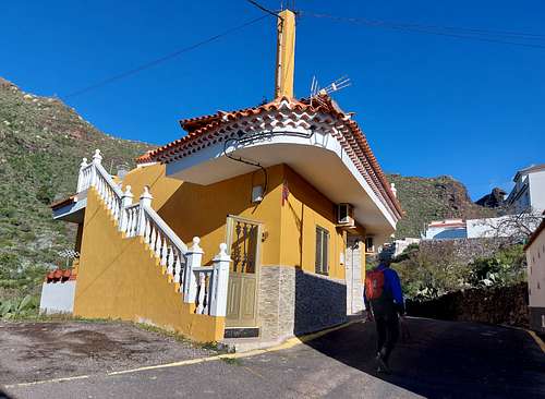
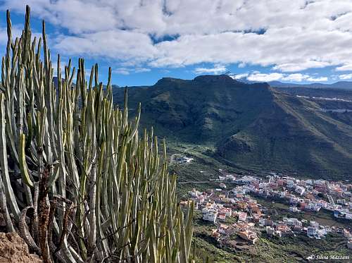
The starting point to climb is the town of Tamaimo.
- From the South
Take motorway TF1 in the direction of Santiago del Teide, before getting to Santiago del Teide, take the detour to Tamaimo, which also takes you to the Puerto de Santiago and to the Los Gigantes cliff.
- From the North
Reach the town of Santiago del Teide and here take the road TF82 in the direction of Tamaimo. Follow it for about 7 km. In Tamaimo look for the Calle El Agua. Limited parking possibilities.
Montaña de Guama loop from Tamaimo
Montaña de Guama loop from Tamaimo and El Bujero
Summit altitude: 863 m
Difficulty: EE
Difference in level: 300 m from Tamaimo
Starting point: Tamaimo
A fine and panoramic route, with the added value of an unmissable natural show...
The beginning of the itinerary is in the village of Tamaimo on Calle El Agua at an altitude of 560 m. Continue walking along Calle Agua until a house, where you turn left (signpost "Cruz de los Misioneros") and take a path between two stone walls. Soon you cross the path to Santiago del Teide. At this crossroads, proceed straight on, continuing along the good path which begins to climb up steeply. The path climbs among a beautiful vegetation of succulents reaching the crossroads below the Cruz de los Misioneros 788 m, which we climb to the right in a couple of minutes. It is a magnificent panoramic rock with a large white cross. Opposite it appears the magnificent pyramid of Risco Blanco, the Risco Verde and various mountain of the Teno Natural Park.
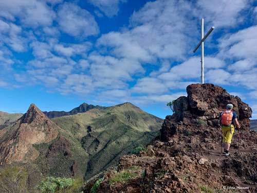
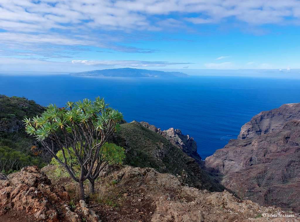
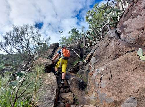
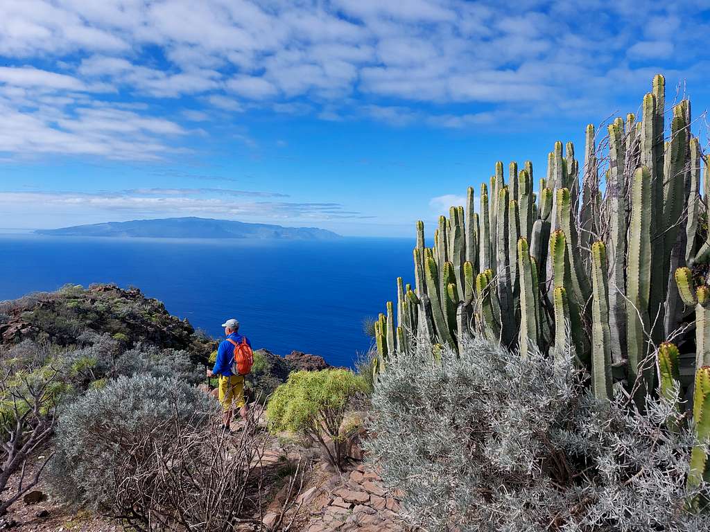
We return to the crossroads, head to left and immediately climb easily up some rocky steps on which a handrail cable has been placed, totally unnecessary. Shortly after we reach a vegetated plateau, where it appears the ocean and the island of La Gomera right in front, which is crossed briefly to get a pile of stones marking the summit of Guama 877 m.
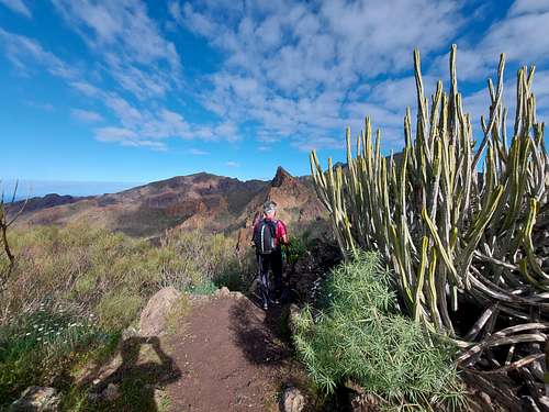
We continue along the path flattening for a while and after 10 minutes we begin the descent to the South. We arrive at a not very noticeable crossroad (just a tiny cairn), where to the right it detaches a narrow trail that will take us to the the natural rock arch of Bujero.
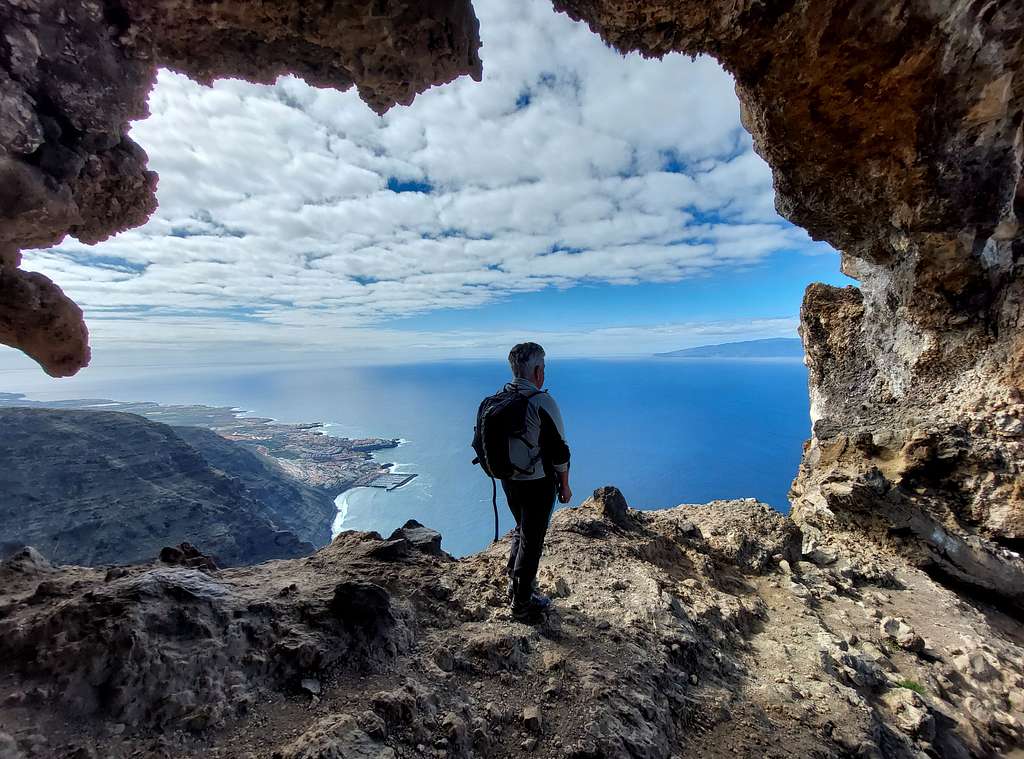
We traverse right, then we start going down the ridge through many terraces, which indicate that crops have existed on these hard slopes. After about 15 minutes we arrive at a block with a yellow arrow, where another deviation to the right traversing an aerial slope will take us to a spectacular rock arch overhanging the sea, a show not to be missed.
We retrace our steps and after getting to the second crossroads, we continue to descend along the path that will lead us to a large saddle in view of the town, the Degollada de Tejera 542 m. Here we go down, reaching the bottom of the valley and a crossroads, where we change direction and turn left following the signpost to Santiago. We go up towards Tamaimo, skirting the S face of Guama, which has some huge caves, and following up the dry bed of a ravine, until we return to the starting point in Tamaimo.
Red Tape
All the mountainous regions are protected as national or regional parks. We find the strictest rules in the Parque Nacional de las Cañadas del Teide, where almost anything is forbidden or restricted. No overnight stay, no leaving trails and paths, no pets, no plucking of flowers. There are no fees or permits needed to climb Guama.
When to Climb
All year round, but Summer may be too hot!
Accomodation
Different possibilities of accomodation in Tamaimo and Santiago del Teide
Climate and nature
Tenerife is characterized by a great variety of climates. The weather for the coastal regions significantly differs from the weather in the Cañadas del Teide which are 2000m of elevation higher. Even the other lower mountainous regions, such as the Teno chain where our mountain Guama is located, record a certain climatic difference, albeit minor, from the climate of the coast. The south of the island benefits from more hours of sunshine per year, while rainfall is higher in the north, where there is also more humidity. These factors create different landscapes. The Canarian Islands (as well as Madeira) are located in the trade wind zone. You almost always encounter North-eastern winds which carry a lot of humid air. Being forced to climb to higher altitudes this moisture condenses into clouds. This in return means that most of the time the north-eastern part of the islands is covered in clouds from altitudes of 1000m through 2000m.
The mountains themselves - being mostly of the same altitude - finally stop the clouds so that on their south-western slopes the clouds "run out". There is a great variety of microclimates that favor many different plant species. The north of the island, exposed to the action of the trade winds, is distinguished from the coastal area, with an average temperature ranging between 19°C and 23°C thanks to the influence of the sea. Between 600 and 1500 meters above sea level, the environment cools slightly and the humidity favors the cultivation of cereals and potatoes. Above 1500 meters of altitude above sea level, the air is drier and snowfalls can be recorded in winter, with temperatures that fluctuate quite a bit between day and night.
Meteo