
-
 1130 Hits
-
 83.1% Score
-
 16 Votes
|
|
Mountain/Rock |
|---|---|
|
|
28.08882°N / 16.64302°W |
|
|
Hiking, Trad Climbing, Scrambling |
|
|
Spring, Fall, Winter |
|
|
2562 ft / 781 m |
|
|
Overview
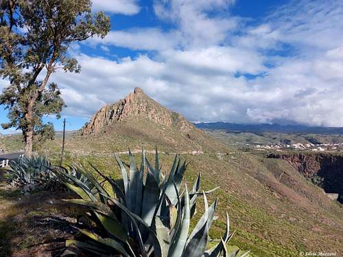
Roque de Jama 781 m
Tenerife is the largest island of the seven ones that make up the Canary archipelago and it's also the highest, being home to the Pico del Teide, an extinct volcano reaching an altitude of 3718 meters, the highest mountain in Spain. Tenerife is also home of other lower mountainous areas, located both in the Northern and Southern parts of the island. The South of Tenerife counts a handful of low summits rising to the East of the town of Adeje, belonging to one of the oldest ranges on the island, the Adeje massif, created by the volcanic activity 7 million years ago, together with the Anaga Peninsula in the north-east and Teno Plateau in the north-west of the island.
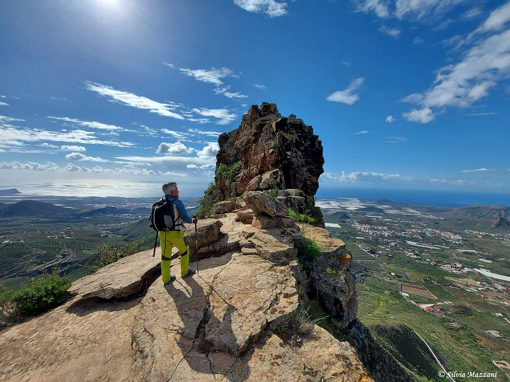
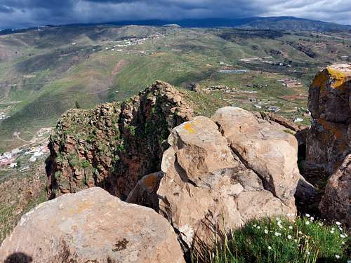
Among these small but fascinating summits, Roque de Jama stands out and attracts attention with its well-identified rocky profile. Roque de Jama is made up of a 781 meter high rock and it's a formation of great beauty, representing a truly unique landscape, one of the oldest on the island of Tenerife. Due to its charming appearance and its ancient origin, it is considered a National Monument. Jama is the largest of the rocks in the municipality of San Miguel de Abona, a monolith that can be seen from any point many kilometers away, whose top, eroded by time, offers incredible views and hosts important habitats of plants that grow on the rocks (rupicoles).
Located to the South-East of the famous peaks of Roque Imoque and Roque del Conde, Roque de Jama dominates from the East the town of Valle San Lorenzo and from the North the small village of El Roque, from where it starts the ascent itinerary to the mountain. Under Roque de Jama is situated the famous viewpoint of La Centinela.
Getting There
The starting point to climb is the tiny village of El Roque. It can be accessed from the center of San Miguel de Abona by taking the TF-28 road and continuing until kilometer 92.7, where the boundary of the Natural Monument begins. Continuing along the TF-28 road you go around the Roque de Jama from the south.
It can also be accessed from Arona, by taking the road that leads to the Valle de San Lorenzo. Once you get here you have to take the TF-28 road which makes a semicircle around the mountain, reaching the village of El Roque located to the North. Driving around the Roque de Jama it is possible to visit the Mirador de la Centinela with a very short detour.
Once you reach the village of El Roque, follow Calle La Degollada and where the descent begins, you will find some modest parking facilities.
Normal Route from El Roque
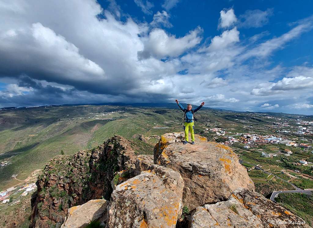
Roque de Jama from El Roque
Summit altitude: 781 m
Difficulty: EE
Difference in level: 350 m from El Roque
Starting point: village of El Roque
A fine route, with a brief and easy rocky stretch. The final part of the itinerary has some exposed sections
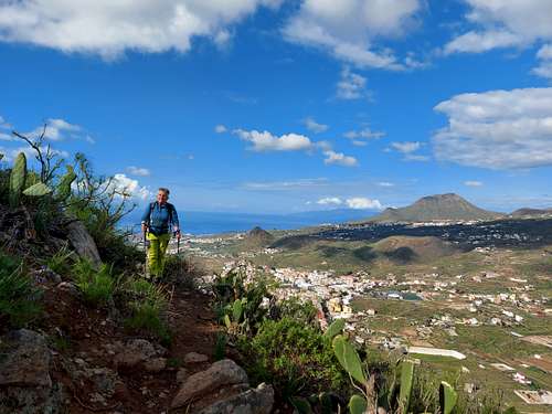
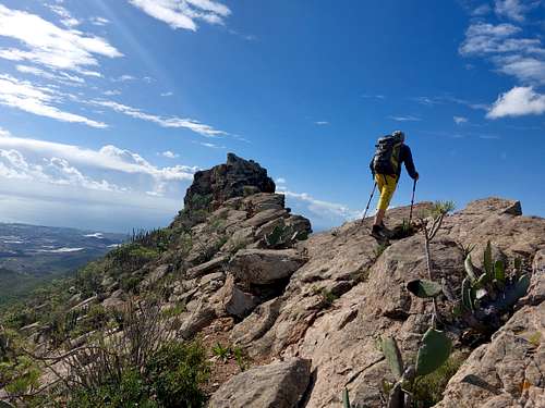
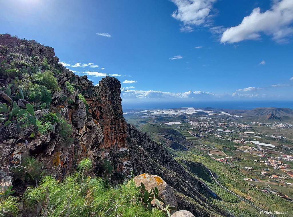
The path starts on the right side of a house, passes next to a ruin and with a long oblique right along the vegetated slope of the mountain reaches a shoulder.From here you go to the beginning of a semi-horizontal rocky crest in view of the impressive and vertical rock face of the Roque, which on the right falls sheer into the valley. Walk along a stretch of this rocky ridge until you reach the base of the short rocky summit tower.
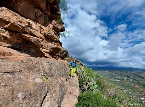
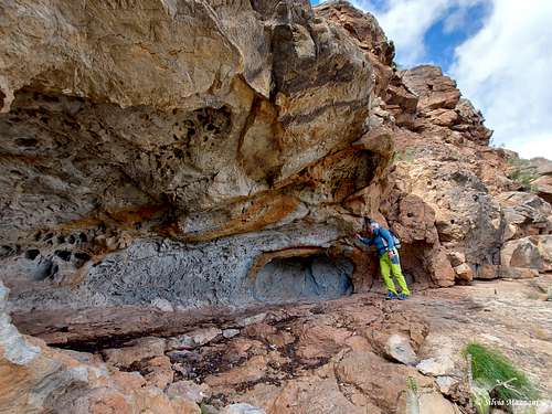
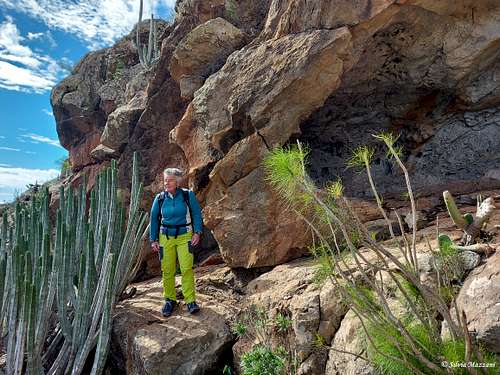
Here it is necessary to go around the rock face of the big head on its left side. Begin to walk along the slightly marked track which, in a magnificent vegetated environment, runs alongside the left side of the rock wall, where there is also a cave.
You will reach the Southern side of the summit head, where you briefly follow an inclined rocky slab. A last short and easy climbing passage gives access to the summit ridge.
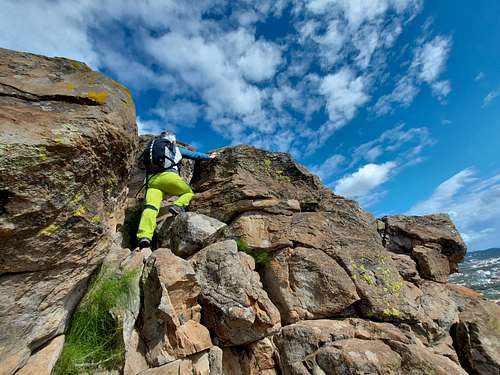
Follow briefly the summit ridge to the North with a slightly exposed walk up to the highest point.
Exceptional setting and vast panorama.
Descent: reversing the same itrinerary
Red Tape
All the mountainous regions are protected as national or regional parks. We find the strictest rules in the Parque Nacional de las Cañadas del Teide, where almost anything is forbidden or restricted. No overnight stay, no leaving trails and paths, no pets, no plucking of flowers. There are no fees or permits needed to climb Roque de Jama.
When to Climb
All year round, except Summer.
Accomodation
Different possibilities of accomodation in the surroundings.
Climate and nature
Tenerife is characterized by a great variety of climates. The weather for the coastal regions significantly differs from the weather in the Cañadas del Teide which are 2000m of elevation higher. Even the other lower mountainous regions, such as the Teno chain where our mountain Guama is located, record a certain climatic difference, albeit minor, from the climate of the coast. The south of the island benefits from more hours of sunshine per year, while rainfall is higher in the north, where there is also more humidity. These factors create different landscapes. The Canarian Islands (as well as Madeira) are located in the trade wind zone. You almost always encounter North-eastern winds which carry a lot of humid air. Being forced to climb to higher altitudes this moisture condenses into clouds. This in return means that most of the time the north-eastern part of the islands is covered in clouds from altitudes of 1000m through 2000m.
The mountains themselves - being mostly of the same altitude - finally stop the clouds so that on their south-western slopes the clouds "run out". There is a great variety of microclimates that favor many different plant species. The north of the island, exposed to the action of the trade winds, is distinguished from the coastal area, with an average temperature ranging between 19°C and 23°C thanks to the influence of the sea. Between 600 and 1500 meters above sea level, the environment cools slightly and the humidity favors the cultivation of cereals and potatoes. Above 1500 meters of altitude above sea level, the air is drier and snowfalls can be recorded in winter, with temperatures that fluctuate quite a bit between day and night.