
-
 17453 Hits
-
 81.18% Score
-
 13 Votes
|
|
Area/Range |
|---|---|
|
|
45.43122°N / 110.46353°W |
|
|
Hiking, Mountaineering, Trad Climbing, Ice Climbing, Mixed, Scrambling, Skiing |
|
|
Spring, Summer, Fall, Winter |
|
|
11212 ft / 3417 m |
|
|
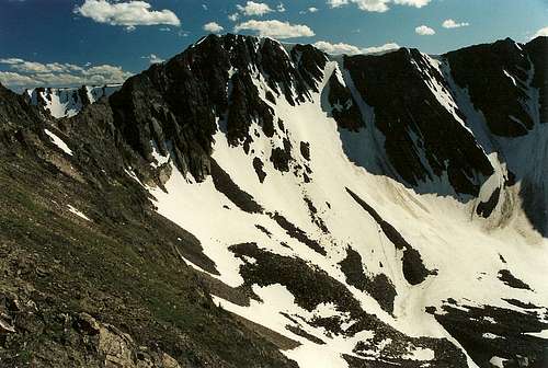
 Ridges above Pine Creek Lake
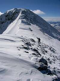 Summit of Emigrant Peak-- photo by b.
Overview
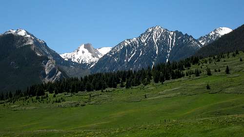
Most people who see the Montana Absarokas in any good detail see them from Paradise Valley between Livingston and Gardiner as they drive on U.S. 89 to or from the north entrance of Yellowstone National Park. The mountains are as dramatic as they are unforgettable. For me, they will always hold a special place because they were both my first glimpse of Montana (a fitting first glimpse, back in 1997) and where, in 2000, the mountaineer in me truly came into being.
Much like the Tetons above Jackson Hole and the Sierra above Owens Valley, the Montana Absarokas rise dramatically from the valley, in this case 5000-6000' up, with little in the way of substantial foothills between the valley and the mountaintops. Unless they are fortunate enough to be in convertibles with the tops down, drivers crane their necks and passengers hang their heads out windows to get a look at these spectacular peaks. But while the mountains are quite popular with people who live in the area, visitors mostly just admire them from the highway, drawn instead by the nearby national park and all of the easily attainable wonders that are there. As a result, the Montana Absarokas contain outstanding mountaineering opportunities that, with a couple of notable exceptions, do not include human company in the price.
Many named peaks have Class 3 and 4 routes as standard ones to their summits, though there are both walk-ups and technical routes as well, and there is no shortage of unnamed summits that will lend a sense of discovery to those that explore them. The range's highpoint, Mount Cowen, is one of the iconic peaks of Greater Yellowstone even though it is difficult to see from roads, and the standard route on it is one of the region's classic scrambles. All over, though, snow climbs and ski descents abound, ridge traverses and mountain walls tantalize, and there is even good ice in season. Most of the range is protected as part of the vast Absaroka-Beartooth Wilderness, but private property does sometimes impact access, especially on the western side of the range.
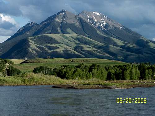 Emigrant Peak from U.S. 89-- by Tie-Dye Mike
Geography and Geology
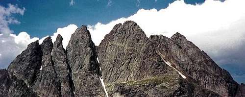 Mount Cowen-- by tristan mt
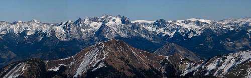
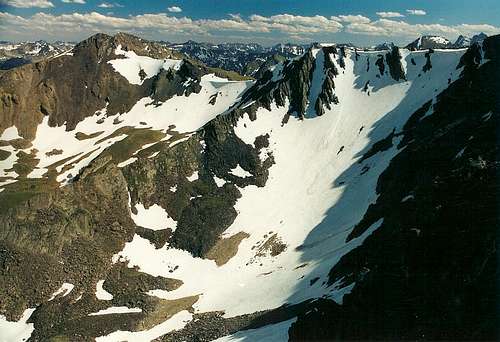 An ocean of mountains
The Western Beartooths?
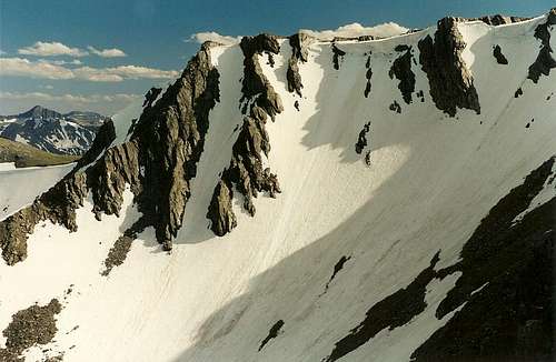
 Ridges above Pine Creek Lake
The confusion about the proper name is not just recent; Ferdinand Hayden referred to the range as the Snowy Mountains, Snow Mountains, and later the Yellowstone Range, and many locals have long thought of these mountains as the North Absarokas while many others have called them the Montana Absarokas.
In his Select Peaks of Greater Yellowstone, one of the best sources for information about the natural and human history of the Greater Yellowstone Ecosystem, Thomas Turiano makes the case that the Montana Absarokas should not be considered part of the Absaroka Range at all but should rather be called the Western Beartooth Mountains, with the peaks commonly called the Beartooth Range being the Eastern Beartooth Mountains.
Many years of using the commonly accepted nomenclature probably will make Turiano's argument a losing one, but he makes an interesting case nonetheless. Since his book is my only source for this position, I would be flirting with plagiarism if I got into too much detail, so I will simply summarize two of his main points as follows:
1. The rock, although a lot of it is volcanic, is closer in composition and history to that in the Beartooths than it is to that in the Wyoming Absarokas. There is, for example, far more exposed granite in the Montana Absarokas than there is in the Wyoming Absarokas (where there is little), and the Beartooths are granitic. This, obviously, explains the notion of calling the range the Western Beartooth Mountains.
2. The drainages of Boulder River and Slough Creek are significant enough to divide the ranges into eastern and western halves, hence the idea of naming two different Beartooth ranges.
Reading Turiano's chapter on the Western Beartooths will provide far more details than I can or will provide here. My view, which I'm sure the world desperately craves to know, is that the best name for the range is the "Montana Absarokas" since it keeps with tradition and also creates the least confusion.
 Alpine heaven?
Access
Access is mostly from U.S. 89 west of the range and MT 298 (Boulder River Road) east of the range.Peaks
 Mount Cowen from Emigrant Peak-- by bigsky801
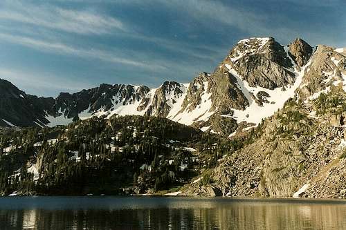 The classic view of Black Mountain from Pine Creek Lake
Popular Destinations
 Elephanthead Mountain-- by wyomtman
 Pine Creek-- by Zac Finley