
-
 72459 Hits
-
 96.95% Score
-
 64 Votes
|
|
Area/Range |
|---|---|
|
|
44.96674°N / 110.71927°W |
|
|
Hiking, Mountaineering, Scrambling, Skiing |
|
|
Spring, Summer, Fall, Winter |
|
|
Overview
The purpose of this page is to provide an overview of the mountains of Yellowstone National Park. Although Yellowstone may not be known for its mountaineering opportunities, the park contains many summits which provide worthwhile and challenging objectives.
Allthough the vast majority of Yellowstones mountains are not yet found on Summitpost, it is hoped that many of them will be added over time. Consequently, this page will be a work in progress.
This page is a continuing work in progress, and I will slowly be adding information and hopefully improving the page as time permits. The main emphasis is intended to be the mountains of Yellowstone, but I'll probably eventually add sections on other popular aspects of the park as well.
 The Abyss
Getting There
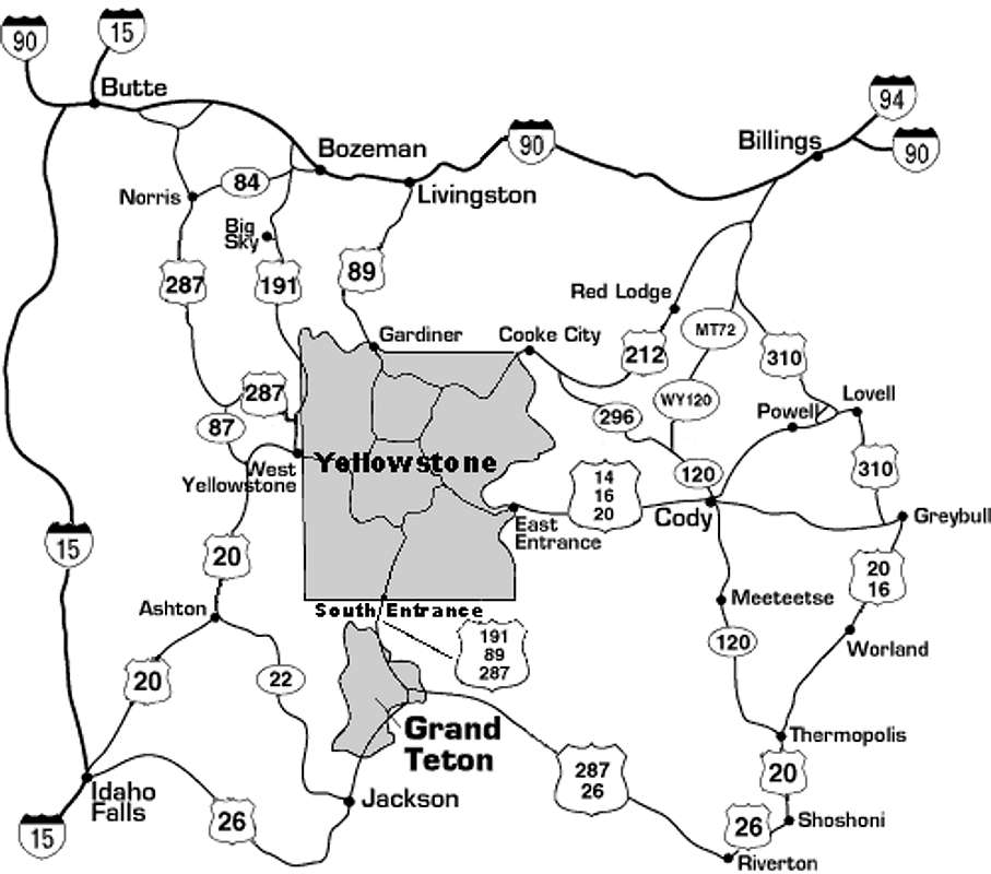
Yellowstone National Park occupies the northwest corner of Wyoming, as well as small portions of southern Montana and eastern Idaho. There are five major roads entering the park:
- West Entrance - Highway 20 through West Yellowstone, MT
- North Entrance - Highway 89 through Gardiner, MT
- Northeast Entrance - Highway 212 through Cooke City, MT
- East Entrance - Highway 20 through Cody, WY
- South Entrance - Highway 89 through Grand Teton NP
The North entrance at Gardiner Montana is the only entrance which remains open during the winter. Refer to the Seasonal Road Opening and Closing schedule for complete details on road opening and closing dates in the park.
Additional information can be found on the Yellowstone Plan Your Visit web page.
Red Tape
Yellowstone Entry Fees
Entering Yellowstone National Park requires purchase of a $25 7-day pass, available at any of the five entry stations entering the park. This pass allows entry into both Yellowstone and Grand Teton National Park to the south. Alternatively, an annual America the Beautiful - National Parks and Federal Recreational Lands Pass may be purchased for $80. This pass provides access to, and use of, Federal recreation sites that charge an entrance or amenity Fee, for a period of one year.
Backcountry Permits
A backcountry camping permit is required for all overnight trips into the Yellowstone backcountry. Backcountry camping permits may be reserved in advance, and require a $15 fee. Backcountry permits may also be obtained on a walk-in basis, (subject to availability) no more than 48 hours prior to the hike - there is no charge for walk-in permits.
Permits may be obtained from most ranger stations in the park. When picking up backcountry permits you will be required to view a short video on regulations and safe travel in the Yellowstone backcountry. The Yellowstone Backcountry Camping & Hiking page contains complete details and regulations on backcountry trips in the park.
Camping and Lodging
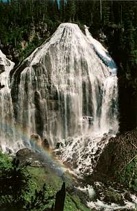
Union Falls
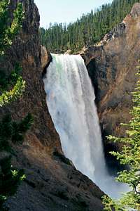
Lower Falls
There are numerous options for camping within Yellowstone National Park. Regulations and available facilities varies among the campgrounds. Visit the Campgrounds in Yellowstone page for complete details.
There are also a number of lodging facilities within the park, ranging from rustic cabins to luxurious lodges and inns. Lodging in Yellowstone is administered by Xanterra Parks & Resorts, the primary concessioner in Yellowstone. Refer to their website for complete details on locations, reservations, etc.
Yellowstone is Bear Country

Both grizzly and black bears are found in the park. Several of the most important precautions for safe travel in bear country include the following:
- Do not hike alone; travel in groups and stay together
- Stay on the trail
- Announce your presence by making loud noise as you hike
- Do not hike at night
- Never store food in a tent; suspend food from a tree or bear pole
- Never approach wildlife; keep a safe distance
Visit Yellowstone's Minimizing the Dangers of a Bear Encounter web page for additional information on hiking in bear country.
Weather and Climate
Yellowstone's weather is characterized by its unpredictability. Always be prepared with warm clothing and rain gear, even on warm and sunny summer days.
Weather related links:
- Current National Weather Service forecast for Yellowstone.
- Yellowstone climate information.
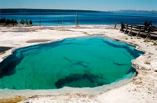
Thermal Features
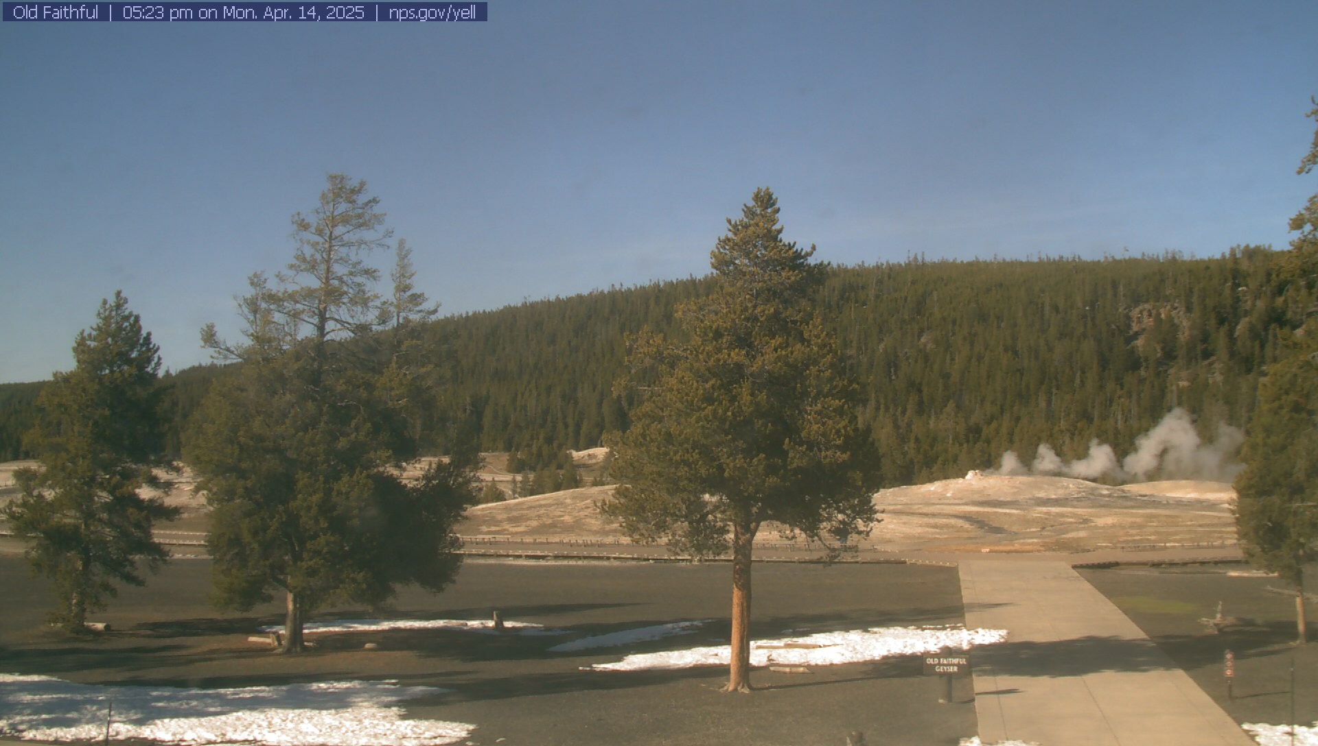
The Thermal Features section will be added at a later date. In the meantime, here is the Old Faithful Geyser webcam:
 White Dome White Dome |
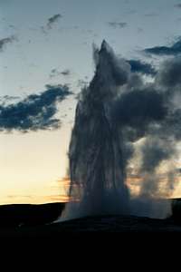 Old Faithful Old Faithful |
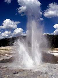
 Beehive Beehive |
|---|
 Beehive Beehive |
 Upper Geyser Basin Upper Geyser Basin |
|---|
The Mountains of Yellowstone
This section is a continuing work in progress. The peaks listed here are those which are currently present on Summitpost. More peaks will be added to this section as they are submitted.

Electric Peak - (10,969 feet)
The most prominent peak in the northwest corner of Yellowstone National Park, and the highest point in the Gallatin Range. With its dominating appearance over the surrounding area the peak is often mistakenly believed to be the highest point in Yellowstone, but it is actually the 8th highest summit in the park. Although much of the mountain and its common approach route lie in the state of Wyoming, the actual summit lies just over the border in the state of Montana.

Cutoff Mountain - (10,695 feet)
A major mountain of Yellowstone, whose summit lies just outside the park in Montana.

Colter Peak - (10,683 feet)
A remote peak in the Thorofare region of Yellowstone, just to the south of Yellowstone Lake. Best accessed via the Thorofare trail.

Mount Doane - (10,656 feet)
A long and difficult approach, with no established trail to the summit.

Avalanche Peak - (10,568 feet)
Avalanche peak is one of the more popular peaks in the state of Wyoming, due to its National Park designation, constructed trail, and the relatively high trailhead access. The peak is often climbed as part of a ranger-naturalist guided hike during the summer tourist season.

Hoyt Peak - (10,506 feet)
An infrequently climbed mountain in the east region of the Park. There is no established trail to the summit of Hoyt Peak.

Republic Peak - (10,491 feet)
A relatively long but otherwise easy hike to the summit of one of the parks northeast summits. Accessed from the Thunderer Cutoff Trail in Yellowstone, or outside the park from Cooke City, Montana.

Barronette Peak - (10,442 feet)
An infrequently climbed peak in the northeast region of the Park. There is no established trail to the summit of Barronette Peak

Mount Holmes - (10,336 feet)
Located in the northwest region of the Park, Mount Holmes anchors the southern end of the Gallatin Range of Wyoming and Montana. With an elevation of 10,336 ft., Mount Holmes is the third highest peak in the range. On the summit is a small stone/wood structure which serves as one of three primary fire lookouts located within Yellowstone.

Mount Sheridan - (10,308 feet)
Along with Mount Holmes and Mount Washburn, this is one of the three primary fire lookouts in the park. Mount Sheridan is usually climbed as part of a backpacking trip to nearby Heart Lake.

Top Notch Peak - (10,245 feet)
An infrequently climbed mountain in the Absaroka Range near the boundary of Yellowstone, approximately 2.5 miles directly to the south of Avalanche Peak. The peak is named for the notched appearance of its summit.

Mount Washburn - (10,243 feet)
This is a popular and easy hike to the summit of one of the park's fire lookout towers, which is occupied by a park employee during the summer months. The Mount Washburn webcam shows the view from the summit (weather conditions permitting).

Mount Norris - (9,935 feet)
An infrequently climbed mountain in the northeast region of the park. There are no established trails to the summit of Mount Norris.

Sepulcher Mountain - (9,646 feet)
The highest point between Electric Peak and Bunsen Peak, Sepulcher lies just to the east of Electric Peak.

Druid Peak - (9,584 feet)
An infrequently climbed mountain in the northeast region of the park. There is no established trail to the summit of Druid Peak.

Observation Peak - (9,397 feet)
An easy climb located near Cascade Lake, with good views of the central region of the park. An unused lookout tower is located on the summit.

Bunsen Peak - (8,564 feet)
An easily climbed peak located in the northwest corner of the park, near Mammoth Hot Springs. Named after the inventor of the Bunsen Burner.

Elephant Back Mountain - (8,290 feet)
An easy hike, offering excellent views of Yellowstone Lake.

Yellowstone Lake Overlook 8034 - (8,034 feet)
A short hike with excellent views of Yellowstone Lake.

Twin Buttes - (7,923 feet)
An easy off-trail hike, usually done as part of a hike to Fairy Falls.

Mount Everts - (7,831 feet)
The huge rounded plateau immediately to the east of Mammoth Hot Springs.

Rattlesnake Butte - (6,735 feet)
Another relatively easy hike to a Yellowstone summit. Located at the extreme north end of the park, near Mammoth Hot Springs.