
|
|
Mountain/Rock |
|---|---|
|
|
45.74783°N / 11.17580°E |
|
|
6230 ft / 1899 m |
|
|
overview
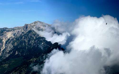
The Monte Cornetto (1899m) lies in the Sengio Alto, in the Piccole Dolomiti group : Prealpi venete. It is oriented from north to south between Pian delle Fugazze and Passo di Campogrosso.It appears as a short mountainous dolomites line whose eastern side is rocky and steep, while the West descends more gently toward the woods and meadows below.From south to north we can recognize the following summits:
The backbone is crossed from north to south by a scenic path dating back to the First World War dug into the bare rock from the Passo delle Gane (between Cima delle Ofre and the Baffelan) to the foot of the top of the Cornetto.
During the First World War some events had like theater in the Altovicentino. Remarquable the STRAFEXPEDITION in the May-June 1916 that is considered the largest alpine battle that was ever fought in history.
The aim of the offensive Austro-Hungarian was to reach the Venetian plain behind the italian army deployed in Carnia and on the Isonzo.
This situation forced the commands of both armies to provide a defensive organization of the entire territory by implementation of trenches, Strand, fortified lines, caves and artillery for troops, shelters roads, waterworks and other structures necessary to enable both military actions and maintaining an impressive number of men and resources in areas that until recently were only attended by climbers.
The trail, better known as "Sentiero d'arroccamento" (transversal route)gives sights on unusual sceneries and almost Dantesque visions among rock wings, screes, low tunnels and some exposed but equipped stretches; it runs along the Forcella Baffelan, passo delle Giare Bianche and M.te Cornetto.
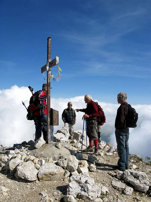 Monte Cornetto | 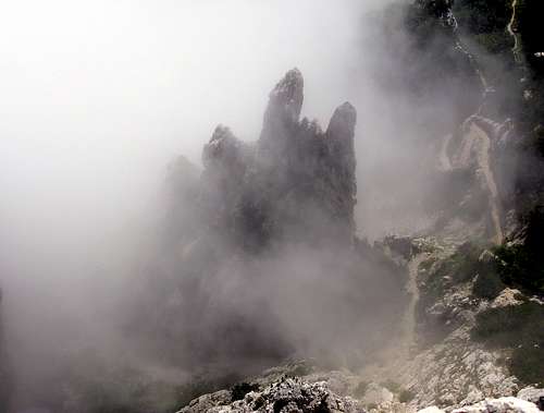 Sengio Alto | 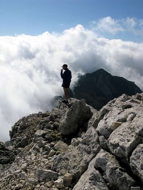 Monte Cornetto |
Getting There
From VALLARSA ( Trentino Alto Adige)SS 46 del Pasubio: Rovereto (201m.) - Vallarsa - Anghébeni - Foxi - Raossi - Pian delle Fugazze ( 1162m.)
From VALLE DEL LEOGRA ( Veneto ) SS 46 MALO - SCHIO - S Antonio ( 567m.) - Balasso Refuge - Pian delle Fugazze (1162m.)
Routes
EMMELE TRAILAt the Pian delle Fugazze pass (SS 46 Pasubio road) take the road for Ossario del Pasubio and then the Strada del Re so you can reach the car parking near Malga Cornetto.
Continue on foot for about 20 minutes until you get the Emmele path (SAT 175).
The trail goes up with regular slant and wide bends alomg the south east wall of Mount Cornetto.
At the selletta dell'Emmele 1675mt. you can see the deep carving of the Vaio Stretto.
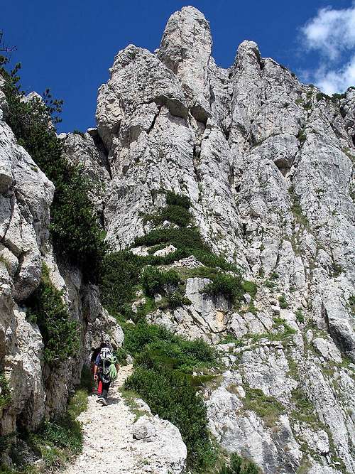
The path 175 continues between the rocks until the Sella of Cornetto 1825m
Here you must climb a short wall equipped with a wire rope of 15 meters, then the trail reaches the top of Mount Cornetto.
 Torre Emmele | 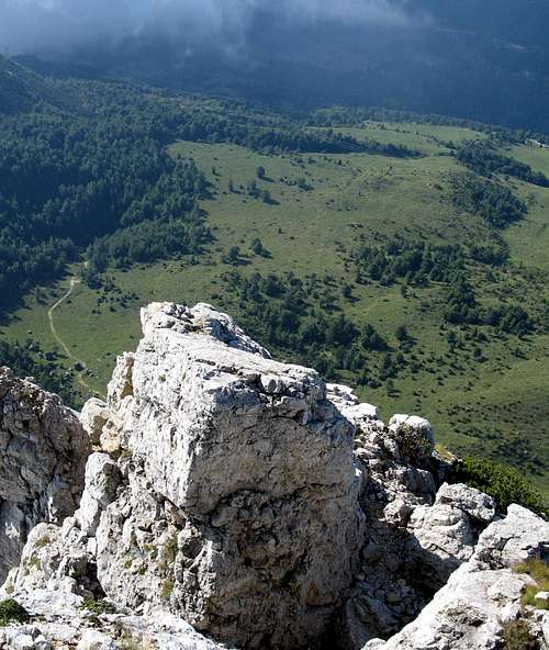 Monte Cornetto | 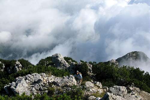 Monte Cornetto |
VAIO STRETTO TRAIL
This route starts from Malga Cornetto where you must park your car.
The path goes on in the wood, with wide bends, up to the base of the rocky walls.
Some fixed ropes allow to get the deep crack of the "Vaio" and using ladders and fixed ropes helping in the exposed passages into the rocks, you can arrive to the Selletta dell'Emmele where the path links the path 175 leading to the summit of Monte Cornetto.
Sentiero del Vaio Stretto
Some rock climbing routes
Weather forecast
For weather and avalanche conditions in Trentino look at this pages:wetterzentrale
Meteotrentino
Meteo Alpin
Società Meteorologica Italiana
Il meteo .it
eurometeo
Provincia di Bolzano
Maps and books
Pasubio- CaregaSezioni vicentine del CAI 1:25.000
" Guida alle Alpi" - John Ball 1867 / 1868
" Schio Alpina" - Francesco Rossi 1878
" Guida del Trentino" - Ottone Brentari 1890
" Guida Storico alpina di Valdagno, Recoaro, Schio, Arsiero " - Carlo Fontana 1898
" Guida delle Piccole Dolomiti e Pasubio " - 1978 CAI
" Guida alle Piccole Dolomiti" - Baldi ,Pieropan 1986
" Escursioni nel gruppo del Carega" - Roberto Chiej Gamacchio Cierre edizioni 1993
"Itinerari sui Lessini e Piccole Dolomiti" - Manfrini Editori 1995
Links
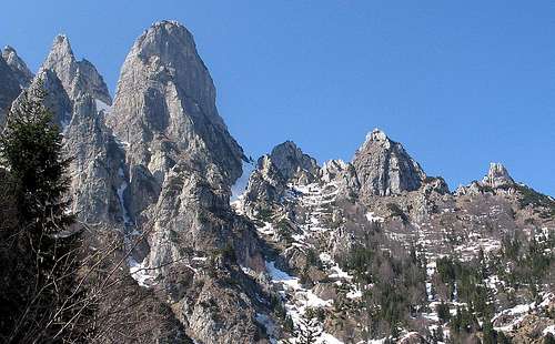
 Sengio Alto | 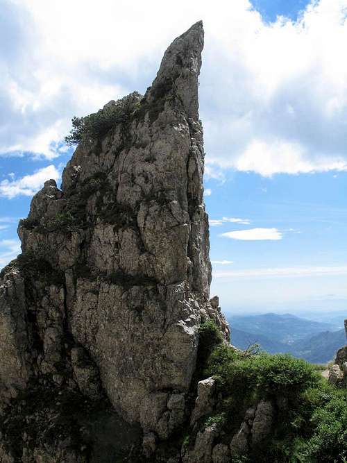 Sengio Alto |