-
 11712 Hits
-
 80.49% Score
-
 12 Votes
|
|
Mountain/Rock |
|---|---|
|
|
45.99893°N / 7.97509°E |
|
|
Piemonte - Wallis |
|
|
Hiking, Mountaineering |
|
|
Spring, Summer, Fall, Winter |
|
|
9790 ft / 2984 m |
|
|
Overview
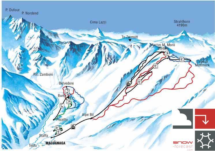
In the northern side of Monte Rosa group the main watershed ridge turns to the East dividing the Valle Anzasca (S - Italy) from the Sass valley (N - Switzerland).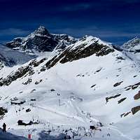 | The Easternmost part of this ridge hosts the mountain that gives the name to the small subgroup : Monte Moro This is a small summit, growing up about 100m from the 2 passes that delimit it : the Bocchetta di Galkerne (W side - 2904m) and the Passo di Monte Moro (E side - 2868m) ... and is the NE end of the Monte Rosa group Though made of good rock (a kind of granite : Gneiss occhiadino) its ridges and slopes are covered with big debris that make it easy to be climbed so that none can consider the climbing of this mountain something more than the access to a fine "belvedere" |
Getting There
the access to this mountain can be done both from Italy and SwitzerlandFrom the highway of Simplon Pass exit Piedimulera
Follow for Macugnaga
From the highway of Wallis exit Saas
Follow for Saas Almagell and up to Mattmark dam
Route
 from Map+ by TIDAC ch from Map+ by TIDAC ch | Very short and easy the two routes normally used to climb and to descend making an amusing and not tiring walkup. easy and comfortable in spring when in good settled snow To get the Passo del Monte Moro, no problems when in snow To get the Bocchetta di Galkerne |
Accomodation
No need if you only want to climb the Monte MoroThe Rifugio Oberto (some 30 meters below the cablecar station) can be useful if you're going to make the "traversata dei Camosci" (easy alpinistic route to access the Rifugio Sella . under the Cima di Iazzi)
Links
Joderhorn 3036m & Monte Moro 2985m - a short report from Cyrill (rip)Monterosa Star - Macugnaga Monte Moro Ski-area