
-
 1738 Hits
-
 84.27% Score
-
 18 Votes
|
|
Mountain/Rock |
|---|---|
|
|
45.64170°N / 7.59024°E |
|
|
Valle d'Aosta |
|
|
Hiking, Scrambling |
|
|
Summer |
|
|
8327 ft / 2538 m |
|
|
Overview
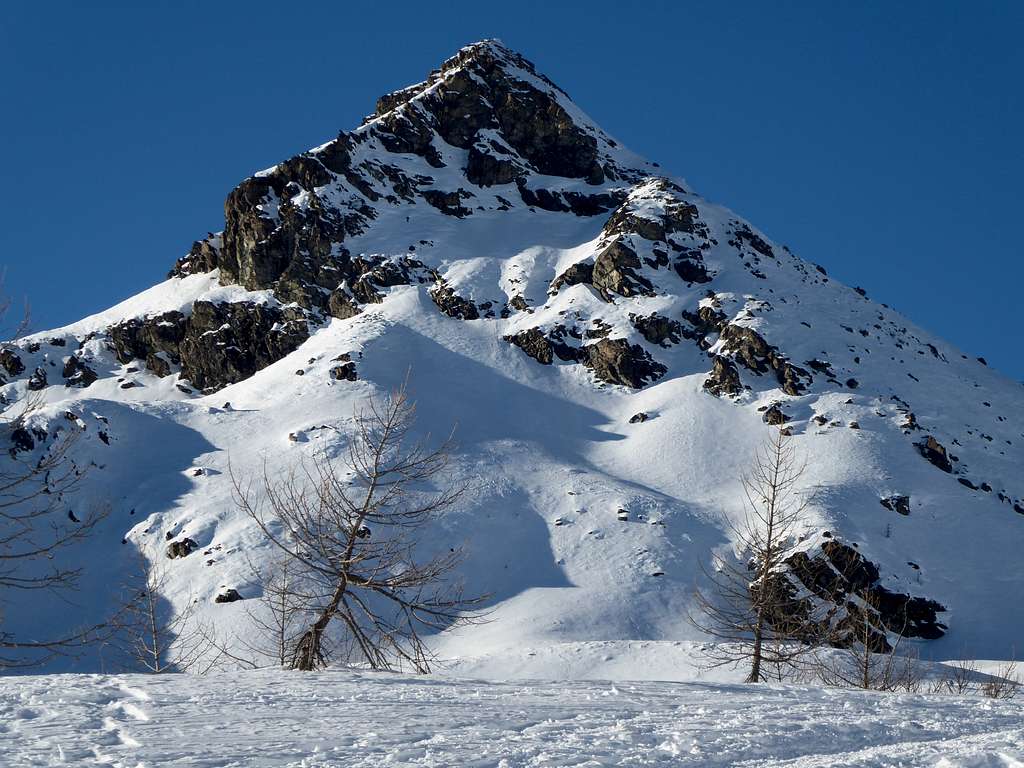
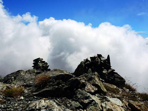
Monte Torretta/La Torretta 2538 m
As its name says, Monte Torretta aka La Torretta, is a massive peak in shape of tower located in the Aosta Valley and belonging to the Emilius-Rosa dei Banchi group. Located within the beautiful Monte Avic Natural Park, South of the Rifugio Barbustel, on the watershed between the Champorcher and Chalamy Valleys, it's a minor peak but worthy of being climbed due to the beauty of the itinerary and the exceptional panorama. It's not a famous summit, but it's climbed rather frequently.
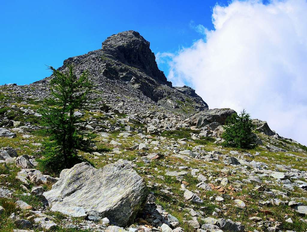
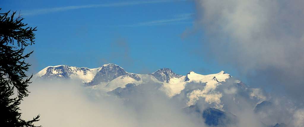
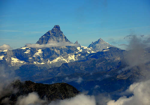
The standard route to the top starts from the Colle del Lago Bianco on the path joining the Valle di Champorcher with the Rifugio Barbustel. The top is surmounted by two stone cairns and towards the North offers an exceptional view over the Monte Rosa group, the Cervino-Matterhorn and the Dent d'Herens, besides the underlying territory of the Park with the clearly visible lakes and the Rifugio Barbustel. Towards the other directions the look can range over the Val d'Ayas and the Champorcher valley with the Rosa dei Banchi.
Getting There
Road access
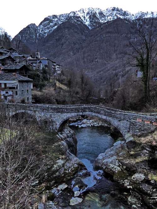
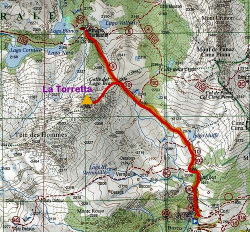
Take the A5 Motorway and exit Pont Saint Martin, then continue on the road SS26 toward Hone-Bard. Here leave the main road and turn to left on the road SR2 entering the beautiful Valle di Champocher, and follow the signposts to Champorcher. The road steeply rises with some hairpins, pass Pontboset then stretches in the valley towards Champorcher. The road reachs Champorcher and more precisely the Castello hamlet. Near a bend in the village take a paved road on the right, following the signposts to Mont Blanc and Dondena. After passing the hamlet of Mont Blanc, continue until you reach a parking lot on the left along the road at about 1775 m of altitude, where it starts the path to the Rifugio Barbustel. There is a visible panel of the Parco Mont Avic, with a parking lot on the left, where it's possible to leave the car.
Route
Summit altitude: 2538 m
Difficulty: F
Difference in level: 760 m
Starting point: road to Dondena pass the hamlet of Mont Blanc
Short, easy and profitable itinerary that in dry condition doesn't oppose particular difficulties, but requires a certain familiarity with the progression on rock.
Route description
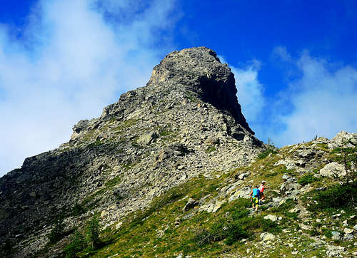
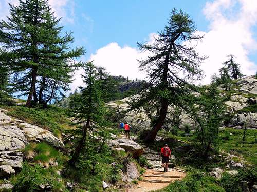
From the parking lot take the clearly visible path that starts steeply on the right side of the road and climbs up with a few bends in the coniferous forest, passing by a 1847 m hut. Cross a wooden walkway and continue to the left of a stream in view of the Gran Cort hut. A little further on, a path indicated by a sign will be left on the right. At a second junction ignore instead the path on the left, exiting onto open ground near the refuge at Lake Muffé 2076 m. To the left of the hut there is a well-marked crossroads with yellow marks, from where you continue to the right towards the Colle del Lago Bianco. La Torretta is now clearly visible in front of us. The path leads below the wide saddle of Colle del Lago Bianco, which is reached directly. Our goal is now on the left, sharp, slender and inviting.
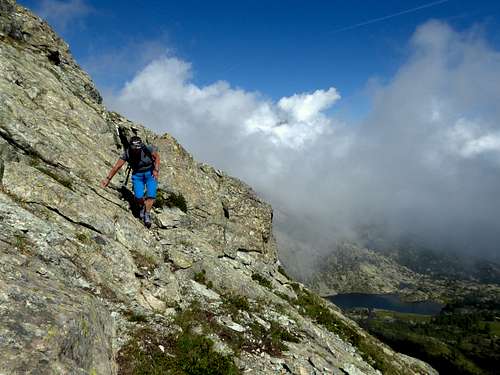
From the col turn sharply to the left (West) and begin to follow the Eastern ridge of the mountain on a not very obvious trail running along a wide ridge. The route, marked by some cairns, becomes increasingly steep and approaches the rocky section on big boulders. Once you reach the final smooth rocks, climb directly then head to the left and with some easy climbing steps reach the panoramic summit.
Descent: reversiong the same route. Once at the Colle del Lago Bianco it is highly recommended a short digression to the Barbustel Refuge which is reached downhill from the col.
Essential gear
Normal high mountain equipment, including mountain boots.
Red Tape
No fees no permits required. Mont Torretta is located inside the protected area of Parco Naturale Monte Avic.
Hiking and scrambling scale
T - Turistico (Tourist): Itineraries on wide, clear and well worn paths, sometimes on mule tracks or gravel roads. The routes are never exposed, don't give any orientation problems and don't exceed 2500 meters of altitude. Suitable also for children
E - Escursionisti (Hikers): Itineraries on marked trails, even narrow and with possible steep and impervious sections. They are never exposed and don't give any orientation problems. They can tread different kinds of ground, such as forests, gravel, meadows, pastures, easy rocks, etc.). They form the majority of the trails that wind up in the mountains and require a certain habit to walk; you need equipment suitable for the altitude and resistant footwear with soles suitable for rough terrain
EE - Escursionisti Esperti (Experienced Hikers): Itineraries for hikers with experience and good knowledge of the mountain. Some of these paths may have exposed sections, however brief, which require firm foot and no dizziness. They require the ability to adapt to particular terrain, such as steep grassy slopes or stretches of rocks with difficulties that can reach the 1st degree of the UIAA scale. They can also reach high altitudes (3000 m or more). Sometimes they may include unmarked sections, requiring a good sense of orientation. Snow slopes are possible, however which can be overcome without specific mountaineering gear (rope, harness, crampons, ice-axe)
EEA - Escursionisti Esperti con Attrezzatura (Experienced Hikers with equipment - The same as EE, in addition these routes require the use of via ferrata equipment (lanyards, harness, carabiners, heat sink, helmet). This kind of itineraries range from the trails with short easy and not much exposed sections, previously equipped with fixed ropes and iron pegs, to the true and more difficult Via Ferratas climbing on rocky walls or on aerial ridges and ledges, previously equipped with long stretches of iron ropes, iron steps, ladders without which proceeding would constitute a real climbing. It is necessary to know how to use the technical equipment and have a certain habit of exposure and mountaineering terrains.
When to Climb
The best period goes from June to October.
Accomodation
B&B, agriturismo and hotel in the Valley of Champorcher.
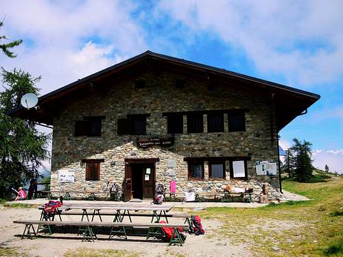
Rifugio Barbustel 2200 m
Situation: near the lakes Blanc, Noir, Cornu and Vallette
Size: 40 persons
Open: from the last Saturday of June until the first Sunday of September. For other periods contact the guardion. The winter hut, open only by reservation, can accommodate up to 6 people
Guardian: Finco Naldo, Pont St. Martin (AO)
Hut phone: 0166/510001
Mobile phone: 347/7892089
Guardian phone: 0125/804604
Meteo
Guidebooks and maps

"Emilius - Rosa dei Banchi" - Parco del M. Avic - G. Berutto, L. Fornelli - Collana Guide dei Monti d'Italia CAI-TCI
"Dal Monviso al Sempione" - R. Aruga, C. Poma CDA.
Map: L’Escursionista Editore n.11 Valle di Champorcher, Parco Monte Avic