
|
|
Mountain/Rock |
|---|---|
|
|
38.62540°N / 106.3855°W |
|
|
Chaffee/Gunnison |
|
|
Mountaineering |
|
|
Summer |
|
|
12755 ft / 3888 m |
|
|
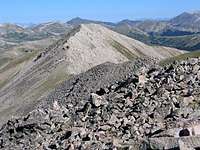
Overview

(R) Chapman & (L) nameless high point

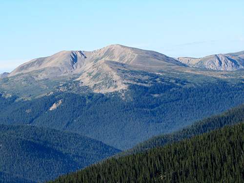
Summit
From SE Summit
Mount Chapman is a gentle mountain that sits on the Continental Divide in the Sawatch Mountains of Central Colorado near the town of Buena Vista. The 12100 ft Hancock Pass separates Mount Chapman to the northwest from Peak 13102 ft & Van Wirt Mountain to the southeast.
The valley of Chalk Creek sits to the north of Hancock Pass and the valley of Quartz Creek to the south. A rough Jeep Trail connects the two valleys via Hancock Pass. Hiking this pleasant trail trough the forest and the Alpine Tundra will take the hiker to Hancock Pass where Mount Chapman can be easily accessed.
The summit of Mount Chapman consists of two high points with roughly the same elevation. The USGS Map only shows contour lines of 12720-12760 ft for the southeastern summit but gives an exact elevation of 12755 ft for the northwestern summit and designates it as Mount Chapman.
Northeastern Face of Mt. Chapman
Some of the views from the summit of Mount Chapman:
 Mt. Helmers |  Mt. Princeton | 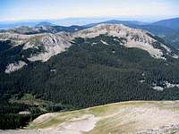 Looking South |  Mt. Aetna |
Getting There
Directions to the ghost town of Hancock:From the town of Buena Vista drive 8 miles south on Route 285 to a place known as Nathrop and then turn west onto Route 162. Drive this road 15.3 miles to just before the ghost town of St. Elmo (the first 10 miles are paved and the rest is a well graded dirt road).
Turn left onto Route 295. This road is rougher but is still passable by most/any car. Continue 2.7 miles until you see a detour around an old decaying railroad bridge (The detour is rather steep and the road beyond it is much rougher. I did not need to use 4 wheel drive but I will probably not drive this road in anything less than an SUV). Continue another 2.8 miles to the remains of the old mining town of Hancock.
 Peak 13102 ft | 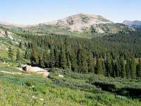 Mount Arps |  Brittle Silver Mountain |  Pomeroy Mountain |
Red Tape
No fees or permits needed for hiking. For other regulations see the official site for San Isabel National Forest.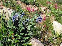 |  |  |  |
Weather
See the forecast for the town of Buena Vista, CO.
Nameless High Point
External Links
Read about Hancock Pass Jeep Trail.
Jeep Trail