
-
 37973 Hits
-
 88.39% Score
-
 27 Votes
|
|
Mountain/Rock |
|---|---|
|
|
45.12110°N / 109.5444°W |
|
|
Hiking, Mountaineering, Trad Climbing, Aid Climbing, Scrambling, Skiing |
|
|
Spring, Summer, Fall, Winter |
|
|
12542 ft / 3823 m |
|
|
Overview
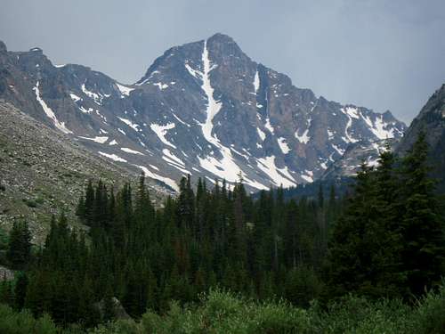
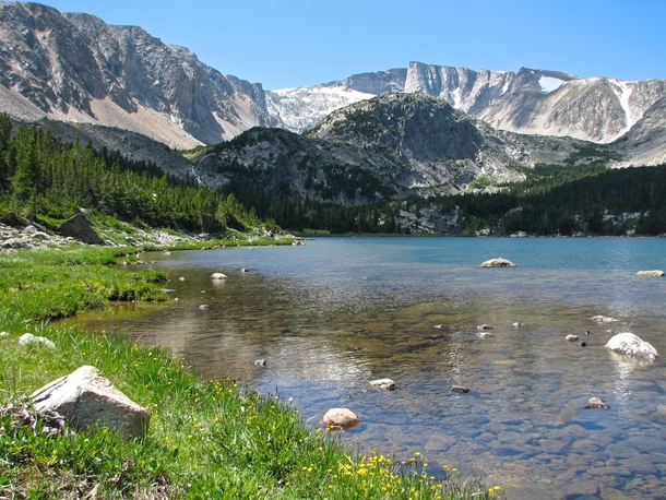
At 12,542 feet, Silver Run Peak is one of only seven ranked peaks over 12,500 feet. This peak is the culmination of the expansive Silver Run plateau which extends for eight miles to the East and four miles to the North-East from the summit proper. The scenic Timberline Creek Valley begins just NE of the summit and bisects the Silver Run plateau into two distinct arms, both of which have several lesser peaks and extend for great distances above 10,000 feet. The top of the plateau is one of the most unique places in Montana. Due to its proximity to the Sundance Pass trail, Silver Run attracts a fair share of visitors and is a popular summer destination for local weekend climbers.
From the summit of Silver Run Peak, one can get a great sense of the immense power that glaciation can have. The huge U-shaped valleys and big cliffs that were carved out of the massive Beartooth plateau have shaped the range to the dramatic and beautiful mountains we see today. Permanent snowfields still cling to the base of Castle Mountain at the head of West Rock Creek valley four miles to the West and if one were to look closely, some large Bergschrunds can still be found. Filling the valley floor below are the rock strewn glacial moraines which make the approach for nearby Castle Mountain so formidable.
There are many potential routes on Silver Run Peak but the easiest is the broad southwest ridge starting from Sundance Pass which is reached by a long, trailed hike. Numerous other off-trail hiking routes can be done as well as a handful of technical rock climbing routes on the rugged west face of Silver Run Peak which drops over 3,000 feet to the West Fork drainage below. Having one of the shorter approach distances for a high Beartooth summit, it's a desirable place for many hikers and climbers.
Note that the USGS maps incorrectly label the summit as the 12,500 foot peak located about a half-mile to the east of the true 12,542 summit.
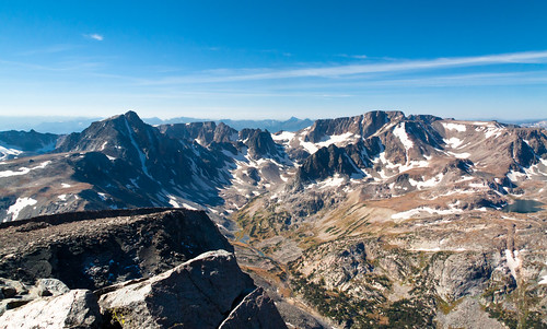
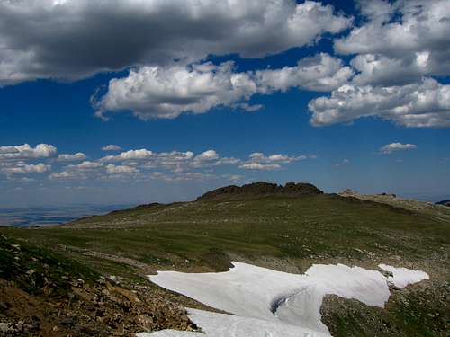
View from the summit of Silver Run
Getting There
Trailheads
West Fork Rock Creek Trailhead
This is one of the more popular trailheads in the Beartooth Mountains and offers fantastic scenery. From the center of Red Lodge at the MT 308 and US 212 junction, head west 0.3 miles on US 212 and turn right onto the West Fork Road with signs for the Red Lodge ski area and measure distances from this turnoff. The road immediately comes to a Y, stay left and head up the paved road passing the Palisades Campground Road (gravel) on the right after 1.1 miles. Continue and enter the Custer National Forest after 2.8 miles and turn left to stay on the West Fork Road at 2.9 miles. Taking a right at this turnoff takes you to the ski area. Pass the winter closure gate at 5.2 miles, the Basin Lake Campground at 7.2 miles and the road turns to gravel at 7.4 miles. At mile 10.5, pass the Cascade Campground and reach the trailhead at mile 13 with an elevation of 7,890 feet. Here there is room for about 40 cars and 7 horse trailers and a pit toilet is available.
Timberline Creek Trailhead
Follow the West Fork Rock Creek Road (as described above) 10.5 miles to the Cascade Campground. Continue another 3/4 mile past this campground and turn left at the signed Timberline Creek Trailhead. There is a small parking area just off the road before the road crosses back to the north side of the West Fork with room for 8-10 cars and a pit toilet.
Lake Fork Rock Creek Trailhead
From the Montana State 308 and US Highway 212 junction in Red Lodge, go 10.8 miles west on US 212 towards Beartooth Pass and turn right onto the Lake Fork Road. Go 1.8 miles on this paved road to its end at the trailhead with ample parking. The elevation at this trailhead is 7200 feet.
Approaches
West Fork Approach
From the West Fork Rock Creek trailhead, start up the trail and take an immediate left with a sign for Quinnebaugh Meadows and Sundance Lake. Follow this trail for two miles through a burn area and reach the small Sentinel Falls at 8,400 feet just past a couple switchbacks. Continue up the more forested trail another 2.2 miles to Quinnebaugh Meadow and the junction with the Lake Mary Trail. The meadow offers fantastic camping and the first views of Whitetail Peak. Continue straight and cross the stream draining Lake Mary on a series of small logs or rocks and reach the first culvert bridge 0.6 mile past the Lake Mary junction at 8,950 feet. At this bridge a short boot path heads up this side drainage towards Senal and Dude Lakes. From here, continue up the flat and well groomed trail for 1.2 miles to a second culvert bridge that crosses Kookoo creek which drains Kookoo Lake. Beyond this point the trail steepens for the next 1.6 miles and climbs 500 feet over a series of switchbacks to a very nice footbridge crossing the West Fork Rock Creek to its SW side.
From this footbridge, you can either camp right next to it on the small grassy bench or continue up the main valley without crossing the footbridge on the creeks NW side over talus and grass for 0.4 mile to Shadow Lake. Excellent camping can also be found at Shadow Lake but don't expect sun in the afternoon...it's called Shadow Lake for a reason.
RT Distance:From trailhead to camp at Quinnebaugh Meadow – 8.4 miles
From trailhead to Sundance Pass – 21.2 miles
From trailhead to Shadow Lake – 16 miles
RT Elevation Gain:
From trailhead to camp at Quinnebaugh Meadow – 1000 feet
From trailhead to Sundance Pass – 3,050 feet
From trailhead to Shadow Lake – 1,610 feet
 Whitetail Peak from Quinnebaugh Meadow | 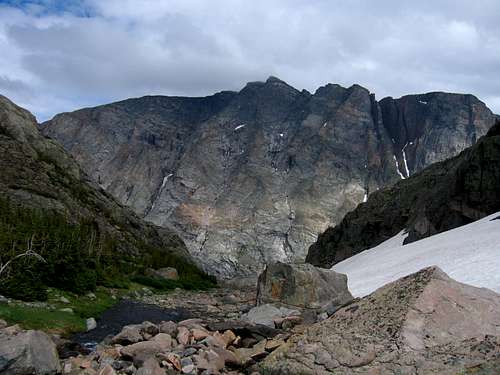 West Face of Silver Run Peak Kookoo Lake | 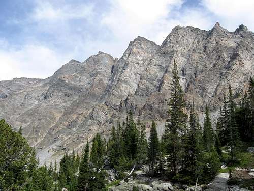 West Face of Silver Run Peak from the West Fork Trail |
Timberline Lake Approach
Start at the Timberline Creek trailhead and hike up the trail through a massive burn area as it switchbacks once and reaching the junction with the Beartrack Trail after 2.7 miles. Stay right and continue for 1.6 miles to Timberline Lake at 9,630 feet passing by Lake Gerturde on the way. There are a couple stream crossings on the final stretch of trail.
RT Distance:
From trailhead to Timberline Lake – 8.6 miles
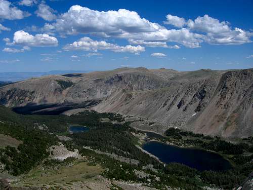
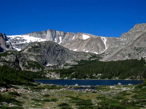
Timberline Lake
Lake Fork Approach
Approaching from the Lake Fork isn't as scenic but is commonly done for Silver Run Peak. This approach is only feasible for the standard SW Ridge route since the remaining routes are reached from the West Fork drainage. The Lake Fork Trail is much more forested and views are harder to come by. From the Lake Fork Trailhead, follow the trail along the south side of the creek for 4.7 miles to the junction with the Lost Lake trail. This spur trail leads 0.2 miles to Lost Lake with good camping, but poor fishing. Lost Lake sees a lot of day hikers so don’t expect much solitude here. Continue past the Lost Lake junction for 0.3 miles to the nice foot bridge crossing the Lake Fork at 8440 feet. Cross the bridge and continue to September Morn Lake which is about 7.5 miles from the trailhead and offers the best camping for this approach.
Just before the trail begins traversing steeply above the Lake Fork, pass a small side trail leading to the left which descends slightly to Keyser Brown Lake. Great camping and fishing is found here and an assortment of boot paths and game trails leads further to First and Second Rock Lake. For the adventurous hikers, you can continue to the head of the Lake Fork drainage passing below the north face of Beartooth Mountain, and reaching Sky Pilot Lake after a long day of bushwhacking and talus hiking. The south ridge of Sky Pilot Mountain can be reached via Sky Pilot Lake.
From September Morn Lake, continue a couple more miles to Sundance Pass and take a nice break and enjoy the views before finishing the climb.
RT Distance:
From trailhead to September Morn Lake – 15 miles
From trailhead to Sundance Pass – 20 miles
 Crossing the Lake Fork | 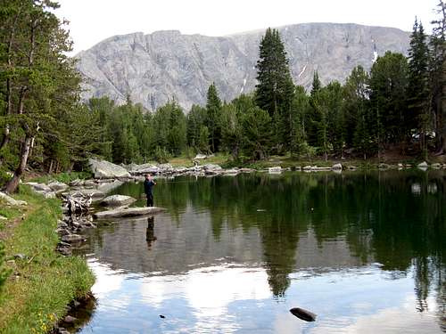 Fishing September Morn Lake |
Route Options
Southwest Ridge via Sundance Pass - Class 1 (Standard Route)
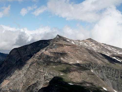
Use the West Fork Rock Creek approach and hike 10.6 miles to Sundance Pass. This is one of the easiest peak climbs in this area and is usually a snow free climb when the snow covering the trail melts out. From the pass, hike northeast up talus and grass for 1.2 miles to the 12,542 foot western summit staying close to the cliffs dropping off to the west. There may be a few deep gullies dropping to the west to walk around. Although the west summit is higher, there are two USGS benchmarks and a summit register on the east summit 0.5 miles to the east. Reach the east summit by dropping 100 feet and hiking across flat talus and regain 100 feet to the eastern summit. The views of the north couloir of Whitetail Peak are inspiring. Nearly all the 12,000 foot peaks in the Beartooths are seen from the summit of Silver Run Peak.
RT Distance:
From Sundance Pass – 3.4 miles
From Camp at Shadow Lake – 7 miles
From trailhead – 24.6 miles
 Silver Run Peak SW Ridge | 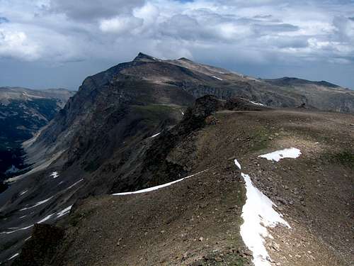 Silver Run Peak twin summits from Whitetail |
Northeast Slopes via Timberline Lake - Class 2
This is one of the few peak climbs in the Beartooth Mountains that can be feasibly day hiked. Keep in mind though, it is still pretty long. Setting up a camp at Timberline Lake is also a good option. Use the Timberline Creek approach and hike 4.3 miles to Timberline Lake. From the lake, hike around the north side over boulders for 0.3 miles to the west end. Once at the far end of the lake, turn right and climb northwest up an open slope between the trees. Some bushwhacking is required but generally you can avoid the trees on talus, grass or willows. Reach a small flat meadow 800 feet (0.4 miles) above the lake at 10,100 feet. Here the trees open up and meadows take over. Continue up a nice grassy slope for 600 feet and reach the silver run plateau at 10,750 feet. There may be a cornice at the top of this slope but you can traverse around its base to the left and gain the plateau 100 feet higher. From the point you gain the plateau, head left (west) for 0.75 miles to the 10,920 foot saddle between Point 11,184 and Silver Run Peak, either crossing over top of or to the south of Point 11,184. Hike southwest for 1,600 feet over easy terrain for 1.6 miles from the saddle to the summit. The cliffs at the head of the Timberline drainage to the east are impressive and include the Silver Pillar. Return the way you came.
RT Distance:
From camp at Timberline Lake – 7.2miles
From trailhead – 15.8 miles
 Looking down to Timberline Lake | 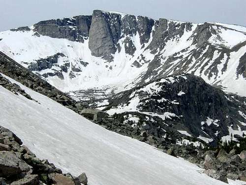 Silver Run Peak |
Technical Climbing
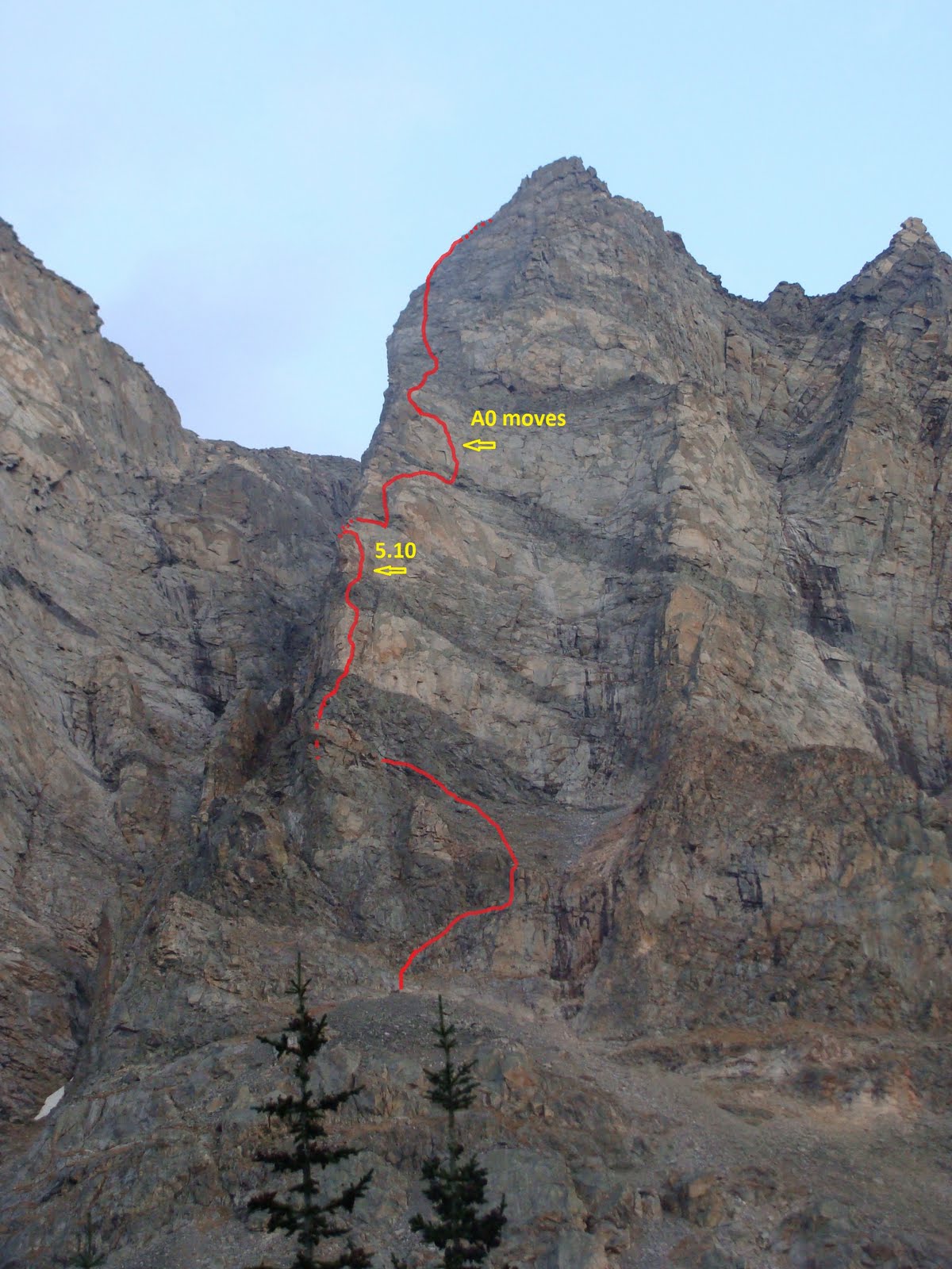
Silver Pillar (Free Silver) - 5.11a - 7 Pitches
This route is probably one of the premier rock climbing routes in the entire Beartooth range. The first ascent of the Silver Pillar was back in the early 70's by Jim Kanzler, Chad Chadwick and Stutzman. Another route was done in 1975 by Brian Leo and Terry Kennedy. These ascents were aid climbs though. The first free ascent of the feature without the use of bolts or pitons was on Sept 3rd, 2006 by Bill Davey and Frank Annighofer. Approach via the Timberline Lake Trail and hike around the north side of the lake. The pillar is very obvious from the lake and an easy 1-2 hour hike from the end of the trail will get you to the base of the pillar. The final 100 feet or so is a 4th class scramble on loose rubble to reach the first pitch.
The climb starts to the left side of the pillar around a large dihedral and up a leftward leading 5.10a hand and fist crack for the first pitch. The second pitch goes over the roof (astoundingly easy) and up a difficult face and the 5.11a crux finger crack. Follow up the crack systems until you reach the plateau after 7 long pitches. Make sure you are a solid 5.11 trad leader before attempting this climb. This is a serious route that has only seen a few ascents. Also be prepared to weather the afternoon thunderstorms.
 Timberline Lake  The Silver Pillar |  Silver Pillar Topo |
Pensive Tower - 5.10a - About 10 Pitches
This tower sits on the wild and rugged west face of Silver Run Peak and is approached via the West Fork Rock Creek trail. 5 miles up the trail you reach Quinnebaugh Meadows where Whitetail Peak is first seen. This route is briefly mentioned in Ron Brunkhorst's guide but the information there is inaccurate. He states the route is 9-14 pitches of rock climbing up to 5.8 but this is wrong. Loren made the ascent in early October 2011 and stated the route had a couple low 5.10 sections as well as a short aid spot. Be sure you are a solid 5.10 lead climber before embarking this route.
See Loren's Trip Report for more information
I plan to climb this route in summer 2014 and will include much more detailed information then.
 Pensive Tower Topo (Loren Rausch) | 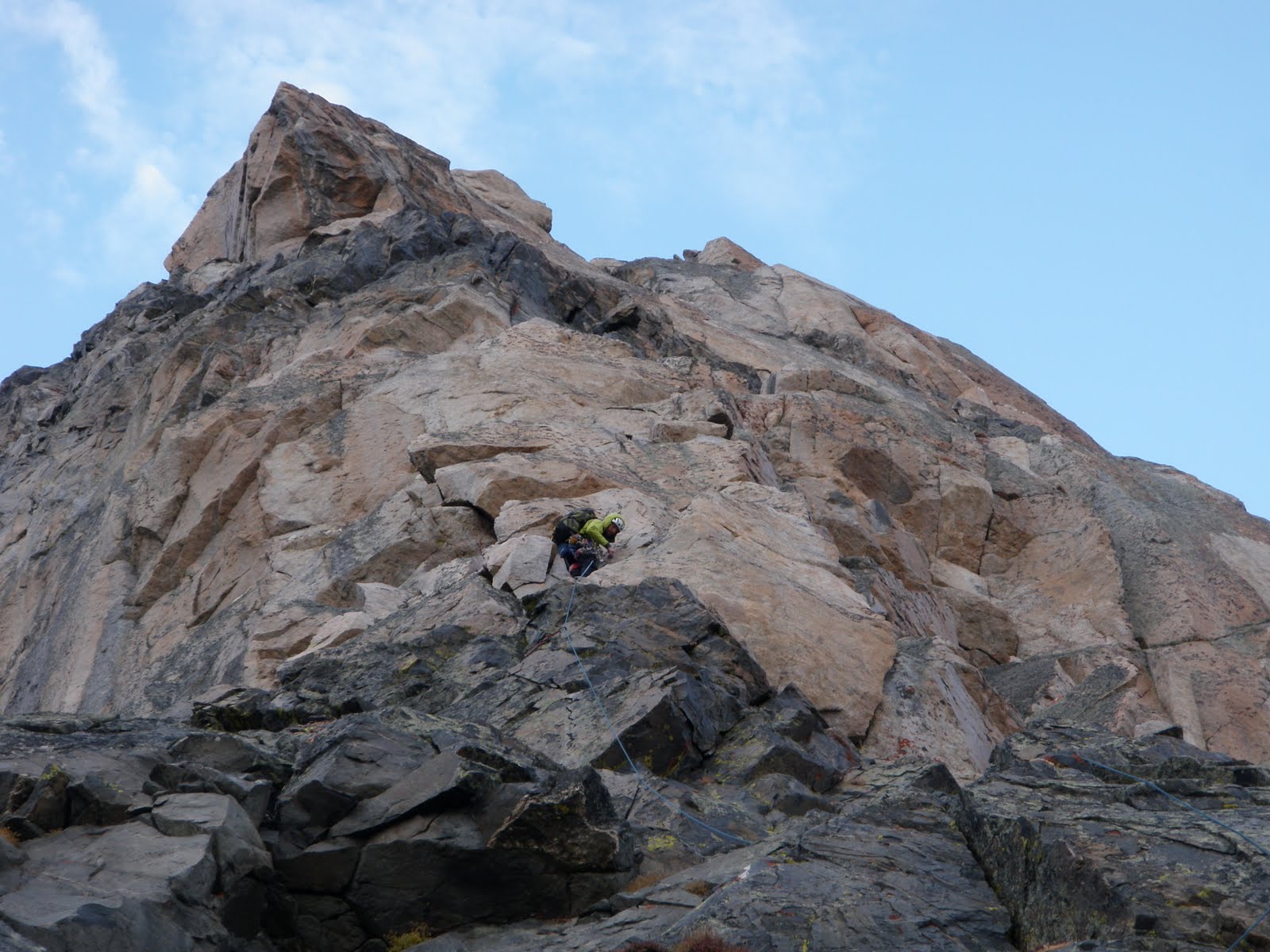 Beginning the route (Loren Rausch) 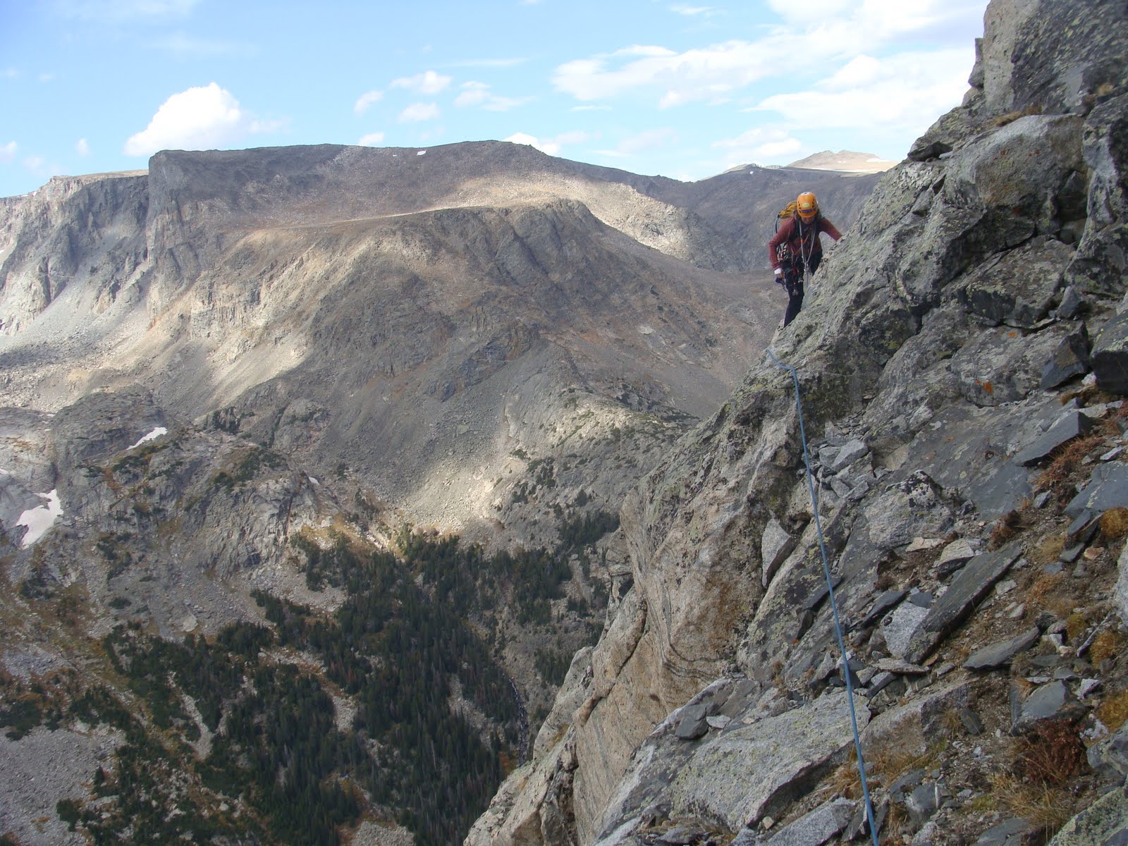 Traversing (Loren Rausch) |
Map
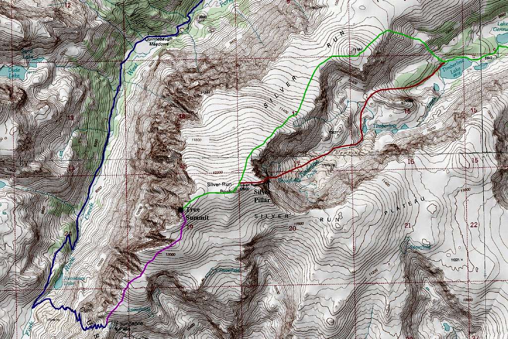
BLUE: West Fork Rock Creek Trail - Class 1
PURPLE: Southwest Ridge Standard Route - Class 1
GREEN: Northeast Slopes via Timberline Creek - Class 2
RED: Silver Pillar - Class 5.11a
Summit Panorama

Silver Run Peak summit view with Whitetail Peak, Castle Mountain, and Bowback Mountain - Photo Credit Jeff Handlin
When To Climb
Spring
For ascents from April through June, the weather can be very unpredictable and snow can fall during any ordinary storm. Be prepared for cold and windy conditions. Despite this, fantastic weather can be found and offers beautiful alpine scenery. This is the prime time to ski the Whitetail Couloir if this is your goal. People often skin up the valley and climb the couloir while carrying skis then ride down. This line is for expert skiers only and has caused serious injuries to some who have failed on the descent. Gear needed for the climb are mountaineering boots, crampons, three pickets, alpine rope and harness and an ice axe. If you are confident on 50 degree snow some parties do free solo the climb.
Summer
Summer ascents of Silver Run Peak can very a lot depending on the previous winters' snow-pack. The best time to climb it is July through early September. For the technical rock routes, whenever the rock is dry, they can be climbed. Ice climbers who are prepared with ice screws, two axes, steel crampons can make an ascent of some of the deeply inset couloirs above Sundance Lake when they are in good condition. By the time September rolls around, nearly all the snow in the area has melted but the first snows of the season are soon to come.
Fall
From September through December, fall snows begin to accumulate making scrambling more tedious. Windstorms begin making ascents more brutal. The Standard SW Ridge route is the best option in the fall.
Winter
This peak is somewhat of an expedition style climb from January through March with harsh weather and very large avalanches common. The route isn't recommended except when the snow-pack is very stable. Add the very long approach, skis may be required.
 Hiking on the Silver Run Plateau in summer | 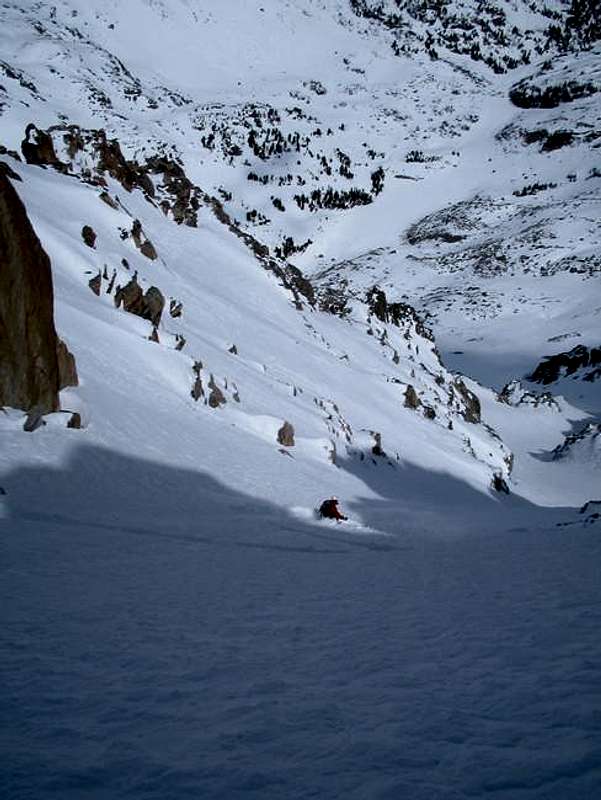 Skiing the Whitetail Couloir |
Camping/Red Tape
Camping is allowed anywhere within the Absaroka-Beartooth Wilderness. You are "requested" to check in with the Beartooth Ranger Station in Red Lodge or call (406) 446-2103 before camping. You must have a permit to cut live trees for firewood. Most parties choose to climb Whitetail in two days, camping either at the base of Sundance Pass by the foot bridge on the West Fork trail, or at September Morn Lake on the Lake Fork approach. Remember to practice Leave No Trace, and as always in bear country, hang your food well away from camp at night and carry bear spray.
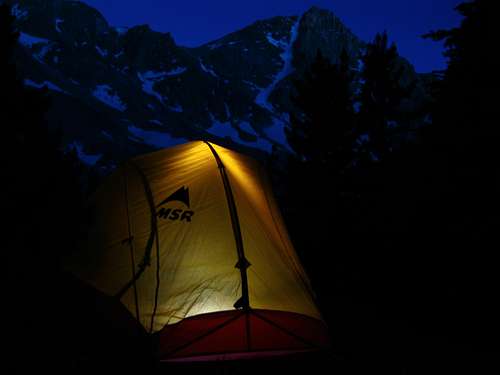
Camp below Sundance Pass
External Links
More information about Free Silver - 5.11a
Loren Rausch's page for Pensive Tower