
-
 35574 Hits
-
 85.25% Score
-
 20 Votes
|
|
Mountain/Rock |
|---|---|
|
|
42.98050°N / 116.65733°W |
|
|
Owyhee |
|
|
Hiking, Scrambling |
|
|
Spring, Summer, Fall |
|
|
8403 ft / 2561 m |
|
|
Overview

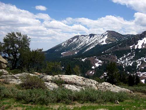
The region surrounding the peak is rich with mining history with remnants of one type or another nearly everywhere. Nearby Silver City offers a taste of a late 1800's mining town without the commercialism of other living ghost towns. Situated just north of Hayden Peak is War Eagle Mountain, the site of many battles amongst miners and management, Indian raids, and more recently a radio antenna. Although these mountains have been the victims of unregulated extraction throughout their recent history, one can easily find complete solitude in one of the most remote sections of the lower 48 states.

Trails / Routes
North Approach via Lineham Flat Road- This route can usually be tailored to your time frame and endurance level. From the Silver City Stage Road, take the Lineham Flat Road south as it snakes just east of War Eagle Mountain, just south of Turntable Mountain, and cuts up the western side of Hayden Peak. An excellent stop is at a pioneer cemetery on the northeast side of War Eagle Mountain. The graves are dated from the 1800's and many are marked "unknown". A good option is to mountain bike much of the approach, and hike to the summit from the junction on the west side of the peak. Mostly Class 1 with some Class 2 hiking near the summit.From the Lineham Road turnoff to the summit: 8 miles and 3200 feet gain (one way)
From the Sinker Creek turnout to the summit: 16.1 miles and 7050 feet gain (one way)
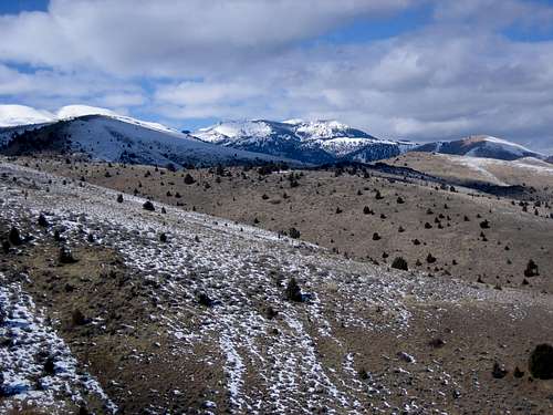
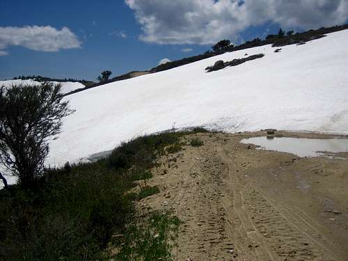
Snow often lingers on this approach well into May and even June in some years. The Stage Road is subject to washouts and variable conditions and 4WD may be required. Utilizing a mountain bike is a viable option for this specific route.
Leave the Silver City Stage Road at the Scotch Creek turnoff (marked with an "Access Yes" sign) and follow a steep jeep road south through the Sinker Tunnel past Oro Fino Gulch. Pass numerous mining remnants and follow the steep road east and then north. Near the Burnham Flat area you can ascend the steeper north side.
From the Scotch Creek turnoff to the summit: 6.2 miles and 4640 feet gain (one way)
From the Sinker Creek turnout to the summit: 10.4 miles and 5340 feet gain (one way)
Snow often lingers on this approach even longer, often into June in many years. Utilizing a mountain bike is a viable option for the first portion of the route. This route offers more hiking and scrambling. Private property issues may exist on this approach, but can be easily avoided. Hiking through on foot or bike seems rather innocuous compared to the mining, off-roading, and destructive grazing that has occurred here.
From the Toy Pass area to the summit: 12.7 miles and 5100 feet gain (one way)
While this approach is generally longer, it offers a more snow free access, thus a longer season. Utilizing a mountain bike is not a great option here due to some brief ridge hiking away from the jeep roads.. Some private property issues exist just west of the ridge and there are more active residents in the area.
Another possibility is from the Jordan Creek Area on the west side of the peak.
Maps: USGS Cinnabar Mountain, USGS Toy Pass, USGS Silver City, 1:100,000 Sinker Canyon
Getting There
North Approaches: From ID-78, just south of Murphy, follow the
signed Silver City Road southwest through a narrow canyon on a highly variable
dirt road. Some years it can driven easily by a sedan. Other years, like
2006, a 4WD and/or high clearance will be required. The Scotch Creek
turnoff is 15 miles from ID-78. The Lineham Flat turnoff is 18.7 miles from
ID-78
South Approach: From ID-78, drive south of Murphy for 13 miles and turn off to Oreana. Follow the Bachman Grade (Triangle Road) up and just over Toy Pass after 14 miles.
Conditions and Season

From late December to March many of the roads are snowed in. From March to June snow drifts may linger, but this time frame offers the greatest chance of solitude as the off road vehicles are not out generally. Summer time and especially summer weekends are very crowded (by Idaho standards) and Fall brings out the "hunters". Early winter may offer a good time to explore also. If you don't mind hiking or biking over a big snow drift, you'll most likely be alone past that point as the Off Roaders don't wander very far from their "machines".
| Silver City, Idaho (Elevation 6150) Climate Data: | Jan | Feb | Mar | Apr | May | Jun | Jul | Aug | Sep | Oct | Nov | Dec | Annual |
| Average Max. Temperature (F) | 35.9 | 38.1 | 45.0 | 51.9 | 60.8 | 69.9 | 80.7 | 80.2 | 70.6 | 58.1 | 41.8 | 35.7 | 55.7 |
| Average Min. Temperature (F) | 20.4 | 20.9 | 27.0 | 31.6 | 40.3 | 46.6 | 55.5 | 55.0 | 46.2 | 36.8 | 25.1 | 20.5 | 35.5 |
| Average Total Precipitation (in.) | 2.91 | 2.16 | 2.29 | 2.40 | 2.49 | 1.34 | 0.60 | 0.54 | 0.82 | 1.41 | 2.10 | 2.09 | 21.15 |
| Average Total SnowFall (in.) | 20.3 | 13.0 | 10.6 | 5.7 | 2.0 | 0.1 | 0.0 | 0.0 | 0.2 | 2.0 | 11.0 | 15.5 | 80.5 |
| Average Snow Depth (in.) | 22 | 27 | 19 | 5 | 0 | 0 | 0 | 0 | 0 | 0 | 3 | 12 | 7 |
National Weather Service-Boise

SawtoothSean - Sep 23, 2006 2:25 am - Hasn't voted
Summit RegisterWas placed on the north flank of the summit under some rocks in 9/06