

-
 22923 Hits
-
 87.7% Score
-
 25 Votes
|
|
Mountain/Rock |
|---|---|
|
|
60.96610°N / 149.3732°W |
|
|
Anchorage |
|
|
Hiking, Mountaineering |
|
|
Summer, Fall |
|
|
4334 ft / 1321 m |
|
|
Overview
 Looking west from the top toward Penguin Lake and King Point (July)
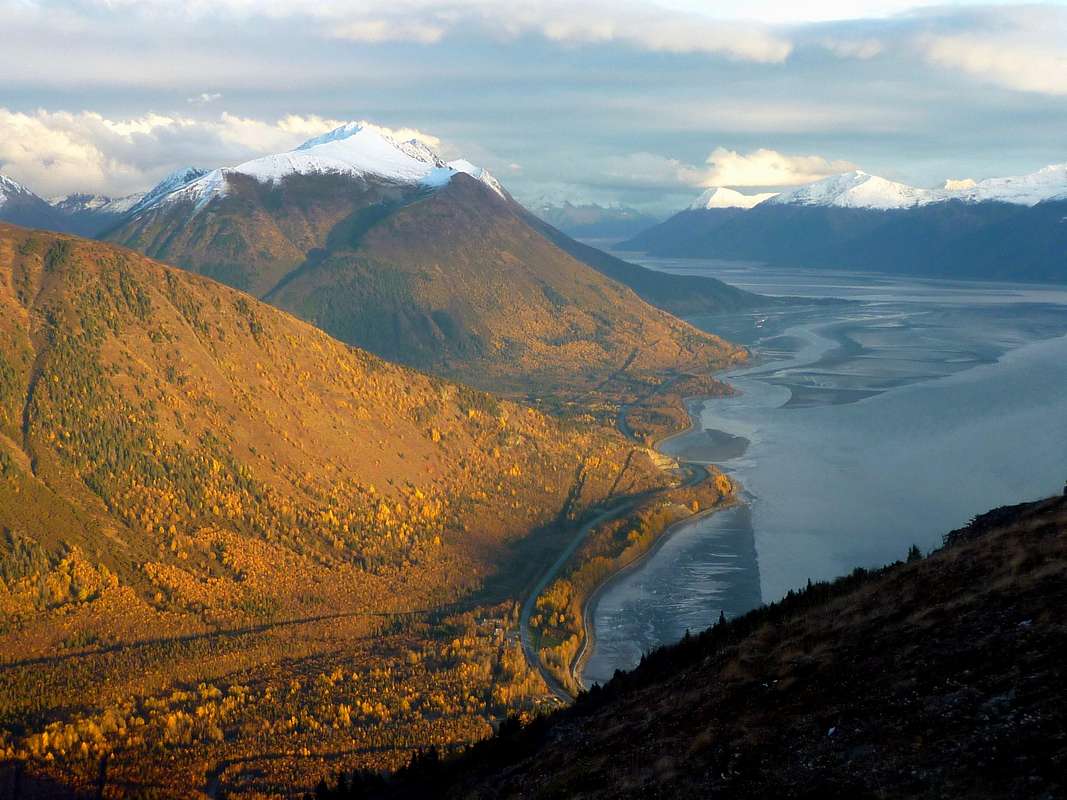
Turnagain Arm offers a surfeit of dramatic ascents--Rainbow, Indianhouse, South Suicide, Homicide's east ridge, to name just a few--and the closed-in, one-dimensional march up Penguin's regular route might not be the first choice of a Turnagain Arm regular. But once on the crest itself, the view is as fine as any to be had. Penguin is also the western gateway to one of Chugach State Park's classic ridge traverses.
Getting There
Access to Penguin Peak begins at the Bird Creek Valley Trailhead located off the Seward Highway on Konikson Road.From Anchorage, head south on the Seward Highway to milepost 101 (which is about 15 miles from the city's southern outskirts) and turn left on Konikson Road.
If coming from the Seward direction, look for Konikson Road on your right 10.3 miles after the Girdwood turnoff.
Once on Konikson Road, travel half a mile to a dead end in a large gravel parking area. Park here and continue on foot.
Routes
 The ascent gully opens out into pleasant tundra at its top end
The total distance traveled from trailhead to summit is only three miles, but it will take some time. Two hours would be quite fast ascent time; most parties will spent three or four reaching the top.
Three cautions are in order about the Penguin Peak Trail. First, it's very closed in below treeline, and in this area of high grizzly density you need to make noise and be prepared. There has been at least one recent mauling nearby. Second, I can't overemphasize just how active this avalanche gully is for, you guessed it, AVALANCHES. There is an incredible snowshed on the upper mountain that causes massive slides to run far below snowline in both fall and spring/early summer (not to mention in winter)--sometimes all the way to the valley floor. And they come right down the trail. When the upper part of the mountain holds even a modest amount of snow cover, this is a risk. Finally, this steep and sunless trail is always wet and slippery--there's just something extra greasy about the soil here. I'm ordinarily no fan of trekking poles, but this is the one place in the Chugach where I wouldn't be caught descending without them.
Penguin Traverse: It is a bit of a rite of passage among Chugach diehards to complete the whole of Penguin Ridge from the town of Girdwood to the village of Bird, or vice versa. At the Girdwood end the ridge is accessed near Gentoo Peak via the California Creek Trail, and from there the ramble and scramble to Penguin Peak is spectacular but unforgiving. Since there is no easy exit from the ridge without completing the whole traverse, to do this you have to commit to about 9500 feet of total vertical rise, sort of like hiking the grand canyon twice in a day (only without the benefit of a trail for most of the route). And once the snow is gone, water can be just about as scarce as it would be in the Grand Canyon. The best description of this marathon is probably Bill Finley's, found here.
Other Routes: Some may be tempted to consider dropping off the north side of the peak into the Penguin Creek drainage, perhaps with a visit to lovely Penguin Lake on the way. After all, the map makes it appear that you might be able to connect with a trail down there. Be aware that bushwhacking in the Penguin Creek Valley is truly heinous and the linkup to the trail system is not practical in any normal sense of the word.
Red Tape
Penguin Peak is located in Chugach State Park; however, the trailhead parking does not require a fee like some others.Camping
Bird Creek Campground is about a mile from the trailhead. The campground has 28 sites with picnic tables, fire pits, water, and latrines. The site fee is $20 per night with a max limit of 7 nights.Few will be tempted to camp on the mountain itself. Through mid-season, it would not be out of the question to camp in the bowl below the microwave relay, if one were inclined to carry a backpack there; pleasant and reasonably sheltered sites can be found on the tundra. Toward the end of the season, these sites would become waterless. Campfires are prohibited.
External Links
Chugach State ParkSeward Highway Scenic Byway
Seward Highway video
Bore tides (often visible from Penguin)