

-
 31763 Hits
-
 86.85% Score
-
 23 Votes
|
|
Mountain/Rock |
|---|---|
|
|
43.77169°N / 116.08875°W |
|
|
Ada/ Boise |
|
|
Hiking, Skiing |
|
|
Spring, Summer, Fall, Winter |
|
|
7582 ft / 2311 m |
|
|
Overview
 Shafer Butte
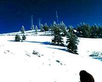
Shafer Butte is located within the boundaries of the Bogus Basin Mountain Recreation Area which is a ski area located in southwest Idaho in Boise County, 16 miles north-northeast of Boise with a summit elevation of 7582 feet (2311 m) above sea level at the top of Shafer Butte, the highest point of the Boise Ridge mountains. Peakbagger.com has Shafer listed at #38 highest prominence in the state of Idaho at 2702 Feet.
 Deer Point
Sister Peaks that surround Shafer Butte is Deer Point at 7070 feet and Mores Mountain at 7236 feet. Shafer Butte has enormous year round activity which includes sleigh rides in the winter and a very popular ski area. Summer has very good Mountain Biking and Hiking. There are several trails worth exploring. Many listed in the Rivers to Ridge Trail system which is clearly marked on each trail.
Bogus Basin Mountain Recreation Area
Getting There
To get to Shafer Butte, From Boise Airport take Airport way proceeding southeast as it turns into Vista Ave; continue on Vista Ave as it turns into Capitol Blvd and winds into Downtown Boise. Turn Left on W Front Street.Then turn right on W 15th and proceed to W Hays which becomes Harrison Blvd which after a mile of beautiful older homes turns into Bogus Basin Road which you will follow 16 miles to the Bogus Basin Resort. Then proceed up to Pioneer Lodge and access the trailhead from there.
Trailhead
The trailhead to Shafer Butte starts here and is connected to the Ridge to Rivers Trail System that covers most of trails from the valley floor to the Boise Ridge Mountains. Trailhead to Shafer next to Pioneer Lodge
They are very well maintained and most are shared with Mountain Bikers. They encourage you to stay on the trails so there is a less of a widening effect.
Ridge to Rivers Trail System
Winter Recreation
Shafer Butte in the winter is encompassed by Bogus Basin Recreation Area. It has everything from Alpine Skiing to snowshoeing and Nordic Skiing, The Nordic trails total 37km of which 7km are designated for night Nordic Skiing. Nordic Trail Map

Snowshoe passes and equipment rental are also available. For those of you who enjoy tubing, the resort has a great tubing hill with an 800 vertical course
Shafer Butte is a very busy year round destination.
Red Tape
None in the Summer-Lift ticket in the winter if you use the chair lifts.Camping
Drive here to hike or climb Shafer Butte or Mores Mountain. The Shafer Butte Campground sits between Mores Mountain and Shafer Butte and has 7 campsites and two fully accessible group picnic areas which can accommodate 30 and 50 people respectively. The Mores Mountain Nature Trail originates in the campground or you can go east and trail it up to Schafer Butte Summit.This is a wonderful campground. The fee we paid was $8 for the evening.
From Boise Airport take Airport way proceeding southeast as it turns into Vista Ave; continue on Vista Ave as it turns into Capitol Blvd and winds into Downtown Boise. Turn Left on W Front Street. Then turn right on W 15th and proceed to W Hays which becomes Harrison Blvd which after a mile of beautiful older homes turns into Bogus Basin Road which you follow 20 miles until you reach a signed dirt road. Turn east on the signed dirt road and go 1.5 miles to Shafer Butte Picnic Area.
Dean - Aug 13, 2008 9:41 am - Voted 10/10
Idaho prominence peakYou can add this distinction to why some of us would like to visit Shafer Butte. With 2700feet of prominence, it comes in at #38 on the Idaho list. http://www.peakbagger.com/list.aspx?lid=41315
tanner921 - Aug 15, 2008 12:27 am - Hasn't voted
Re: Idaho prominence peakDean, Thank you Sir! Take look now and see if it is better. I appreciate your advise. Tanner Weston