
-
 3460 Hits
-
 86.37% Score
-
 22 Votes
|
|
Mountain/Rock |
|---|---|
|
|
46.46540°N / 11.68610°E |
|
|
Trentino Alto-Adige |
|
|
Trad Climbing |
|
|
Spring, Summer, Fall |
|
|
7536 ft / 2297 m |
|
|
Overview
Geographical classification: Eastern Alps > Dolomites > Catinaccio Group > Palacia del Dociorìl
Palacia del Dociorìl
Palacia del Dociorìl is a mountain crag belonging to the Catinaccio Group, subgroup Molignòn-Antermoia, located on the South East flank of the Dociorìl. It’s not one of the most known and important peaks of the Catinaccio Group, however the summit projects to the Val d'Udai an interesting and vertical rocky wall of good yellow-grey dolomia, facing South and about 200 meters high. On the opposite side, to the North and to the East, the summit slopes with a steep grassy flank towards the bucolic meadows of Val di Dona. In addition to the existence of a beautiful and sustained route, the interest of this crag is due to the possibility of being frequented also when the ground-conditions on the highest peaks are not favorable, as early in the season or after summer snow-falls, given its favorable exposure and middle altitude. Moreover, the surroundings are charming and the lonely summit of Dociorìl gives liberally wonderful views over the nearby Dirupi di Larsèc and the surrounding Marmolada and Sassolungo groups.
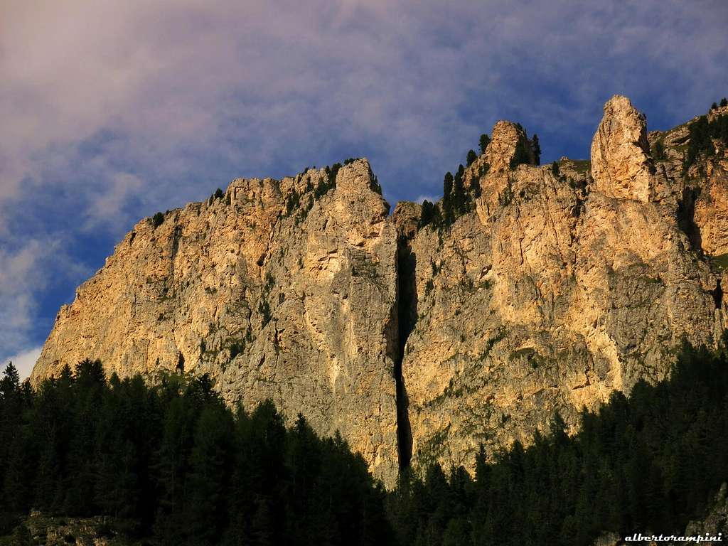
Palacia del Dociorìl South Face
Getting There
The starting point to approach the mountain is Mazzin di Fassa, located in the homonymous Val di Fassa, between Pozza di Fassa and Campitello.
Road access to Mazzin
- from Trento follow the Brennero Motorway towards North, exit Egna-Ora and take the road S51 towards Fassa Valley, getting to Cavalese, Predazzo, Moena, Pozza di Fassa and Mazzin (50 km. from Egna-Ora).
- from Bolzano take the Val d’Ega road, getting to Passo di Costalunga and descending to Vigo di Fassa and Pozza di Fassa. From here same approach as the previous description.

|

|

|
Spigolo delle Bregostane report
South Wall – Spigolo delle Bregostane report (UIAA scale)
Summit altitude: m 2297
Difficulty: Alpine TD-, UIAA max V+
Route length: 250 m
Exposure: South
First ascent: G. Battisti – E. Ravaglia 1988, July
Starting point: Mazzin di Fassa
The route "Donatella" or Spigolo delle Bregostane is a classic exposed climb on good rock with some fine pitches.
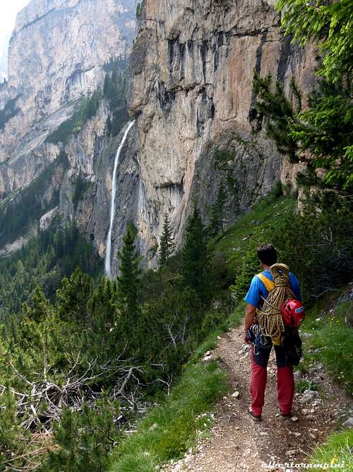
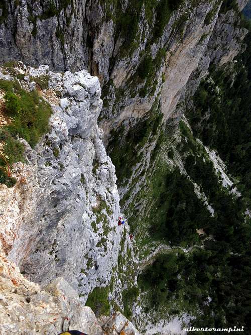
Admiring the Soscorza Fall |
An airy climb |
Spigolo delle Bregostane |
Walking approach - From Mazzin reach the upper part of the village, following the signposts to Val d’Udai and leave your car before the start of the forest road entering the Val d’Udai. Walk up along the fine forest road, at a first fork follow to the left and continue up along the path n. 580 reaching the scenic Cascate di Soscorza (Soscorza Falls), falling on the left of the path. After the falls you will meet a blue marked track, heading to the right. Be aware: here you must leave the main path n. 580 and turn to right, following the blue marked track rising inside the wood. When the blue track crosses a scree gully, leave it and scramble up the gully and the upper slopes, reaching steeply the base of the wall. The starting point of the climb is situated about 15 meters to the left of the edge.

|

|
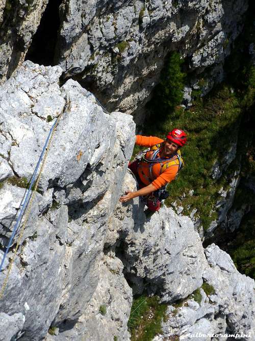
Climbing report
L1 - Climb slanting right on an easy grey slab reaching a stance near the ridge. III, IV, 20 m.
L2 – To the left reach a small ledge, traverse it left, then up a yellow corner, then a crack becoming a chimney. Belay in the chimney under an overhang. IV, V, 30 m.
L3 – Up the overhang, then a grey crack. An easy ramp to the left leads to the stance V, IV, 40 m.
L4 – Traverse right and take an overhanging yellow corner, then on the left climb a yellow crack, reaching a ledge. Up the slab above the ledge and reach a stance on the right. V, V+, 40 m.
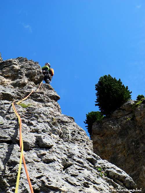
Exposed climb |
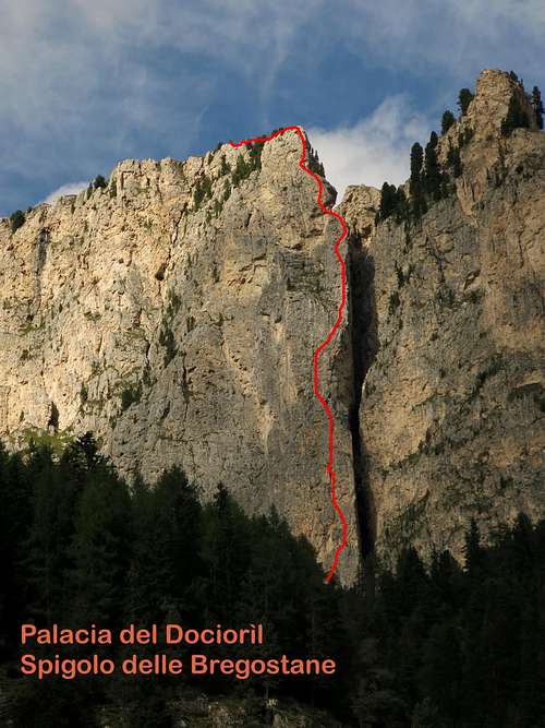
Spigolo delle Bregostane topo |
L5 – Climb the ridge, after a dwarfpine move towards left on grey slabs to the stance. III, IV, 40 m.
L6 – Again up the ridge to a stance below a yellow overhang. IV, 20 m.
L7 – Slanting left climb the overhang, then up directly and finally slanting right, reaching again the ridge. Pass two trees and reach the stance. IV, IV+, 25 m
L8 – Head to a yellow corner, climb it, then up a grey slab on the left of the ridge to the grassy summit IV+, III, 40 m.
Descent - Follow a grassy crest and some easy rocks, then up the wide meadows to reach the Docioril main summit m. 2355 (10 minutes from the exit of the route). From here descend towards left along the wide grassy slopes, reaching the path n. 580 descending along the val d’Udai.
Essential gear
Ropes 2x50, helmet, slings, middle and big friend are usefulSummit views

|

|
Red Tape
No particular restrictions in climbing and hiking.Natural parks
The Dociorìl is located inside the Natural Park Sciliar-Catinaccio-Latemar. This area, shared between the provinces of Bolzano and Trento, is one of the nine mountain systems of the Dolomites acknowledged as UNESCO World Heritage Site. This park is one of the most important systems worldwide for the study of the stratigraphy of the Triassic, in reason of the plenty of fossils on Alpe di Siusi, the relationship between carbonate and volcanic sediments, and the fact that the outcrops are easily accessible.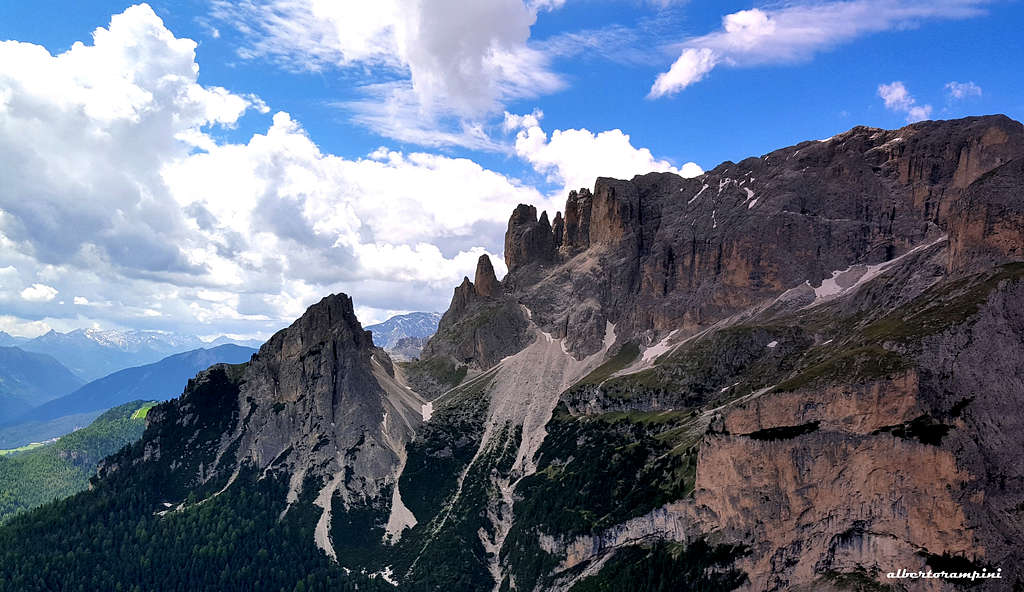
Catinaccio, with the stunning Vajolet Towers, forms a series of peaks and sharp needles showing the movement of an island which sank into the sea 240 million years ago. Cima Catinaccio is located inside the Natural Park Sciliar-Catinaccio and Latemar. This area, shared between the provinces of Bolzano and Trento, is one of the nine mountain systems of the Dolomites acknowledged as UNESCO World Heritage Site. It is one of the most important systems worldwide for the study of the stratigraphy of the Triassic, in reason of the plenty of fossils on Alpe di Siusi, the relationship between carbonate and volcanic sediments, and the fact that the outcrops are easily accessible. Catinaccio, with the stunning Vajolet Towers, forms a series of peaks and sharp needles showing the movement of an island which sank into the sea 240 million years ago. More info about Dolomiti Unesco World Heritage here: Dolomites living mountains Dolomiti Unesco
When to Climb
The best season goes from May to OctoberWhere to stay
Val di Fassa is a primary touristic destination, offering several possibilities of accomodation: hotels, campings, roomsMeteo
METEO TRENTINO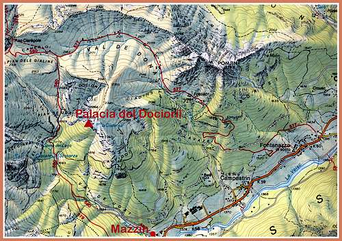
"La nuova guida del Catinaccio" by Antonio Bernard
"Dolomiti e dintorni" by Roberto Iacopelli - Cierre Edizioni 2000
 |
 |