
|
|
Mountain/Rock |
|---|---|
|
|
25.2412°S / 48.82956°W |
|
|
Campina Grande do Sul |
|
|
Hiking, Mountaineering, Scrambling |
|
|
Fall, Winter |
|
|
6070 ft / 1850 m |
|
|
Summit view...
Located at the middle sector from Ibitiraquire Range, Caratuva is one of the highest peaks from Paraná state and the whole brazilian south region, with 1.850m (6.070 ft) high. The name comes from a plant of the grass family, which grows in the camps over 1.400m (4.590 ft). The summit is covered with these plants.
Caratuva Peak is one of the most visited mountains in this range, because its trail is short and relatively easy. On a sunny day at the weekend, the summit is visited by 30 – 50 people. Sometimes even more.
Caratuva’s summit is a good place to enjoy the view of all other mountains of Ibitiraquire, especially the view of Paraná Peak group. The sunrise seen from there is unforgettable, with the shadows of Parana Peak massif.
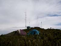
A curiosity: on the summit there are three antenas from radio stations (used to reply signal for amateur radio transmitions), and a wind generator, which can do on a windy day a horrible sound! Not a great view to a mountain summit of course.

Informational view of Ibitiraquire Sierra.
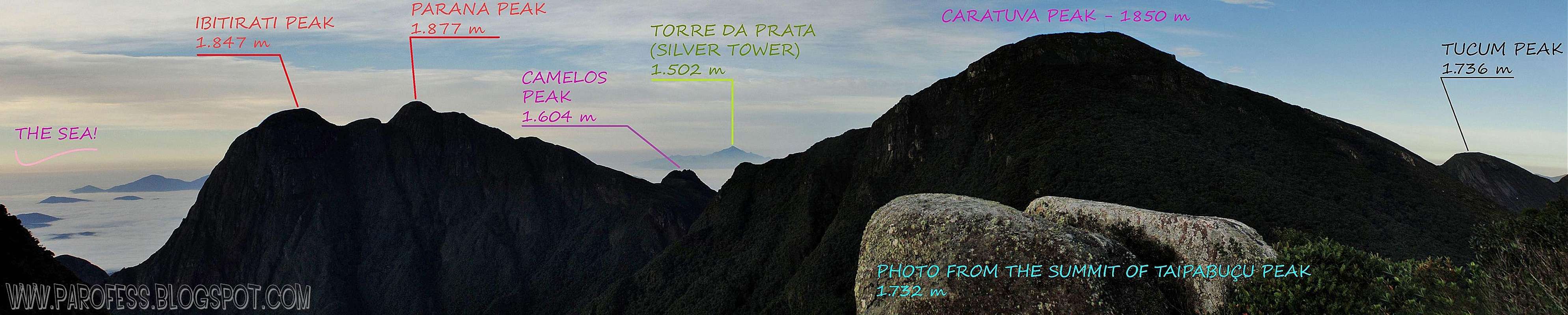
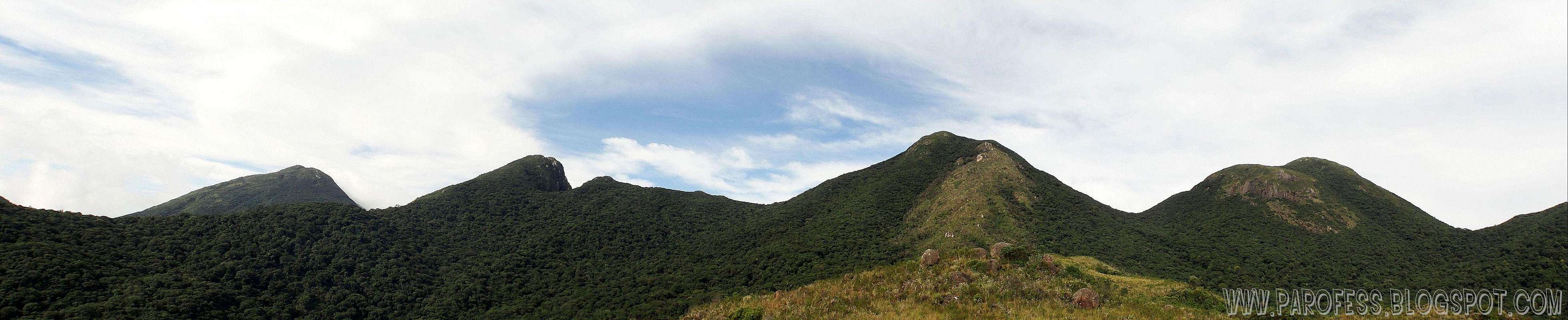
Another great informational view of Ibitiraquire range.
Getting There
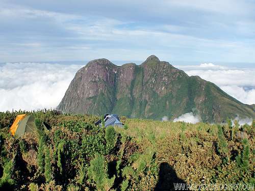
Left to right: Ferraria Peak, Taipabuçú Peak, Caratuva Peak and Itapiroca Peak
Summit of Caratuva
The trail:
In the first kilometers you will walk in the Pico Paraná trail going over a hill called Morro do Getulio. Just when this one goes into the forest (around one hour mabe an hour and a half), you'll see a trail cross encounter. To reach Caratuva e summit stay ahead. To the left you go around Caratuva straight to Taipabuçú Peak, and to right, the trail leads to Itapiroca Peak and after that Parana Peak. Be careful: if this creek is dry, you must go back to Paraná Peak trail, and walk other 15 minutes to find a water man made pool, with clean mountain water and a small pipe. There is no other water at Caratuva’s trail after the creek!
The way goes up, easy walk up to the summit, around 40 - 50 minutes tops. Just before the top, the trail changes from the forest into the “caratuvas sea”, the camps over the mountain, dominated by this plant.
Red Tape
To visit Caratuva and other mountains in this region, you must pay a symbolic tax of R$ 15,00 (around US$ 7.00) at the farm with Dilson (the farm owner), when you register.At all costs, forbidden to make fire and deforest any area. Sometimes people get lost inside the woods for a long time, be advised, Paraná Sierras can be very tricky. It's always good to be with someone that knows the trails if you wish to walk around that area.
Fire: Back in 2007 a huge fire destroyed a big part of Caratuva fauna. The clearer part on the main photo is the trace of that fire. Probably it was arson. A great deal of mountaineers with the fire department fought the fire bravely before it was too late. Even though, the changes are visible at the mountain side even today, years after the unfortunate fire.
Fighting the fire:
Photo: http://jornale.com.br/lineu_click/category/jornalismo/page/11/
Camping

Other option is to sleep at the farm, where there is a house with 7 or 8 beds, and in the next day to do an fast ascent to the mountain. You must pay of course for the bed, R$ 20,00 (around US$ 9.00).
Good to set up camp also above Getulio Hill and Itapiroca summit. Another great mountain in the area.
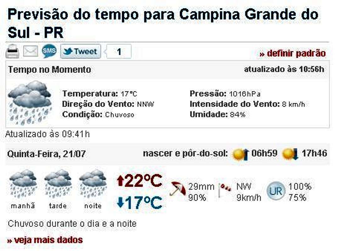
Weather forecast
You can hike this mountain in all seasons, but in summer there are rains every day. In winter is cold, but the days are clearer. The temperatures going from -10°C to 15°C.Best time to climb: April to September.
Legal Issues
To hike/ climb is a dangerous activity and requires proper equipment and clothing, the owner of this page cannot be blamed by injuries caused to anyone who read this page for its info about the mountain, and eventually got hurt by doing so with reckless behaviour or bad weather conditions.
Paulo Roberto Felipe Schmidt – AKA: PAROFES
External links
A brazilian website to get mountains info, including gps files to download:http://www.rumos.net.br/rumos/My youtube channel: www.youtube.com/parofes - Now with 270+ videos online!
The biggest brazilian website about climbing and mountaineering, for which I'm a columnist: