
-
 16855 Hits
-
 80.49% Score
-
 12 Votes
|
|
Mountain/Rock |
|---|---|
|
|
47.59432°N / 113.01452°W |
|
|
Hiking |
|
|
Summer |
|
|
8858 ft / 2700 m |
|
|
Overview
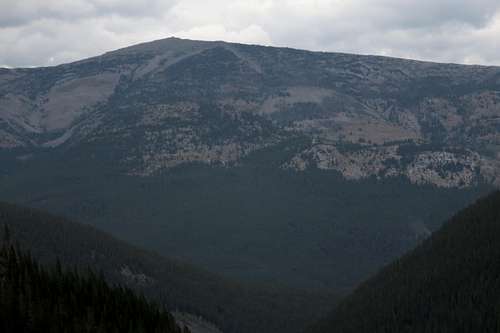
Prairie Reef from near White River Pass
Throughout the Rocky Mountain Front are several long north-south limestone ridges called reefs characterized by sheer eastern faces and gentler western slopes. Some of the better-known ones are Washboard Reef and Volcano Reef because they are closer to roads and trailheads and/or easily seen from highpoints accessible by day hikes or climbs, but Prairie Reef is notable for its remote position, as its summit is about 14 miles from the nearest trailhead; for its exceptional views of the spectacular and even more remote Chinese Wall; and for the fact that its summit is the highest point in the Bob Marshall Wilderness accessible via a maintained trail.
At the summit is a USFS fire lookout, manned in the summers. Of all the lookouts in the country's national forests and parks, this one has got be be among the top ones for quality of scenery. Use of the summit as a lookout began in the 1920s, with the first building constructed in 1931. The lookout building there today was erected in 1968.
Also visible from the summit is Rocky Mountain, the highest peak of the Bob Marshall Wilderness.
Although someone is outstanding shape could do the trip to and from Prairie Reef in one day, it makes far more sense to make it one of the destinations of a multi-day backpacking trip. A day's trek away is the Chinese Wall, as is White River Pass, which can serve as an important corridor for the hardy few making an east-west journey across the Bob Marshall Wilderness Complex.
Some online sources describe the trail up to the lookout as an out-and-back of about 9 miles. That is for the trail itself and does not include the approach.
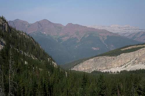
Hazy-day view to Red Butte and the Chinese Wall
Getting There
"The Bob" is a vast place, with numerous access points and virtually countless ways of putting an itinerary together, so I will simply describe the way I went to Prairie Reef, which also happens to be the shortest way.
From the small town of Lincoln, find the signed road heading west toward the mountains and Benchmark, which is the most heavily used trailhead for the Bob Marshall Wilderness. It takes about 45 minutes to an hour to reach the TH via a good but dusty gravel road that approaches and then winds through beautiful scenery. Park as close to the north end of the lot as you can, for that is where the trail begins.
Route
Take the South Fork Sun River Trail. Almost right away, there is a large bridge to cross. After almost 5 miles of mostly gentle hiking that is more downhill than up, cross another large bridge, this one over the West Fork Sun River. Shortly after the bridge, which is a great place to rest, have lunch, and replenish water supplies, reach a trail junction. Turn left to leave the South Fork Sun River Trail and follow the West Fork Sun River Trail.
Now the trail trends uphill, with some dips, but still retains an easy grade most of the time.
9.1 miles from the TH is an easy creek crossing; it is also the last good water source before the trail to Prairie Reef and from there to the summit unless you leave the trail and clamber down to the Sun River, which usually will entail about 100' of descent.
9.6 miles from the TH is the signed junction with the Prairie Reef Lookout Trail.
To this point, nearly 10 miles from the car, you have gained about only 650' but lost around 550' as well. Now prepare to grunt.
It is 4.7 miles to the summit, with 3518' of elevation gain. More than half the trail has little or no shade.
As there are no side trails and the trail is well-maintained, there are no confusing spots to write about. One notable waypoint is a saddle just east of Point 7570 where you get your first views of the Chinese Wall.
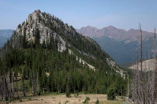
Point 7570 and the saddle
After the saddle, the trail climbs steeply again, soon reaching treeline and then making the final push to the summit and the lookout tower.
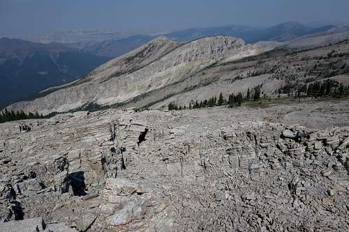 North Along Prairie Reef | 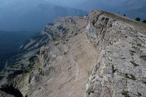 South from Prairie Reef Lookout |
Parties are supposed to register before departing. This is free.
Read the regulations posted at the trailhead.
Packing a gas stove is a good idea. This area gets hot and dry in the summer, and fire bans are not uncommon.
When to Climb
Summer.Camping
There are numerous camping opportunities along the trail. Making a base camp near Indian Point Meadows, 10.5-11.5 miles from the trailhead, is a good idea. From that point, day trips to Prairie Reef, the Chinese Wall, Pearl Basin, and White River Pass are possible.