
|
|
Mountain/Rock |
|---|---|
|
|
45.32728°N / 7.12629°E |
|
|
Hiking |
|
|
Spring |
|
|
11371 ft / 3466 m |
|
|
Overview
Punta Chalanson is placed at the end of the important border ridge between France and Italy that starts from Ciamarella.For its easy and amusing route is visit frequently in spring from a lot of alpinist and is very important even for ski-mountaineering.
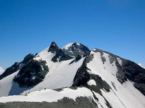
From right: Chalanson - Ciamarella - Piccola Ciamarella. Wiew from Chalanson pass (july 2006)
Getting There
- Fom Turin,motorway A55 exit Venaria Reale follow indications for Lanzo Torinese and go on through Germagnano and Ceres, here you enter in Val d'Ala, continue passing Ala di Stura and Balme and reach Pian della Mussa (1830 m.) where the road ends (78 km from Turin). Here you find Rifugio Città di Ciriè, or in 2.30 h on a good path, you can reach the Rifugio Gastaldi.Red Tape
There are no fees or permits.
Pay parking at Pian della Mussa, at the start of the route to Rifugio Gastaldi, there are no limitations for climbing and hiking. No problem for one night free camping, take care of nature as usual!
Normal Route
In 1 day, from Pian della Mussa - Rifugio Città di Ciriè using the path to Rifugio Gastaldi, reach the Pian dei Morti, from here turn right ascent the Naressa pasture and following the indications reach Pian Gias (2.15 h).
In 2 days, from Rifugio Gastaldi (2659 m) following the horizontal path on N direction, reach the old arrive station of the aerial railway and descent on the rocky slope to Pian Gias (50 min.).
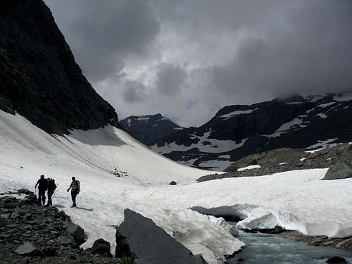
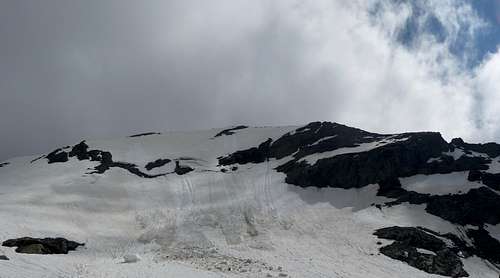
Pian Gias (2580 m.) on 20/07/2013
From Pian Gias (2580 m.) ascent on the left side of the glacier till surround the base of SSW ridge of Punta Chalanson and rise on the right the snowy slope of Collerin Glacier. Reach the Lower Chalanson Pass (3316 m. – Difficult F – 1.40 h) a large level area of debris, warning French side throw down directly on Glacier des Evettes, and proceed on the right ascending the West ridge reaching directly the summit (Difficult PD – 40/1.30 h, according to the ridge conditions). The first part of the ridge is rocky after is snowy, shaped and exposed, you must be careful especially with ice.
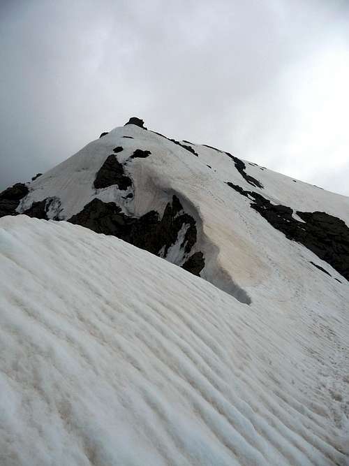
Punta Chalanson - West ridge (20/07/2013).
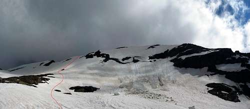
Variant: it is usual to reach the Chalanson West ridge on the right of the Lower Chalanson Pass, climbing the snow slope (WSW side) on the right of a rocky spur.
Punta Chalanson - Normal Route Variant (20/07/2013)
DESCENT: Descend on the same route, from Pian Gias is useful, if you don’t have to return to Rifugio Gastaldi, to descent directly on the Naressa pasture to Pian della Mussa, in this case pay attention at the end of Pian Gias, leave the snowy slope for the path on the right moraine (hydrographic).
When to Climb
The best time is from June to middle of July (depending of snow quantity and conditions).After without snow the climbing is absolutely not interesting.
Punta Chalanson WSW side (20/07/2013)
First Ascents
W ridge: W.A.B. Coolidge, F. Gardiner, Ch. Almer – July 05, 1885
N side: M. Levi, E. Barisone , L. Brosio - Sept. 21,1924
NE ridge: O. and G. Dumontel, E.C. Biressi – July 25, 1903
WSW side: not known
SSW ridge: not known
Accomodations
You can find accommodations in all villages of Valli di Lanzo, at Pian della Mussa you can use Rifugio Città di Ciriè. Contacts: Rifugio Città di Ciriè phone +39 0123 820008
You can use Rifugio Gastaldi as base for the ascents to: Uja di Ciamarella (3676 m), Albaron di Savoia (3627 m), Bessanese (3604 m),
Piccola Ciamarella (3540 m), Punta Chalanson (3466 m), Punta Maria (3302 m.).Refuge is open from 01/04 to 21/05 and from 1/06 to 17/09
Contacts: Rifugio Gastaldi phone +39 0123 565008 or visit www.rifugiogastaldi.it
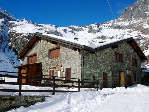
Rifugio Città di Ciriè
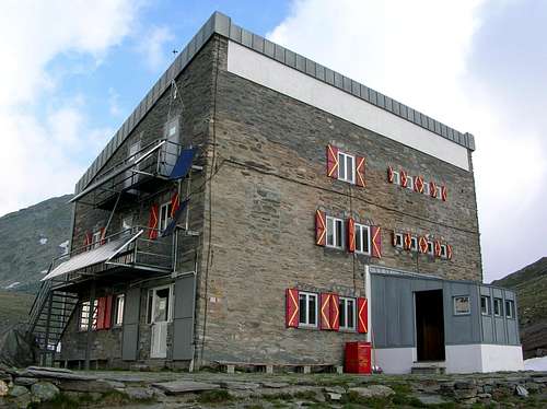
Gastaldi hut
Books and Maps
BOOKS
- G. Berruto, L. Fornelli "Guida dei Monti d'Italia - Alpi Graie Meridionali" Club Alpino Italiano/Touring Club Italiano (1980). (Italian)
google books - Guida dei Monti d'Italia - Alpi Graie Meridionali
MAPS
- IGC- Istituto Geografico Centrale N° 103, 1:25.000 Rocciamelone Uja Di Ciamarella Le Levanne
- ASF- Alpi senza frontiere / Alps without frontiers (IGN Institute Geographique National) N° 13, 1:25.000 Mont-Cenis Ciamarella
- IGC- Istituto Geografico Centrale N° 2, 1:50.000 Valli di Lanzo e Moncenisio
Mountain Conditions
You can get whether forecast at this site:
www.regione.piemonte.itofficial site of the Regione Piemonte
Miscellaneous Info
Useful:
Mountain Rescue phone n°: Italy 118 , France 04 79 05 11 88
Avalanche Bulletin: www.aineva.it
Union of Mountain Guides (Piemonte-Valle d'Aosta) phone n°: +39 011 517162