


-
 1980 Hits
-
 81.18% Score
-
 13 Votes
|
|
Mountain/Rock |
|---|---|
|
|
45.63980°N / 7.56987°E |
|
|
Hiking, Mountaineering |
|
|
Summer, Fall |
|
|
8885 ft / 2708 m |
|
|
Note
|
La montagna chiama i suoi figli, ed essi rispondono fedelmente al suo appello… Osvaldo Cardellina, Diario alpinistico, 1964-65 Page texts: @ OsvaldoCardellina "Osva", passed away on May 2, 2022. Page owners: Christian Cardellina e Osvaldo Cardellina. Any updates from September 12, 2022: Antonio Giani, page administrator, friend and climbing companion. Testi della pagina: @ OsvaldoCardellina "Osva", scomparso il 2 maggio 2022. Proprietari pagina: Christian Cardellina e Osvaldo Cardellina. Eventuali aggiornamenti dal 12 settembre 2022: Antonio Giani, amministratore della pagina, amico e compagno di salite. |
Overview
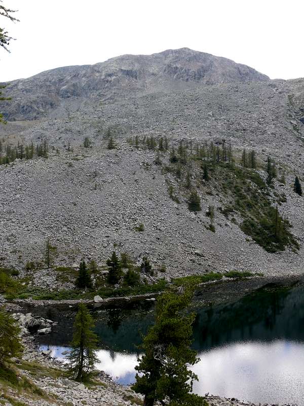
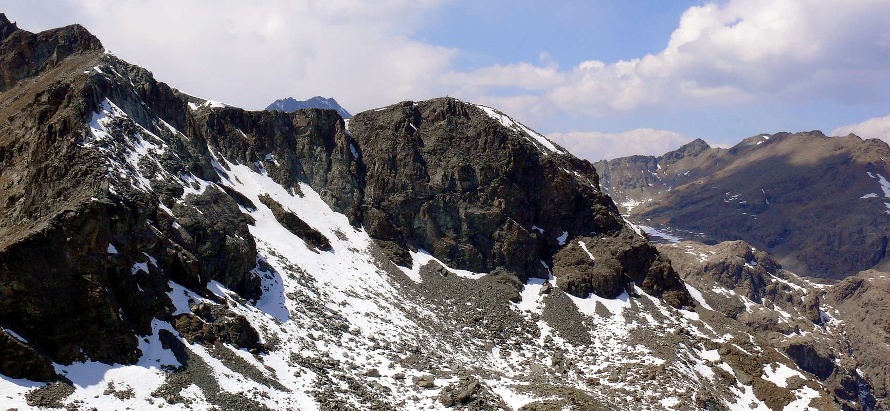
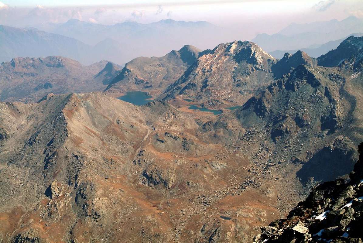
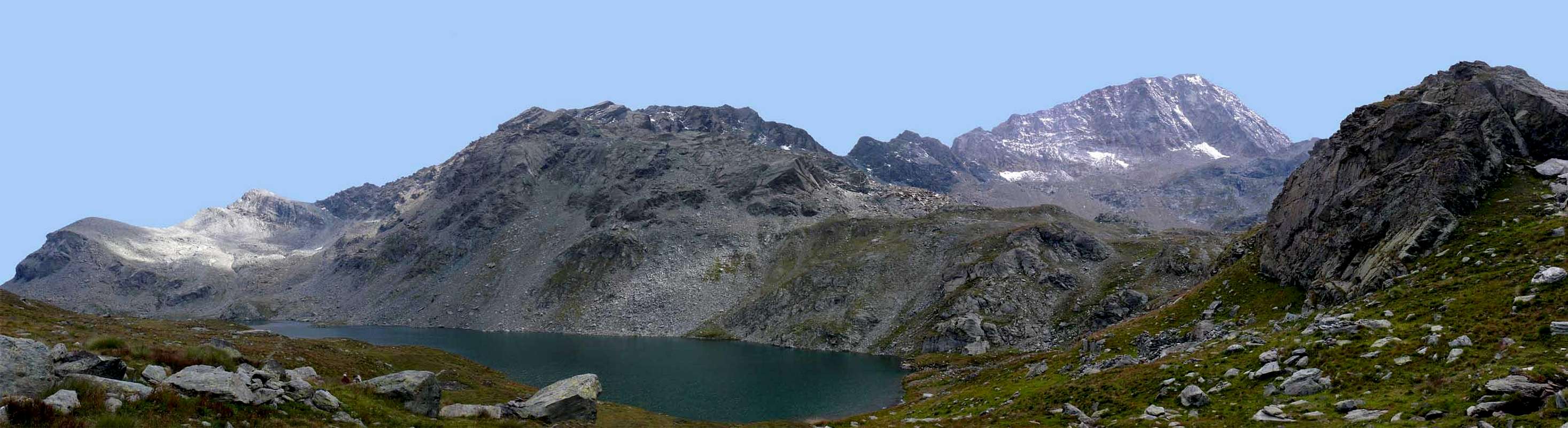
This small summit is the lowest in the large amphitheater above the Gran Lago (2.485m ; the largest in the Aosta Valley), that is, in that long watershed which divides the Champorcher Valley to the South from that of Champdepraz, or Vallone dei Laghi, to the North. In fact, after Mont Glacier (3.186m), the two Colli della Gran Rossa (West 2.786 meters approximately, East 2.763/6m), the two Summits of the Gran Rossa (East 2.858/60 meters approximately, West 2.866 m), the Saddle or Col du Pisonet (2.734m) and the Boccon Damon (2.790/2m) the partition still forms a small triangular pyramid (2.760/5 meters approximately) before heading decidedly North, leaving the main branch that continue towards the East with the Col Raty (2.541/2m) and the Tête des Hommes (2.614/18m), and conclude with the Altitude 2.708 meters for not many years called Punta G. Marquis, as says the plaque on the Summit.From the point of view of toponymy, it should be noted that this peak, topographically important as it delimits this splendid amphitheater to the East but less important in terms of mountaineering, has had this name for not many years. In fact, it is not mentioned in any publication except in some photo captions posted in SP; so no map of every era mentions it, while it appears for the first time in the "Carta dei sentieri" of the "Parco Naturale Mont Avic" on a scale of 1:25.000 edited by "L'Escursionista editore" 2005/06. Furthermore, as per personal experience, until 1975 there was no sign or mound on the Summit; also to be noted, as in the ""Book of Mont Glacier", "since 1922, there is no trace of a path in this regard.
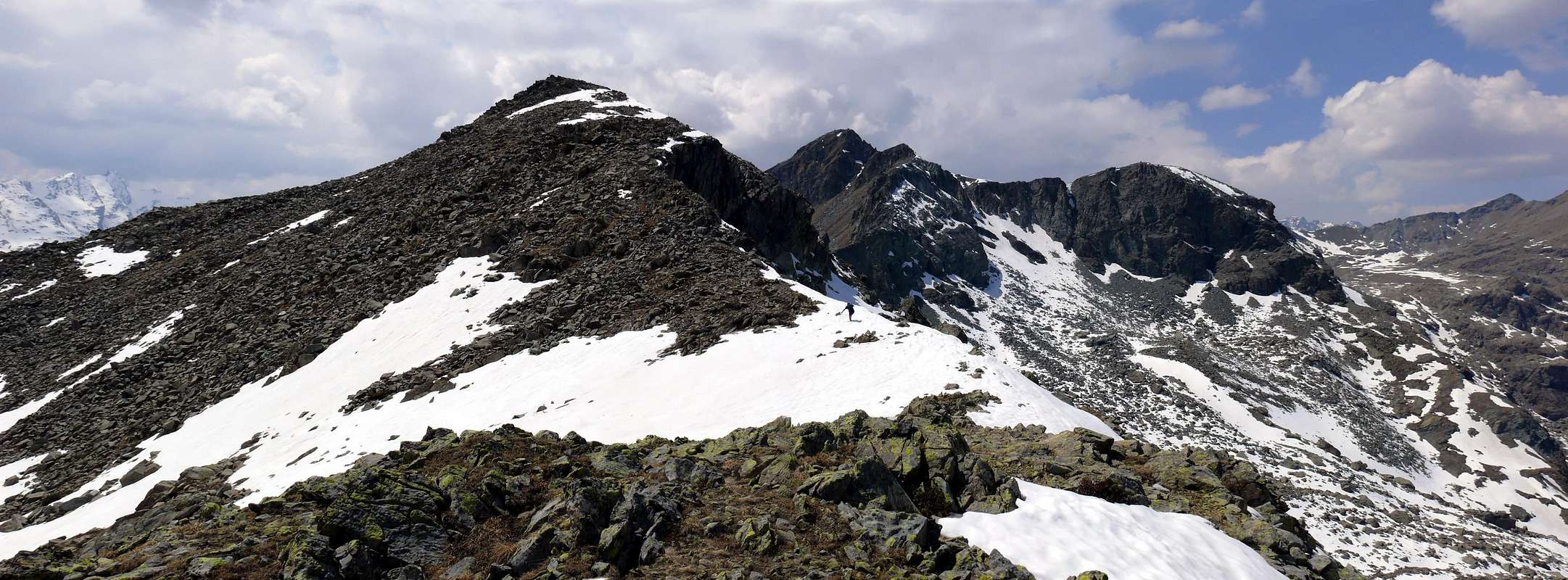
Questa piccola Sommità é la meno elevata nell'ampio anfiteatro soprastante a Meridione il Gran Lago (2.485 m; il più grande della Valle di Aosta), cioé in quel lungo spartiacque atto a dividere la Valle di Champorcher a Sud da quella di Champdepraz, o Vallone dei Laghi, a Settentrione. Infatti dopo il Mont Glacier (3.186 m), i due Colli della Gran Rossa (Ovest 2.786 metri circa, Est 2.763/6 m), le due Sommità della Gran Rossa (Est 2.858/60 metri circa, Ovest 2.866 m), la Sella o Col du Pisonet (2.734 m) ed il Boccon Damon (2.790/2 m) il divisorio forma ancora una piccola piramide triangolare (2.760/5 metri circa) prima di indirizzarsi decisamente a Nord, lasciando continuare il ramo principale verso Oriente con il Col Raty (2.541/2 m) e la Tête des Hommes (2.614/18 m), e concludere con la Quota 2.708 metri circa da non molti anni chiamata Punta G. Marquis, come recita la lapide posta sulla Vetta. Dal punto di vista della toponomastica c'é da annotare come questa Vetta, topograficamente importante poiché delimita ad Oriente questo splendido anfiteatro ma alpinisticamente meno importante, possiede questo nome da non molti anni. Infatti non la si trova citata in nessuna pubblicazione se non in alcune didascalie di foto postate in SP; così nessuna carta di ogni epoca la nomina, mentre appare per la prima volta nella "Carta dei Sentieri Parco Naturale Mont Avic" in scala 1:25.000 edit. da "L'Escursionista editore" 2005/06. Inoltre, da esperienza personale, fino al 1975 non esisteva nessun segnale o tumulo in pietra e no sulla Sommità; altresì da annotare, come dal ""Libro di Vetta del Mont Glacier", dal 1922, non esista traccia di percorso in merito.
First Ascents
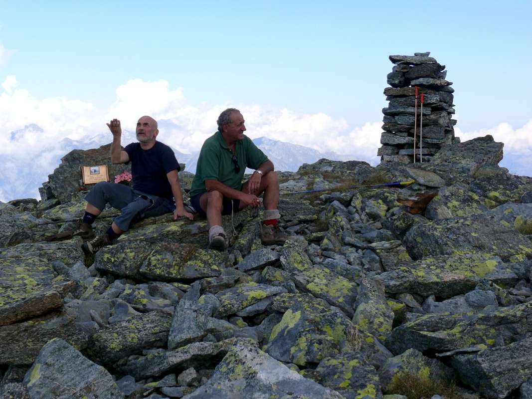
- First on the Summit: probably Osvaldo Cardellina, lone (Aug 18th, 1975), in descent from Mont Glacier through Eastern Ridge with crossing to Gran Rossa, Boccon Damon and Northern Crest.
- In winter: Unknown.
- West-northwest Slope (Normal Route): unknown, in ascent from Champorcher or Champdepraz towards Refuge Barbustel, Lac Noir, Lac Cornu, Gran Lago.
- E Wall (Central Edge/Gully) Osvaldo Cardellina, solo, (Aug 15th, 2007), in ascent from Petit Mont Blanc Hamlet, Grand Cort Pasture, Muffé Loch, Colle del Lago Bianco, Lac Noir; in descent Northen Crest towards Pisonet Alp, Lac Cornu, Lac Noir, Lago Bianco, Refuge Barbustel,, Colle del Lago Bianco, Petit Mont Blanc.
- Northern Spur Osvaldo Cardellina, solo, (Aug 15th, 2007), in descent from the Top towards Pisonet Alp, Lac Cornu, Lac Noir, Lago Bianco, Refuge Barbustel.
Getting There
BY CAR:
- From TORINO, MILANO, etc: Motorway A5. Exit at IVREA or Quincinetto (PIEDMONT).
- From IVREA Town: in West (Southern side) to Pont Saint Martin, Donnas, Bard, Champdepraz Municipalities.
- Southern Side: From Pont Bozet (775m) to Champorcher Valley, Camporcher-Château (1.427m), Petit, Grand Mont Blanc, La Cort Villages, towards Dondena Village (2.092m), Dondena & Miserin Refuges, through Royal Road and dirt roads; Barbustel Refuge, through Royal Road and path towards Champdepraz Vallon. From Hône-Bard towards Champdepraz (523m) and from this to Lakes Vallon and Voella or Raye Chevrères Village (1.307m; by Regional Road). Barbustel Refuge with path from Voella.
- From FRANCE: through the Mont Blanc Tunnel to Entrèves-crossroads to Vény/Ferret Valleys - Mountain Guides of Courmayeur - La Saxe Rock Gym - Courmayeur. By Little Saint Bernard Pass, closed since November until half May to La Thuile Valley - Pré Saint Didier - Courmayeur. It is not necessary to take Motorway A5: you can drive on SS.26, in the direction of AOSTA - IVREA - TURIN.
BY PLANE:
- Aeroporto "Corrado Gex" Saint Christophe (Aosta).
![G. Marquis This Lord got lost! Brrrrrr excuse Eminence ......]()
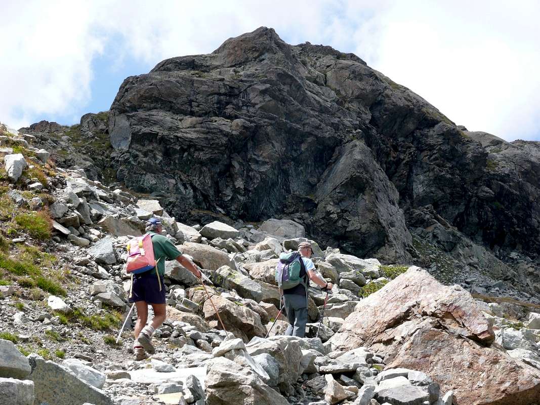
![G. Marquis Ascending to the Summit]()
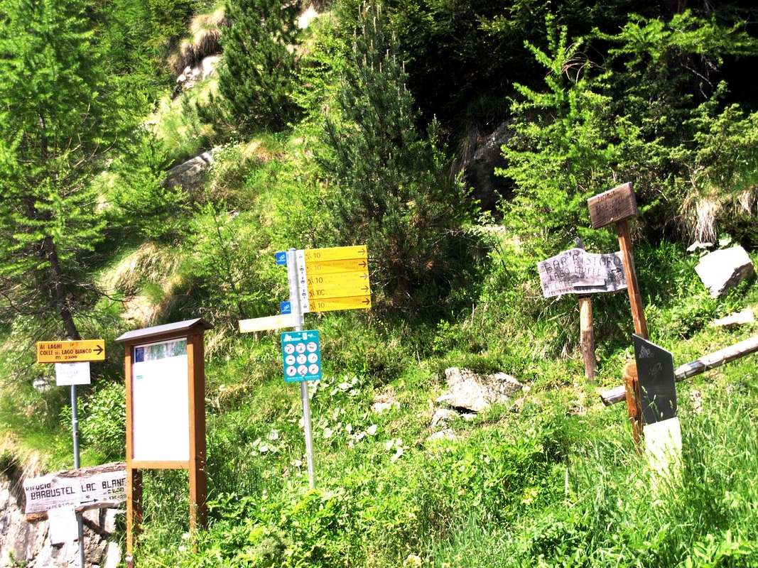
![Tableaux & signals towards Barbustel Refuge...]()
Approaches to Barbustel Refuge from Champorcher & Champdepraz Valleys
From Champorcher Valley (through Colle del Lago Bianco or by Col de la Croix)
From the car park (1.766m) to the entrance of the Natural Park of Monte Avic on the Royal Road to Dondena Hamlet go up with the path n° 10 reaching Alpe Grand Cort (1.945m) and the following junction 2.220 meters for the Colle del Lago Bianco/Col de la Croix; leave to the right (Northeast) the deviation n° 10C for the latter and instead continue North towards the former. A short descent leads to the Barbustel Refuge (2.200 m), consisting of a restored hut with a beautiful wooden fountain, and positioned in a clearing fifty meters above the Lago Bianco and immediately Northeast of Lago Nero (1.766m; 1h'15'/1h'30).
Dal parcheggio (1.766 m) all'ingresso del Parco del Monte Avic sulla Strada Reale per Dondena salire con il sentiero n° 10 raggiungendo l'Alpe Grand Cort (1.945 m) ed il successivo bivio 2.220 metri per il Colle del Lago Bianco/Col de la Croix; lasciare a destra (Nordest) la deviazione n° 10C per questo ultimo e proseguire invece con direzione Nord verso il primo. Una breve discesa conduce al Rifugio Barbustel (2.200 m), costituito da una baita restaurata con bel fontanile in legno, nonché posizionato in una radura una cinquantina di metri al di sopra del Lago Bianco e subito a Nordest del Lago Nero (1.766 m; 1h'15/1h'30).
From Champdepraz Vallon or Valley (with various possibilities) Through Leser Vallon: from Voella or Chevrère (1.307m) before in Southeast to locality of Fénis Dèsot (1.416/60m) with path n°5, after towards the Low, Upper Alps (1.900m), Loch (2.019m) and in Southwest connection-paths to Vallette Loch (2.170m) before the Barbustel Refuge (2.132m), with following numerous variations to two hills and lochs (see below Lakes Valley).
Lakes Vallon:
1) - from Voella in South to Alp La Serva (1.540m) and Lake (1.801m) with path n° 5C , Bayet Alp (2.071m), Cousse or Coucy Pasture (2.051m), Refuge Barbustel, with path. From this:
2) - in Southeast Lake Vallette (2.170m) to Col de la Croix (2.287m) and Cima Piana, with path n° 4/102 , which becomes trail n° 10 to descending from the Pass into the Champorcher Valley ;
3) - Also in South then Southwest starting from Covarey - Park Visitor Center (1.264m) towards Bois de Pessey (Pessey's Wood) and reaching the previous path at fork 1.960 meters just above Leser Damon Alpages (1.907m), with paths before n° 4 and after n° 4/5/102.
Attraverso il Vallone di Leser: da Voella o Chevrère (1.307 m) dapprima a Sud-est verso la località di Fénis Dèsot (1.416/60 m) tramite il sentiero n° 5, dopodiché verso le Alpi Basse, Altei (1.900 m), Lago di Leser (2.019 m) ed a Sud-ovest i sentieri di collegamento al Lago Vallette (2.170 m) prima del Rifugio Barbustel (2.132 m), con a seguire numerose varianti ai due colli e laghi (vedi sotto Valle dei Laghi).
Vallone dei Laghi:
1) - da Voella a Meridione verso l'Alpe La Serva (1.540 m) ed omonimo Lago (1.801 m) tramite il sentiero n° 5C, all'Alpe Bayet (2.071 m),a quella di Cousse o Coucy (2.051 m) e Rifugio Barbustel, con sentiero. Da questo:
2) - a Sud-Est Lago Vallette (2.170 m) al Col de la Croix (2.287 m) e Cima Piana, con sentiero n° 4/102, che diventa percorso n° 10 scendendo dal Passo dentro la Valle di Champorcher;
3) - Oppure a Sud e poi a Sudovest partendo da Covarey-Centro Visita Parco (1.264 m) verso il Bois de Pessey e raggiungendo il precedente al bivio 1.960 metri appena sopra l'Alpeggio di Leser Damon (1.907 m) e la Valle di Champorcher, con sentieri dapprima n° 4 ed indi n° 4/5/102.
From Rifugio Barbustel (2.000m) to the entrance of Vallone dei Laghin or Valley of the Lochs located at the top of the Municipality of Champdepraz, go down briefly with the path n° 5 towards the Southwest reaching the footbridge at 2.263 meters for the Black Lake; it crosses the stream that comes from the Vallone del Monte Orso and the ruined Alps of Pisonet (2.292m). From here, always with the same path n° 5 as well as trail inter valleys n° 102 , for the first time you definitely change direction towards the South, arriving at the ford (2.306m) on the emissary from the Great Lake (2.485m) and then, gradually turning before to the Southwest and after to the West, reaching the same (1h'00/1h'30). From the mouth of the emissary there are two possibilities with
A: head immediately towards the Southern shore of the lake and go up directly towards the Southeast the wide moraine that descends from Punta G. Marquis leaving immediately on the left (North) that characteristic rocky spur shaped like a head of lion. Or, if you want to make the tour more pleasant and panoramic,
B: continue on the Northern shore reaching after a short ascent the Rifugio della Forestale, dedicated to P. Verhuy and located on the road to Colle di Mezove or Medzove Pass (2.614/16m). Rounding the lake from West to East on scattered traces, reach the point of the previous itinerary at the altitude of 2.513 meters South-east of the lake itself and from this point go up the wide moraine with two possibilities
1) - aim definitely to the East towards the altitude (2.646m), located at the base of the aforementioned rocky promontory surrounding it on the right (South) passing between this and a rocky strip that descends diagonally; or
2) - go up further South-east (scattered yellow signposts) towards the Saddle (2.683/85m) located immediately South of the Summit, whence in a short time and without any difficulty (from half an hour to an hour for the two routes A and B, same time for the other two on the West-Northwest Flank).
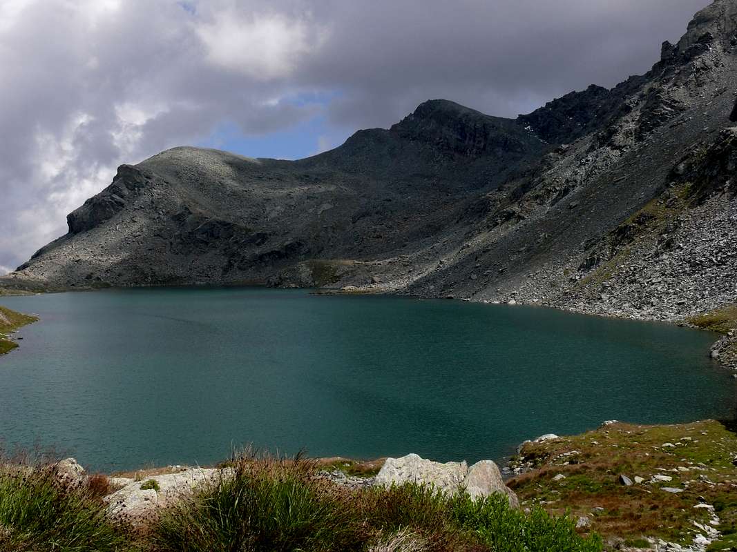
Dal Rifugio Barbustel (2.200 m) all'ingresso del Vallone dei Laghi sito al vertice del Comune di Champdepraz, scendere in breve con il sentiero n° 5 verso Sudovest raggiungendo la passerella a 2.263 metri per il Lago Nero; la stessa attraversa il torrente che proviene dal Vallone del Monte Orso e dalle Alpi diroccate del Pisonet (2.292 m). Da qui, sempre con lo stesso sentiero n° 5 nonché intervallivo n° 102, si cambia una prima volta decisamente direzione verso Sud approdando al guado (2.306 m) sull'emissario dal Gran Lago (2.485 m) e quindi, volgendo gradualmente a Sudovest e poi ad Ovest, il medesimo (1h'00'/1h'30). Dalla foce dell'emissario due possibilità con
A: indirizzarsi subito verso la sponda Meridionale del lago e risalire direttamente verso Sudest l'ampia morena che scende dalla Punta G. Marquis lasciando subito sulla sinistra (Nord) quel caratteristico sperone roccioso a forma di testa di leone. Oppure, volendo rendere più piacevole e panoramico il giro,
B: proseguire sulla sponda Settentrionale raggiungendo dopo breve risalita il Rifugio della Forestale, dedicato a P. Verhuy nonché posto sulla via per il Colle di Mezove oppure Medzove (2.614/16 m). Doppiando il lago da Ovest ad Est su tracce sparse, raggiungere il punto dell'itinerario precedente presso la quota di 2.513 metri posta a Sudest del lago medesimo e da questo punto risalire l'ampia morena con due possibilità
1) - puntare decisamente ad Est in direzione della quota (2.646 m), collocata alla base del suddetto promontorio roccioso contornando il medesimo sulla destra (Sud) tra questi ed una fascia rocciosa che scende in diagonale verso destra; oppure
2) - risalire maggiormente verso Sudest (sparsi segnavia in giallo) in direzione della Sella (2.683/85 m) situatasubito a Sud della Vetta, donde in breve tempo e senza nessuna difficoltà alla stessa (da mezz'ora ad un'ora per i due percorsi A e B, stesso tempo per gli altri due sul Versante Ovest-nordovest).
Difficulties
F (Easy) and for Hikers (E).F (Facile) e per Escursionisti (E).
Campings
Remember that free camping is forbidden (except for emergency reasons, over 2.500m, from darkness until dawn).Huts

Mountain Conditions
- You can get meteo information at the official site of the Regione Valle d'Aosta:
- Valle d'Aosta Meteo
Books and Maps
- "Guida delle Alpi Occidentali" di Giovanni Bobba e Luigi Vaccarone C.A.I. Sezione di Torino Volume II (parte II), 25 Maggio 1896.
- "Guida dei Monti d'Italia – Emilius Rosa dei Banchi-Parco del Mont Avic" di Giulio Berutto e Lino Fornelli - Club Alpino Italiano/Touring Club Italiano, Marzo 2005.
- "Diari Alpinistici" di Osvaldo Cardellina e Indice Generale accompagnato da Schedario Relazioni Ascensioni 1964-2019 (inediti).
 |
 |
 |
- Ingenia "Parco Naturale del Mont Avic" Carta dei sentieri 1:25.000.
- Enrico Editori Ivrea "Carta turistica del Canavese" 1:100.000
- Enrico Editore Ivrea-Aosta "Gruppo del Gran Paradiso" 1:50.000.
- L'Escursionista editore "Valle di Champorcher Parco Mont Avic" Carta dei Sentieri (n° 11) 1:25.000.
- L'Escursionista "Valle di Cogne" Carta dei Sentieri 1:25.000.
Important Information
- REGIONE AUTONOMA VALLE D'AOSTA the official site.
- FONDAZIONE MONTAGNA SICURA Villa Cameron, località Villard de la Palud n° 1 Courmayeur (AO) Tel: 39 0165 897602 - Fax: 39 0165 897647.
- A.I.NE.VA. (Associazione Interregionale Neve e Valanghe).
Useful Numbers
- Protezione Civile Valdostana località Aeroporto n° 7/A Saint Christophe (Ao) Tel. 0165-238222.
- Bollettino Meteo (weather info) Tel. 0165-44113.
- Unità Operativa di Soccorso Sanitario Tel. 118.