
|
|
Mountain/Rock |
|---|---|
|
|
42.30000°N / 19.45000°E |
|
|
6748 ft / 2057 m |
|
|
Overview
 |  |  |  |
Popadija (2057 m) peak belong to group of very popular peaks for climbing, even it doesn't belong to highest peaks of PROKLETIJE massif. But still, Popadija peak is very attractive and offers the enjoyable mountain adventure in all year seasons, specially in winter time, when you can climb and reach it's summit and spent some time in enjoyment of many unforgetable summit panoramas.
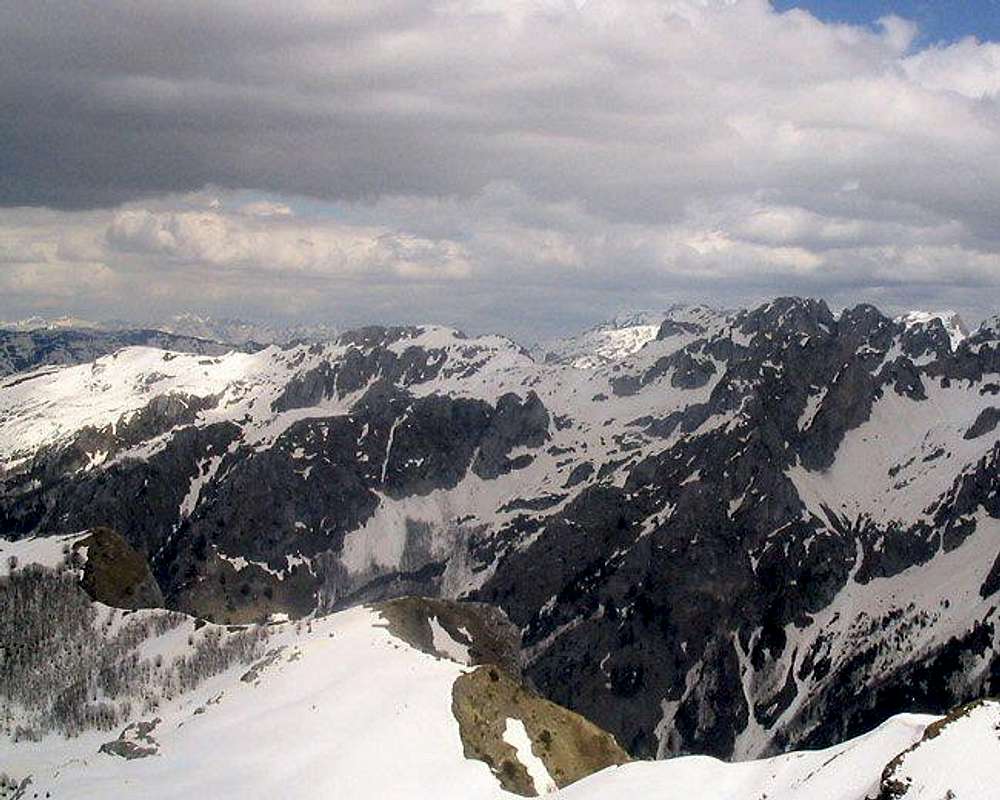
Popadija peak, similar like Volusnica (1879 m) peak, is also very known as maybe one of the best viewpoint peak in area of peaks which are belong to Gusinje part of Montenegrin Prokletije, and with Volusnica (1879 m) and Vojusa (Vojushit, 2210 m) is for sure one of the best and most impressive viewpoint to amazing Karanfili (2460 m, 2490 m, 2441 m) peaks. Popadija summit view to Karanfili peaks is different than view from Volusnica, because from Popadija you can see also amazing Ropojanska Vrata (Ropojan's Door) which is placed between Juzni Vrh Karanfila (Karanfil South Peak, 2441 m) and Forca (2340 m).
Also, from Popadija summit you can see Ocnjak (2185 m) peak and many other high and sharp peaks of Prokletije massif which stay in border zone with Albania.
Climbing of this peak is used as preparation for other, more difficult tours in this part of the Prokletije mountain range, as are Karanfili (2490 m), Ocnjak (2185 m), Rosni Vrh (Maja Rosit, 2525 m) and Kolac (Kolata, 2528 m).
Even is not belong to the group of the highest peaks of Prokletije range, Popadija offers unforgetable enjoyment in amazing beauty of Prokletije massif. So, if you are visiting Montenegrin part of Prokletije, don't miss Popadija!
LOCATION:
Popadija (2057 m) is placed above Dolina Volusnice (Volusnica Valley) on it's SW side. Volusnica Valley stretches in NE-SW direction. The lowest point of the valley is the entrance from the forest, while it's highest point is on SW side - Popadija (2057 m) peak, on border line with Albania. Volusnica Valley is open to Grbaja Valley by Volusnicki Potok (Volusnica Brook).
Southern border of Volusnica Valley is it's ridge, from where the slope of the valley descends easily to the valley and "katuni" (shepherd's huts). On north side of the valley is ridge which Volusnica (1879 m) separate from Popadija (2057 m). The only approachable connection between those two peaks is Cafa Pass (1870 m)(read "Chafa"). Volusnica Valley is mostly grassy and very rich with water springs which are placed everywhere. This valley is also easily accessible, so that's one more reason why mountaineers like it very much.
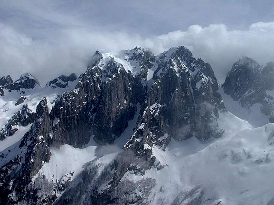
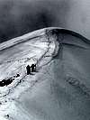
Popadija (2057 m) massif from Volusnica (1879 m)
Popadija (2057 m) peak is located on NW from Kolac (Kolata, 2528 m), Rosni Vrh (Maja Rosit, 2525 m), Karanfili (2460 m, 2490 m, 2441 m), Maja Lagojvet (2466 m), Maja Vukoces (2450 m), Forca (2340 m), Maja Haruses (2424 m) and Maja e Pecmaras, on N from Maja Jezerce (2694 m), Maja Popluks (2569 m), Kokervhake (2508 m), Maja Grik e Halt (2625 m), Maja Radohines (2570 m), Maja Brijaset (Brijac, 2567 m), Maja Hekurave (2561 m), Majet e Zabores, Maja Malisores (2490 m), Maja Shchokishte (2461 m), Sev i Barde (2252 m), Maja Ragomit (2472 m), Maja Alis (2422 m), Maja Snikut (Nikacki Vrh, 2554 m), Maja Skurt (2499 m) and Vojusa (Vojusit, 2210 m), on S from Popadija (2057 m), Karaula (1915 m), Rogopec (Vezirova Brada, 1780 m) and Gusinje town, on W from Djeravica (2656 m)&Bogdas (2530 m)(two peaks of Serbian part of Prokletije), Volusnica (1879 m), Mt Bor and Vusanje village, on N from on SW from Visitor (2211 m).
SUMMIT VIEW:
SE: Kolac (Kolata, 2528 m), Rosni Vrh (Maja Rosit, 2525 m), Karanfili (2460 m, 2490 m, 2441 m), Maja Lagojvet (2466 m), Maja Vukoces (2450 m), Forca (2340 m), Maja Haruses (2424 m) and Maja e Pecmaras
S: Maja Jezerce (2694 m), Maja Popluks (2569 m), Kokervhake (2508 m), Maja Grik e Halt (2625 m), Maja Radohines (2570 m), Maja Brijaset (Brijac, 2567 m), Maja Hekurave (2561 m), Majet e Zabores, Maja Malisores (2490 m), Maja Shchokishte (2461 m), Sev i Barde (2252 m), Maja Ragomit (2472 m), Maja Alis (2422 m), Maja Snikut (Nikacki Vrh, 2554 m), Maja Skurt (2499 m), Vojusa (Vojusit, 2210 m)
N: Popadija (2057 m), Karaula (1915 m), Rogopec (Vezirova Brada, 1780 m), Gusinje town
NE: Visitor (2211 m)
E: Djeravica (2656 m)&Bogdas (2530 m)(two peaks of Serbian part of Prokletije), Volusnica (1879 m), Mt Bor and Vusanje village
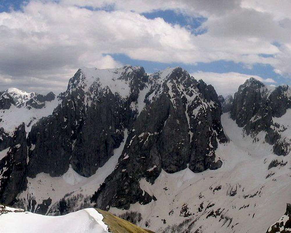
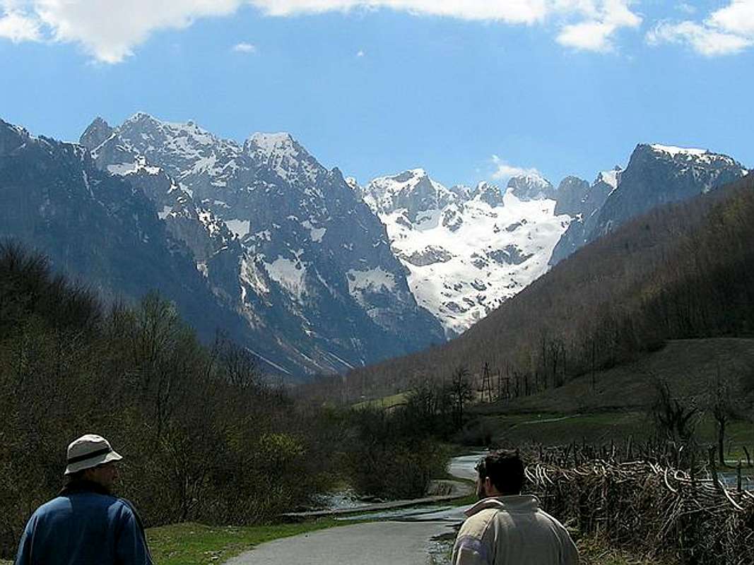
Karanfili (2460 m, 2490 m, 2441 m) from Popadija (2057 m) summit
 |  |  |  |  |
Routes Overview
Classical route: Dom Grbaja (Grbaja Hut, 1160 m) - Volusnica katun (1680 m)(T3) 1h - Popadija (2057 m)(T3)(42.30 N, 19.45 E) 2h: 3hHeight difference: 899 m
Duration: 3h
Trail: Marked
ACCESS: 12 km on the road from Plav to Gusinje, and than 7 km more to Grbaja Valley. This mountain valley is a former glacial riverbed, surrounded by the peaks of Vezirova Brada, Podgoja, Karanfili, Volusnica and Karaula.
ROUTE DESCRIPTION: The marked trail starts at the "Dom Grbaja" (1160 m, Grbaja Hut), near the military watchtower and then through a beech wood to the plateau and Volusnica Katun (1680 m)(shepherd hut). It is a glacial cirque and the katun is rich with water. The Volusnica Brook is formed from melting snow and a waterfall, and flows to Grbaja Valley. Near the Volusnica katun markers goes in two directions, one to the left to Volusnica (1879 m) peak and one straightaway to the Popadija (2057 m) peak. Continue your path to Popadija peak, walking on path on steep slopes on right side of Volusnica Valley, going on left side by waterfall, active during spring and summer. After that go to Chafa Pass and via pass to Popadija ridge. Than on the ridge to the summit of Popadija (2057 m).
Popadija (2057 m), (also named "Talijanka") is a part of the border line with Albania.
Acces to Volusnica & Popadija should be made along the layered rock (1790 m), which is a carved "strip" from the Neolith Age of 600 years B.C. There is a primitive drawing of a wolf attacking a child.
This tour is tipical hiking tour and is used as preparation for other, more difficult tours in this part of the Prokletije mountain range.
 |  |  |  |  |
Getting There
Going to Grbaja Valley from Dolja Valley
Gateway to Prokletije and Popadija (2057 m) peak are Plav town and Gusinje town and Grbaja Valley. Information how to get there:
By Plane
~To Beograd (Belgrade, Serbia&Montenegro capital) airport. Than with plane to Podgorica, capital of Montenegro, or with bus or car to Plav town.
~To Podgorica airport. Than with bus or car to Plav town and after to Gusinje town.
Information about flights & tickets find on the sites of JAT Airways, a former Yugoslav airlines, or on Montenegro Airlines.
By Bus
~Beograd (Belgrade)-Plav
~Podgorica-Plav
By train
~Beograd (Belgrade)-Bijelo Polje. Than with bus or with car (rent a car) to Plav and Gusinje.
By car
~Beograd (Belgrade)-Kraljevo-Novi Pazar-Plav-Gusinje.
~Podgorica-Kolasin-Andrijevica-Plav-Gusinje
Gusinje town and Plav town (in Montenegro) are the main destinations you would head first. In Gusinje you can buy everything (food, shampoo, soap, clothes,... and many other things), all what you need for few days of trekking and climbing in heart of Prokletije massif.
Gusinje - Grbaja valley: 7,5 km, (2 h of walking with big rucksack (backpack).
 |  |  |  |  |
When To Climb
If you're interested in backpacking/hiking/mountaineering/climbing, June - September are the best month to do so. In June and July also, you will find snow area on some places, specialy on north side of massif. Don't worry, snow is hard. If you will come earlier, take with you everything from mountain equipment (crampons, ice axe,...), which you will need for example in winter or spring time.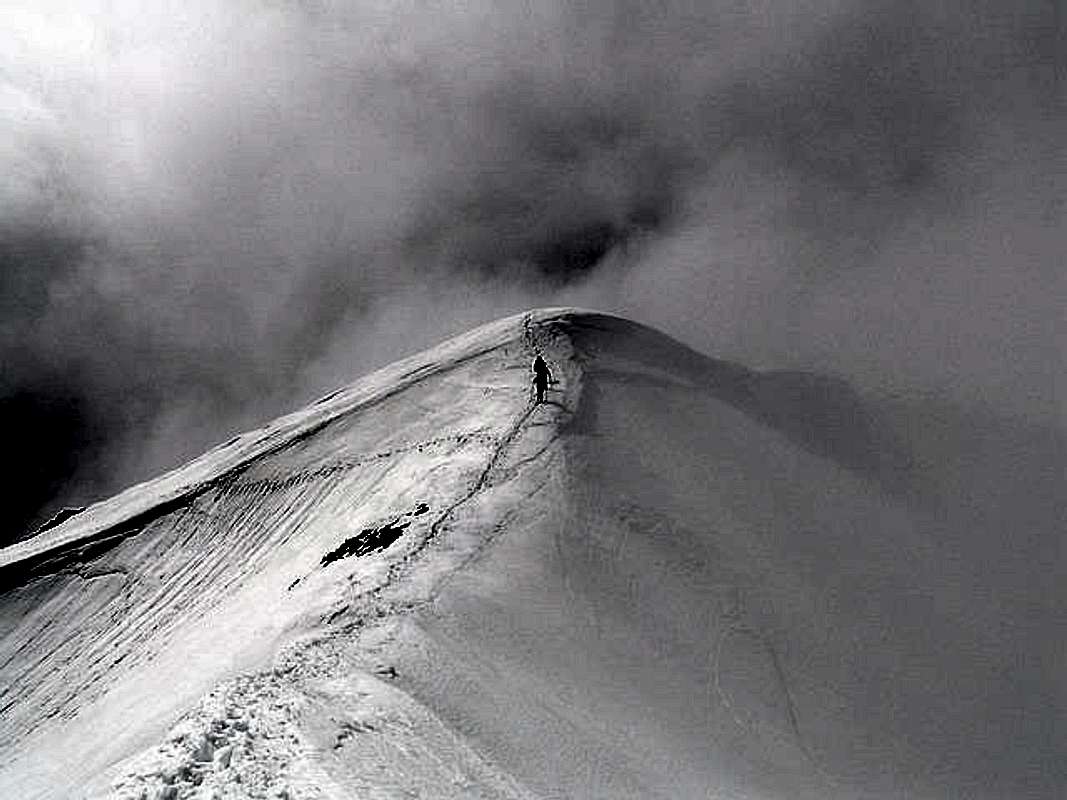
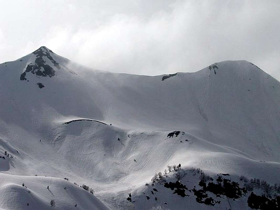
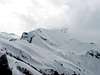
Popadija (2057 m) final ascent
 |  |  |  |  |
Camping
Optimal place for stay and camping in the Montenegrin part of Prokletije range are "Branko Kotlajic" Hut and "Karanfili" Hut, both placed in Grbaja Valley. The owner of "Branko Kotlajic" Hut is "Radnicki" Mountain Club from Belgrade/Serbia). Exist possibility for getting a key of that hut and stay there. Information: e-mail: info@pd-radnicki.rs, www.pd-radnicki.rs . The owner of "Karanfili" Hut is "Karanfili" Mountain Club from Gusinje town.Exist chance to make a deal with shepherds who offer a place in their huts. Try it and let yourself be surprised. Most of the wayside restaurants can offer accomodations over night, you just have to ask "prenochishte". Camping is not allowed but not controlled regularly.
Also, you can rent rooms in Plav and Gusinje towns and stay there. For orientation - from Gusinje till Grbaja valley is 7 km distance. By car - 10 minutes on asphalt road, by walk with big rucksack - 2 hours.
 |  |
Mountain Conditions
The best local weather forecast (4 times daily) for Prokletije (Plav town) on VREME YUBC NET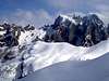 |
Red Tape
No fees or extra fees for entering the Prokletije.No permits needed either.
Usual rules of behaviour for NP's do apply.
 |