
|
|
Mountain/Rock |
|---|---|
|
|
42.30000°N / 19.50000°E |
|
|
8169 ft / 2490 m |
|
|
Overview
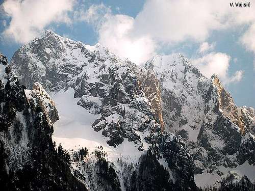
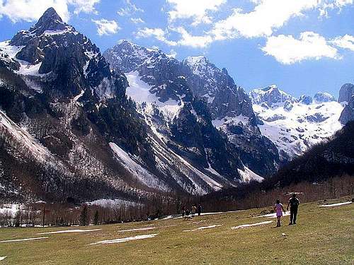
 Impressive winter scenery of Karanfili group
Karanfili (Carnations) is one of the most dominant peak of PROKLETIJE massif and for sure also of whole Montenegro. Actually, Karanfili massif have three peaks - Severni Vrh (Maja Bals, North Peak, 2460 m), Veliki Vrh (Kremeni Vrh, Maja Gurt e Zjarmit, 2490 m) and Juzni Vrh (Zlovrh, Maja e Keq, South Peak, 2441 m). Also, part of wide Karanfili massif are Karanfil Ljuljasevica (2290 m), with branches of Podgoja (2029 m) and Vezirova Brada (1781 m).
Karanfili three-head peak belong to Montenegrin part of Prokletije massif. It's impressive 800 m high wall (highest wall in Montenegro, with Soa Nebeska wall on Durmitor) proudly dominate above beautiful Grbaja Valley, one of most beautiful valley of Prokletije, Montenegro and maybe also of Europe. Karanfili peaks are natural border between two most beautiful valleys of Prokletije and Montenegro - Grbaja Valley and Ropojana Valley. Both valleys , Grbaja and Ropojana can be wonderful seen from Karanfili summits.
With it's very impressive form and outlook, Karanfili peaks and it's wall remind many people on Italian Dolomites. That's reason why many people called these impressive peaks - "Dolomites of Montenegro".
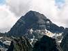
 Amazing outlook of Karanfili peaks
Local position: Karanfili peaks are placed in SE part of Montenegro, inside of Montenegrin Prokletije mountain massif, as a part of wide Prokletije massif, which is also in Serbia (Kosovo) and in Albania, where are located the highest peaks of whole massif and the highest one - Maja Jezerce (Jezerski Vrh, 2694 m). Karanfili are placed on SW from Ocnjak (Canine Tooth, 2185 m), on SE from Trojan (2190 m), on E from Popadija (2057 m), Vojushit (2210 m) and Volusnica (1879 m), on SW from Vezirova Brada (1781 m), on NE from albanian peaks Forca (2340 m), Maja Lagojvet (2466 m) and Maja Shkurt (2499 m) and on N from Maja Jezerce (2694 m). Looking from Montenegrin side, Karanfili peaks are beginning of highest peaks of Prokletije massif, which all rises up to 2500 m.
ROUTE OVERVIEW:
Plav town - Gusinje town - Grbaja Valley (Mt. lodge, 1158 m) - Krosnjina Vrata Pass (2156 m)(T3+T4) 3:30h - Severni Vrh (Maja Bals, 2460 m)(T4) 2:30h - Veliki Vrh (Kremeni Vrh, Maja Gurt e Zjarmit, 2490 m)(T4+T5) 30 min
Access:
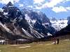
From Plav town going to Gusinje town and than with asphalth road to Grbaja (Grebaje) Valley (Gusinje - Grbaja Valley: 7 km). The view from this valley overlooking the Prokletije Mountain range is something unforgettable. The Karanfili (carnations) Mountain group borders the Ropojana Valley from southeast and from the northeast by the Grbaja Valley.
The start of this tour begins at Grbaja Valley 3rd meadow. The marked path switchbacks lead to the extremely rocky, conical Maja Hekurit (Gvozdeni Vrh, 2000 m), into the glacial cirque of Krosnja (read 'Kroshnja). Approximately halfway into the cirque there is a rock overhang that can cover several people. It's called "Pecurka" (Mushroom, 1950 m)(read 'Pechurka). This climbs' markings were renewed by the Gusinje & Plav mountaineers. From here it is called "Sekijeva Staza" (Skeky's Path), after the respected and devoted mountaineering veteran Radonja Sekularac, who deserved this honor during his lifetime. From "Pecurka", make the steep ascent, through the loose rock falls that are covered by snow most of the year, to the Krosnjina Vrata Pass (2165 m). From there movements require great caution. The exit to Krosnjina Vrata rewards with a view towards the south, facing the display of the Albanian Prokletije range, from Maja Jezerces (2694 m, the highest peak of Prokletije). In the 800 m deep from the Krosnja Pass extends the valley of Ropojana (Ropojane). From the Krosnja Pass, circle the upper massif of Mt. Karanfili from the south, by steep grassy slopes. With greath caution, follow the markings to the Severni Vrh (Maja Bals, North Peak, 2460 m). From there continue to the nearby exposed face of Veliki Vrh (Kremeni Vrh, Maja Gurt e Zjarmit, Big Peak, 2490 m), where again it continues to the third somewhat lower yet exposed peak of Mt. Karanfili called Juzni Vrh (Zlovrh, Maja e Keq, South Peak, 2441 m). On the Severni Vrh there is an official registration book. For enjoyment recommendation is to using the return descent via Krosnja to Pecurka, through Suplja Vrata and descent to the Ljubokuch cirque and then by marked trail near the impressive Ocnjak (2185 m)(read 'Ochnjak'). Descent from there to the Grbaja Valley.
 |  |  |  |  |
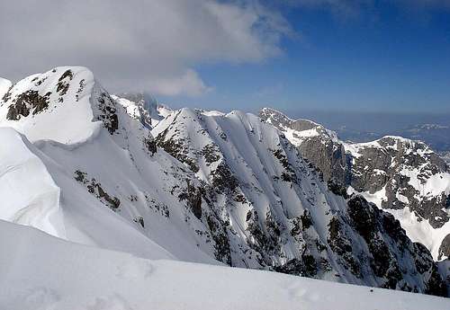
Summit View
 Summit view from Severni Karanfil (2460 m) to Maja Jezerce (2694 m)
Summit view: Karanfili (2490 m) summit is a perfect viewpoint of whole Prokletije massif. First, in Montenegrin part of Prokletije, from Karanfili summit you can see on NE Ocnjak (Canine Tooth, 2185 m) and Karanfil Ljuljasevica (2290 m). On E are visible Mt Hajla (2403 m) and peak Djeravica (2656 m) in Serbian part of Prokletije. On NW are visible Trojan (2190 m) and Mt Komovi (2487 m), on W are Volusnica (1879 m), Vojushit (2210 m), Popadija (2057 m) and Mt Kucka Krajina (2184 m), on SE is Rosni Vrh (Maja Rosit, 2524 m), on SW are visible few Albanian peak of Prokletije massif - Forca (2340 m), Maja Lagojvet (2466 m) and Maja Shkurt (2499 m) and Presto (Maja Koprishtit). Of course, on S is visible The Lord of Prokletije - Maja Jezerce (Jezerski Vrh/Lakes Peak, 2694 m), which is from Karanfili summit just 7 km far (air distance). Also, from Karanfili summit you can enjoy in incredible and breathtaking view to deep Grbaja Valley on W and to Ropojana Valley on E.
 Veliki Karanfil and Juzni Karanfil from Severni Karanfil
 Karanfili summit panorama 360 °
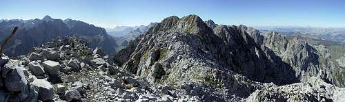 The summit of Severni Karanfil (Maja Bals, 2460 m)
Getting There
 Ocnjak and Karanfili) from beautiful Grbaja Valley
Gateway to Prokletije and Karanfili peaks are Plav town and Gusinje town and Grbaja Valley. Information how to get there:
By Plane
~To Beograd (Belgrade, Serbia&Montenegro capital) airport. Than with plane to Podgorica, capital of Montenegro, or with bus or car to Plav town.
~To Podgorica airport. Than with bus or car to Plav town and after to Gusinje town.
Information about flights find on the sites of JAT Airways, a former Yugoslav airlines, or on Montenegro Airlines.
By Bus
~Beograd (Belgrade)-Plav
~Podgorica-Plav
By train
~Beograd (Belgrade)-Bijelo Polje. Than with bus or with car (rent a car) to Plav and Gusinje.
By car
~Beograd (Belgrade)-Kraljevo-Novi Pazar-Plav-Gusinje.
~Podgorica-Kolasin-Andrijevica-Plav-Gusinje
 Summit view from Karanfili from Popadija summit
Gusinje town and Plav town (in Montenegro) are the main destinations you would head first. In Gusinje you can buy everything (food, shampoo, soap, clothes,... and many other things), all what you need for few days of trekking and climbing in heart of Prokletije massif.
From Gusinje town you can go deeper in Prokletije massif through two valleys - Grbaja & Ropojana. Distance Gusinje - Grbaja valley: 7,5 km, (2 h of walking with big rucksack (backpack).
 |  |  |  |  |
Red Tape
You're in border country and will have to ask for military permission to visit certain (Albanian) parts of the range, where is highest peak of Prokletije massif - Jezerski Vrh/Maja Jezerce/Lake Peak (2694 m) and beautiful Lake Valley with few glacier lakes.But, just for climbing in Montenegrin part of Prokletije massif, specially to Karanfili Peaks, you don't need a military permission!
At hotels you can get information about the permits required. But there always destinations that are reachable without any permits.
 |  |  |  |  |
When To Climb
If you're interested in backpacking/hiking/mountaineering/climbing, June through September are the best month to do so. In June and July also, you will find snow area on some places, specialy on north side of massif. Don't worry, snow is hard. Like in many mountains, you will find full lakes from April till July. If you want to take a photos of lakes, better come in this period. Jun or July is the best for this. If you will come earlier, take with you everything from mountain equipment, which you will need for example in winter or spring time. Also, late summer and autumn offer a variety of fruit you will be easy picking while ascending some ridges like wild plums, raspberries and blueberries.If you're not afraid of winter conditions you could learn about the special attire of life in a remote mountain region. Towns like Andrijevica or Gusinje are like ferry tale towns when snow is covering the ridges around and you sit in one of the restaurants drink boza (traditional lemonade) or eat hot burek and watch the local markets. Also, you have chance to buy milk products from local people of Prokletije area.
 |  |  |  |  |
Camping
Optimal place for stay and camping in the Montenegrin part of Prokletije range are "Branko Kotlajic" Hut and "Karanfili" Hut, both placed in Grbaja Valley. The owner of "Branko Kotlajic" Hut is "Radnicki" Mountain Club from Belgrade/Serbia). Exist possibility for getting a key of that hut and stay there. Information: e-mail: info@pd-radnicki.rs, www.pd-radnicki.rs . The owner of "Karanfili" Hut is "Karanfili" Mountain Club from Gusinje town.Exist chance to make a deal with shepherds who offer a place in their huts. Try it and let yourself be surprised. Most of the wayside restaurants can offer accomodations over night, you just have to ask "prenociste". Camping is not allowed but not controlled regularly.
 |
Mountain Conditions
The best local weather forecast (4 times daily) for Prokletije (Plav town) on VREME YUBC NET |  |