The Rothorn hut as seen coming down from the Zinalrothorn
The Rothorn Hut was built west of Zermatt in 1949 at the foot of a rock rib that divides the Rothorn and the Trift glaciers. It is strategically located for climbing the popular 4000-meter peaks Zinalrothorn and Obergabelhorn. Before the building of the hut the mountain hotel Trift situated almost 900 meter lower down was the starting point for mountain and glacier routes in the region.
The hut sleeps 90 people and is open from 10 July to 15 September. There is room for ten people during the winter.
Getting there
The last part of the walk to the hut up the moraine
Overall information on travel to Zermatt is given on the Matterhorn SP page.
Arriving at Zermatt railway station and walking five minutes up the main street there is a small sign post pointing westward saying “Rothornhütte 4½ Sd.” The walk up to the hut is relatively long and strenuous from 1600 m to 3198 m. The first part goes steep up on the side of the Triftschlucht. Half way lies the Trift Hotel where the path forks right to the Mettelhorn (3406 m). Continue to the left along the Vieliboden before reaching the moraine of the Trift glacier. The path follows the moraine up towards the hut.
Routes
From the Rothorn Hut to the summit of the Zinalrothorn by the normal route
Peaks ascended from the hut are:
Zinalrothorn (4221 m) by the normal route from the south-east (1050 m from the hut, AD-, 4-5 hours), by the south-west ridge called the Rothorngrat (D, 7 hours).
Obergabelhorn (4063 m) by normal the route along the east-north-east ridge (D, 5-6 hours). The route traverses over the Wellenkuppe (3903 m).
Trifthorn (3728 m). A popular and frequently climbed peak both from the Rothorn and the Mountet Hut.
Schalihorn (3975 m) being the highest point on the ridge between the Zinalrothorn and the Weisshorn. Traverse south-north from the Rothorn Hut to Schalijochbiwak (II-, 5 hours to the summit).
Parents refers to a larger category under which an object falls. For example, theAconcagua mountain page has the 'Aconcagua Group' and the 'Seven Summits' asparents and is a parent itself to many routes, photos, and Trip Reports.

 The Rothorn hut as seen coming down from the Zinalrothorn
 The last part of the walk to the hut up the moraine
 From the Rothorn Hut to the summit of the Zinalrothorn by the normal route
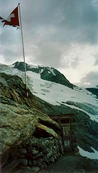 Rugged place behind the Rothorn Hut