

-
 71553 Hits
-
 97.47% Score
-
 69 Votes
|
|
Mountain/Rock |
|---|---|
|
|
46.03860°N / 7.66741°E |
|
|
13330 ft / 4063 m |
|
|
Overview
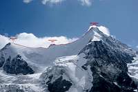
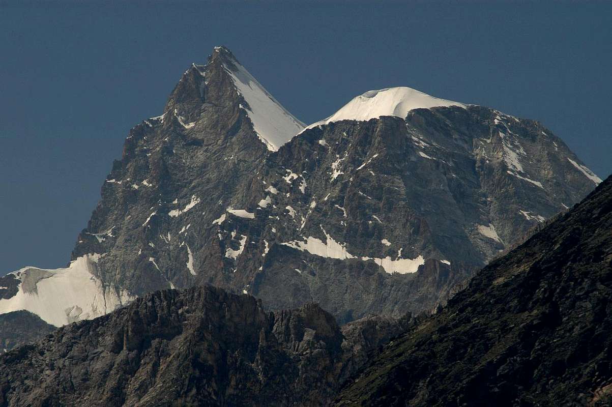 Obergabelhorn and Wellenkuppe from NE (Photo by om - 19.8.2004) Obergabelhorn and Wellenkuppe from NE (Photo by om - 19.8.2004) |
*In memory of Rahel Maria Liu</font color=grey>, the former maintainer of this page. Rahel died on the Innominata Spur to Mont Blanc in a snowstorm on August 24th, 2004.
 |
 |
 |
 |
 |
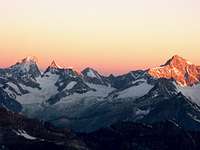
| Sunrise | Obergabelhorn | Coeur Ridge | Good View from E | Evening-light |
Obergabelhorn - a peak between famous mountains of the Pennine Alps
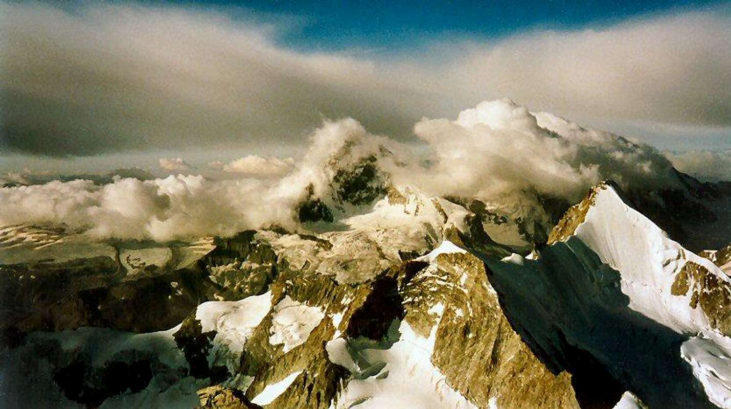
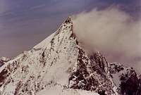
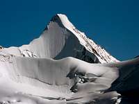
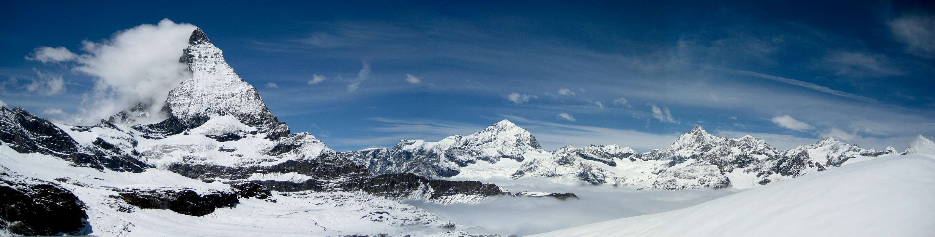
- This peak is situated between more famous mountains like Weisshorn, Matterhorn and Zinal Rothorn. Ober Gabelhorn ascent gives nice views on such known mountains. Ober Gabelhorn (4063 m) is considered to be one of the nicest Valais mountains. There is no really easy way to the summit. The easiest (but long) way from the Rothornhut is AD. The Obergabelhorn has very steep flanks to each side. The smooth ice face to the north is very impressive. The S Face is a pure rock face. It is one of the very few rock faces in the Walliser Alps which one can recommend. From the summit, one has a wonderful view of the Matterhorn with its N Face. Here a view of the N Face.
Obergabelhorn with its steep and icy North Face, watched from the Rothornhut on August 12, 2003 (Photo by Rahel Maria Liu).
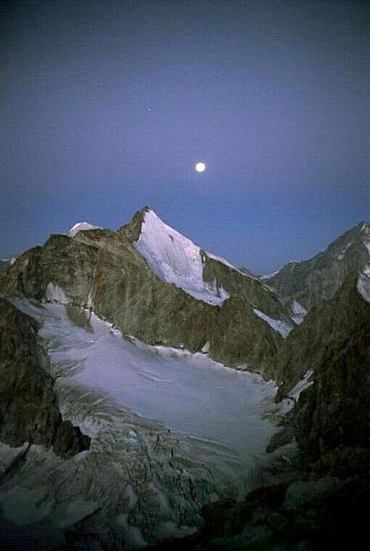 The moon above the Coeurgrat - N Face The moon above the Coeurgrat - N Face |
The way to the summit:
- Four ridges are more secure, since they have less danger of rock- and icefall.
- The SW Ridge - Arben Ridge - provides great rock climbing possibilities. The NE Ridge to the Wellenkuppe is a mixed route. The SE Ridge is not very difficult. The NW Ridge - Coeur Ridge - is only in the upper, snowy part really interesting.
Historical notes
- First ascent: A. W. Moore, H. Walker with J. Anderegg, on 6. July 1865 (M. Vaucher, p. 146).
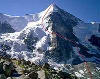
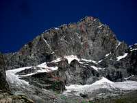
Routes Overview
Routes to the Summit of Obergabelhorn - Photos by RoyD - as/Antonio Giani - Rahel Maria Liu - olijacob and Bart
 |
 |
 |
 |
 |
| ENE Ridge | WSW Ridge | NW/Coeur Ridge | N Face | S Face/Arben R |
 |
ENE Ridge - Normal Route from the Rothornhütte (3198 m): |
- Wellenkuppe 3903 m), Grand Gendarm (3870 m), Obergabelhorn (4063 m)
- ZS, III+, 4,5 h (Biner , 231)
- 250 hm, G 7, III- (1 passage), I and II near the summit; the rest ice till 50° 4,5-5h from Rothornhütte (Waeber, 434)
- Photos by RoyD - JanG - kiss istván - alejandro - as/andrea.it - corvus - ChristophGeisler
 |
 |
 |
 |
 |
 |
 |
 |
 |
| Top | ENE Ridge | Ascent | RothornH | Top | Descent | Ridge | N Side | Ridge |
 |
WSW Ridge - Ascent from Arben Bivouac (3224 m): |
- ZS, III+, 3,5 h (Biner, 238)
- G 6, III+ (short passage), II and I, 2,5 - 3 h, 500 hm, very good rock (Waeber,434)
- Photos by as/Antonio Giani - as/Cyrill - as - Chandra - Cyrill
 |
 |
 |
 |
 |
 |
 |
| from NW | ArbenR | Approach | E Summit | ArbenR | Bivouac | Ridge |
 |
Coeurgrat/NW Ridge - Normal Route from Cabane du Mountet (2886 m): |
- ZS, III, 5 h, danger of rockfall ( Biner, 236 )
- G 7, III+, ice till 50°, 5-6 h, 1170 hm, in the upper third beautiful firn ridge (Waeber, 438)
- Photos by Rahel Maria Liu - mvs/alpinpete - Huberschwiller - hansw - Hiltrud Liu - kiss istván - EricChu - Mathias Zehring
 |
 |
 |
 |
 |
 |
 |
| Summit | Mountet H | Coeur-Grat | from Zinal | N Side | Alpenglow | NW Ridge |
 |
N Face - Normal Route from Cabane du Mountet: |
- Impressive iceface - steepness 55° in the average, at the end steeper, 450 hm. 1250 hm from the hut (Waeber, 439)
- S, danger of rockfall, 6 h from the Mountet Hut (Biner, 238)
- Photos by olijacob - Frank - Cyrill - marco979 - Michael Prittwitz - risch - kiss istván - mamo
 |
 |
 |
 |
 |
 |
 |
|
| Ascent | Summit | N Face | N Side | Sunrise | North Wall | Storm |
 |
S Face - Several routes through the S Face, the easiest one: |
- IV, G 7, good rock, very little danger of rockfall (Waeber, 439)
- S, IV+, 5 h (Biner, 240)
- Photos by Bart - om - Bart - Diego Sahagún - Henk van den Akker - Cyrill - as - Pierre smeters
 |
 |
 |
 |
 |
 |
 |
| ArbenR | Climb | View | South Face | Summit | Abseiling | Ridge |
Getting There
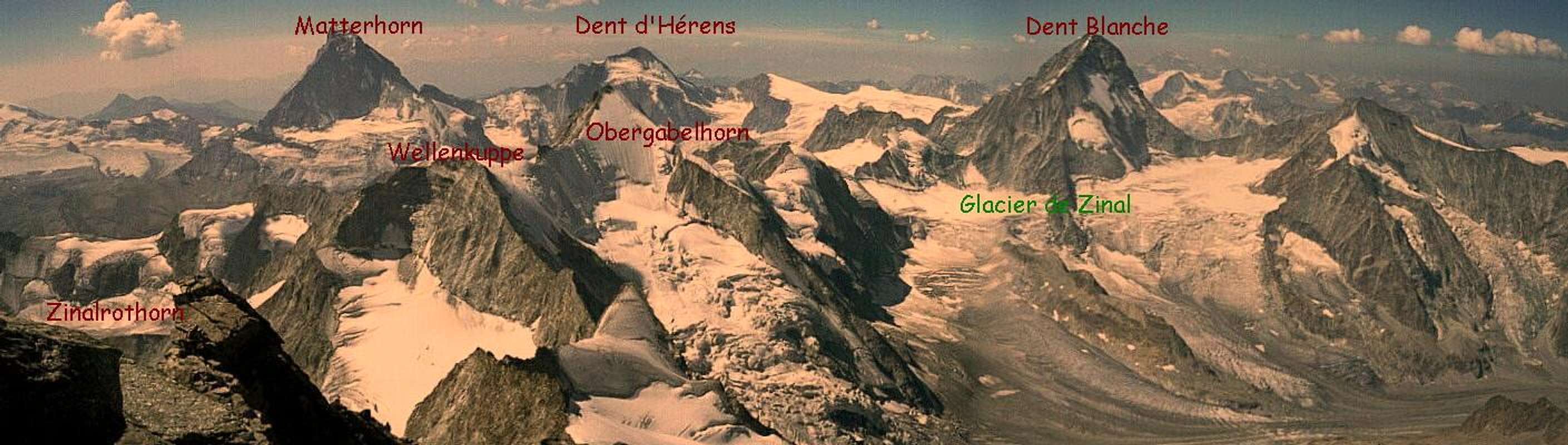
 Panorama - Obergabelhorn, Zinalrothorn and Weisshorn - Photos by Rahel Maria Liu Panorama - Obergabelhorn, Zinalrothorn and Weisshorn - Photos by Rahel Maria Liu |
To the Obergabelhorn:
- You can come from the Rothornhütte (3198 m). You can come from the Cabane du Mountet (2886 m).
To the Rothornhütte (3198 m):
You reach the hut
- in 4,5 hours from Zermatt (1580 hm). You reach the Berghaus Trift (2337 m) in 2 hours from Zermatt. The best way is if you follow the sign in the center of the village. You go over grass to Bodmen and on the northern side of the Triftbach to the Triftschlucht.
- The way goes through it and to a bridge to the S side. In zigzag you go up to the hotel Edelweiss and the way along the Triftbach, pass it then and climb up to the Trifthaus along the northern side of the stream.
- Then you go further up along the stream and reach Vieliboden. You go up to the moraines of the Triftglacier and along the left/northern moraine
- in zigzag to the Rothornhütte. 2,5 h from Trift
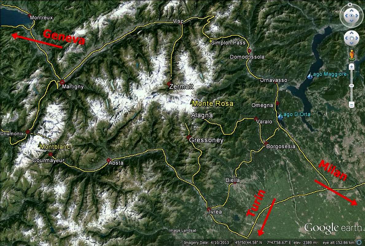
You reach Zermatt (1616 m)
- with car or bus from Visp/Brig and by train from Täsch.
Zermatt is well-known in the whole world as one center of the Walliser Alps. You are not allowed to drive your car in the village.
Brig is the main city of the upper Wallis and the junction of the trains:
- Bern - Lötschberg - Simplon - Domodossola
- Furka - Oberalppass (Andermatt/Disentis, Glacierexpress)
- Brig - Visp - Zermatt
- Lake of Geneva - Milano
In Brig, many busses arrive as well:
- Simplon-Gondo
- Saastal
- Blatten
- Mund
- Rosswald
You reach Visp/Brig by car:
- from the
West: From Geneva (airport) on the A1 to Lausanne, on the A9 via Montreux, Martigny and Sion to Sierre. From Sierre the road no. 9 in direction of Brig. But at Visp, you turn already right to the S in directin of the Saaser valley. In Stalden, you turn right and leave the Saaser valley to the left. Here, the Matter Valley begins. Via St. Niklaus, Randa and Täsch, you reach Zermatt.
- from the
North: From Bern on the A6 to Spiez, from here the road to Kandersteg, at Kandersteg, you drive your car on a train and go by train through a tunnel; end of the tunnel: Goppenstein; you continue the road to the S and reach the main road from Sierre. On the crossroad, you turn left (E) and reach Visp. From here, continue as discribed.
- from the
East: from Bregenz on the A13 to Chur; turn off at Reichenau and continue the road no. 19 to Brig/Visp via Flims - Sedrun - Andermatt - Gletsch - Fiesch. From Visp, continue as described.
- from the
South: either from Como on the A2 via Bellinzona to Airollo, then road no.2 till Hospental and here to the left on the road no. 19 to Brig/Visp or from Arona till the end of the A26 and then the E62 via Domodóssola to Brig.
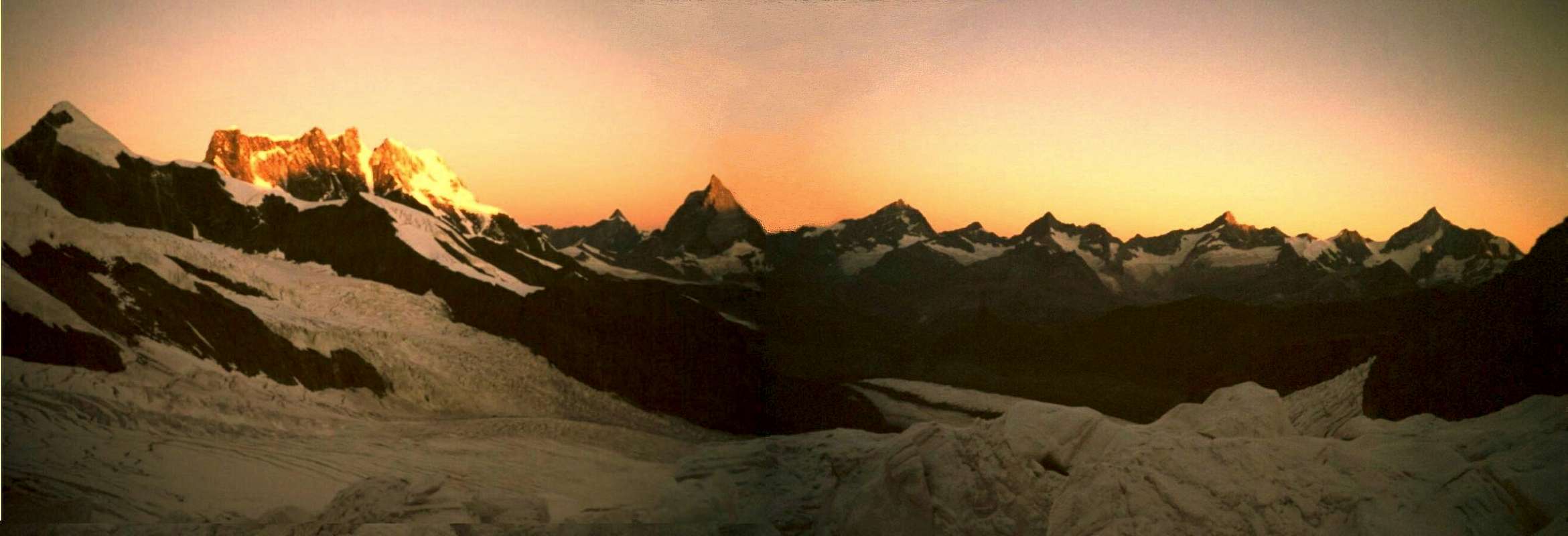
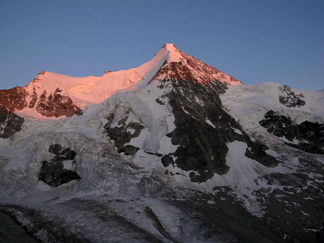 Wellenkuppe and Obergabelhorn at Sunset- Photo by EricChu Wellenkuppe and Obergabelhorn at Sunset- Photo by EricChu |
To the Cabane du Mountet (2886m):
- You reach the hut from Zinal on the E route (4 1/2 h, 1250 hm, 9 km): From the parking place at the South end of Zinal, you cross a bridge and follow the road on the western side of the Navisence to the S till it goes up. You keep on the road which goes up to the alphut Le Vichiesso (1862 m). Shortly afterwards, you turn right to the new Mountet hut way. You go the road down to the left, traverse the stream of the glacier end
(Zinal glacier) on a bridge. You reach the turn off to the Tracuit hut and Ar Pitetta hut (1,5 h). You take the right way and go up zigzag in SE direction, traverse the western hangs of the Besso above the breaks of the Zinal glacier. You turn around the Besso SW ridge via a rock zone below P. 3052m. In SE direction, you reach the hut via lumps of rocks.
- You reach the hut from Zinal on the W route (4 1/2 h, 1350 hm, 9 km). From the parking place at the South end of Zinal, you cross a bridge and follow the road on the western side of the Navisence to the S till it goes up. You keep on the road which goes up to the hut Le Vichiesso (1862 m). Here, you leave the way and go up to the Petit Mountet hut (2 h). The new way goes up over the hangs of the Pgne de la Le, around a rock zone at about 2550 m. Then you go down and reach the falling line of the Bouquetins-O-rib which leads to the Zinal glacier via the break.
- You traverse the glacier in SE direction and go up on the orographically right side. You leave it at P. 2652 m and go up to the hut over the W .
- The ski ascent goes over the whole Zinal glacier. Pay attention to avalanches from the flanks if there is much sunshine!
- You reach Zinal from Sierre (28 km) by bus or car via Vissoie and Ayer (Val d'Anniviers). To Sierre from Sion (491m) in the West of Visp/Brig in the East.
 N Side - Matterhorn, Wellenkuppe and Obergabelhorn - Photo by hansw N Side - Matterhorn, Wellenkuppe and Obergabelhorn - Photo by hansw |
Mountainhuts
* Obergabelhorn - Photos by Mc Bojan, KoenVI, om, Antonio Giani and marco979
 |
 |
 |
 |
 |
| West Side | East Side | Obergabelhorn | South Side | N Face from Cab. de Tracuit |
Rothornhütte (3198 m)
 |
- The Rothornhütte is situated at the foot of Eseltschuggen, at the end of the SE Ridge of the Zinalrothorn, and on the left side of the Trift glacier.
- 90 beds
- winter room with 10 beds
Cabane du Mountet (2886 m)
 |
- Cabane du Mountet is situated right above the glacier de Zinal, the lowest end of the Blanc-de-Moming SW ridge.
- 127 beds
- winter room with 50 beds
- guarded: from March to May and from July to September
- phone: ++41(0)27/4751431
- internet:
- Summits to climb from the hut:
- Ober Gabelhorn (4063 m), Dent Blanche (4357 m), Grand Cornier (3962 m),
- Auml;schhörner (3618 m), Mettelhorn (3406 m), Schalihorn (3974 m)
Arben Bivouac (3224 m)
 |
- The Arben Bivouac is situated in a valley on the S side of Obergabelhorn.
- situation: SW of Zinalrothorn
- how to go there: Rhône valley - Sierre - Mission - Ayer - Zinal
- how to climb there:
- 1. Zinal - Le Vichiesso - Pont sur la Navisence - Grépon: 5h
- 2. Zinal - Le Vichiess o - Petit Mountet - Plan des Lettres - Glacier de Zinal: 5 h
 View from Zinalrothorn - Photo by Rahel Maria Liu View from Zinalrothorn - Photo by Rahel Maria Liu |
Infos
 NW Face - Weisshorn (4506m), Zinalrothorn (4221m), Wellenkuppe and Obergabelhorn (4063m) - Photos by hansw NW Face - Weisshorn (4506m), Zinalrothorn (4221m), Wellenkuppe and Obergabelhorn (4063m) - Photos by hansw |
GENERAL INFOS:
WEATHER
CAMPINGPLACES
- There is a Campingplace in Zermatt or in the other villages in the valley.
Maps&Books
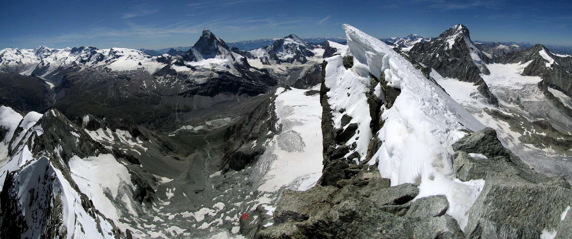 The fragile W Summit of Obergabelhorn - Down below, in the red circle, the Arbenbiwak (Photos by as, 2009) The fragile W Summit of Obergabelhorn - Down below, in the red circle, the Arbenbiwak (Photos by as, 2009) |
Schweizer Landeskarten:
- 1:25000 no. 1327 Evolène
- 1:25000 no. 1328 Randa
1:50000 no. 5006 Matterhorn-Mischabel Hikr.org
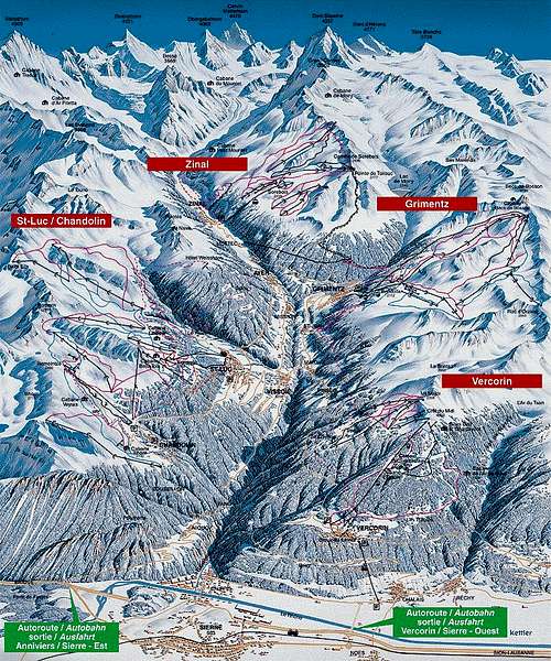 Val d'Anniviers Map - Photo by Whitesail Val d'Anniviers Map - Photo by Whitesail |
UKC - Obergabelhorn 4000er Karte
 * GOOGLE MAP Weisshorn Group - Obergabelhorn -- Photo from Antonio Giani * GOOGLE MAP Weisshorn Group - Obergabelhorn -- Photo from Antonio Giani |
BOOKS
- Banzhaf/Biner/Burgener, Alpinführer Walliser Alpen 4/5, Vom Theodulpass zum Simplon (2009).>
- Helmut Dumler/Willi P. Burkhardt, The High Mountains of the Alps.
- Hermann Biner, Hochtouren im Wallis. Vom Trient zum Nufenenpass. 2nd ed. 1996. ISBN 3-859022-160-5.
- HelmutDumler/Willi P Burkhardt, Viertausender der Alpen. 11th ed. Munich 1998. ISBN 3-7633-7427-2.
- Michel Vaucher, Walliser Alpen. Die 100 schönsten Touren. 2nd ed. Munich 1990. ISBN 3-7654-2124-3 .
- Erich Vanis, Im steilen Eis. 80 Eiswände in den Alpen. Munich et al. 1980. ISBN 3-405-12158-2.
- Michael Waeber, Walliser Alpen. DAV-Gebietsführer 12th ed. Munich 1999. ISBN 3-7633-2416-X.
- Clubführer Walliser Alpen, Vol. II, Verlag Swiss Alpine Club.
Link - MountainArea
 Breithorn, Matterhorn, Obergabelhorn, Zinalrothorn and Weisshorn - Photo by Rahel Maria Liu Breithorn, Matterhorn, Obergabelhorn, Zinalrothorn and Weisshorn - Photo by Rahel Maria Liu |
 |
MountainArea |
Panorama 1Panorama 2Aiguille Verte at www.4000er.dePennine Alps by Air Overview II - Photo by Diggler
 Matterhorn - Dent Blanche - Obergabelhorn - Zinalrothorn - Weisshorn (Photo by Hiltrud Liu) Matterhorn - Dent Blanche - Obergabelhorn - Zinalrothorn - Weisshorn (Photo by Hiltrud Liu) |
Google Map
 Google Map - Photo from markhallam Google Map - Photo from markhallam |