
-
 10909 Hits
-
 83.1% Score
-
 16 Votes
|
|
Mountain/Rock |
|---|---|
|
|
39.13530°N / 106.0639°W |
|
|
Park |
|
|
Hiking |
|
|
Spring, Summer, Fall, Winter |
|
|
11243 ft / 3427 m |
|
|
Overview
It says something about the topography of the state of Colorado that an 11,243 ft. landform receives the title “Hill”. Against a western backdrop of peaks rising in excess of 13,000 feet, Round Hill most certainly appears to be just that: A hill. Yet this hill, the 1,664th highest* “hill” in Colorado, rises high enough to cause a typical sea-level visitor the dizziness and shortness of breath associated with the affects of higher altitude. Buffalo Peaks from the South Slopes of Round Hill.
08 Mar 09
A mild little landform indeed, but in the fall the golden aspen in the area are blinding in their brightness (especially on the southern slopes of Round Hill). Wildlife is abundant on the slopes of Round Hill. During our winter visit we had barely shouldered our packs when a coyote ran out in front of us, stared at us for a short moment and shadowed us for a good part of the ascent. Elk sign was overwhelming: Scrapings on the aspen trunks, well-foraged shrubs and scat galore.
While many high points are obvious, the summit cairn of Round Hill plays a good game of hide-and-seek. Near the top, Round Hill levels out to a very broad summit plateau without a prominent apex. Enjoy the journey while searching for the summit. The highpoint of Round Hill is shrouded in trees, but to the south of the highpoint an open meadow fringed by ancient Bristle Cone pines treats the hiker to unimpeded views of the mighty Buffalo Peaks twin Thirteeners.
Colorado Rank: 1,664th highest peak in Colorado
Prominence: 333 feet
Mountain Range: Tenmile/Mosquito
USGS Quad: Fairplay West
Trails Illustrated Map: #110 (Leadville, Fairplay)
*Rank and Prominence Reference: Lists of John
Getting There
Round Hill sits about 7 ½ miles as the raven flies southwest of Fairplay, Colorado on the far western fringes of South Park. It is about 8 miles southeast of the Fourteener Mount Sherman. Click on map to enlarge
Route Overview
| Route | Mileage | Elevation Gain | Special Note | Driving Directions |
|---|---|---|---|---|
| South Slopes | 3.5 miles RT (from top of last switchback) | 1,100 ft. | Southern exposure makes this the best option in snow season | 5 miles south of Fairplay on Hwy 285 to Weston Pass Rd. (County Rd 5) for less than 5 miles to Round Hill Road (unmarked); park at junction or 4x4 to top of last switchback and park |
| Via Breakneck Pass | 5.25 miles RT (from end of graded road) | 1,200 ft. | Old ranching road eases navigation when there is no snow | 5 miles south of Fairplay on Hwy 285 to Weston Pass Rd. (County Rd 5) for about 1.75 miles to Breakneck Pass Rd; turn right (west); continue on Breakneck Pass Rd. until grading runs out or as far as your 4x4 takes you toward pass |
Red Tape
 Ptarmigan Peak to the west
08 Mar 09
 Ridge to the west from Round Hill
08 Mar 09
There is little red tape governing recreational use in this part of the National Forest and there is no fee to access this area. Adhere to LNT (Leave No Trace) principals, observe fire ban when in effect and do not harass wildlife or allow your pet to do so.
Private property holdings exist on and around Round Hill, including a privately held block very near the summit. Do your best to stay on public lands and avoid passing through privately owned land.
Camping & Lodging
Immediate AreaCamping on or very near to Round Hill is limited due to lack of water sources and an abundance of private property (primarily ranches and summer homes).
Rustic 4x4 Camping
Those with a stout 4x4 and solid off-roading skills may find plentiful rustic camping along Sheep Creek in Sheep Park, west of Breakneck Pass, accessed via FR 175.

|  |  |
Click on images to enlarge.
Designated National Forest Service Sites
North-northwest of Round Hill the Forest Service operates two campgrounds along Fourmile Road (County Road 18): Fourmile and Horseshoe. Be aware that both sites may be busy in the summer months due to their proximity to the Fourteener Mount Sherman.
Fourmile Campground:
- 14 sites
- No reservations (first come, first served)
- $12.00 per night
- Elevation: 10,762 ft.
Horseshoe Campground:
- 19 sites
- Reservations accepted in summer
- $12.00 per night
- Elevation: 10,560 ft.
Southwest of Round Hill is Weston Pass campground which, despite the name, actually sits about 4 miles southeast of Weston Pass.
Weston Pass Campground:
- 14 sites
- No reservations (first come, first served)
- $12.00 per night
- Elevation: 10,200 ft.
Fairplay
A small collection of hotels and bed & breakfasts can be found in the nearby town of Fairplay.
Weather & Seasons
Due to relatively low elevation, Round Hill can we enjoyed year-round.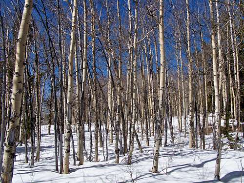 Aspens in the snow, Round Hill
08 Mar 09
Fall would be the absolute best time to visit Round Hill, when the aspen trees are glowing golden. Be aware, however, that a lark elk herd frequents the area. Be cautious during the fall rut (generally September and October) when hormones and spirits run high among the herds, as the bulls build and defend their cherished harems.
The broad, featureless summit of Round Hill collects deep snows during snow season and the terrain of the summit area is such that the snow is not swept leeward. It simply accumulates among the trees into deep drifts. In winter and spring, be prepared for a deep snow slog through the trees.