Page Type Page Type: Mountain/Rock
Location Lat/Lon: 46.67200°N / 12.69500°E
Additional Information Elevation: 7952 ft / 2424 m
Sign the Climber's Log

Overview


Geographical Classification : Eastern Alps > Carnic Alps > Carnic Alps Main Ridge (West) > Schulterhöhe

Schulterhöhe photo_id=114233

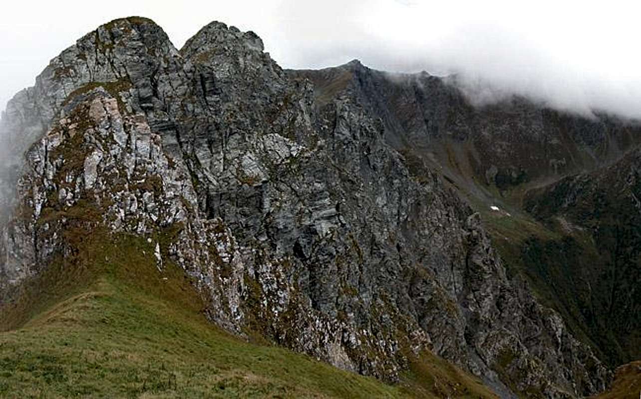
Schulterhöhe is located on one of the northern side ridges of the Carnic Alps Main Ridge. It can be reached easily from the village of Maria Luggau in central Lesachtal Valley. The steep ascent leads through dense forests before it reaches the timberline. From there on the views towards the Lienz Dolomites and the surrounding parts of the Carnic Main Ridge make the mountain a deserving destination. On clear days (we were not lucky) you can see as far as Hohe Tauern in the north and the Ortler Cevedale Group in the west.

Schulterhöhe shows a nice north-eastern face towards Lesachtal, which is where some of the pictures have been taken. It is a great mountain for sunrises and sunsets so I could experiment a little. The two best pictures are included below.

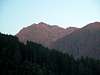
For us the climb of Schulterhöhe was "accidental". We had planned to climb its neighbour, Zwölferspitz, on the last day of our vacation. But when the weather report called for stormy weather with snow and hail down to 1500m we decided on the easier, but only 150m lower Schulterhöhe (the grassy Zwölferspitz summit block is supposed to be dangerous in wet conditions). Making it to the summit just in time (we had found shelter from a hail shower in one of the cabins made for storing hay). I shot the last views down into the valley before the wind changed and clouds started chasing up the valley from the east. More hail, snow and rain caused a fast retreat.

Getting There


Western Main RidgeWest Central Main RidgeCrode dei LongerinPeralba - Chiadenis - AvanzaEast Central Main RidgeBiegengebirgeKellerwand - Hohe WarteMooskofel GroupRinaldo Group
Overview map of the western part of the Carnic Alps Main Ridge. See the Carnic Alps Main Ridge (West) Page for an overview of the ridge. Click on the numbers to get to the descriptions of the subgroups. Schulterhoehe is located right of center in subgroup 2.

You can reach Schulterhöhe from the village Maria Luggau, which is a place of pilgrimage, famous in the south-eastern Alps. There is a monastery with a large abbey (compared to the size of the village at least) and several Ways of the Cross lead from the mountains towards the abbey. Maria Luggau is located in Lesachtal Valley, "Europe's remotest alpine valley" as the info prospects reveal. To reach the valley chose from the following itineraries:

From the West (Brenner Motorway A22)
Leave the Brenner Motorway near Brixen / Bressanone and follow SS49 to the east through Pustertal / Val Pusteria. To the east of Innichen / San Candido you cross the Austrian-Italian border and follow the road (now B100) to Tassenbach. Turn right (south-east) here onto B111, which you follow in direction Kötschach-Mauthen. You cross the Kartitsch Saddle and head down through Ober- and Untertillach towards Maria Luggau.

From the North
There are two possible roads:
  • From Kitzbühel over B108 through the Felbertauern Tunnel to Lienz, then southwest to Tassenbach (B100), where you turn on to B111 east into the Tyrol Gailtal.
  • From Salzburg along motorway A10 to Spittal. Turn west on B100 to Oberdrauburg, there south to Kötschach-Mauthen were you turn east on B111.

From the South (Udine)
Take Motorway A23 to the exit Camia Tolmezzo. Follow SS52 north to Tolmezzo where you turn onto SS52 bis. This leads to Plöckenpass, where it crosses the Austrian-Italian border. In Austria the road turns into B100 and at Kötschach-Mauthen you have to turn east on B111 into Lesachtal Valley.

Schulterhöhe photo_id=114235

Red Tape


There is no red tape that I'm aware of. In its remoteness the valley does not need to be protected yet. Sheep and cattle are grazing (even on the summit) so please close all gates and respect the (electrical) fences.

Free camping is not allowed in the area. There is a bivouac close by. Mitterkarbiwak is located on the western side of the mountain at an elevation of 1973m. The ridge traverse from the bivouac to Schulterhöhe, however, is far from easy. You'll have to do som UIAA grade 3 climbing. The nearest refuge would be Hochweißsteinhaus to the southeast, some two hours away. And in the valley, rooms appartments and camping places can be easily obtained (see "Accommodation" Section. Moreover hay cabins, which you find in the upper parts of the normal route, can serve as shelters, though they won't keep the wind outside.

Mushrooms can be collected in the area but be prepared for some heavy competition. A lot of Italians cross the border over the weekends to collect them. I assume that the restrictions in the national parks in Italy are enforced thoroughly. But maybe competition is even greater on the southern side of the border ;-)

You have to pay attention to the poisonous ones like the one to the right (fly agaric mushroom).
 Schulterhöhe photo_id=114250

When To Climb


Schulterhöhe can be climbed all year round. For hikers the best time is between early June and late September. In winter the mountain is a possible ski tour destination. Lesachtal has only one ski lift but is popular for cross-country skiing. You may combine both types.

Accommodation


You won't find any "real" campgrounds in Lesachtal Valley. The nearest one is in Kötschach-Mauthen, some 40km away. But in most of the villages there is a small space for campers, which in most cases is associated with an inn or a hotel. If you are looking for hotel rooms or apartments follow one of the links below

Weather Conditions


The weather in Carinthia and East Tyrol usually is better than in the rest of Austria. However, the closeness to the Carnic Main Ridge sometimes causes low clouds oozing over the ridge and around the surrounding summits.So keep yourself informed by one of the links below

Maps 'n' Books


Maps
I have been using maps by Kompass and Tabacco, which both are very good for the hiking trails.
  • Lienzer Dolomiten / Lesachtal
    1:50000
    Kompass Map WK47
    Kompass Verlag
    ISBN: 3-85491-053-3
  • SAPPADA-S.STEFANO-FORNI AVOLTRI
    Tabacco Map 001
    Editione Tabacco

As for books please look at the corresponding section of the Carnic Alps page.


Children

Children

Children refers to the set of objects that logically fall under a given object. For example, the Aconcagua mountain page is a child of the 'Aconcagua Group' and the 'Seven Summits.' The Aconcagua mountain itself has many routes, photos, and trip reports as children.