Page Type Page Type: Mountain/Rock
Location Lat/Lon: 46.65680°N / 12.80620°E
Additional Information Elevation: 7385 ft / 2251 m
Sign the Climber's Log

Overview


Geographical Classification : Eastern Alps > Carnic Alps > Carnic Alps Main Ridge (West) > Mittagskofel
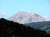
Mittagskofel photo_id=116198

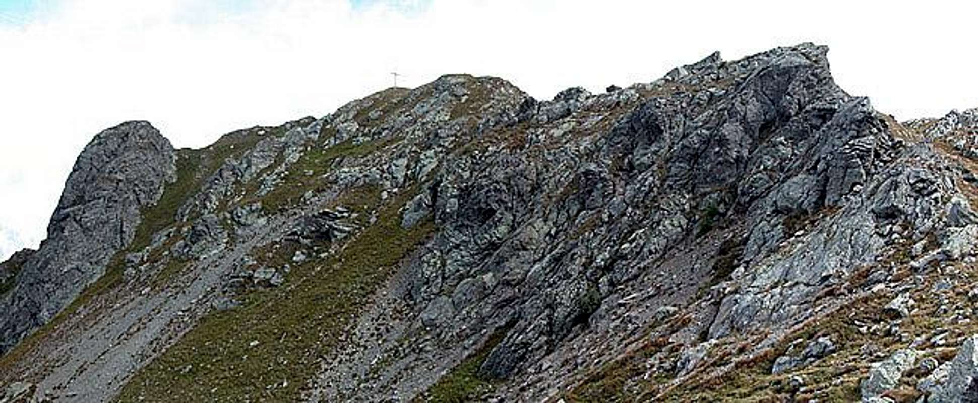
As you might see from the pictures posted to this page Mittagskofel is not the perfect mountain to be seen but certainly one of the best to see around from. It is located on one of the northern side ridges of the western part of the Carnic Alps Main Ridge. Actually it is on the third ridge counted from the east. It towers above the Lesachtal Valley and though its elevation is far from impressive the position on the northern tip of the ridge makes for great views towards the Lienz Dolomites and Carnic Alps. In particular the close-up view of the Steinwand, Edigon and Raudenspitze north faces is a very impressive experience.

There are three routes up the mountain none of which is much more than a hike in character. The ascent through Obergailer Tal is very steep at the outset and since the valley doen't see much light (being located north of the massive Steinwand north face) the path is very slippery - a much better ascent- than descent route. The other two routes use broad trails up to the summit block which then has to be scrambled upon.

The name of the mountain - Mittagskofel - stems from the location with respect to the village of Liesing directly to its north. Like so many of the mountains of the Alps it has been named by the time during which the sun is located directly above its top. "Mittag" means noon in German so that would explain the location sirectly south of the village. In many cases mountains are called Neuner (9), Zehner (10), Elfer (11) Zwölfer (12) and Einser (1) and in the Sexten Dolomites (some 30km to the west) you have a "sundial" with all of them.

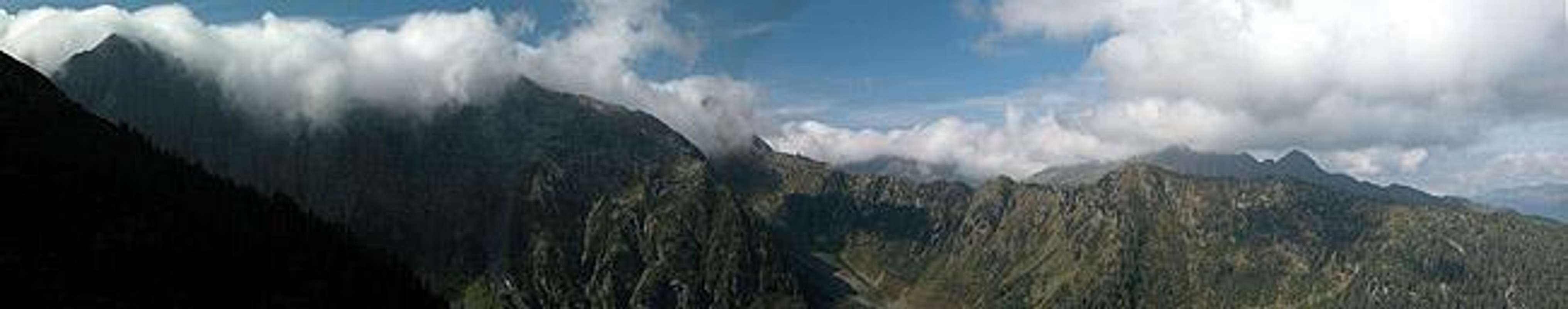
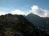
Views from the summit


Mittagskofel photo_id=116216

Getting There


Western Main RidgeWest Central Main RidgeCrode dei LongerinPeralba - Chiadenis - AvanzaEast Central Main RidgeBiegengebirgeKellerwand - Hohe WarteMooskofel GroupRinaldo Group
Interactive map of the western part of the Carnic Alps Main Ridge. The numbers refer to the respective subgroups as given on the Carnic Alps Main Ridge (West) Page. Click on them to get the subgroup description. Mittagskofel is located at the centre of subgroup 5.

There are two starting points for the ascent of Mittagskofel, Obergail and Niedergail, both located to the south of Lesachtal Valley which can be reached as follows:

From the West (Brenner Motorway A22)
Leave the Brenner Motorway near Brixen / Bressanone and follow SS49 to the east through Pustertal / Val Pusteria. To the east of Innichen / San Candido you cross the Austrian-Italian border and follow the road (now B100) to Tassenbach. Turn right (south-east) here onto B111, which you follow in direction Mötschach-Mauthen. Between St. Lorenzen and Liesing a side road turns off right (south) to Obergail, after Liesing the road to Niedergail also turns off right.

From the North
There are two possible roads:
  • From Kitzbühel over B108 through the Felbertauern Tunnel to Lienz, then southeast to Oberdrauburg and Kötschach-Mauthen (B110), where you turn on to B111 west into Lesachtal. From this side the Niedergail exit turns off south first.
  • From Salzburg along motorway A10 to Spittal. Turn west on B100 to Oberdrauburg, there south to Kötschach-Mauthen were you turn east on B111.

From the South (Udine)
Take Motorway A23 to the exit Camia Tolmezzo. Follow SS52 north to Tolmezzo where you turn onto SS52 bis. This leads to Plöckenpass, where it crosses the Austrian-Italian border. In Austria the road turns into B100 and at Kötschach-Mauthen you have to turn east on B111 into Lesachtal Valley.
Mittagskofel  photo_id=113594Mittagskofel  photo_id=113597Mittagskofel  photo_id=113600Mittagskofel  photo_id=113595

Red Tape


Mittagskofel photo_id=116218

I'm not aware of any red tape. The area below Mittagskofel is used for logging so it is definitely no good idea to park the car somewhere in the road. The logging trucks will have trouble getting through. Apart from the usual regulations (close gates, leave plants) there are no rules.

Side note: the area north of the Carnic Alps Main Ridge is covered with blueberry, raspberry, blackberry and even currant bushes. It might be a good idea to carry a container for collecting your dessert ;-)

When To Climb


The mountain can be climbed all year round. The usual hiking season is late May through late September. Ski tour ascents are possible, however, due to the ridge being rather short they are not very popular. A better option would be the next ridge to the east - Runseck, Stallon, Säbelspitz, accessible from Niedergail or Nostra.

Accommodation


Mittagskofel is close to the villages of Liesing, Obergail and Niedergail. There is - in principle - no need to camp near the mountain. Also there are some refuges in the "further vicinity". The next ones would be Wolayer See Hütte and Hochweißsteinhaus. Please refer to the relevant section on the Carnic Alps page
There are small campgrounds in Lesachtal Valley mostly associated with an inn or hotel. If you are looking for hotel rooms or apartments follow one of the links below

Weather Conditions


In general the weather in south-eastern Austria is much better than in the northern and western parts of the country. Still, the Carnic Alps Main ridge is a weather divide in northern or southern wind conditions so it pays to keep informed. Just look at some of the pictures and you'll understand why: while the north had beautiful weather the ridge was covered in clouds just oozing over it.

Look at one of the links below :

Maps 'n' Books


Maps
I have been using maps by Kompass Verlag, which are very good for the hiking trails though they don't show ALL the relevant summits of the area.
  • Lienzer Dolomiten / Lesachtal
    1:50000
    Kompass Map WK47
    Kompass Verlag
    ISBN: 3-85491-053-3

As for books please look at the appropriate section of the Carnic Alps page.


Children

Children

Children refers to the set of objects that logically fall under a given object. For example, the Aconcagua mountain page is a child of the 'Aconcagua Group' and the 'Seven Summits.' The Aconcagua mountain itself has many routes, photos, and trip reports as children.