
-
 8183 Hits
-
 92.5% Score
-
 39 Votes
|
|
Mountain/Rock |
|---|---|
|
|
49.14926°N / 20.02078°E |
|
|
Hiking, Mountaineering, Mixed, Skiing |
|
|
Spring, Summer, Fall, Winter |
|
|
6762 ft / 2061 m |
|
|
Overview
Name: Sedielková kopa (sk), Siodelko (pl), Szedilkó (hun), Sedilko (ger)
 Sedielkova kopa on the left with Ostra veza on the right
Sedielkova kopa towers above two valleys - valley Vazecka dolina - its part valley Dolina suchej vody - is to the west and north and valley Furkotska dolina is to the east. It has two long shoulders - one from the main summit to the SSE and the other to the SW. Between the two shoulders there is small valley called Zlomisko, through what flows creek Zlomiskovy potok. In the elevation of apprimately 1450 meters this creek cross the red marked hiking trail to the tarn Jamske pleso, from where you may summit Kriván. From Jamske pleso you may also ascend Sedielkova kopa, but it is illegal due to presence of strict nature reserve. For more info see red tape section and this map. White areas within magenta dashed borders are places, where there is forbidden movement also for climbers. This route to Sedielkova kopa fall within this area.
Sedielkova kopa means in english "Saddlous heap" and in print it was first used by Karel Koristka, who was the professor of Prague polytechnics, in 1864 in Gothe in Germany. First it was described by wrong name "Furkot" (maybe according to its position up from Furkotska valley) by Albert Sydow in 1830. The first conquerer remained unknown. First to be on the summit may have been shepherds, hunters or miners. In winter was the first summiter Peter Havas Hornicek, who stood on the summit in january 1906. Except of dense fields of knee timber and of its SE ridge it is easily accesible by walk-up. But there leads no marked hiking trail to the summit. For more info see Red Tape section.
Massif maps and picture description
 map of area of Sedielkova kopa
For seeing maps presenting hiking trails to approach Sedielkova kopa see external maps linked from Getting there section.
 Sedielkova kopa massif (numbers 1-3) from west
 Sedielkova kopa massif from east
 Map of both marked and unmarked hiking trails in west part of High Tatras.
Getting There and routes
 Train approaching Strba, where you may change to Strbske pleso and there you may start your hike for Sedielkova kopa
Despite some 3 decades ago there led marked hiking trail to the summit of Sedielkova kopa, it was cancelled due to nature preservation. Now no marked hiking trail leads to the summit of Sedielkova kopa.
On Strbske pleso you may start your hike to Sedielkova kopa as well as to many other neighbouring summits. You´ve got two possibilities how to get closer to the Sedielkova kopa. Both you see clearly on this map. You may join the red marked hiking trail towards Jamske pleso (30 minutes), but at first junction follow yellow marked hiking trail to the valley Furkotska dolina (30 minutes) and from another junction follow the yellow route only for 15 more minutes, than you are to go west, cross the creek Furkotsky potok and ascend easily the saddle Sedielkovy priechod (1950 m), which takes another 30 minutes. From there you go easily through the Kopa pred Sedielkom and meadow on periglacially formed Sedielkova plan to the main summit of Sedielkova kopa. From the saddle it longs 15 minutes. The first, who followed this route is unknown. In summer - maybe first known - Alfred Martin ascended it on th 19th semptember 1907. In winter this route absolved first Gyula Komarnicki on the 22nd april 1912.
The other possibility how to approach Sedielkova kopa from Strbske pleso, is to follow blue marked hiking trail towards the chalet Chata pod Soliskom (1830 m). It will take 90 minutes. About the chalet see also the Camping section. From the chalet follow blue marks slightly down to the valley Furkotska dolina (15 minutes) and from the junction with the yellow mark you continue as was described above. The only parts of UIAA grade higher than 0 is SE rib of Sedielkova kopa. It has parts of grade I UIAA.
Security and deaths
In High Tatras most fatal accidents (75%) fall within the subjective mistakes. When going to mountains be healthy, be careful and do not overestimate your abilities! From objective dangers there is the greatest lightning shot in summer and avalanches in winter. According to the statistics of the Tatras mountain rescue team to the date one man died on Sedielkova kopa. His name was JUDr. Jan Jamnicky (* 1908 Jasenova; + 4th august 1972 near the summit of Sedielkova kopa). R.I.P. He was national artist and actor. The cause of death was falling in senselessness.
Red Tape
 This - western slope of Sedielkova kopa is part of strictly protected nature reserve.
For things not to be so simple, as is Sedielkova kopa over two valleys, so differs the red tape. The west and north valley Vazecka dolina - and its part Dolina Suchej vody - is due to protecting chamoix strictly protected nature reserve. This means nobody except from national park rangers and scientists should ascend or descend Sedielkova kopa to that side. The side of valley Furkotska dolina is less illegal. If you see this map, it will approve, what was just mentioned. White areas within magenta dashed line are forbidden also for climbers. As you see at that map, the SE shoulder and N ridge of Sedielkova kopa is the border of the strict nature reserve. Ascend from Furkotska valley is thus less, but still in most cases illegal.
 Signpost announcing the closure of particular Tatras hiking trails every winter from 1st november till 15th june. Kopa pred Sedielkom on the left.
Currently it is discussed the reason of so strict restrictions and the regulations may be set not so strict, but the actual state of affairs is very strict, as I described it above. This regulation means that anybody you may be, you are restricted to summit Sedielkova kopa. For example Sedielkova kopa was suggested to be legal skialpinism area. It was the governmental council for saviour and re-examinating of Tatras (after the hurricane - "kalamita") who came with that claim. Recently nobody seems to be trying to fight for renewing the marked hiking trail to the summit of Sedielkova kopa.
The prohibition is the reason I´ve yet never summited it. I respect the law and I have in respect the rule of law. If laws are bad, we might try to change the state of affairs.
Camping
 Sedielkova kopa seen from terrace of chalet under Solisko.
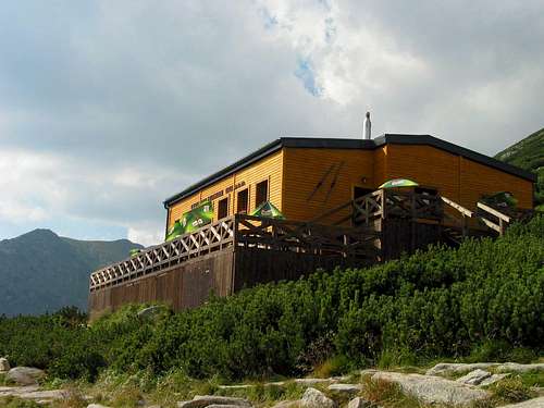
Due to the presence of national park, camping is strictly restricted. Only allowed are climbers, but only in urge situations. The nearest place to spend the night is the chalet chata pod Soliskom, where you may spend the night for 300 slovak crowns - approximately 10 euro. To the chalet leads also ski-lift from Strbske pleso that operates also in summer. You may spend your night also in hotels in the village Strbske pleso or in neighbouring villages. The nearest campsite is FICC Eurocamp in Tatranska Lomnica, some 20 kilometers away. The other campsite is autocamp Rackova dolina, that is as far from Sedielkova kopa, as is Eurocamp Tatranska Lomnica.
 chalet under Solisko. From here you need one more hour to get to the top of Sedielkova kopa.
In the first half of the 20th century there was one chalet directly in the valley Furkotska dolina, at its beginning. It was finished in 1936, was named Furkotska chalet and the owner was Lonek. This is, why it was called also Lonek´s chalet. In 1948 it was nationalised. In 1951 it was renamed after captiain Raso, former chief of local partisans during Slovak national uprising against fascism. In 1956 in was completely burn down. It was never renewed.
External Links
Actual conditions and security:
-Actual webcam shots from Strbske pleso is here.
-Tatra weather forecast: http://www.hory.sk/
-Tatra mountain rescue urgent phone line: 18 300
-In case mountain rescue rescues you, you will have to pay for it unless you have special mountain insurance. It costs 20 Slovak crowns (70 eurocents) a day.
-Current cautions about moutain conditions you find here.
-Actual avalanche situation is presented here.
External photos and trip reports
Summit photos and panoramas
-A summit photo with copyright of Stanislav Klaučo from www.hory.sk:
 summit view from Sedielkova kopa - to the right of the cross Hruby vrch and Furkotsky stit.
-view of Krivan from Sedielkova kopa
-summit view over Kratka and Kozi hrb - here you see how differs the crotch of Ostra - the west side remained untouched by glaciers, but east faces were mortised by "hungry" glaciers.
Views over the summit
Winter views of photographer Havran:
-1. a winter view of the summit from upper part of valley Furkotska dolina
-2. a winter photo of Sedielkova kopa from the upper part of Furkotska dolina with Ostra veza and Kozia stena on the right.
-3. an alpinist ascending Sedielkova kopa in winter.
Outcomes of scientific work on Sedielkova kopa
-Impact of climatic changes on flora in Tatras.