Sensory Overload
If you read enough SummitPost pages on the Elk Range you will come across the words
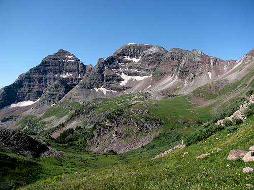
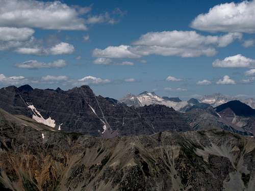
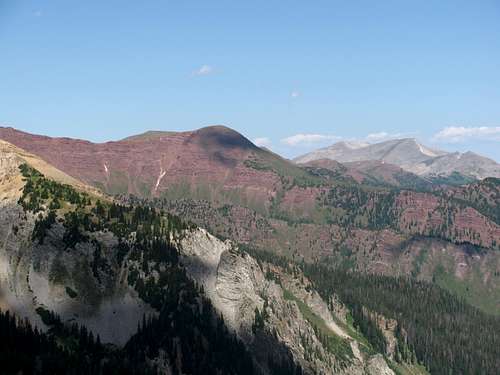
sensory overload a number of times. After spending four days hiking in the Elks I now understand why! On three of these days we were able to get in a full day of hiking. Those days included hikes to Buckskin Benchmark, “Electric Pass Peak" and to Capitol Lake. Over the course of our week long trip in the Elk and Sawatch Ranges we were able to get in seven hikes and all of them were special for various reasons, but these three in the Maroon Bells-Snowmass Wilderness (the Bells) were the highlight. It was non-stop incredible scenery all day long. And sensory overload couldn’t be truer!
August had finally arrived and it was time for my 5th annual pilgrimage to the mountains of Colorado. After four straight years of hiking in Rocky Mountain National Park I decided it was time for a change of scenery. After referencing a very large number of SP pages I decided to head to the Elk and Sawatch Ranges and split the trip up between the Maroon Bells-Snowmass Wilderness and the Holy Cross Wilderness.
There would be three of us on this trip. My friend Rob Wood was joining me again for the third time, and I was quite happy that my son Andrew would be making his first hiking trip to Colorado with me. The timing had always been bad on my August trips the previous four years as he was always starting college. With that behind him the timing was finally right.
Altitude Test - Independence Lake and Lost Man Pass
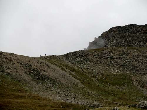
My original plans never included a hike for Saturday. I figured more than likely we would be arriving in Colorado just in time for the afternoon thunderstorms, so I never put too much energy into researching possible hikes. We left Indianapolis at close to 6 PM (Colorado time) on Friday and after our all night drive we were at Independence Pass shortly after 1 PM. After nearly 20 hours of driving Andrew was ready to head straight for the campground. Hiking wasn’t on his agenda. But I explained to him that it was important to go on a short hike in order to see how he would respond to the change in altitude. From our previous trips I was confident that Rob and I wouldn’t have altitude sickness issues, but I had no idea how Andrew would fair. Less than 20 hours ago we were in Indianapolis, which has a mean elevation of 717 feet. My plan was to hike up to Buckskin Benchmark on Sunday, with an elevation of 13,370 feet. I knew that getting some hiking in today would pay big dividends for Andrew on Sunday. Of course, if altitude sickness was going to be a problem I wanted to know now, so I could start thinking about how to rearrange the week’s hiking itinerary.
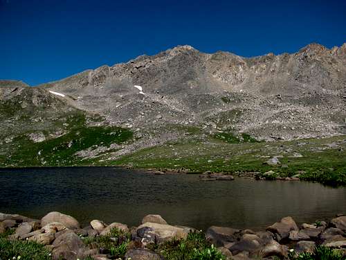
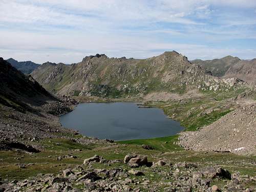
I had no ambitions for this hike, other than to see how Andrew responded. Even if it was just a one mile stroll, I was going to be satisfied. Thanks to some very last minute information from SP I chose the hike to Independence Lake, which was perfect. Since we were driving over Independence Pass to get to Aspen, we stopped at the Linkins Lake Trailhead (1.9 miles west of Independence Pass). With a starting elevation of around 11,500 feet, the 1.7 miles to Independence Lake would be a good acclimatization hike.
![Independence Lake]() Independence Lake
Independence Lake![Independence Lake]() Independence Lake
Independence Lake
We started off at a nice easy pace and everything was going fine. Everyone felt great by the time we reached the lake. I was satisfied with just getting there, but Rob wanted to continue up the extra 0.6 miles to Lost Man Pass. I told Andrew and Rob that I would continue on if they wanted to. So we headed for the pass, and I was quite happy to see Andrew taking the lead up the trail.
![Lost Man Trail]() Views on Lost Man Trail
Views on Lost Man Trail![Lost Man Pass]() Lost Man Pass
Lost Man Pass
While the views were great to Lost Man Lake, Geissler Mountain and UN 13,001, I was more excited with how Andrew responded to the altitude. No issues! This was what I was hoping for and now things looked promising for a long hard week of hiking!
![Lost Man Lake]() Lost Man Lake and UN 13,001
Lost Man Lake and UN 13,001
With the way we were feeling, along with the rare blue sky afternoon we were having, we more than likely could have continued on up to Geissler Mountain. But it was getting late and we still had to get to Silver Bells Campground on Maroon Creek Road. I didn’t want to set up our tents and grill supper in the dark, so we headed down.
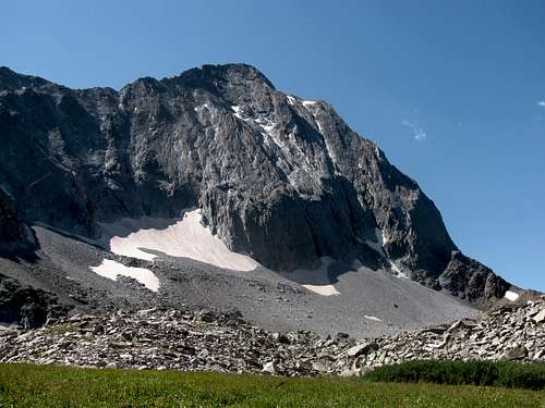
Buckskin Benchmark – Smack Dab in the Middle
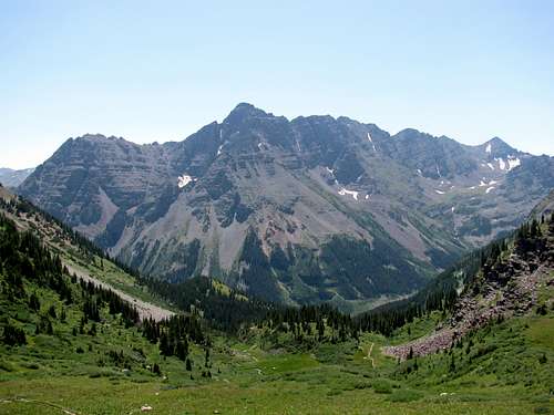
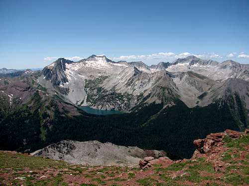
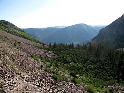
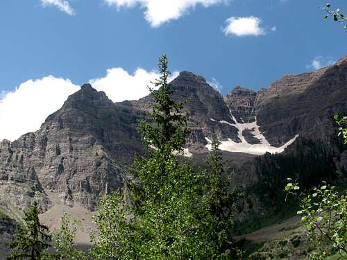
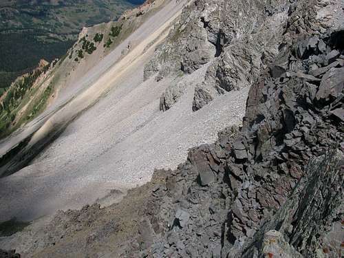
Since the altitude didn’t look like it was going to be a problem I stuck with my original plan of hiking up Buckskin Benchmark on Sunday. I was very excited about this hike as I had heard rave reviews about the scenery in Minnehaha Gulch and the trail to Willow Pass. Also, I knew that the view from the summit was spectacular, with a great view of Snowmass Lake and the Capitol-Snowmass massif. With it being a 10 mile round trip walk-up with 3,800 feet of elevation gain, it should have been a simple day, but it ended up being a little more complicated!
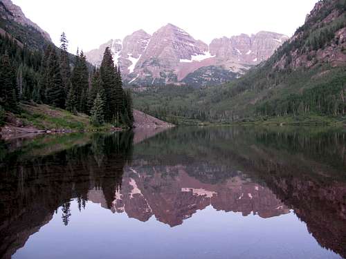
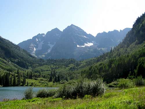
I set the alarm for 5 AM. Not a particularly early start considering it was monsoon season, but the great weather from Saturday was forecasted for Sunday as well, so I was gambling that the afternoon thunderstorms wouldn’t develop. We were at the trailhead by 6:15, early enough to walk by a short line of photographers waiting to get that perfect early morning shot of the Maroon Bells along with the accompanying reflection in Maroon Lake. We fortunately arrived at the perfect time to get that great shot. I snapped a couple of photos and we were on our way. Way too easy!
![The Maroon Bells Reflected in Maroon Lake]() Maroon Lake
Maroon Lake
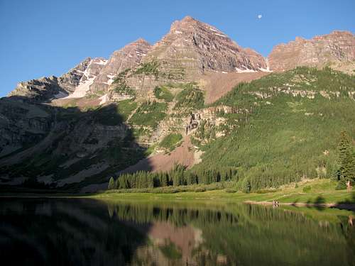
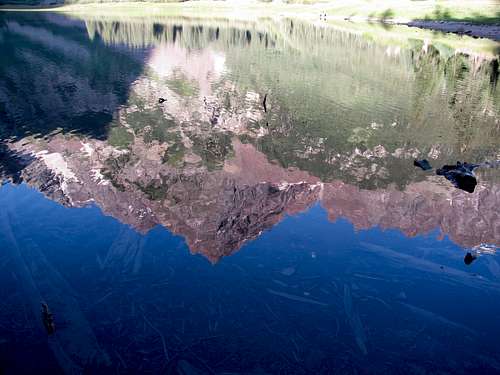
We stopped by Crater Lake before heading up into Minnehaha Gulch. Again, we arrived at the perfect time to catch some alpenglow on the Maroon Bells as well as their perfect reflection in Crater Lake.
![The Maroon Bells]() Crater Lake
Crater Lake![The Maroon Bells Reflected in Crater Lake]() The Maroon Bells reflected in Crater Lake
The Maroon Bells reflected in Crater Lake
At this point I was quite happy with the lack of people on the trail. Leading up to the trip I had read the countless stories about the huge crowds in the Bells, but despite a relatively late start, I was amazed at the lack of traffic. Early on we ran into a group of three climbers heading for Pyramid Peak. Later on in Minnehaha Gulch we met a couple on their way to North Maroon Peak. I was expecting a lot more traffic, but other than these two small groups we never saw anyone else until after we reached Willow Pass.
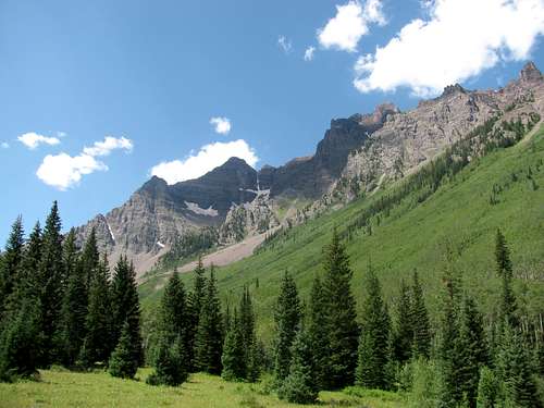
![North Maroon Peak and The Sleeping Sexton]() North Maroon Peak and the Sleeping Sexton
North Maroon Peak and the Sleeping Sexton![Maroon Bells Cascade]() Cascade on Willow Lake Trail
Cascade on Willow Lake Trail
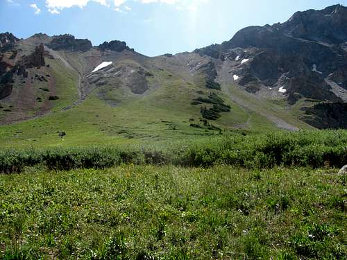
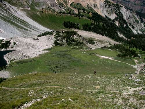
After the hike thru Minnehaha Gulch, we headed up Willow Lake Trail. The plan was to hike over to the saddle between Buckskin Pass and Buckskin Benchmark and continue up the nice grassy slope to the summit from there. Unfortunately there was still quite a bit of snow at this saddle, which was blocking our route.
With our primary route not an option, we continued on the trail up to Willow Pass hoping there might be a route to the summit from there. When we got to the pass, the wind was blowing strong and if there was a route up this ridgeline it was more challenging and required more route finding than we were willing to try as a group, so dejectedly we began our descent down Willow Pass.
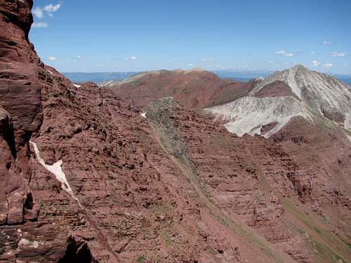
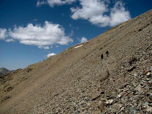
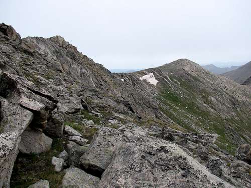
![Buckskin Benchmark]() Buckskin Benchmark
Buckskin Benchmark![UN 13,336 - Willow Peak]() "Willow Peak" from Willow Pass
"Willow Peak" from Willow Pass![Willow Pass]() Andrew and Rob descending from Willow Pass
Andrew and Rob descending from Willow Pass
At this point I was in a pretty foul mood. For one, I had fears of a repeat of my 2007 trip where we succeeded on only 2 out of 7 hikes. Secondly, summiting Buckskin Benchmark was my highest priority for this trip. I wanted to see those views from the summit and now I wasn’t going to get to do that!
When we reached the Willow Pass-Buckskin Pass junction we stopped for a short break. I looked up at the pass and knew that the spectacular views to Snowmass Lake were so close! I didn’t want to let this opportunity pass us by. I hinted to Rob and Andrew that we should head up. Rob was willing, but Andrew had no interest in climbing up to Buckskin Pass. But I told him, rather emphatically “One way or another, I am going to see Snowmass Lake during this trip. You can either hike up to the pass now so I can see the lake, or you can do the 17 mile round trip hike to the lake with me later this week!” Andrew quickly decided that Buckskin Pass was the better option, but they both made me agree that we would take a long break on the way up. Agreed! We stopped about half way up where there was a great spot for Andrew and Rob to lie down on some grass. I sat with the perfect view of the Pyramid massif in my face. It was a wonderful spot for a short break!
![The Pyramid Massif]() The Pyramid massif
The Pyramid massif
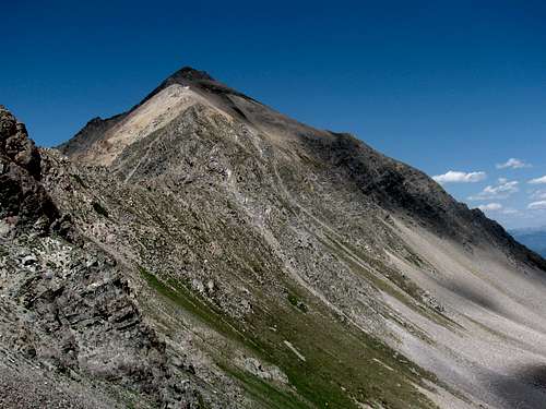
We continued up to the pass and the views were spectacular! Andrew saw the easy route to the summit of Buckskin Benchmark and thought we should give it a try. I was all for this!
![Buckskin Benchmark]() The easy climb up Buckskin Benchmark from Buckskin Pass
The easy climb up Buckskin Benchmark from Buckskin Pass
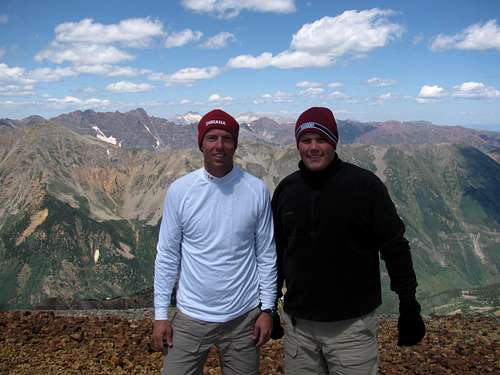
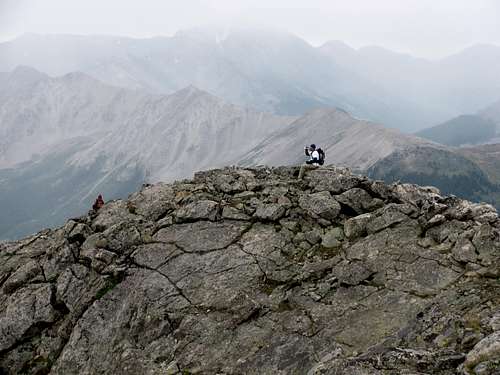
After taking in the views from the pass we headed up. Andrew and Rob were pretty tired at this point and not too far into the summit attempt decided that they had had enough. I asked if it was OK for me to continue on and they both agreed. They found a nice grassy slope to nap on and I hustled up to the summit. I hiked up a lot faster than I normally would have. But since they were generous enough to let me continue on hiking, and to wait for me, I figured the least I could do was move quickly.
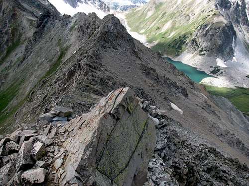
The hike up was easy with nothing technical about the route. Near the top I did run into a little bit of that loose red rock the Bells are so famous for, but it didn’t cause much of an issue. It was more of a minor nuisance that was easily bypassed.
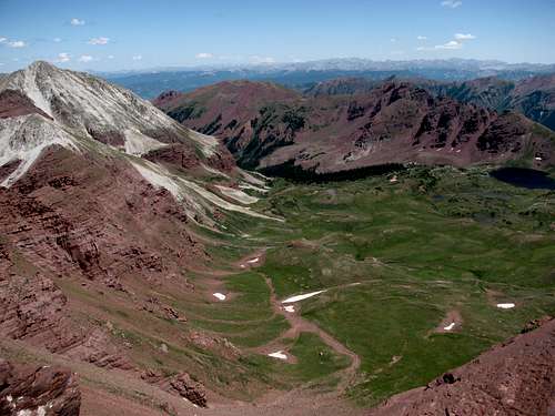
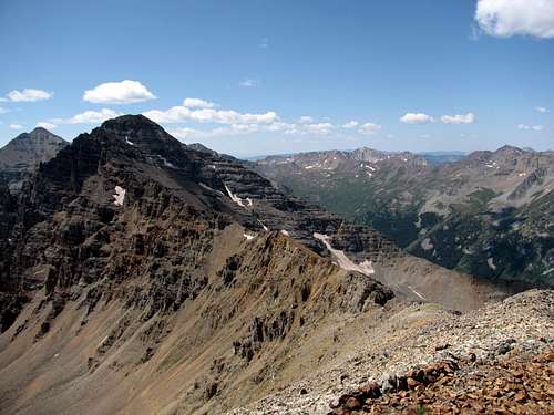
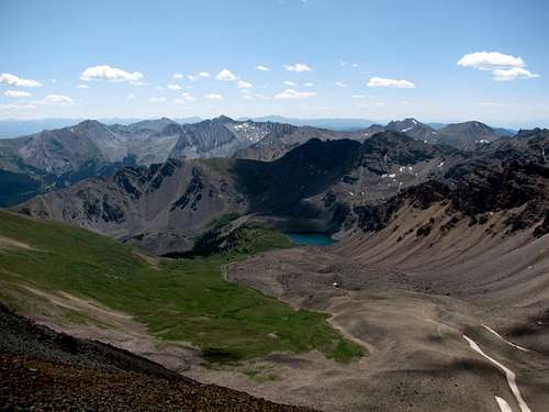
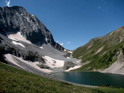
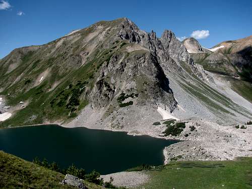
The views from the summit were all that was advertised. I looked around to Snowmass Lake, the Capitol-Snowmass massif and then around to the Pyramid massif and North and South Maroon Peak and I realized I was smack dab in the middle of all that I had wanted to see during my visit. The fact that I was on the summit all by myself only made it that much better.
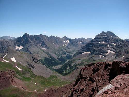
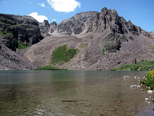
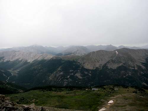
![Snowmass Lake]() The Capitol-Snowmass massif from Buckskin Benchmark
The Capitol-Snowmass massif from Buckskin Benchmark![Willow Lake Basin]() Willow Basin from Buckskin Benchmark
Willow Basin from Buckskin Benchmark![Buckskin BM- Willow Peak Ridgeline]() The ridgeline towards "Willow Peak" from Buckskin Benchmark
The ridgeline towards "Willow Peak" from Buckskin Benchmark![The Pyramid Massif and Maroon Bells]() The Pyramid massif and the Maroon Bells from Buckskin Benchmark
The Pyramid massif and the Maroon Bells from Buckskin Benchmark![The Maroon Bells]() The perfect end to a perfect day on the trail
The perfect end to a perfect day on the trail
Later on I thought about how amazing it is that so many people skip the simple trip to the Benchmark. So many day-hikers and backpackers get up to Buckskin Pass, but I didn’t see a single one head for the summit. It’s so close and so easy, and the views are incredible.
I felt much better after summiting and started thinking that maybe this week would be a series of successes after all. But while I felt great, Andrew regretted not going to the summit. He didn’t talk about it a lot on the descent but over the course of the week he made it clear that he wished he would have continued on with me. In hindsight, I realize that when Rob and Andrew decided to stop and let me go on to the summit, I should have slowed down and taken another break with them. Under that scenario I’m sure they both would have continued on to the summit.
“Electric Pass Peak"
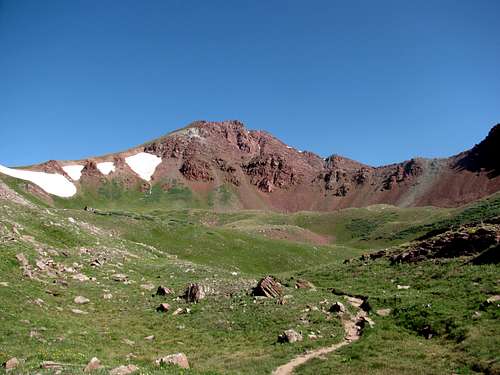
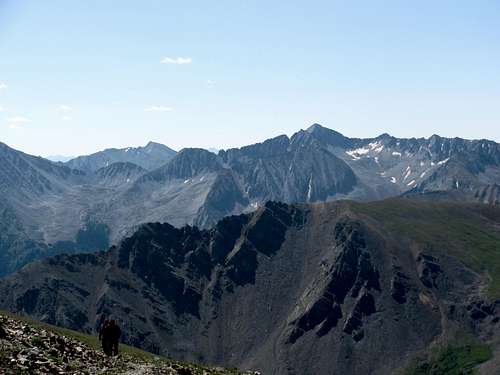
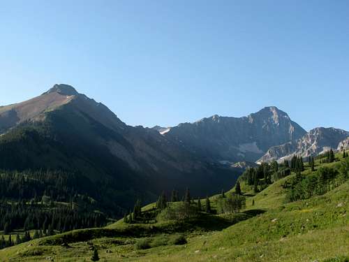
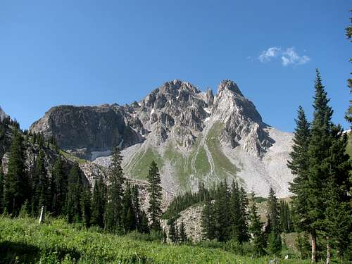
All the while we were descending from Buckskin Pass I started to realize that the chances of success on any other 13ers during this trip were getting slim. While we ate dinner at camp on Sunday night I asked Rob and Andrew if it was important to them to summit a 13er. Rob answered that it was no big deal, but Andrew answered emphatically “Yes”. Based on this response I knew that I needed to change Monday’s plan. The original plan for Monday was to go to Capitol Lake and then to try and summit Mount Daly. I knew that Daly was a long shot and in reality the only good possibility I had left for a 13er was “Electric Pass Peak", with its non-technical class 2 walk-up. And at less than 10 miles round trip, with 3,700 feet of elevation gain it wouldn’t be a particularly long day.
Prior to the trip I had considered “Electric Pass Peak", but a few weeks before we left, Andrew asked for a “day off” for the middle of the week. To me, a day off would be a nice 5 mile hike. Cathedral Lake fit that bill. And since Cathedral Lake is on the way to “Electric Pass Peak" I took Electric Pass off the list. Cathedral Lake would be the “rest day’ hike. Now, based upon Andrew’s desire to summit a 13er, plans had to be changed and I knew “Electric Pass Peak" was the best option. The weather forecast was great for Monday so I didn’t want to put it off until later in the week and take a chance on the weather keeping us from being successful, so I made the decision that we were heading for “Electric Pass Peak" on Monday. And a very good decision that would be!
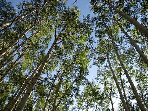
![Aspen Grove]() Aspen on Cathedral Lake Trail
Aspen on Cathedral Lake Trail
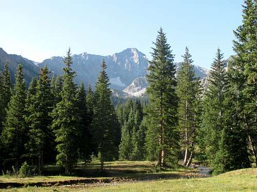
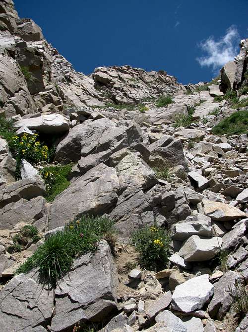
The hike to “Electric Pass Peak" is beautiful. And despite what I had read, the trail was not busy. There was one car at the trailhead when we showed up at 7:15 AM, and another car with three hikers heading for Cathedral Lake arrived a few minutes later. Other than these three gentlemen, we didn’t run into anyone else on the trail until we were descending from the summit. Again, like with Buckskin Benchmark, the hike to “Electric Pass Peak" was filled with so much eye candy. The solitude only added to the experience.
![Cathedral Lake Trail]() Rob and Andrew on Cathedral Lake Trail
Rob and Andrew on Cathedral Lake Trail![Cathedral Peak]() Cathedral Peak
Cathedral Peak
We bypassed the cutoff trail that descends to Cathedral Lake, deciding that we would stop there on the way down as a good place to take a break. After this junction the trail gets pretty narrow and thick with krummholz, and I started thinking that maybe "Electric Pass Peak" isn’t climbed very often. As we continued to gain altitude on the switchbacks, the views continued to get better and better.
![Electric Pass]() Andrew and Rob approaching Electric Pass
Andrew and Rob approaching Electric Pass![Summit of Electric Pass Peak]() Summit Views
Summit Views
We stopped at the pass for a short break. Andrew was all for a summit attempt. Rob was less interested, but decided he’d continue on as well. From here, the narrow climber’s trail takes you across the face of the peak and there is a relatively steep slope for a short stretch, and depending on how much you tolerate exposure, watching your footing can be important. This was Andrew’s first experience on this type of terrain, and Rob doesn’t particularly like exposure, so although I took the lead, I tried to keep us close together to ensure everyone was reasonably comfortable. Once we reached the turn for the summit ridge we all headed up at our own pace. And we had the place all to ourselves!
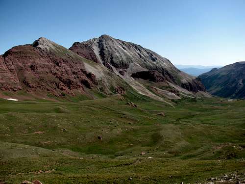
The beauty of the summit views took a close second to those from Buckskin Benchmark. Andrew proudly signed the summit register, and we spent about 15 minutes taking in the scenery. The ridgeline views of the Maroon Bells and the Capitol-Snowmass massif were stunning. The summit also provided a great view of Cathedral Peak and its ridgeline.
![Cathedral Peak]() Cathedral Peak
Cathedral Peak![Cathedral Lake]() Cathedral Lake
Cathedral Lake![The Face of Electric Pass Peak]() Andrew and Rob crossing the face of Electric Pass Peak
Andrew and Rob crossing the face of Electric Pass Peak
We started our descent and by the time we reached the bottom of the ridgeline and turned to cross the face, we finally ran into some other hikers. There were a few more people taking a break at the pass, but again I was very surprised, and quite happy with the lack of traffic on the trail.
![Cathedral Peak]() Cathedral Peak from the shore of Cathedral Lake
Cathedral Peak from the shore of Cathedral Lake
As agreed, we stopped at Cathedral Lake for a break. It was a little busy, but I didn’t care at this point. Rob was particularly interested in getting a better understanding of the route up to Cathedral Peak. Not that we would be trying an attempt of Cathedral this year!
The day was a great success. It was a beautiful hike, Andrew got his first 13er, and Rob, despite initially not caring about getting up to the summit was very happy with the choice.
Rest Day – East Maroon Creek
Tuesday ended up being our “rest day”. In hindsight taking a rest day was a good idea. It was now Tuesday and we had three good hikes in already. Andrew argued that a rest day would give us a chance to recover before hitting the trail hard for the last three days.
![North Maroon Peak and The Sleeping Sexton]() North Maroon Peak and the Sleeping Sexton
North Maroon Peak and the Sleeping Sexton
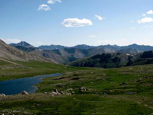
Unfortunately the day ended up being somewhat frustrating for all of us. For Andrew, he wanted an actual day to rest, but we ended up hiking about 8 miles! It was pretty easy terrain with less than 1,000 feet of elevation gain. By my standards this was a rest day. For Rob, the East Maroon Creek Trail was the perfect trail. With the easy slope and interesting ridgeline views, Rob could have hiked on this trail for a long time, but I had to reel him in and remind him that I promised Andrew a short day, and two hours out on the trail was enough. It was time to turn around. For me, there were other hikes I was more interested in. The weather was incredible and I envisioned myself on a hike out to Snowmass Lake or on West Maroon Creek Trail, heading up to West Maroon Pass and maybe Belleview Mountain.
We hiked on East Maroon Creek Trail until we were just behind Pyramid Peak. My only goal for this hike was to see Pyramid from this side of the trail and the views were excellent.
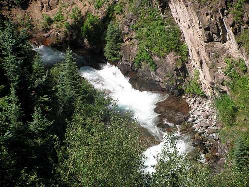
![East Maroon Creek]() East Maroon Creek
East Maroon Creek![East Maroon Creek Valley]() Ridgeline views on East Maroon Creek Trail
Ridgeline views on East Maroon Creek Trail![Pyramid Peak from East Maroon Creek]() Pyramid Peak from East Maroon Creek Trail
Pyramid Peak from East Maroon Creek Trail
We made it an early day, and I made it up to Andrew as later in the afternoon we headed into Aspen for some dinner at Hickory House Ribs. This was a good choice, as the BBQ was great and the Fat Tire was nice and cold. It was a nice relaxing evening. We headed back to the campsite fairly early so we could get ready for our big hike out to Capitol Lake on Wednesday morning.
Capitol Lake
Very early in my planning I knew that we had to get a hike in to Capitol Lake. With the open terrain, the views to Capitol Peak from the trail looked outstanding. And as with our hikes on Sunday and Monday, the scenery was beyond compare.
![Capitol Peak and Mount Daly]() Mount Daly and Capitol Peak
Mount Daly and Capitol Peak![Capitol Peak]() Near the Capitol Ditch and Capitol Creek junction
Near the Capitol Ditch and Capitol Creek junction![Capitol Creek Trail]() Nearing Capitol Lake
Nearing Capitol Lake![Capitol Peak]() Capitol Peak from the turnoff to the climber's trail to the Daly-Capitol saddle
Capitol Peak from the turnoff to the climber's trail to the Daly-Capitol saddle
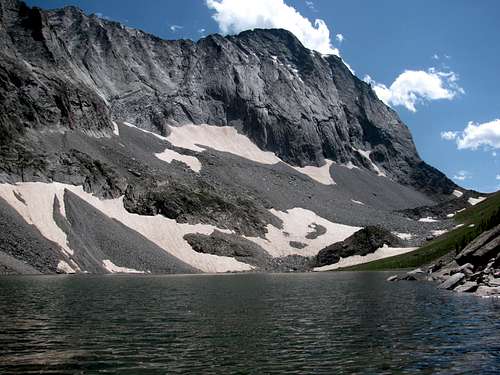
We ended up taking the Capitol Ditch Trail. Other than for a few obnoxious cows on the trail and initially missing the creek crossing to Capitol Creek Trail, the hike out to Capitol Lake was uneventful. The views however were spectacular, and again, there was no one else on the trail. We didn’t see another hiker until we reached the turnoff for the climber’s trail to the Daly-Capitol saddle. We stopped for a short break before heading to the saddle and a lone climber who had summitted Capitol earlier in the day strolled up from the lake.
![Mount Daly-Capitol Peak Saddle]() Daly-Capitol Saddle
Daly-Capitol Saddle![Capitol Lake]() Capitol Lake from the climber's trail
Capitol Lake from the climber's trail
For now, we just rested at the turnoff and didn’t go all the way to the lake. As with Cathedral Lake earlier in the week, our plan was to finish the hike to Capitol Lake on our way down from the mountain. The mountain I’m talking about is Mount Daly, not Capitol Peak. I never even remotely considered Capitol Peak when planning this trip. I have a lot more climbing I need to do before I’ll be ready to give Capitol a try. And with all the exposure, I doubt that that day ever will come
Mount Daly – Feeling Gravity’s Pull
I added Mount Daly to the itinerary after studying the topo map around the Capitol Lake area. With it’s proximity to the lake and its class 3 route, it was a logical choice for extending our dayhike from Capitol Lake. Besides, I had seen pictures of the view back to Capitol Peak from the Mount Daly summit, and that was a view worth working for. Unfortunately there is not a lot of information on this particular route to Mount Daly. I solicited some help from several SP members who were quite helpful in providing me with some additional details: stay on the east side of the ridge; it’s class 2 and 3; probably a little more exposure than a day hiker is use to.
![Capitol Lake]() Capitol Lake from the climber's trail
Capitol Lake from the climber's trail![Mount Daly-Capitol Peak Saddle]() Ridgeline views from the saddle
Ridgeline views from the saddle![Mount Daly-Capitol Peak Saddle]() Looking down the climber's trail from near the saddle
Looking down the climber's trail from near the saddle![Mount Daly]() Mount Daly
Mount Daly
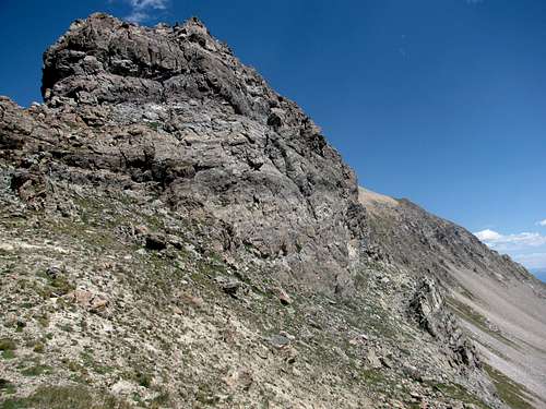
We headed up the climber’s trail to the saddle, which was a little steeper than it appeared from a distance. I made it to the saddle first. Rob and Andrew made it up a little while after that and while I waited for them I considered the climb to Daly. When they reached the saddle, I asked Rob if he wanted to try for Daly. He had no interest! Andrew was very tired from the climb to the saddle. From a safety standpoint I didn’t think it was a good idea for him to try and climb Daly. This would be his first experience on a somewhat exposed ridge, and then there was the loose rock to deal with. Based upon this and how tired he was, I told Andrew he wasn’t going. He didn’t argue!
![Mount Daly]() Tower at the start of the climb to Mount Daly
Tower at the start of the climb to Mount Daly
Just like with Buckskin Benchmark, they were both fine with me heading up on my own. But at this point I wasn’t even sure I was going to be able to try. I couldn’t see the ridgeline from the saddle due to the rock tower that blocks the view. The tower looked easy enough to get around so I told them I would get around the tower, take a look at the route and decide then if I was going to continue on.
![Mount Daly]() On the Mount Daly ridgeline, looking down the west side
On the Mount Daly ridgeline, looking down the west side
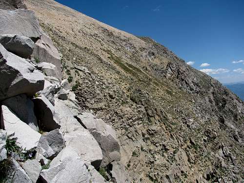
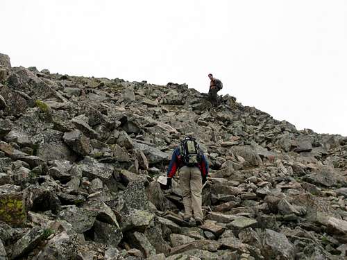
My first thought after I got around the tower and looked at the route was “no chance”. Given enough time I believed I could make the climb to the summit. But unlike with Buckskin Benchmark, the round trip was going to take a lot longer than 90 minutes. I stood there in a debate with myself for several minutes. I never really believed I was going to be successful, but I yelled back to Rob that I was going to give it a shot. After all the months of planning I just couldn’t walk away without at least trying. Rob and Andrew were going to scope out the area and the trail towards Capitol Peak as they were both quite enamored with that huge beautiful rock. We agreed that we would meet back at the saddle. For now, the weather was a non-issue with nothing but blue sky, so we all headed our separate ways.
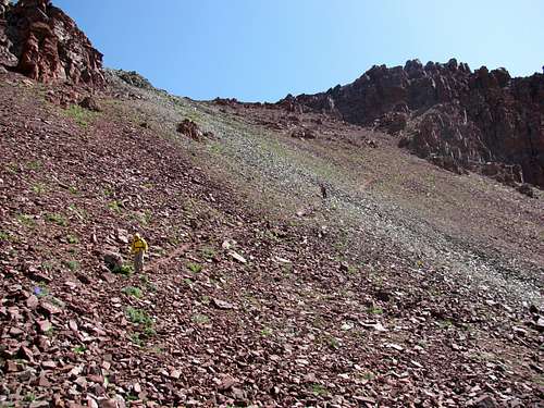
I didn’t initially head straight up towards the ridgeline. This left me in the scree filled slope and this became tiresome as I moved directly across the mountain. After about 10 minutes of this I decided to head for the more solid looking rock near the ridgeline. The rock was better, but the route finding was challenging.
![Mount Daly]() One of several gullies I climbed - Plenty of loose Elk rock!
One of several gullies I climbed - Plenty of loose Elk rock!![Mount Daly]() End of the line
End of the line
I ended up having to ascend and descend several gullies along the way. As advertised, much of this rock was quite loose and I found myself having to test my footing and every hand hold twice in certain areas. And there was definitely some exposure. Not overly intense, but it was there! I continued on this way for about 45 minutes when I came to a spot that I knew I could not climb around. I would have to backtrack so I could either ascend or descend around it.
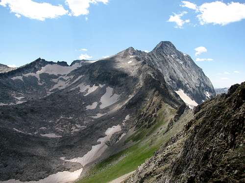
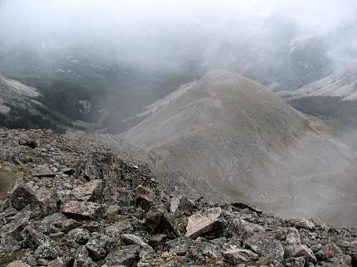
![Capitol Peak]() Capitol Peak from the Mount Daly ridgeline
Capitol Peak from the Mount Daly ridgeline
At this point I estimated that I might have been half way to the summit. I looked ahead at the route, checked my watch, and realized that this was going to take a lot more time than I had available. With Rob and Andrew waiting for me at the saddle I decided it was time to turn around. I stopped for a few minutes to take in some of the views and snap a few photos. From this point the view back to Capitol Peak was all that I had expected and this made the effort worthwhile.
![Mount Daly]() The Mount Daly ridgeline as I make my way back to the saddle
The Mount Daly ridgeline as I make my way back to the saddle
Of course I still had to get back, and at this point I was now pretty tired, so the return trip to the saddle was much more difficult. I had moved too fast on the way out, and I was paying for that now. I also know that I didn’t take the exact same route back and I ended up in one small gully that was particularly difficult. All of the rock in this gully seemed to be loose, and getting solid hand or foot placement was challenging, requiring quite a bit of patience. I sent plenty of rock down this slope, knowing that every time I did this I was probably making Andrew and Rob nervous.
![Capitol Peak and Capitol Lake]() Capitol Lake
Capitol Lake
Eventually I did make it back to the saddle and even though I didn’t summit Mount Daly I had picked up some valuable experience climbing in the Elk Range. And yes, Andrew and Rob were glad to see me back safe - and I was correct in that each rock slide I started did make them a little nervous.
We came down from the saddle and headed over to Capitol Lake. Besides wanting to see the lake, I also wanted to take a break and soak my sore feet in its cold water. Again, the views from the lake were stunning, and the cold water was quite healing for my feet, making the long six mile hike back to the car a lot easier.
Moving Day – UN 13,033 and Midway Pass
Sad as it may sound, when I woke up on Thursday morning I did not have a hiking plan in place for the day. At this point I was pretty satisfied with what we had accomplished for the week. Since it was now Thursday, we had worn out our five day welcome pass at the Silver Bells Campground and we had to move. My original plan was to spend the last two days of our trip in the Holy Cross Wilderness. Months prior I had made a reservation at the Camp Hale campground as it was the closest campground to the Holy Cross Wilderness that I could reserve. The original plan for Thursday was to hike the Missouri Lakes-Fancy Pass loop and then on Friday to try for Mount of the Holy Cross, going up Halo Ridge and descending the standard route. But by Wednesday night we had decided to scrap that plan, mostly because of the distance and difficulty of Mount of the Holy Cross. Besides, the weather forecast for Friday wasn’t great. The forecast was calling for rain most of the day and since the Halo Ridge route requires a day with great weather we started looking for alternative options for Thursday and Friday. As bad as I wanted to summit Mount of the Holy Cross, it would have to wait another year. And as late of a start as we were getting today we never would have had enough time to drive up to the Missouri Lakes Trailhead to get in the complete loop route I wanted to do.
For several days we had some discussions about giving Castle Peak a try. I could tell that Rob and Andrew were itching to get in a 14er, particularly one easier than Mount of the Holy Cross. Unfortunately I never did much research on Castle prior to the trip and with my lack of familiarity with the route, along with no topo map for Castle I never felt comfortable giving it a try. Besides, there was a reason I didn’t research the route very closely. It might be the highest peak in the Elk Range, but I was never inspired by the standard route up Castle. Maybe I’m missing something, but there just seems like better routes to hike and climb in the Bells.
I woke up early and started rearranging our plans for the day. With the Holy Cross Wilderness not happening this year, I didn’t have a strong emotional attachment to any other hikes or climbs. Bad weather was arriving as well, which made it easy for me not to get too optimistic. My plan was to find a campground we could head to where there were two good hikes with trailheads relatively close to the site.
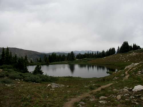
![Alpine Lake]() Alpine Lake
Alpine Lake
We had already decided that La Plata Peak was the best option for Friday, it being a class 2 walk-up to 14,336 feet. La Plata would allow Rob and Andrew to get in their 14er fix, so all I had to do was find a nice short day hike in that area for Thursday. I had brought along my Falcon trail book
Hiking Colorado's Maroon Bells-Snowmass Wilderness by Eric Molvar, and in the Hunter-Fryingpan Wilderness section there was a hike to Midway Pass from the Lost Man Trailhead. This looked like a good choice for the day. It was a short 3.5 mile hike to the pass, with about 1,700 feet of elevation gain. And to top it off, according to Molvar’s book, there were two 13ers in the Williams Mountains we might be able to try for as well, UN 13,125 or UN 13,100 (I learned after I got home and did some more research that UN 13,100 is actually UN 13,033). I had the plan all set by the time Rob and Andrew rolled out of the tents and they were quite pleased with the option, so we tore down camp and headed for Lincoln Gulch Campground on Hwy 82. Fortunately we were able to get a site. We paid our dues for a two night stay and then drove the few short miles to the Lost Man Trailhead.
The weather was not great, but who was I to complain. Up to now we had had unbelievable weather. It was Thursday and I hadn’t even pulled my rain gear out of my backpack yet. Five blue sky days with no rain and not a single decibel of thunder! It had been a rare week in Colorado for early August.
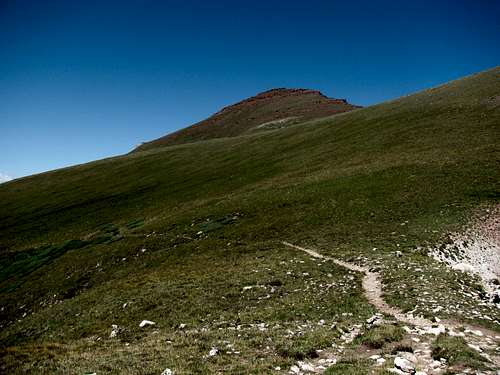
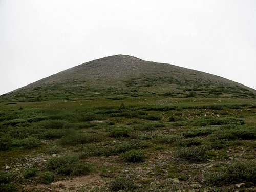
We had no real plan other than to make it to Midway Pass. As we neared the pass, UN 13,033 came into view. From the trail it is by no means an aesthetically appealing peak, but hey, the weather wasn’t all that great so trying to summit an easy 13er was as good an option as we had.
![UN 13,033]() UN 13,033
UN 13,033![UN 13,033 Terrain]() Terrain near the summit
Terrain near the summit
It ended up being a really good choice for Andrew from an experience standpoint, as there is no established route to the summit with no climber’s trail and no cairns. Once we decided to head for the summit it was simply a matter of aiming for the ridgeline and switching back as much as needed to make the elevation gain tolerable. Once we left the trail I took the lead and reached the summit first. There was only one false summit and overall, it was an easy trek to the top. Andrew and Rob reached the top shortly afterwards and we enjoyed the summit experience despite the low lying clouds that blocked the views to the ridgelines.
![UN 13,033 Ridgeline]() Andrew taking a break on the ridgeline just below the summit
Andrew taking a break on the ridgeline just below the summit![Midway Pass]() Midway Pass from the summit
Midway Pass from the summit
When we got ready to descend Rob decided to make more of a loop hike out of the day and head towards Midway Pass as opposed to just backtracking. Andrew and I weren’t particularly thrilled with this option but I didn’t want us to separate so we followed Rob down towards the saddle.
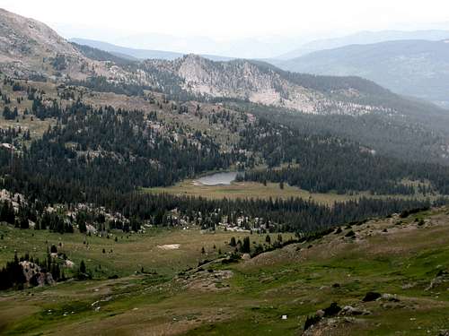
![Midway Lake]() Midway Lake from the summit
Midway Lake from the summit
I started descending too quickly and ran into some steep cliffs. I yelled up to Rob and Andrew to continue heading straight for the saddle and then to descend to the grassy slopes of Midway Pass. We enjoyed the nice view from the pass and headed back to the trailhead. With our plan to try for La Plata Peak on Friday I wanted to get back to the campsite and call it an early evening. The alarm was going off early.
La Plata Peak
Our plan for Friday was the hike up La Plata Peak so we went to bed early and I set the alarm for 4 AM. But shortly after we called it an evening it started to rain, and it rained all night. The rain kept me awake for most of the evening, and sometime in the middle of the night I realized that climbing La Plata wasn’t going to happen. There was no way the weather was going to cooperate. So eventually I went to sleep and ended up sleeping through my alarm. I woke up shortly after 5 AM, hoping to go back to sleep, when Rob walked by the tent and said it was time to go hiking. I thought it was still raining but Rob said he could see the moon and the rain had stopped. Andrew was anxious to get started as he’d be trying for his first 14er so he rolled right out of the tent. Despite Rob’s enthusiasm I was less optimistic, but I rolled out of the tent as well and we headed up the road to the trailhead.
I’m sure that the hike up La Plata Peak is quite beautiful. But on this day the low lying clouds blocked most of the ridgeline views. So instead of spending my energy soaking up the scenery, most of my focus was on watching the weather. Fortunately for us, bad weather never did develop. Friday was a repeat of Thursday. There were plenty of low lying clouds, some occasional drizzle but no thunderheads.
![La Plata Peak s Northwest Ridge]() Northwest Ridge
Northwest Ridge![Boulderfield on La Plata Peak]() Boulderfield
Boulderfield
Without the views the hike strictly became a peak bagging session. And considering the weather, La Plata’s northwest ridge route was a good choice. Other than for a brief stretch after you reach the ridge, there is a trail that goes all the way to the summit and there are plenty of cairns along the way. No climbing!
![La Plata s Northwest Ridge]() Looking down the northwest ridge on the descent
Looking down the northwest ridge on the descent
The distance to the summit might be short at only 4.3 miles, but with the nearly 4,300 feet of elevation gain, it’s a steep hike! We didn’t set a blistering pace. Rob took the lead and I took up the rear, hoping to press the pace due to the weather. By the time we reached the northwest ridge there had been no change in the weather. It wasn’t getting better, but it wasn’t deteriorating either, so we continued on. I hadn’t read anything about false summits but we experienced several. With the low lying clouds reducing visibility maybe there just seemed like a lot of false summits. On a clear day I’m sure it’s easier to see towards the summit. But on this day it seemed like there were at least a half dozen false summits.
Finally we did reach the summit. There was a couple already there. The gentleman had a GPS and he said it read 14,340 feet. Close enough! I was happy that Andrew was able to summit his first 14er, but we didn’t spend a lot of time enjoying the moment. After spending over four hours getting to the summit we spent less than 10 minutes on top, enough time to eat a snack and get a drink, then we hustled down.
![La Plata s Northwest Ridge]() Looking down the northwest ridge on the descent
Looking down the northwest ridge on the descentHeading East & Plans for 2010
We drove straight back to Lincoln Gulch. We had the campsite for the evening but we decided it was time to start heading east. The plan was to start driving and get a hotel room that evening. This would allow us to get back home late Saturday or early Sunday. We took our time tearing down camp and packing things up so it was 6 PM by the time we were on the road. We got a hotel room in Denver, caught a few winks and were driving home by 6 AM.
Reflecting back on the trip, it couldn’t have gone better. Andrew had a very positive experience and was successful on both a 13er and 14er. Before we even left for home, Andrew was making plans for hikes he wants to do in 2010. I have some unfinished business of my own in the Bells, so between those climbs and the additional hikes that Andrew is interested in, the itinerary for 2010 is already pretty well set. The Winds have been calling for a few years now, but if Andrew wants to head back to Colorado for next year’s trip then it looks like heading farther north may just have to wait one more year, and all things considered, I am more than content with that.


Comments
Post a Comment